


![]()
Вы здесь
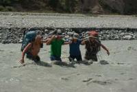
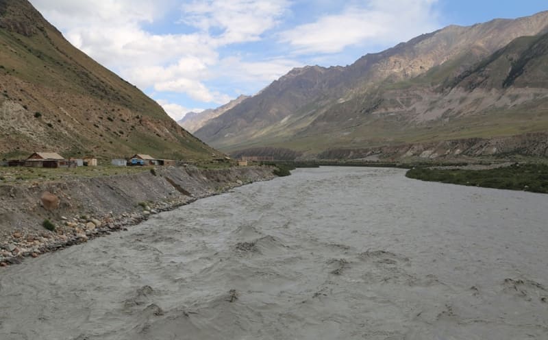
Inylchek River.
Main tourist attractions in mountains of Kyrgyzstan.
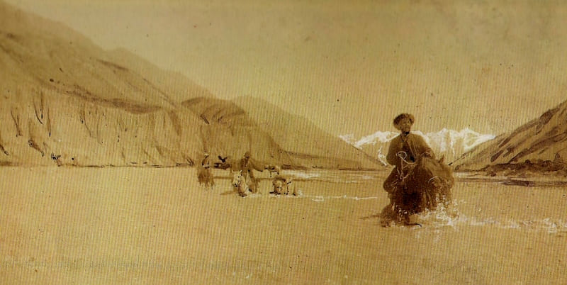
"The Inylchek River valley turned out to be very interesting. Anyone interested in geology would find a real museum for studying geological processes here. From the left slope of this valley, formed by marbles, numerous small rivers and streams flow, and here I had the opportunity to see the most interesting results of water activity: these insignificant streams managed to cut real cracks in the marble ridge, sometimes only 3-4 meters wide, with sheer walls hundreds of meters high. These cracks, or corridors, sometimes go straight, sometimes make bends; in some places their polished walls almost close at a certain height, forming low arches, and then it becomes almost dark in the corridor."
V.N. Shitnikov. "From the Memories of a Naturalist." 1912.
Whistle-stop trip in mountains of Kyrgyzstan.
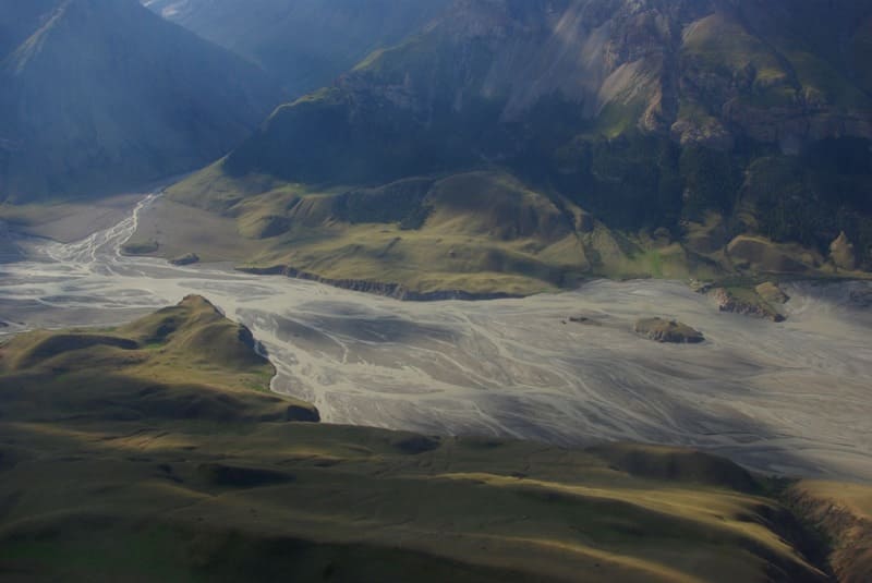
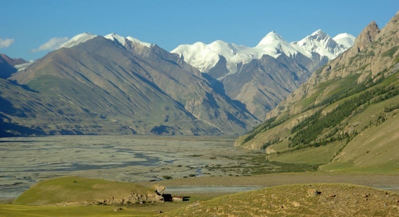
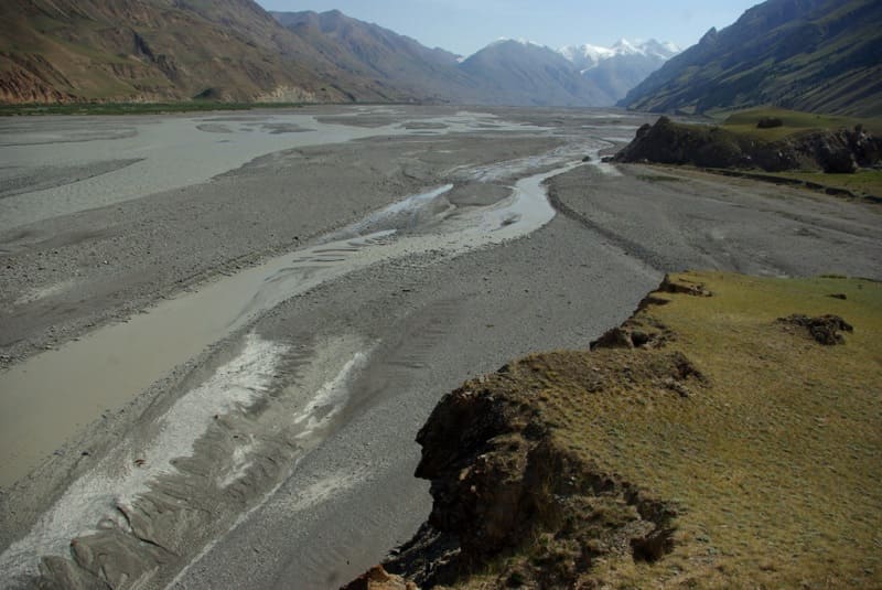
Inylchek River is located at an altitude: source is 2979 and mouth is 2479 meters above sea level. River is located in mountains of Central Tien-Shan between northwestern spurs of Inylchek-Too ridge and southeastern slopes of Saryjaz ridge in Ak-Su district of Issyk-Kul region.
After 107.6 kilometers from the beginning of the sources or 115.5 kilometers before crossing the state border between the Kyrgyz Republic and the People's Republic of China, a large tributary Inylchek with a length of 56.5 kilometers flows into the Saryjaz River from the left.
The river originates in the Chon-Tash tract in the western part of the South Inylchek glacier at an altitude of 2931 meters above sea level. The sources are located between the northern slopes of the Inylchek-Too ridge and the southern slopes of the Saryjaz ridge.
On the right, in addition to the described tributaries, 12 small, nameless rivers and streams flow into the river, and on the left there are 9 tributaries. 4.7 kilometers southwest from the source in the main ridge of the Inylchek ridge is Nansen Peak with a height of 5697.2 meters above sea level. The mouth of the river is located at an altitude of 2479 meters above sea level.
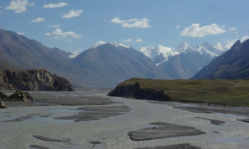
Approximately 15 kilometers from the end of the South Inylchek glacier, the North Inylchek glacier adjoins on the right, on which, almost at the junction with the South Inylchek, there is Lake Merzbacher, located at an altitude of 3,319 meters above sea level.
Every year in the last ten days of July or the first ten days of August, the lake overflows, and the water breaks out of it and flows along the glacial channels of the South Inylchek and rushes along the bed of the Inylchek River into the Sary-Dzhaz River. This is a grandiose spectacle, the river increases in size several times and the water spreads throughout the entire valley of the Inylchek River and flows into the Sary-Dzhaz with noise and roar.
Geographic coordinates of Inylchek River: N42°09'49 E79°28'31
Right tributaries of Inylchek River.
Maibulak River.
After 6.7 kilometers from the beginning of the source, the Maibulak tributary, 5.2 kilometers long, flows into Inylchek on the right. The Mayybulak River originates from the southern slope of the Saryjaz ridge.
Geographic coordinates of the Maibulak River: N42°13'24 E79°35'49
Tyuz River.
830 meters after the confluence of the Maibulak River into Inylchek, the Tyuz tributary, 3.4 kilometers long, adjoins on the right. The river originates from the northern slope of the Tyuz pass at an altitude of 4001 meters above sea level.
Geographic coordinates of Tyuz River: N42°13'07 E79°34'43
Achutash River.
After 9.7 kilometers from the beginning of the source, the Achutash tributary, 5.1 kilometers long, flows into Inylchek on the right. The Achutash River is formed at an altitude of 3262 meters above sea level from several tributaries. The right, extreme tributary originates from the western slope of the Achutash pass at an altitude of 4171 meters above sea level.
The central tributary originates from the southern slope of the Saryjaz ridge at an altitude of 4221 meters above sea level. The extreme left tributary originates from the eastern slope of the Saryjaz ridge at an altitude of 4130 meters above sea level.
Geographic coordinates of Achutash River: N42°13'02 E79°32'21
Desho River.
After 12.8 kilometers from the beginning of the source, the Desho tributary, 4.2 kilometers long, flows into Inylchek on the right. The sources of the tributary are located on the southern slope of the Saryjaz ridge at an altitude of 4130 meters above sea level.
Geographic coordinates of Desho River: N42°12'21 E79°30'53
Taldybulak River.
After 10.7 kilometers from the beginning of the source, the Taldybulak tributary, 7.5 kilometers long, located on the southern slope of the Saryjaz ridge, flows into Inylchek on the right. At an altitude of 3434 meters above sea level, the main channel of the river is formed.
The left, eastern tributary originates at an altitude of 4433 meters above sea level. The right, western tributary originates at an altitude of 4386 meters above sea level.
Geographic coordinates of Taldybulak River: N42°11'04 E79°26'19
Tyuklyukolon River.
After 12.8 kilometers from the beginning of its sources, the Tyuklyukolon tributary flows into Inylchek on the right length 6.3 kilometers. The source of the river begins from a small glacier located on the southern slope of the Saryjaz ridge with an area of 0.88 square kilometers, the perimeter of the glacier reaches 6.03 kilometers.
The glacier consists of two branches - western and eastern. The length of the right, western branch of the glacier is 2.3 kilometers. The length of the left, eastern branch of the glacier is 2 kilometers.
Geographic coordinates of Tyuklyukolon River: N42°10'52 E79°24'51
Dzhailmashaldy-Bulak River.
After 26.5 kilometers from the beginning of the source, the Dzhailmashaldy-Bulak tributary, 4.3 kilometers long, located on the southern slope of the Saryjaz ridge, flows into Inylchek on the right. In the upper reaches of the river there are two glaciers: Dzhailmashaldy-Bulak East and Dzhailmashaldy-Bulak West.
The area of the Dzhailmashaldy-Bulak East glacier is 0.83 square kilometers, the perimeter reaches 6.59 kilometers. The length of the glacier is 2.3 kilometers.
Geographic coordinates of Dzhailmashaldy-Bulak Eastern glacier: N42°11'47 E79°21'07
The area of the Dzhailmashaldy-Bulak West glacier is 2.83 square kilometers, the perimeter reaches 10.36 kilometers. The length of the glacier is 3.44 kilometers.
Geographic coordinates of Dzhailmashaldy-Bulak Western glacier: N42°10'51 E79°20'57
Geographic coordinates of Dzhailmashaldy-Bulak River: N42°10'50 E79°20'57
Karashyndy River.
After 29.1 kilometers from the beginning of the source, the Karashyndy tributary, 3.4 kilometers long, flows into Inylchek on the right. In the upper reaches of the river there is the Karashyndy glacier with an area of 1.42 square kilometers, the perimeter of the glacier reaches 9.15 kilometers. The length of the glacier is 2.3 kilometers.
Geographic coordinates of Karashyndy glacier: N42°10'25 E79°19'19
Geographic coordinates of Karashyndy River: N42°08'39 E79°21'29
Sharaly River.
After 33.7 kilometers from the beginning of the source, the Shar tributary, 4 kilometers long, located on the southern slope of the Saryjaz ridge, flows into Inylchek on the right. In the upper reaches of the river there are three glaciers: Sharaly East, Sharaly Central and Sharaly West.
Eastern Sharala Glacier. The glacier's area is 1.55 square kilometers, its perimeter reaches 11.11 kilometers. The length of the glacier is 3.1 kilometers. The sources of the glacier are located at an altitude of 4512 meters above sea level.
Geographic coordinates of Sharaly Vostochny glacier: N42°09'50 E79°18'17
Sharaly Glacier Central. The glacier's area is 2.29 square kilometers, its perimeter reaches 8.44 kilometers. The length of the glacier is 4.1 kilometers. The sources of the glacier are located at an altitude of 4445 meters above sea level.
Geographic coordinates of Sharaly Central glacier: N42°09'43 E79°17'06
Western Sharaly Glacier. The glacier's area is 1.57 square kilometers, its perimeter reaches 7.68 kilometers. The length of the glacier is 3.2 kilometers. The sources of the glacier are located at an altitude of 4700 meters above sea level.
Geographic coordinates of Western Sharaly glacier: N42°09'12 E79°16'18
Geographic coordinates of Sharaly River: N42°08'14 E79°17'42
River Tez.
40 kilometers from the beginning of the source, the Tez tributary, 8.2 kilometers long, flows into Inylchek on the right, located on the southern slope of the Saryjaz ridge. The sources of the river are located on the eastern slope of the Tez pass at an altitude of 4520 meters above sea level.
Geographic coordinates of Tez River: N42°07'25 E79°14'11
Left tributaries of Inylchek River.
Eastern Atjailau River.
After 19.5 kilometers from the beginning of the source, the 7.8-kilometer-long Atjailau Eastern tributary, located on the northern slope of the Inylchek-Too ridge, flows into Inylchek from the left. The river receives its origins from Lake Atjailau East, located at an altitude of 3645 meters above sea level.
The lake is located on the eastern slope of the Atjailau pass, 3674 meters above sea level, between the Inylchek and Atjailau Vostochny rivers. The area of the lake is 78,740 square meters, the length of the coastline reaches 1,248 meters. The length of the lake is 450 meters, the greatest width is 235 meters.
Geographic coordinates of Eastern Atjailau River: N42°07'30 E79°28'02
Authority:
Alexander Petrov.
Photos by:
Alexander Petrov and Vladimir Serbenko.