


![]()
You are here
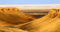
Saline land Mertvyi Kultuk.
Grand tour in Central on Manfyshlak.
“Nature is an infinite sphere whose center is everywhere”
Ralph Waldo Emerson.
Combined Tours Along Central Asia and Kazakhstan.
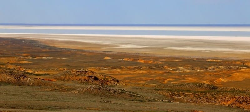
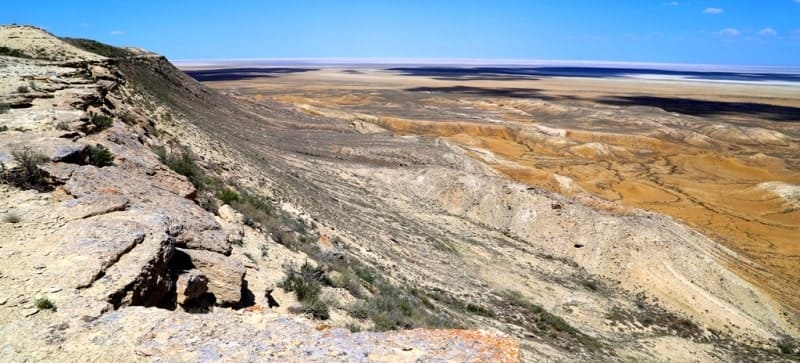
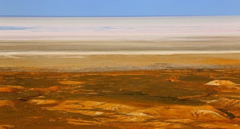
Saline land Mertvyi Kultuk (former Tsesarevich Bay and Komsomolets Bay), a former bay near the northeastern shore of the Caspian Sea, now a strait into Kaydak Bay, skirts the Buzachi peninsula on the Kazakh coast of the North Caspian from the southeast, is located on the territory of the Mangistau region.
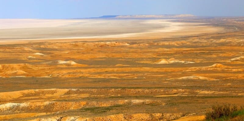
The longest eastern and northeastern parts of the Mertvyi Kultuk saline land is almost 100 kilometers. The northern part of the Mertvyi Kultuk saline land stretches for almost 80 kilometers. In the 40s of the XXth century, most of the Komsomolets Bay, due to the lowering of the level of the Caspian Sea, turned into a vast saline area - the Dead Kultuk saline land.
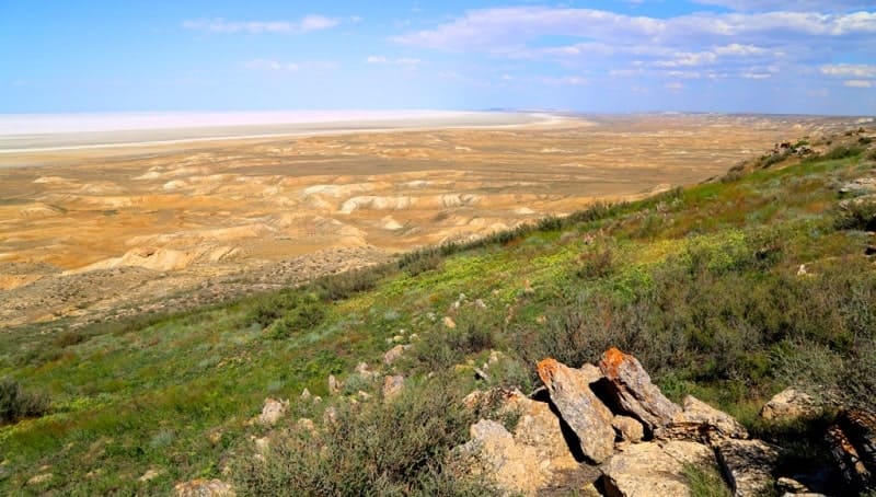
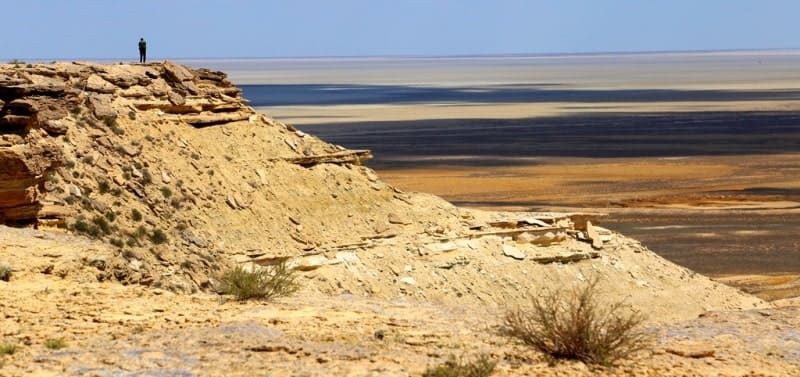
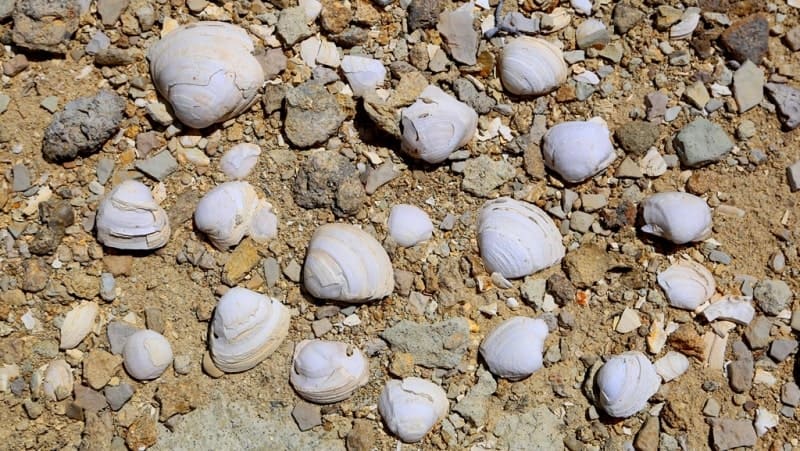
The bay was first described by G.S. Karelin in 1832. The bottom of the former bay, a vast, slightly concave saline land plain. It has distinct shores developed during the era of higher water levels in the Caspian Sea.
At the foot of the cliffs of Ustyurt, at elevations from - 25 to - 22 meters, abrasion ledges, sandy and clay coastal ridges are widely developed. Through the neck of the Komsomolets Bay, when the level of the Caspian Sea rises and surges, water regularly enters and marshes are formed.
An offshoot of this bay to the south is the now dry Kaydak Bay. In the process of lowering the water level in the Caspian Sea in the middle of the XXth century, most of the bay turned into a vast saline land, the area decreased from 15,000 square kilometers to 500 square kilometers, and the depth did not exceed 1 meter.
At present, the water level in the Caspian Sea is rising, so the Dead Kultuk is increasing, and the once-dry Kaydak Bay is again filled with water. On Dead Kultyk there are oil and gas bearing structures located in the northern part of the Mertvyi Kultuk sor, 300 kilometers northeast of the city of Aktau.
The area of the oil and gas structure of the Dead Kultyk is 7273 square kilometers, the water depth is 1 - 2.5 meters. The deposit is located within the system of the Buzachinsk-North-Ustyurt trough in the area of the Mertvyi Kultuk saline land
Three promising structures have been identified in the Mertvyi Kultuk deposit - Sarytau, Salkyn and Ostrovnaya. The development operator is Kazmunaiteniz, a subsidiary of Kazmunaigas. The development of the Mertvyi Kultuk field is planned to carry out a complex of seismic surveys and drilling of two exploration wells for a total amount of at least $47,000,000.
In the Mertvyi Kultuk field, the estimated recoverable oil reserves are estimated at 164,000,000 tons. Of these, 110,000,000 tons are in the Sarytau structure. At present, the water level in the Caspian Sea is rising, so the Dead Kultuk is increasing, and the once-dry Kaydak Bay is again filled with water.
Geographical coordinates of Mertvyi Kultuk saline land: N45°30'43.99" E53°53'55.09"
Authority:
"The short geographical encyclopedia" Volume 2 Gl.Red. Grigoriev A. A. M.: The Soviet encyclopedia - 1961, 592 pages about silt. and cards., 27 l. cards. and silt., 1 l. отд. cards
http://www.caspianmonitoring.ru/
Photos by
Alexander Petrov.