


![]()
You are here
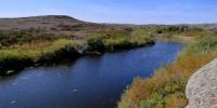
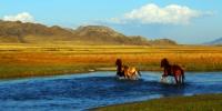
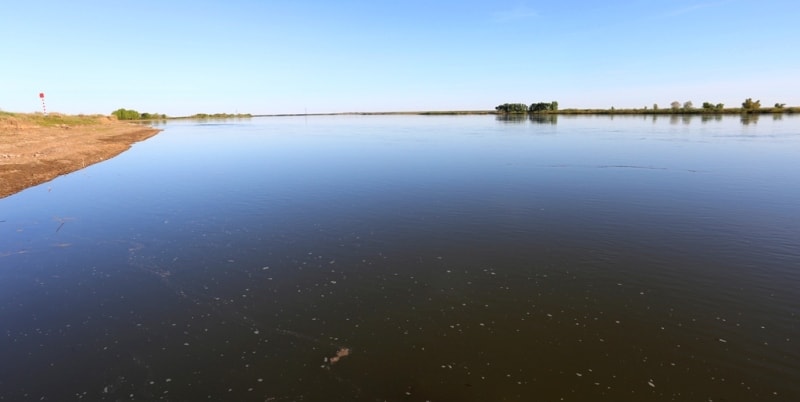
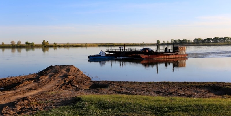
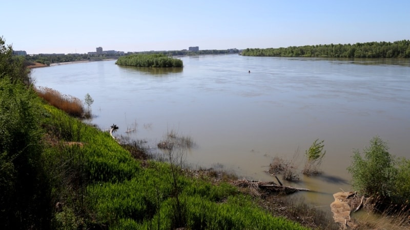
Ishim River in Kazakhstan.
The Great Silk Roa d Kazakhstan.
"Coastal noise of green reeds
And the splash of the wave breaking the silence
Pour into the mood of my soul.
I am glad to welcome you, Ishim!
And your talk, and your majestic run"
Valery Ponomarev.
Destinations and routes of the Kazakhstan.
Ishim (Kazakh. Esil) is a river in Kazakhstan and Russia, the left and longest tributary of the Irtysh. The catchment area is 177,000 km2. (163,000 km2), length 2,450 kilometers.
The average annual river flow is about 2.5 km3. water consumption - 76.0 cubic meters cbm in sec according to the state water register of Russia, it belongs to the Irtysh basin district, the water sector of the river is Ishim from the border of the Russian Federation with the Republic of Kazakhstan to the mouth without Lake Bolshoy Uvat, to the hydroelectric power station Bolshoy Uvat, the river sub-basin is the basins of the Irtysh tributaries before the confluence of Ishim.
The river basin is Irtysh, the mouth of Ishim is located on the left bank of the Irtysh, at its 1016 kilometer. Folk legend says that the Ishim river got its name from the name of the son of the Tatar khan Kuchum Ishim, who drowned in an nameless river, named later in his honor. Also, the word "Ishimak" is translated from the Tatar as "destructive".
The river originates in the low mountain range Niyaz of the Kazakh small hills and for 775 km flows from east to west, taking a number of large tributaries flowing from the Kokchetav Upland and from the spurs of the Ulytau Mountains.
In the upper reaches it flows mainly to the northwest and west, mainly in a narrow valley, on rocky shores. Below Astana, the valley expands, beyond Atbasar direction to the south-west. At 1578 km near the city of Derzhavinsk (the conditional border of the upper reaches of Ishim), the riverbed sharply changes its direction to the meridian - from south to north.
Below Sergeevka, the river reaches the West Siberian Plain and flows along the flat Ishim plain in a wide flood plain with numerous old women, flows in the lower reaches among marshes and flows into the Irtysh near the village of Ust-Ishim.
Nutrition Ishim is mostly snowy. The river freezes in early November, opens in April - May. The average discharge at the village of Vikulovo, 100 km from the mouth, is 56.3 cubic meters. in sec, the largest 686 cbm. in sec, the maximum flow rate of the Ishim River in the upper reaches of the city of Astana is 1080 - 1100 cubic meters per second, the annual flow rate of 1 299 967 thousand cubic meters. in year. The average annual water consumption is 1.11 cubic meters in sec.
In the Ishim basin, the general plain of the basin determines the possibility of the passage of Atlantic, Arctic, Central Asian air masses from the west (the prevailing type), north, southwest, and southeast. The most humid periods are associated with the western and to a lesser extent with the meridional circulation, low-water periods - with the predominance of the eastern component.
The intra-annual variation in air temperature is characterized by persistent severe frosts in winter, intense heat build-up in the short spring season and hot summers. The coldest month is January, the warmest is July. The extreme air temperatures observed in the winter and summer season are respectively -49 °, + 40 °.
The duration of the warm period according to the dates of transition of air temperature through 0 ° 180 - 200 days. The spring period is short (20-30 days) and begins in the second half of April, characterized by a rapid increase in temperature, up to 0.5 ° per day, which determines intense snowmelt.
The distribution of precipitation is uneven throughout the year. In the warm season, 70 - 72% of the annual precipitation falls, with a directional change in the north from 300 mm to 400 mm. On average, the highest rainfall per month falls in July, and the least in February.
The number of days with precipitation reaches 190. In the distribution of snow cover over the territory of the basin, pronounced zonality from north to south is observed. Stable snow cover in the Russian part of the basin is established, on average, in the first - beginning of the second decade of November.
Duration of snow cover is about 175 days. The main increase in snow depth and water reserves in it occurs in the first half of winter. Snowfalls usually reach their greatest magnitude in early and mid-March and amount to 25 – 40 cm. Average (of the largest during the winter) water reserves in the snow cover before the beginning of spring snowmelt are in the range of 80 – 100 mm.
Snowmelt in the spring usually begins even at negative air temperatures due to the influx of heat from solar radiation. Since the onset of positive The temperature of snow melting is intense. In open areas, snow cover melts within a few days, often 5 - 7 days.
Snow cover in the Russian part of the basin decreases on average around April 20 – 25. Fluctuations in water reserves in the snow are significant - up to 4 - 5 times, which also determines large runoff fluctuations during the flood period.
The plain relief of the territory favors the development of wind activity. Maximum runoff volumes and water discharges occur in the spring-summer flood phase. Ishim is characterized by the spreading of a flood wave, which leads to a decrease in costs downstream from the village of Ilyinka to the mouth one and a half times.
The maximum costs vary in all sections within a wide range. The maximum spring flood occurs in May - June. In the lower reaches the river floods up to 15 km. Security expenses of 1% are 5-10 times higher than security expenses of 50% and 70 times higher than security expenses of 95%.
The highest discharge on the Ishim River was observed in 1908 (up to 280.0 cubic meters per second), the lowest - in 1968 (1.57 cubic meters per second). In the summer-autumn season, runoff decreases from July to October, and in the winter from November to March.
The transition from summer-autumn low water to winter is not accompanied by a drop in the level, but on the contrary, the processes of ice formation on the rapids narrow the course and create a backwater for upstream stretches, from which the levels on them slightly increase. In some years, runoff may increase in late summer or in the post-spring months, but such cases are not typical and can be considered as a separate distribution option.
Until 1959, the flow of the Ishim River exerted a systematic, and subsequently periodic, flow of water from the Nura River basin. The river flow in Kazakhstan is regulated by reservoirs, 11 reservoirs have a capacity of more than 10 million cubic meters.
Long-term regulation of the flow of the Ishim River is carried out by two reservoirs: Vyacheslavsky (Useful volume = 375.4 million cubic meters) and Sergeevsky (Useful volume = 635 million cubic meters). The total runoff of suspended sediment in the middle reaches of the river is 500 - 600 thousand tons per year, 200 - 250 thousand tons are carried out outside the basin in the form of suspended particles.
The predominant part of sediment flows in the Ishim channel in the spring, in winter the amount of sediment is negligible, and in the summer-autumn period it amounts to a few percent of the annual sediment flow. The greatest turbidity is observed after the peak of flood, but in some years - and at maximum water flow.
The particle size distribution of suspended sediment is characterized by the predominance of fine particles, up to 90 - 95% of the sediment has a diameter of less than 0.1 mm. Typically, flat sediments on flat rivers do not exceed 5 – 8% of suspended sediments.
Currently, part of the sediment is delayed in the Sergeevsky reservoir. The catchment area of the Ishim River is 177,000 km² [2], of which about 20% of the area falls within the territory of Russia, within which about 30% of the flow is formed.
The main tributaries (in Kazakhstan): the right - Coluton, Zhabay, Akkanburlyk, Imanburlyk, the left - Terisakkan. The main tributaries (in Russia): the right tributaries are Karasul (flows into Ishim, not far from the village of Borovoe), Ik, and the left is Barsuk.
The capital of the Republic of Kazakhstan, the city of Astana, is also located on the Ishim River, as well as the cities of Atbasar (a few kilometers north of the mouth of the Zhabay River), Esil, Derzhavinsk (Akmola Region), Sergeevka, Petropavlovsk (North Kazakhstan Region). In Russia, the city of Ishim is located on the river.
The population of rural settlements uses river water for domestic and drinking purposes, both centrally and in a decentralized manner. In addition, the Ishim River is used by workers and employees of cities and workers' villages for recreation.
The river has transport significance. Ishim is navigable upwards from Petropavlovsk for 270 km to the Sergeyevsky reservoir and from the village of Vikulovo (Tyumen region) to the mouth. Navigation on Ishim is open from April to November.
In addition, the Ishim River is a fishery reservoir of the first category. Not far from the mouth of the river, near the villages of Panovo and Ust-Ishim, in 2008 the oldest known find of human remains of the modern type (Homo sapiens) was discovered - a femur 45 thousand years old, from which high-quality DNA was extracted.
A man from Ust-Ishim (en: Ust'-Ishim man) was the owner of the Y-chromosome haplogroup K * (xLT) and the mitochondrial haplogroup R. The waters of the Ishim River are heavily polluted. In the lower reaches (in the territory of the Russian Federation), the content of oil products exceeded the fishery MPC by 6 times, the concentration of oil products varied from 2 to 3 MPC (in the wellhead), and iron - from 7 to 4 MPC of water.
The copper content was in the range of 6 – 7 MPC of fish; a high content of manganese (up to 20 MPC of fish) in the river water was observed throughout. The average annual concentration of pesticides such as DDT and HCH varied from 0.001 to 0.03 μg / L.


Authority:
https://ru.wikipedia.org
Photo
Alexander Petrov.