


![]()
You are here
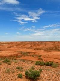
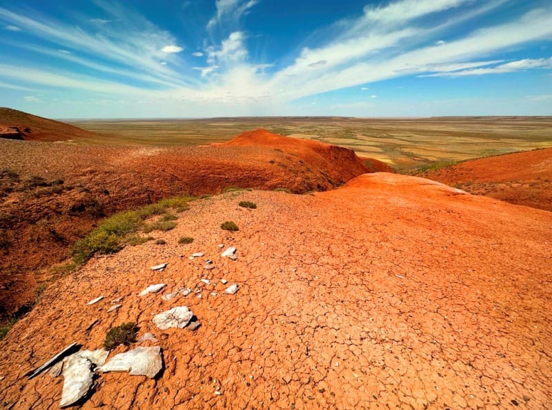
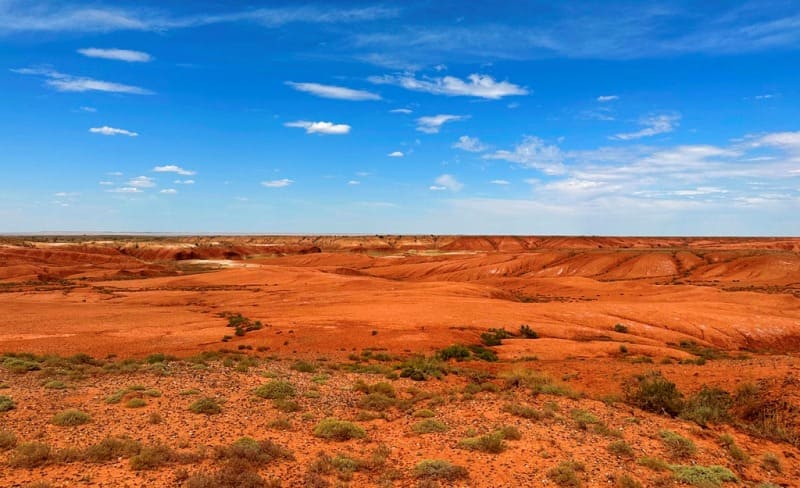
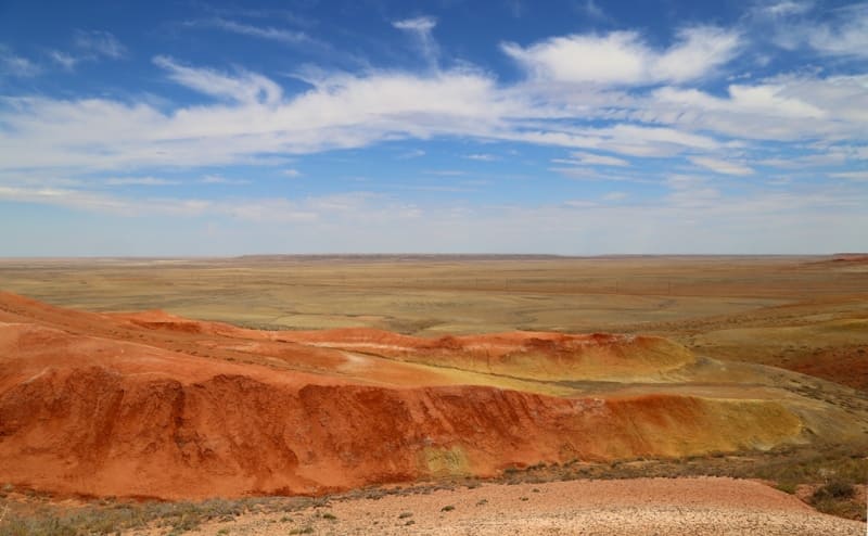
Cliffs of Kyzylkiya valley.
Adventure tourism Kazakhstan.
"It doesn't matter what the
Wind is, quiet or violent,
Whether it kisses the waves,
Or fiercely begins to foam,
Listen to his tale,
Listen to him about love and revenge.
And when you come to Kyzylkiya,
Where there is a grave under a stone,
Bow to two young souls,
Pray for them to Allah."
"The Tale of Kozy Korpesh and Bayan Suu." Georgy Tveritin.
Extreme tourism Kazakhstan.
Cliffs of Kyzylkiya valley with an altitude of 233 in south-west and up to 284 in north-west meters above sea level are located in southern part of Turgai Lowland, on territory of Karmakshinsky district in north-east of Kyzylorda and Ulytau district in south-west of regions of same name.
The valley stretches from southwest to northeast for 123 kilometers along the Omsk - Pavlodar - Shymkent oil pipeline, located between the Aryskum sands in the east and the Moyynkum sands in the west. Cliffs of the Kyzylkiya valley is partially located on the territory of the Kumkol oil and gas field.
The orography of the area is a gently undulating plain, clayey and saline surface, and layered cliffs of red loam. The climate on the cliffs in the Kyzylkiya valley is sharply continental with sharp fluctuations in seasonal and daily temperatures, with little precipitation and high dry air in the summer months.
The vegetation is represented by desert and semi-desert species, camel thorn, wormwood, biyurgun, kokpek, boyalych subshrubs are found, saxaul is rare. In the period from 1914 to 1917, along the cliffs of Kyzylkiya, the British laid the so-called “copper route” from Zhosaly station to the village of Karsakbay; along this route, goods were transported along a temporary, narrow-gauge railway road for the construction of the Karsakbay copper smelter.
The length of the route was 342 kilometers. In 1925, «Atbastsvetmed» launched a steppe road along this route for cars and horse-drawn vehicles from Karsakbay to Zhosala. 18 adobe pickets were built on the road. Warehouses for food, fuel and lubricants were built here.
Along this route, equipment for the Karsakbay copper smelter was delivered to Karsakbay by cars, camels and horses. Now all that remains from the pickets are ruins in the steppe.
Geographic coordinates of cliffs Kyzylkiya valley: N46 ° 25'02 "E65 ° 13'04

Authority and photos by:
Alexander Petrov.