


![]()
Вы здесь
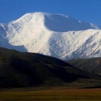
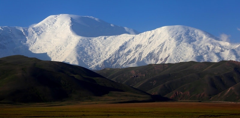
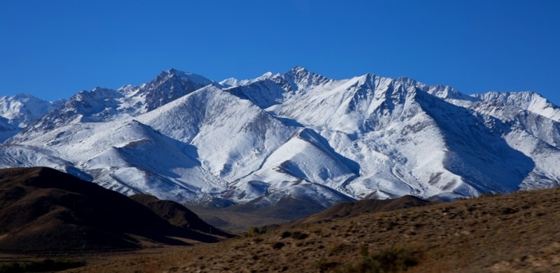
Alai mountain range.
Rock Tour in Alai mountains.
“Travel makes one modest. You see what a tiny place you occupy in the world”
Gustave Flaubert.
Rock Climbing Routes in Pamir mountains.
Alai mountain range is part of Pamir-Alai mountain system, located in Kyrgyzstan and partially in Tajikistan.
The highest point of the ridge is Tandykul peak, 5539 m. a. s. l. It divides the Ferghana and Alai valleys. The length of the ridge is 400 kilometers. Most peaks of the Alai Range exceed a height of more than 4500 m. a. s. l., more than 30 peaks - 5000 m. a. s. l., the highest point reaches a height of 5539 m. a. s. l.
Characterized by a mountainous terrain with alpine forms in the crest. The lengths of the valleys of the northern slope reach 45 kilometers with a difference in elevation from 1800 to 3200 - 3900 meters. The southern slope is shorter and steeper, divided by branched valleys up to 35 kilometers long with a height difference of 1900 to 3600 meters.
Within the Alai Range, the most complex and significant areas are distinguished. On the slopes are dry feather grass and fescue steppes, meadow steppes, junipers, passing into subalpine and alpine meadows. Juniper, almond, apricot, and walnut grow in the gorges.
Above 5000 meters above sea level - nival landscapes. The total area of glaciation of the Alai Range is about 811 square kilometers. The ridge is almost entirely covered by eternal snow and abounds with glaciers, especially in the west.
The passes here are very high and difficult.
The Alai Range is composed of sandy and clayey rocks and crystalline schists. Alpine terrain prevails. In the eastern part of the ridge is the Taldyk pass. The southern slopes of the Alai ridge abruptly break off to the Alai valley. The Kyzylsu River flows with reddish water along the Alai Valley.
South of the Zaalai Range, it flows in Tajikistan under the Tajik name Surkhob ("Red River"). The Alai ridge was the first to receive Russian travelers who set off at the end of the last century for exploration of the Pamir-Alai. In 1871, A.P. Fedchenko, together with his wife, O.A. Fedchenko, made a tremendous trip at that time, riding over 1000 km on horseback through the territory of the Kokand Khanate.
Having received the Khan's travel label (certificate) and guides in addition, Fedchenko examined the northern spurs of the Turkestan and Alai ranges and the Alai valley. In Darautkurgan, he was received by the Bek of Alai, the governor of the Kokand khan, in a small fortress, which served as a defense against the raids of the karategin bek (Bukhara khanate).
Showing "concern" for the safety of travelers, Bek of Alai delayed Fedchenko's advance into the Alai Valley and forced him to turn back. The dilapidated walls of the fortress can still be seen in Darautkurgan. By the labor of A.P. and O.A. Fedchenko, a great contribution was made to the scientific knowledge of the Pamir-Alai.
They collected collections of flora and fauna, for the first time described the Zaalaysky ridge and discovered its highest point - Lenin Peak, 7134 m. a. s. l.
Geographic coordinates of Alai Range: N39°46'14 E72°29'20
Authority:
"Glaciers." L.D. Dolgushin, G.B. Osipova. Series "Nature of the world." Moscow, the publishing house "Thought". 1989.
Photos by:
Alexander Petrov