


![]()
Вы здесь
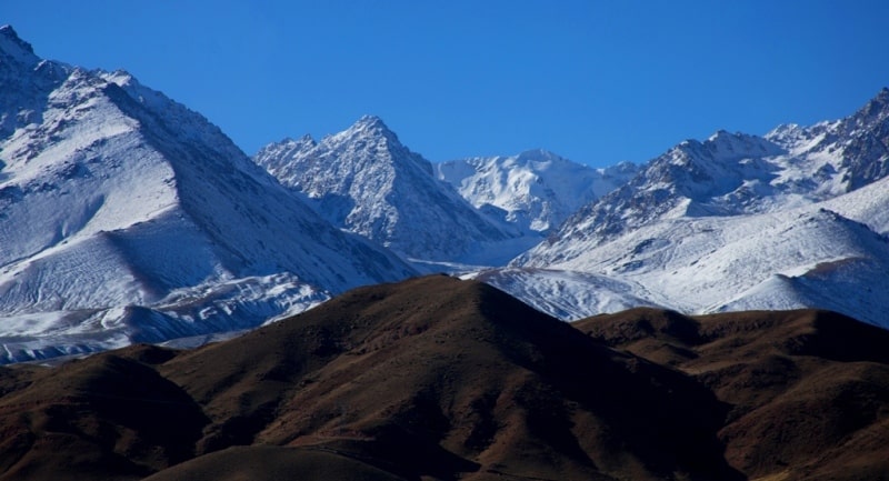
Gissaro-Alai mountain system.
Corporate travel to Uzbekistan.
“I am becoming old, but I always travel and I learn a lot everywhere”
Excursion trip to Kokand town.
Gissar-Alai system is located in the northern part of the Pamir-Alai. Gissar-Alai is located west of the Pamir, between the Fergana Valley in the north, the Karshi steppe, the Tajik depression and the Alai valley in the south. The eastern part of the system is located on the territory of Kyrgyzstan, the middle - in Tajikistan and the western - in Uzbekistan.
The length of Gissar-Alai from west to east is about 900 kilometers, width in the western part - up to 150 kilometers, in the east - up to 80 kilometers. This includes the Alay and Turkestan ranges with heights above 4000 meters above sea level, which border the Fergana Valley from the south.
The ridges are elongated in the latitudinal direction and form a single line. Their structure is asymmetric: the southern slopes are steep, the northern ones are gentle. The advanced chains stretch along the northern slopes: Kichik-Alai, the maximum heights of which reach 4640 m. a. s. l., and others.
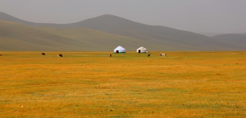
The western-northwestern continuation of the Turkestan ridge is the low Nurata mountains, consisting of two parallel ridges. Their northern slopes are steep, while the southern slopes are gently declining. The tops are flat. The Alai Valley is located between the Alai Range in the north and the Trans-Alai Range in the south, at an average altitude of up to 3000 m. a. s. l.
It stretches from east to west for 130 kilometers. In the western part, the valley passes into a gorge, in the eastern part, through a low pass, it has an exit to the valley of the Kashgar Kyzylsu. The bed of the Kyzylsu river, which has a reddish-brown water color, is cut into the flat bottom of the valley.
The river has a slight dip, a calm flow and a winding, highly branched channel. The relief of the valley is characterized by moraine hills, ridges, lakes, fan cones of the side tributaries of the Kyzylsu. The high Zeravshan Range, which is characterized by a particularly strong dissection of the northern slope, the presence of through valleys and sharp asymmetry transverse profile.
The southern slope is steep, almost vertically descending to a high longitudinal valley. From the eastern part of the Zeravshan ridge in the western direction, the Gissar ridge with peaks over 4500 m. a. s. l. is cut off. To the west of the headwaters of the Shing River, the ridge sharply changes its direction and forms an arc facing the bulge to the north-northwest.
In the direction of the Tajik depression, numerous spurs depart from it. The ridge is a watershed between the Zeravshan and Amu Darya basins. Between the Gissar ridge and the northern end of the Babatag ridge, there is a latitudinal intermontane depression - the Gissar valley.
The Gissar-Alai system belongs to the Hercynian folding zone, and the history of its development is similar to the geological history of the southern chains of the Tien-Shan. The ridges of this system are composed of sedimentary rocks of the Middle Paleozoic - from the Upper Silurian, Devonian to the Lower Carboniferous.
They are represented by clay shale, sandstone, limestone. The main phase of powerful folding appeared at the border of the Lower and Middle Carboniferous. The final formation and introduction of large intrusions of granites and diorites occurred at the end of the Paleozoic.
For territories composed of limestone, karst landforms (mainly caves) are characteristic. The main ridges of the largest ridges of the Gissar-Alai have a typical alpine relief. In the northern advanced chains of the Alai and Turkestan ridges, in the western part of the Turkestan and on its spurs, flat leveled surfaces are well preserved, which experienced tectonic deformations in the Neogene-Pleistocene time in the form of longitudinal vaulted swelling.
The plateau-like surfaces of the ridges and slopes are dissected by erosional gorges. Strongly dissected loess foothills (adyrs) are developed at the northern foothills of the Alai and Turkestan ranges, Kichik-Alai. In the limestones of the Zeravshan ridge, the northern forward ridges of the Turkestan and Alay ridge, manifestations of karst are widespread.
Tectonically, the Gissar-Alai is a symmetrical folded structure of the Hercynian age, composed of geosynclinal Paleozoic formations. The central part of the system is composed mainly of thick strata of Silurian schists. The northern slopes of the Turkestan and Alay ranges, the Zeravshan range and the northern slope of the Gissar are formed by Mesozoic limestones and shales.
Conglomerates, sandstones and effusive rocks are developed along deep faults in the Zeravshan valley and on the northern slope of the Turkestan ridge. The igneous rocks of the Gissar-Alai - granites, granodiorites and alkaline - form large bodies in the axial part of the Turkestan and Alai ridges, they are also present in the Zeravshan ridge, and in the Gissar ridge they form a large batholith.
At the end of the Paleogene, the era of the newest revitalization began, which led to the formation of a modern relief. The Mesozoic and Paleogene deposits have a platform appearance and have been preserved in the mountains in the form of narrow strips clamped by faults, and in South Fergana and in the southwestern spurs of the Gissar ridge they form wide fields.
They are represented by continental carboniferous Jurassic, red-colored Lower Cretaceous and marine variegated Upper Cretaceous and Paleogene formations, collected in simple folds. Oligocene-Miocene, Pliocene and Old Anthropogenic deposits form an orogenic complex of continental molasses, filling foothill and intermontane depressions.
Deposits of tungsten, molybdenum, arsenic and gold are associated with granitoids of the Late Paleozoic. The most important are the mercury-antimony deposits of the northern slopes of the Turkestan and Alai ridges and the antimony deposits of Tajikistan.
Coal is confined to the Jurassic deposits. The Shorsu sulfur deposit is located in the Paleogene deposits of the northern foothills of the Turkestan ridge, the oil deposits of South Fergana are associated with Cretaceous and Paleogene deposits.
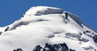
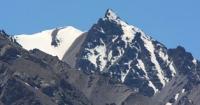
The modern glaciation of the northern part of the Pamir-Alai is developed within the northern slope of the Alai ridge, where glaciers are located in the upper reaches of almost all large rivers. The high ridges of the mountains are covered with eternal snow and glaciers.
In Gissar-Alai, there are more than 3800 glaciers with a total area of about 2320 square kilometers, of which 380 square kilometers are covered with a continuous moraine cover. A large glacier center with a large Zeravshan glacier 25 kilometers long and an area of 41 square kilometers extending from it is located in the Matchinsky mountain cluster.
Almost all of the large glaciers in the ridge subsist on avalanche feed, that is, their basins are below the 365 level. The surface of these glaciers ends at the foot of the steep slopes well below the snow line. All glaciers of the Alai ridge are in a state of degradation.
Gissar-Alai rivers.
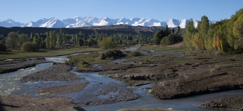
Belong to the basins of the Amu-Darya, Syr-Darya and Zeravshan. They are distinguished by a rapid current, without having developed a longitudinal profile, the presence of rapids and waterfalls. The maximum runoff on them usually occurs at the end of July - during the melting of alpine snows and glaciers.
The Syr Darya basin includes the rivers Karadarya, Aksu, Khadzhabakyrgan, Isfara and others, which form their runoff from the northern slopes of the Alai and Turkestan ranges. Most of the rivers flowing from the low mountain ranges of Nuratau and Aktau have the character of temporary streams.
To the river basin Zeravshan include rivers that flow down from the southern slopes of the Turkestan ridge, the northern slopes of the Gissar and Zeravshan ranges. Due to the good moisture content of the basin, most of its rivers have a high specific water content.
The Amu-Darya basin includes rivers flowing from the Gissar ridge. There are few lakes in the region. On the northern slope of the Gissar ridge, at an altitude of 2,176 m. a. s. l., there is a lake. Iskanderkul is one of the most picturesque lakes in the world. The lake is dammed up by the end moraine of an ancient glacier.
Climate of Gissar-Alai.
The mountains of the Gissar-Alai system are located in the subtropical zone. But the features of the relief determine the variegation and contrasts in the climate, creating high-altitude climatic zoning on the slopes of the mountains, which is outwardly expressed in landscape zonation.
There is a change of belts from desert to steppe, forest and meadow, belt of alpine meadows, snow and glaciers. hese belts are located in different mountains at different heights. Up to an altitude of 350-450 m. a. s. l., a desert climate can be traced, which is characterized by a sharp continentality - large daily and annual temperature fluctuations, little precipitation, low relative humidity and cloud cover.
Up to 1,500 meters above sea level, there is a steppe climate zone that covers the foothills and low mountains. Winters are relatively short and mild here, summers are long with high temperatures. The average July temperature reaches + 25 °, and above + 20 °.
The absolute maximum is +35, + 40 °, and in the west it is higher than in the east. Average January temperatures are -5, -7 °, absolute minimums are -25, -30 °. Annual precipitation reaches 350 - 700 mm. In the zone of heights of 1500 - 3500 meters above sea level, the climate acquires the features of a mountain, it is cooler and in most cases more humid, above 1500-3500 m. a. s. l. it becomes polar.
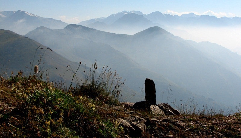
Due to the peculiarities of atmospheric circulation, the windward western and south-western slopes receive the greatest amount of precipitation, while the eastern slopes are in the rain shadow. On the Gissar ridge, at an altitude of 1500 - 3500 meters above sea level, up to 1500 mm of precipitation falls, on the Zeravshan - over 1000 mm. In the east, the amount of precipitation decreases significantly.
Soils and vegetation of Gissar-Alai.
The lower zone is formed by semi-deserts, or desert steppes, which are developed in the foothill belt. On the foothill plains of the Nuratau, Turkestan, Alay and Gissar ridges, serozems are developed, which in the western part are often saline and gypsum.
The soil horizons are heavily indented by the tunnels of various burrowing animals. On the Alai Range, the low foothills are occupied by an ephemeral wormwood desert dominated by Artemisia tenuisecta. Sod grass steppe grasses - fescue (Festuca sulcata) and feather grass (Stipa kirghisorum), as well as xerophilous shrubs are found in some places.
In the Turkestan ridge, due to its strong rockiness, the vegetation is even more xerophytic. In the foothills, sparse wheatgrass semi-savannas are spread. In the foothills of the Zeravshan Range, wheatgrass-forb steppes prevail. Above the belt of gray soils, a belt of dark gray soils is distinguished.
They have developed semi-savannahs with a predominance of hairy wheatgrass (Agropyrumtrichophorum). In the middle mountains, mountain-forest brown and brown soils under deciduous forests are spread in places. In this belt, thickets of juniper (treelike juniper) are developed, which occupy quite large areas in the mountains, located mainly within the range of heights from 1900-2000 to 3000 m. a. s. l.
Under favorable conditions, juniper can rise higher. Mountain brown-brown soils are developed under them. Within the northern slopes of the Turkestan and Alai ridges, the density of juniper stands is high. The grass cover of juniper forests is dominated by steppe species: fescue (Festuca sulcata), timothy grass (Phleum Boehmeri), as well as large forbs - ephemeral umbellates: yugan (Pfangos pabularia) and camole (Ferula Jaesckeana), etc.
On the Zeravshan ridge, in the lower part of this belt, there are areas of maple forests from Acer turcomanicum. In contrast to the Turkestan and Zeravshan ranges, on the slopes of the Gissar and Darvaz ranges, at altitudes from 1100 to 2400 - 2800 meters above sea level, broad-leaved forests and thickets of mesophilic shrubs, as well as meadow communities, are widely developed.
Maple and walnut forests are widespread on the fine-earth slopes of the northern exposure. On the southern rocky slopes, there are junipers, almonds, in the grass cover - yugan, camol, ram, as well as mesophilic grasses - hedgehog and foxtail.
Shrubs from Rosa ecae, Ephedra procera Cerasus, which create almost continuous thickets, are also characteristic of the mid-mountain zone. At an altitude of 2800-3000 m. a. s. l. , there is a subalpine highland, under which mountain-meadow-steppe soils are developed.
Here, along with steppe vegetation, large umbrella plants dominate - yugan, camol, and sevchok. In some places hedgehog and bluegrass are mixed with them. On the Turkestan ridge, pillow-like vegetation is developed. Above 3000 meters above sea level, there is an alpine belt, in which semi-mountainous mountain meadow-steppe soils (Alai Range), mountain meadow semi-mountainous soils are mainly represented.
Vegetation is represented by small areas of low-grass cryophyte meadows and steppes. The high-mountain Alai Valley (3000 m) stands out in terms of soil cover. Alpine dark chestnut soils are widespread in the eastern part of the valley, while in the western part, more low, part - alpine light chestnut calcareous soils.
On the slopes surrounding the valley, mountain-meadow chernozem-like soils are developed, which are replaced higher by mountain-meadow semi-turfy leached soils. The vegetation of the eastern part of the valley is dominated by steppes of fescue, small feathery feathergrass (Stipa orientalis, S. glareosa), turf bluegrass, thin-legged with alpine forbs.
The western part is dominated by sparse communities formed by half-shrub wormwood (Artemisia Lehmanniana).
Geographic coordinates of Gissar-Alai system: N39°47'49 E71°49'58.59"
Authority:
http://big-archive.ru
Photos by:
Alexander Petrov, Alexander Ezhov.