


![]()
Вы здесь
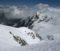
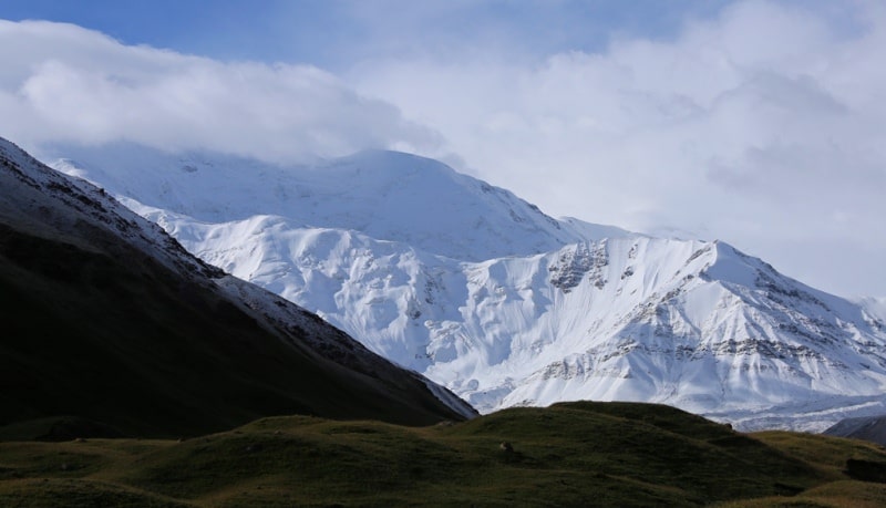
Ridge of North-Alichur.
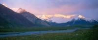
Nature trip to Pamir mountains Tajikistan.
“Now more than ever do I realize that I will never be content with a sedentary life, that I will always be haunted by thoughts of a sun-drenched elsewhere”
Isabelle Eberhardt, «The Nomad: The Diaries of Isabelle Eberhardt».
Small detour in Tajikistan.
The Northern-Alichur ridge has another name - the Bazardarinsky ridge, located in the Eastern Pamirs, on the right bank of the Alichur River, in Tajikistan. Located in the territories of three districts of the Gorno-Badakhshan Autonomous Region - Shugnansky, Roshtkalinsky and Murgabsky districts.
The length of the ridge is about 130 kilometers in the latitudinal direction, adjoining the Rushan ridge in the west, ending in the east near the Karasu river valley, where a 70-kilometer jumper ridge connects it with the South Alichursky ridge.
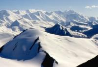
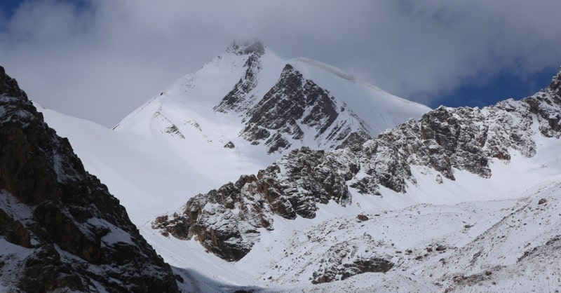
Most peaks have a height of 4000 - 5000 meters above sea level, the highest height is 5929 meters above sea level - Kulin peak. The foot of the ridge in the north, the Murgab valley, lies at an altitude of 3200 - 4000 meters above sea level, in the south, the upper river of the Gunt and the valley of the Alichur River - 3700 - 4150 meters above sea level.
Two parallel spurs are distinguished in the north, the Karadzhilga ranges (65 kilometers long) and Sarez (40 kilometers long) ridges, as well as the Uezgi-Niyazek mountains (35 kilometers long), and in the south, a number of spurs (up to 20 kilometers long) depart.
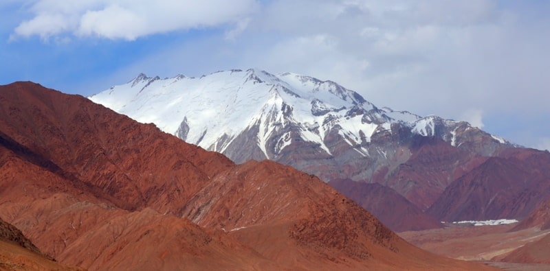
In the lower part of the slopes in the east there is an alpine wormwood and teresken desert, in the west there is a sparse alpine steppe, desert and meadow vegetation. Above 4000 - 4200 meters above sea level - nival landscapes.
The company line on the slope of the northern exposure lies at an altitude of 4850 - 5000 meters above sea level, on the slope of the southern exposure - at an altitude of 4900 - 5100 meters above sea level. The total area of glaciation of the North Alichur Range is about 158 square kilometers.
About 10 passes are known, of which the most accessible are: the Lyangar-Kutev pass, 4625 meters high above sea level and the Yashilkul pass, 4800 meters high above sea level. The main approaches are from the north from the valley of the Murgab river, from the east from the Pamir tract (Karasu river valley), from the south from the valley of the Alichur river (Yashilkul lake).
The ridge is composed of granitoids, metamorphic and clay shales, sandstones and limestones.
Authority:
"Glaciers." L.D. Dolgushin, G.B. Osipova. Series "Nature of the world." Moscow, the publishing house "Thought". 1989.
Photos
Alexander Petrov.