


![]()
Вы здесь
Shahdarinsky ridge.
Corporate travel in Tajikistan.
“Life while traveling is a dream in its purest form”
Agatha Christie.
Quick trip in Tajikistan.
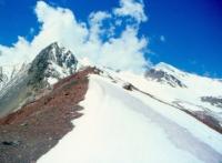
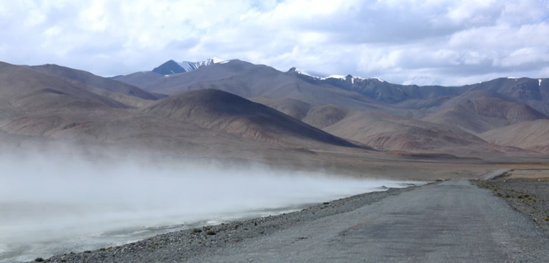
Shahdarinsky Range is located north of the Pyanj River, in the southwestern part of the Pamirs in the Roshtkala and Ishkashim regions of the Gorno-Badakhshan Autonomous Region in southern Tajikistan. In the interfluve of the Pyanj and Shakhdara rivers, on the border of Tajikistan and Afghanistan.
It consists of the meridional Ishkashim ridge and the latitudinal Shakhdara ridge itself. The Shakhdari Range is the extreme, southwestern link of the Pamir Mountains. Its heights exceed 6000 meters above sea level. It serves as a watershed for the Pyanj and Shakhdara rivers.
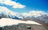
The total glaciation area of the Shakhdara Range is about 270 square kilometers. The Shakhdara range can be divided into three main parts: western, central and eastern. The western part of the ridge starts from the peak of Mayakovsky and the top of Saparkhodzha with a height of 5864 meters above sea level at the junction with the Ishkashim ridge.
The crest of the ridge from a height of 6000 meters above sea level drops and becomes more destroyed in the area of the Shitharv pass at a height of 5000 meters above sea level. The boundary separating the western part from the central one is the valleys of the rivers Badom - Rostoudar and Daraidarshay.
To the east of these rivers, the central part of the range rises. The prevailing heights of the peaks are 5800 - 5900 meters above sea level, in the area of the Saryshitharv glacier. Three peaks have heights of more than 6000 meters above sea level.
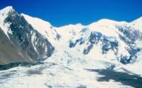
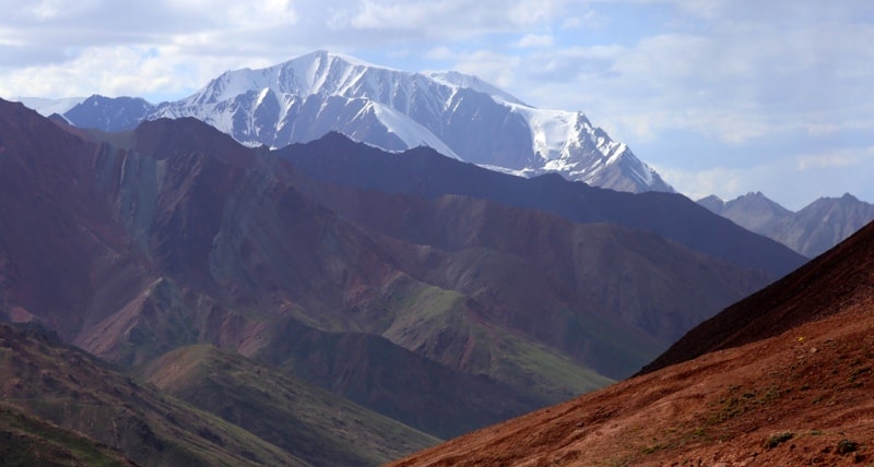
The tiered structure of their rocky slopes is characteristic, sheer walls, often including marble belts, alternate with small scree shelves. In the eastern part of the ridge there are the highest peaks: the peaks of Karl Marx, Tajikistan, Engels, Leningrad State University, Moscow Pravda, Babel.
The narrow southern and southeastern valleys sharply decrease in height, they have the shape of canyons. A significant spur extends to the northwest - the Badomdara Range, 18 kilometers long. Most of the peaks are 4000 - 5000 meters above sea level, about 10 peaks are over 6000 meters, the highest up to 6726 meters above sea level is Karl Marx Peak.
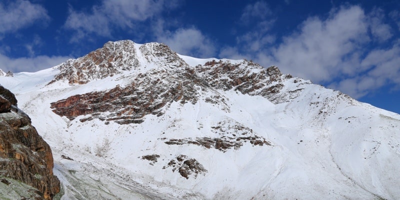
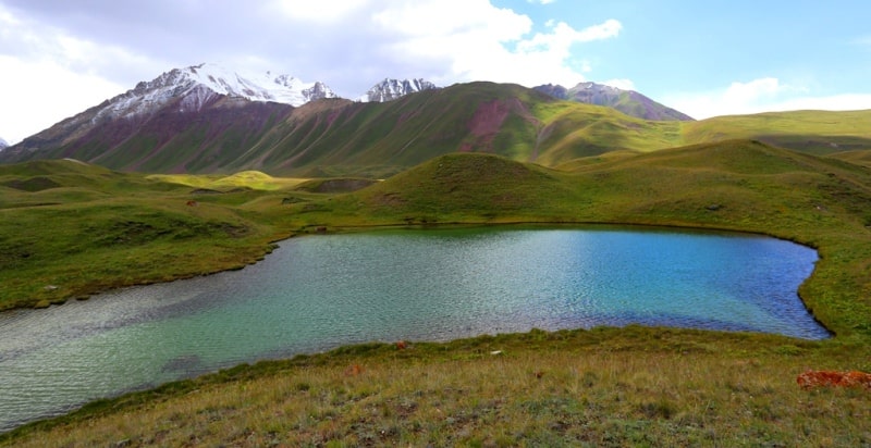
The lower parts of the slopes are covered with desert, steppe and meadow vegetation. In the river valleys there are sagebrush deserts with rare shrubs. Above 4200 - 4300 meters above sea level - nival landscapes.
The snow line is located at an altitude of 4700 - 5400 meters above sea level. In the Shahdara Range and its spurs, there are several passes up to 4000 meters above sea level, about 30 passes 4000 - 5000 meters above sea level, more than 30 above 5000 meters above sea level.
The simplest crossing routes are in the western part of the Shitharv pass 4800 meters above sea level, in the east - the Vrang pass 4800 meters above sea level. The main approaches are from the north from the Shakhdara river valley, from the south from the Pyanj river valley, where there are roads.
There are several peaks in Shahdara Range with a height of more than five six thousand meters above sea level:
1. Marshal Grechko Peak (another name is Poydzhelakh), 6013 (6105) meters above sea level, the first ascent was made by a group of climbers on 08/30/1976 under the leadership of V. Starlychanov.
2. Baikonur Peak (another name is Dzharkh) with a height of 6037.9 or 6038 meters above sea level, the first ascent was made on August 29, 1976 by a group of climbers led by V. Starlychanov.
3. Peak of the Armed Forces with a height of 6138 meters above sea level, the first ascent was made on August 27, 1976 by a group of climbers led by V. Starlychanov.
4. Snezhny Peak (another name is Chibud), 5962 meters above sea level.
5. Peak Litovsky (another name Lituanika) 6004 meters above sea level.
6. Darbs and Girenas Peak 5998 meters above sea level. The first ascent was made by a group of climbers in 1984, under the leadership of V. Melentiev.
7. Karl Marx Peak 6723 meters above sea level. The first ascent was made on September 6, 1946 by a group of climbers led by E. Beletsky.
8. Peak 6455 meters above sea level. The first ascent was made in 1961 by a group of climbers led by V. Kavunenko a group of climbers led by V. Kavunenko.
9. Nikoladze Peak 6444 (6340) meters above sea level. The first ascent was made on August 13, 1954 by a group of climbers led by M. Gvarliani.
10. TSU Peak 6340 (6183) meters above sea level. The first ascent was made in September 1961 by a group of climbers led by S. Savvon.
11. Peak 6183 (6100) meters above sea level. The first ascent was made in 1968 by a group of climbers led by R. Ivanov.
12. Tajikistan Peak 6564.7 (6565) meters above sea level. The first ascent was made in 1962 by a group of climbers led by S. Savvon.
13. Peak South Tajikistan 6300 meters above sea level. The first ascent was made in 1972 by a group of climbers led by V. Laukhin.
14. LSU Peak 6202 (6222) meters above sea level. The first ascent was made in 1958 by a group of climbers led by V. Tikhonov.
15. Peak Mayakovskaya Pravda 6075 meters above sea level. The first ascent was made on August 17, 1964 by a group of climbers led by A. Snesarev.
16. Engels South Peak 6312 (6318) meters above sea level and Komsomol Ukrina Peak. The first ascent was made on August 5, 1964 by a group of climbers led by Yu. Yakovenko.
17. Engels Peak 6507 (6510) meters above sea level. The first ascent was made on September 5, 1954 by a group of climbers led by M. Gvarliani.
18. Peak of Tbilisi State University, 6141 meters above sea level. The first ascent was made in 1954 by a group of climbers led by S. Gugava.
19. Peak Lithuania 6080 meters above sea level. The first ascent was made in 1964 by a group of climbers led by R. Agunas.
20. Babel Peak 6007 meters above sea level. The first ascent was made in 1964 by a group of climbers led by R. Agunas.
21. Peak 6470 meters above sea level. First ascent made
Geographical coordinates of Shakhdara Range: N37°06'24.12" E72°15'37.57"
Authority:
Alexander Petrov.
"Glaciers." L.D. Dolgushin, G.B. Osipova. Series "Nature of the world." Moscow, the publishing house "Thought". 1989.
Photos by
Alexander Petrov.