


![]()
Вы здесь
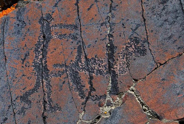
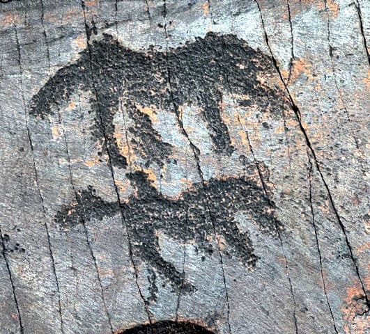
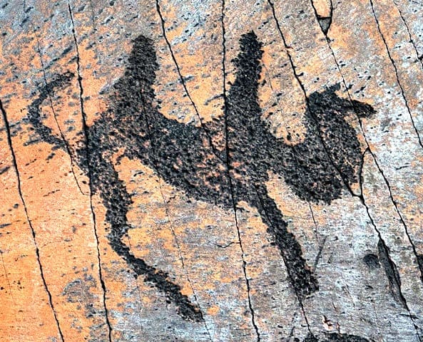
Petroglyphs Tamdy in Ulytau.
Tours in Ulytau region.
“The rock engravings of Kazakhstan represent the greatest treasure left by our distant ancestors and serve as an indispensable source for understanding the distant past.”
A. Kh. Margulan.
Petroglyphs of Ulytau region.
Petroglyphs of Tamdy 1 are located at an altitude of 367 m. a. s. l., located on rocks of the left bank of the Tamdy River, on the southeastern side of the Sarytau Mountains, 21.8 kilometers southeast of the mouth of the Tamdy River in Sary-Torgai, 4.8 kilometers to the southeast of the Baitleu wintering area, 28.7 kilometers south and slightly west of the village of Korgasyn (Shenber), 22.3 kilometers south of the village of Sarlyk.
Petroglyphs of Tamdy 2 are located at an altitude of 352 meters above sea level, located on the rocks of the left bank of the Tamdy River, on the southeastern side of the Sarytau Mountains, 18.6 kilometers southeast of the mouth of the Tamdy River in Sary-Torgai, 1.5 kilometers to the southeast of the Baitleu wintering area, 24.2 kilometers south and slightly east of the village of Sarlyk.
Petroglyphs of Tamdy 3 are located at an altitude of 333 meters above sea level, located on the rocks of the left bank of the Tamdy River, on the southeastern side of the Sarytau Mountains, 16.2 kilometers southeast of the mouth of the
Tamdy River in Sary-Torgai, 3.5 kilometers to the southwest of the Baitleu wintering area, 29.8 kilometers southwest of the village of Korgasyn (Shenber), 23.4 kilometers south and slightly west of the village of Sarlyk.
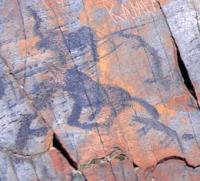
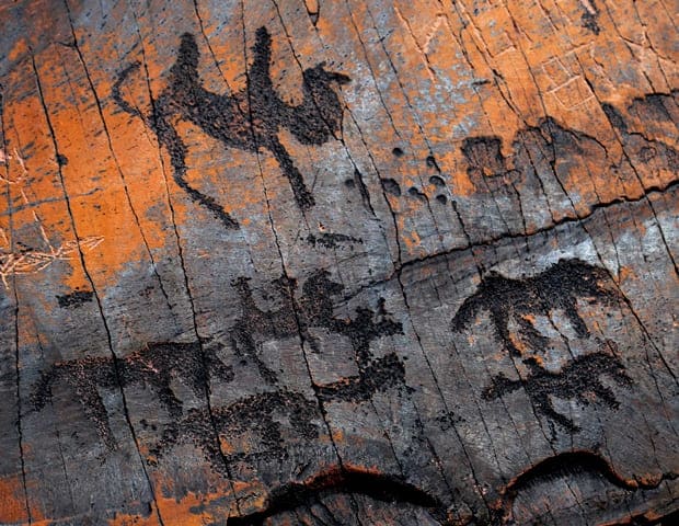
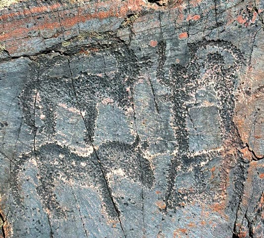
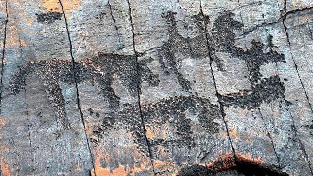
All drawings are located on the territory of the Ulytau district of the region of the same name. Single rock paintings and rare multi-figure scenes are painted on red-brown diorite-porphyritic sandstones. The Tamdy 1 petroglyphs are located at a distance (in a straight line) of 3.3 kilometers from the Tamdy 2 petroglyphs.
The distance from the Tamdy 2 petroglyphs to the Tamdy 3 petroglyphs is 3.3 kilometers. Most of the petroglyphs are concentrated in the middle reaches of the river. Here, on the surface of massive rocks and rocky outcrops destroyed by wind erosion, 18 planes with 130 images were discovered. Among them the following percentage is observed:
horses (24%), camels (13%), mountain goats (4%), bulls (3%), anthropomorphic images (10%). Single recorded: a rider on a horse, a predator, a snake, a dog, a bird, as well as vague images (14%).
Geographic coordinates of Tamdy 1 petroglyphs: N48°57'28 E66°37'06
Geographic coordinates of Tamdy 2 petroglyphs: N48°58'26 E66°34'49
Geographic coordinates of Tamdy 3 petroglyphs: N48°57'31 E66°32'05
Authority:
M.V. Bedelbaeva, V.A. Novozhenov, N.V. Novozhenova. "Fine monuments of the Kazakh small hills". Karaganda State University named after academician E.A. Buketova. Saryarka Archaeological Institute. Karaganda. 2015.
Photos by:
Alexander Petrov.