


![]()
Вы здесь
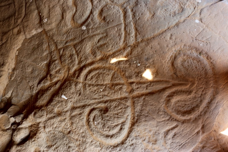
Toleubulak petroglyphs.


Business and leisure trips to Kazakhstan.
“That was the day the ancient songs of blood and war spilled from a hole in the sky
And there was a long moment as we listened and fell silent in our grief and then one by one, we stood tall and came together and began to sing of life and love and all that is good and true
And I will never forget that day when the ancient songs died because there was no one in the world to sing them”
Brian Andreas.
Class trip in Kazakhstan.
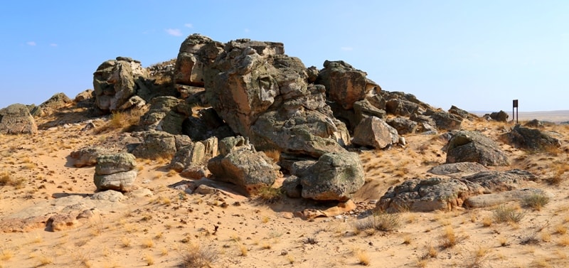
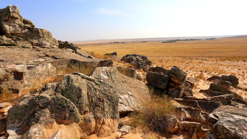
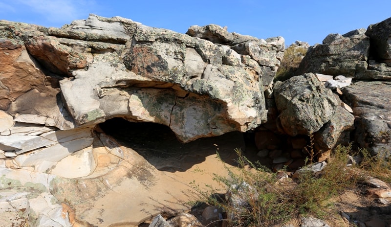
Grotto Toleubulak (Emba) is located in the northwestern part of the Mugodzhary mountains, 3.4 kilometers southeast of Lake Solenoe, 13.6 kilometers northeast of the Bulakty village and 9.7 kilometers southeast of the village Miyaly in the Mugalzhar district of the Aktoyabinsk region.
The site, discovered in 1999 by a Russian-Kazakh expedition led by Taymagambetova Zh.K., was studied in 2005 by Samashev Z. (Samashev 2006). The grotto of aeolian origin is located in the western part of a rock massif made of siliceous sandstone. It contains a significant quantity of petroglyphs on its floor.
There is another cavity with petroglyphs 400m northwards. Near the grotto under an overhang is also a group of pecked images of a camel and horse, and humans on a separate boulder 100m west wards. The largest grotto with petroglyphs is the most interesting; its wide entrance opens to the south, its surface is 20m2 and it is up to 0.70m at the highest part near the entrance.
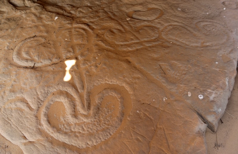
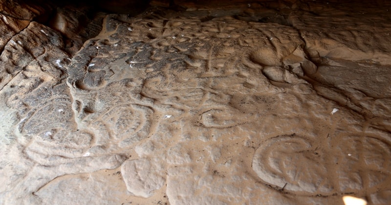
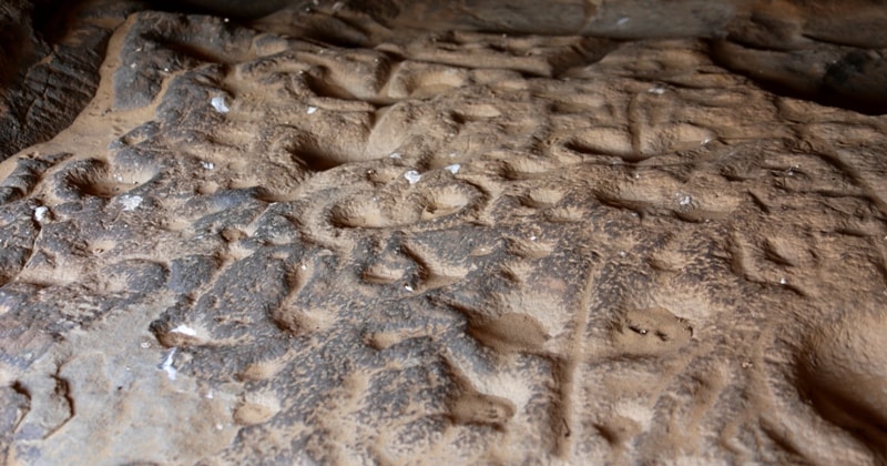
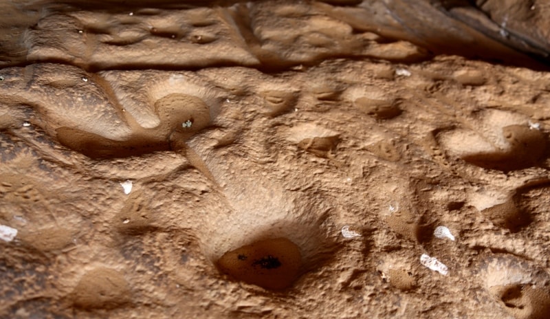
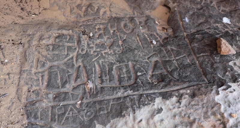
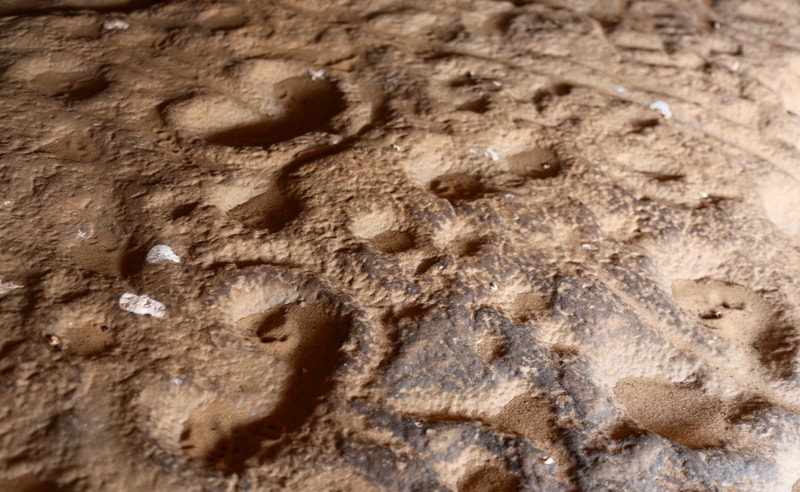
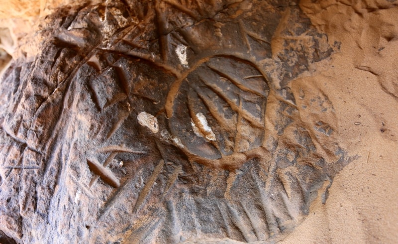
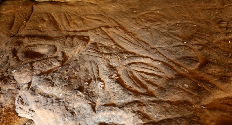
Practically, the entire floor is occupied by petroglyphs. The drawings are deeply carved into the surfaces; some figures are additionally abraded. There is one case of overlapping of figures, but, in general, the entire pictorial complex is homogeneous.
Three zones approximately equal in area and with similar images have been identified from the top part of the surface inclined towards the entrance. The upper zone is covered with rows of carved sub-parallel lines sometimes intersected by crossing lines.
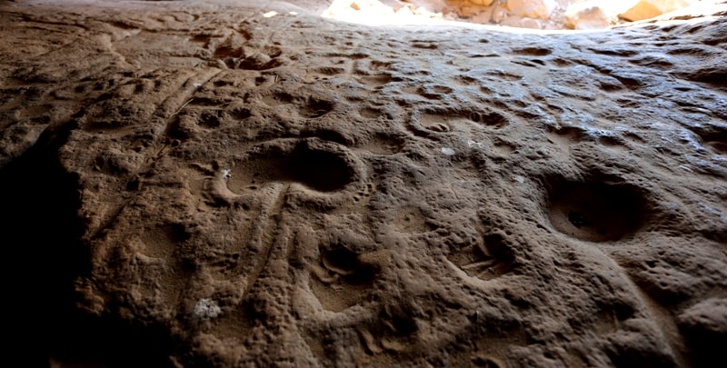
The second group consists of often open circles with lines inside. The second includes cup-holes that are up to 6cm deep and 17-25cm in diameter. The second or middle zone comprises well-preserved phallic figures; there is also a large number of cup-holes there, mostly abraded.
The third zone represents large images of a bean-shaped fruit or horse hooves. The drawings were incised then abraded. The specificity of the panel is the absence of human or animal images and the prevalence of linear-geometrics and cupholes.
According to its topography and repertoire, the Toleubulak Grotto has no analogies in Central Asia, but researchers find it comparable to the Kamennaya Mogila grottos in the Northern Near Azov Area. Its images are tentatively attributed to the first half of the Holocene, no later than the Neolithic.
Stone Age dwelling sites and other sites from different periods were discovered in the area.
Geographic coordinates of the Toleubulak grotto (Emba): N49 ° 14'53.71 "E58 ° 34'40.47"

Authority:
“Rock Art Sites in Kazakhstan”. Alexey E. Rogozhinskiy.
Photo by
Alexander Petrov.