


![]()
Вы здесь
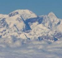
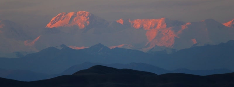
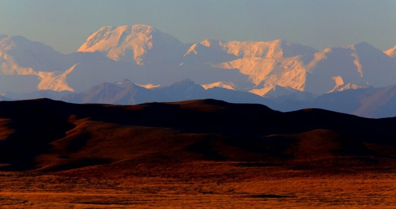
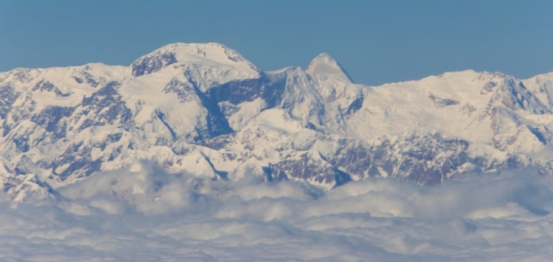
Pobeda Peak.
Special excursion in Bishkek.
“And if these mountains had eyes, they would wake to find two strangers in their fences, standing in admiration as a breathing red pours its tinge upon earth's shore. These mountains, which have seen untold sunrises, long to thunder praise but stand reverent, silent so that man's weak praise should be
Donald Miller. «Through Painted Deserts: Light, God, and Beauty on the Open Road».
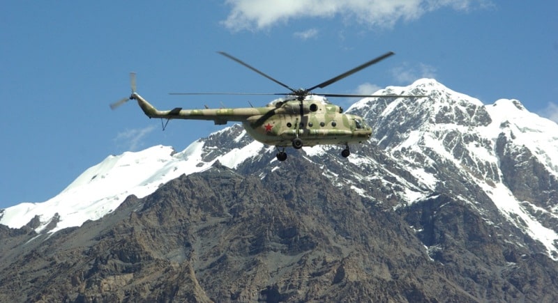
Junket in Kyrgyzstan.
Pobeda Peak 7439 meters above sea level, the highest point of the Tien Shan mountain system, the peak is located on the border between the Republic of China and the Kyrgyz Republic, located in the eastern part of the Kakshaal-Too ridge in the Ak-Suu district of the Issyk-Kul region.
This is one of the five seven-thousanders that are located on the territory of the CIS, the peak is particularly difficult to climb. To the south of the Tengri-Too ridge, the snow-white slopes of the most powerful Tien Shan ridge, Kokshaal-Too, rise.
The entire eastern part of the ridge is a grandiose snow-covered wall, the ridge line of which is at a level of 6000 meters above sea level. The rise in the eastern half of this wall with the highest elevation of 7439 meters above sea level is called "Pobeda Peak".
Pobeda Peak ranks 78th in the list of the highest mountains in the world. The crest of the summit consists of three peaks - Western peak - Vazha Pshavela peak 6918 meters above sea level, Eastern peak (Eleven peak) 7079 meters above sea level and Main peak 7439 meters above sea level.
The most popular route to Pobeda Peak lies through the northern ridge of Vazha Pshavela Peak. A western, rather sharp, snow-ice ridge with rocky outcrops leads to the upper point of the Pobeda peak, about 2 kilometers long.
The massif itself stretched for ten kilometers, in the west it is crowned with the peak of Nehru - 6740 meters above sea level, to the north the Zvezdochka and Dikiy glaciers slide down from the crest, in the south - the territory of China.
Pobeda Peak occupies a special place in the history of Soviet mountaineering. It is called the most inaccessible, the most formidable seven-thousander - this peak makes very high demands on the physical and moral preparation of the climbers.
The weather here is changeable and insidious: now the hot sun warms and caresses, and in a few minutes a snow charge is already sweeping. The expeditions of M.T. Pogrebetsky in 1929-1935 played an important role in the exploration and development of the Central Tien-Shan, where Pobeda Peak, Khan Tengri and other lesser-known peaks are located.
From the top of Khan Tengri, 6995 meters above sea level, Pogrebetsky saw an unknown mountain located to the south, the grandeur and height of which amazed him. Legends and rumors about the existence of a peak equal to or greater than Khan-Tengri have been confirmed.
It was in 1931, and five years later, the group of E. Abalakov, who climbed Khan Tengri, received additional evidence of the existence of an unknown giant. Finally, the expedition of A. A. Letavet in 1938 was already purposeful, she studied the approaches and the possibility of conquering the discovered peak.
The expedition was organized in the year of the 20th anniversary of the formation of the Communist Youth League. On the eleventh day of the ascent, young climbers climbed to the summit in almost complete absence of visibility.
Climbers called it the peak of the 20th anniversary of the Komsomol. In 1943, a topographic expedition headed by P. N. Rapasov worked on the Tien Shan. One of the most important results was the exact determination of the height of the highest peak of the Tien Shan.
It turned out to be equal to 7439 meters above sea level. The highest point of the Tien Shan, named by topographers at the end of filming as the peak of Military topographers, in 1946 was renamed Pobeda Peak - in honor of the victory of our people over Nazi Germany.
The peak of the Military topographers was a high nameless peak 6873 meters above sea level, located in the Meridional Range. On the slopes of Pobeda, climbers faced the most difficult meteorological conditions, with a high avalanche danger. It was necessary to overcome endless snow fields, icefalls, snow-covered and sometimes icy rocky terrain.
The expeditions of 1949, 1952, 1953 and 1955 failed. Only in 1956, a well-organized Spartak team led by V. Abalakov climbed the Central Pobeda. Two years later, the expedition of the Moscow Burevestnik ended in success. The Central Pobeda was visited by a team of seven people led by I. A. Erokhin.
The peak at Pobeda Peak is very smoothed and stretched. The exact definition of the highest point in such cases is difficult. Therefore, the teams that climbed Pobeda set the summit tour where they considered it right. So it turned out that Abalakov did not find the tour left by L. Gutman in 1938, and Erokhin did not find the tour of Abalakov.
Misunderstandings with the location of the summit tour on Central Pobeda continue to this day. In 1981, the Minsk team was not credited with the ascent, since they did not find the tour of the USSR Sports Committee team in severe weather conditions and set their own, and in 1984 their note was found not far from the summit tour.
Geographical coordinates of main summit of Pobeda Peak: N42°02'08.29" E80°07'47.38"
Geographical coordinates of Western Peak (Vazha Pshavela Peak): N42°02'44.67" E80°04'41.57"
Geographical coordinates of Eastern Summit (Peak Eleven): N42°02'13.98" E80°11'52.28"
Authority:
Vladimir Puchkov, Candidate of Technical Sciences, Honored Master of Sports of the USSR, Everest climber. Magazine "Around the World". May 1985. "To the Peak of Victory".
http://mountains.tos.ru/clmb.htm
Photos by
Alexander Petrov and Vladimir Serbenko.