Вы здесь
Tour to Sary-Chelek lake and to Arslanbob.
Ecological tourism in Kyrgyzstan.
“To travel is to live”
Hans Christian Andersen.
Short description of route of tour from Bishkek through lake Issyk Kul in settlement Arslanbob and town of Osh:
Bishkek - natural park Ala-Archa - architectural complex Tower of Burana - lake Issyk Kul - petroglyphs Cholpon-Ata - town of Cholpon-Ata - Grigoryevskoe and gorge Semenovskoe - Orto-Tokoi reservoir - settlement Kochkorka - pass Kalmak-Ashuu of 3446 meters above sea level - lake Son-Kol of 3016 meters above sea level - pass Kara-Kiche - Susamyr valley - pass Ala-Bel 3184 meters above sea level - gorge Chichkan - Toktogul reservoir - town Karakul - settlement Arkit - lake Sary-Chelek of 1876 meters above sea level - settlement Arslanbob - town of Uzgen - town Osh.
Distance of route: 1 792 km.
Season: From 20 of April, 1th till October, 1st.
Best time for travel: May - September.
Duration of tour: 14 days, 13 nigts.
Detailed description of tour from Bishkek up to town of Osh:
Travels from Kyrgyzstan to Fergana.
Day 1. Bishkek.
Arrival in Bishkek, meeting at the airport, transfer to hotel (30 km), accommodation, rest. Breakfast. Excursion on town Bishkek, visiting of the main area of the country - Ala-Too. It is Ala-Too in translation from the Kirghiz language means «Snow mountains», symbolizes the nature of the country which two thirds make mountains. The area "Ala-Too" - the most popular place in city where are spent national open air celebrations, holidays, meetings and other actions. In the center of the area the 10-meter bronze sculptural monument to the hero of national epos Manas, monument to the Kirghiz writer Chingizu Aitmatov and black-and-white monument in memory of events 2002 and 2010 towers.
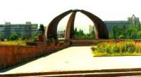
On the area flutters 45 meter flag of Kyrgyzstan. Visiting State museum of History of Kyrgyzstan, Nikolskii churches, mosaic monument «Friendship of people» established in 1964, visiting of monument of Great Domestic war on the area the "Victory", established in 1985, by 40-th anniversary of victory over the Second world war.
Visiting of the Osh market, visiting of museum of Michael Frunze. After lunch the trip to gorge Is Ala-Archa (38 km). Walk in vicinities of natural park is Ala-Archa. Returning to Bishkek. Transfer to hotel, dinner and overnight.
Day 2. Natural park Ala-Archa (47 km).
Breakfast. After breakfast walk in natural park Ala-Archa. Transfer: Bishkek - natural park "Ala-Archa" (42 km, 40 min). Hiking: hotel "Ala-Archa" - gorge Aksai - the foot bridge through the river Aksai (3 km). There where the highway comes to an end, two tracks, in narrow gorge along the river Aksai begin and, the second track, conducts in gorge Ala-Archa. Our walk will pass on more flat and picturesque gorge along river Ala-Archa up to mouth of right inflow Ala-Archa - the rivers Topkaragai.
We pass more than 2 kilometers and hardly above the right inflow of the river Teketor we pass on the foot bridge to the left party of river Ala-Archa. The further hiking: the bridge through river Ala-Archa - right inflow Topkaragai of 2588 meters above sea level (4 km).
After we pass the bridge gorge Ala-Archa extends and mountain tops are in the distance visible. The right inflow of the river Topkarai originates from glacier Topkaragai, in the north from which there is peak Free Korea. Walks in vicinities of gorge Topkaragai. Picnic on beautiful and cosy glade at the river. Returning to hotel "Ala-Archa" (7 km). Returning to Bishkek, dinner and overnight.
Day 3. Bishkek - settlement Tokmok - architectural complex Burana Tower - town of Balykchi - lake Issyk-Kul - petroglyphs "Сholpon-Ata" - town of Сholpon-Ata (259 km).
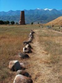
Breakfast. Transfer: Bishkek - an architectural complex «Burana Tower» (72 km, 1 hour). Arrival on an architecturally-archeological museum «Burana» ruins of ancient site of ancient settlement Burana. Visiting of museum open-air - Stone statue monuments with image Turkomans VI - X centuries, here is collected more than 80 various Stone statue. Visiting of collections the mill millstones found at excavation in territory Burana of site of ancient settlement (X - XII в.в., millstones from mills of our time and millstones XVIII - beginnings XX с.с.
Visiting of museum Burana Tower, the pottery of different forms and the sizes, utensils from glass, ceramic and bronze fixtures, manual grain bruiser, Kairaks with Arabian and Nestorianism writing, potter's water pipes, subjects of arts and crafts, bronze coins here is presented.
Visiting of monuments Epigraphy which are presented gravestone stela with inscriptions in the Arabian language, on stela sayings from the Koran, name, year of death of the late are include. Visiting of tower Burana Tower. Burana Tower - minaret of XI century. Initial height Burana of minaret was 45 meters now height of tower makes 24,6 meters.
Visiting of the central ruins where there is hill in the sizes 100 х 100 meters and height of 10 meters which where there are rests of palace complex or temple existed here up to X centuries. The excavation lead on hill, on the top surface here have opened inhabited constructions X - XII c.c. And burial places XIII - XIV c.c. The end of excursion.
The further transfer: Burana Tower - petroglyphs Сholpon-Ata (183 km). Further our way lays through the well-known gorge Boom on which the furious river Chu, further small town at northwest coast of lake Issyk Kul - Balukchi flows. Lunch in the way. Up to the town of Sholpon-Ata our way lays on northern coast of lake Issyk-Kul. Arrival on petroglyphs Сholpon-Ata. Visiting petroglyphs natural boundaries "Сholpon-Ata."
Cave painting natural boundaries «Сholpon-Ata» are located between northern, western and northwest surburbs of the town of Sholpon-Ata on southern slopes of ridge Kungeyi Ala-Too. In territory in length from the east on the West of 4 kilometers and width 0,6 - 2 kilometers are tens thousand stones-boulders.
Petroglyphs Сholpon-Ata are dated in II millenium B.C. - VIII century of BC. Most part Cave painting concerns to the period VII - III в.в. up to BC. Transfer: Cave painting Сholpon-Ata - town of Sholpon-Ata (4 km). Arrival in Сholpon-Ata, transfer to hotel, accommodation, dinner and overnight.
Day 4. Gorges Grigorevskoe and Semenovskoe (119 km).
Breakfast. After breakfast trip to mountains Kungei Ala-Too: Cholpon-Ata - settlement Grigoreyvka - gorge Grigoreyvka - First lake (56 km). On way to the First lake located in gorge Chon-Aksu stop on coast of river Chon-Aksu at local shepherds who have put here the yurts for the summer, acquaintance to life of the Kyrgyzh shepherds, tasting of national dairy drinks Kyrgyzh - koumiss and airan (keefir).
Arrival on lake, walk in vicinities of lake, photographing of lake landscapes with Tien-Shan fur-trees. In gorge magnificent kinds of fir forest which grows on slopes of mountain ridges and infinite Alpine meadows and glades on which cost yurts the Kyrgyzh shepherds and are grazed flocks of sheeps and herds of horses.
Transfer: First lake - gorge Grigoryevka - pass Kek-Bel of 2376 meters above sea level - Semenovka gorge (11 km). On way the stop on pass Kek-Bel, from here opens fine panorama on gorge Grigoreyvka and the top part of gorge Semenovka. Walks in gorge Semenovka, photographing of vicinities. Picnic on coast of the river.
The further transfer: Semenovka gorge - settlement Semenovka - Cholpon-Ata - yachts club on lake Issyk Kul (52 km). Walk on boat on lake Issyk Kul (1 hour). Returning in hotel, dinner and overnight.
Day 5. Cholpon-Ata - town Balykchi - Orto-Tokoi water basin - settlement Kochkorka - pass Kalmak-Ashuu of 3446 meters above sea level - settlement Sary-Bulak - lake Son-Kol of 3016 meters above sea level (365 km).
Breakfast. Transfer: Cholpon-Ata - settlement Kochkorka (164 km). Town Balykchi will be the last at northern coast of lake Issyk Kul, we see the most part of northern coast of lake Issyk-Kul in the extent hardly more than 200 kilometers. Ahead of us wait one of large water basins Issyk-Kul of hollow - Orto-Tokoi. Arrival in settlement Kochkora, visiting of craft workshop in settlement, Arrival in settlement Kochkora, visiting of craft workshop in settlement, visit of museum of an applied art, we can take part in creation of felt carpets "Ala-Kiiz" (The Motley carpet), walk on local market.
The further transfer: Kochkorka - pass Kalmak-Ashuu of 3446 meters above sea level - lake Son-Kol of 3106 meters above sea level (130 km). Arrival on lake Son-Kol, accommodation in yurst camp, overnight.
Day 6. Lake Son-Kol.
Breakfast. High-mountainous jailoo in vicinities of lake Son-Kol for the Kirghiz shepherd the best. Here for the summer drive the herds of horses, herds cattle and flocks of sheeps many shepherds Naryn of area. Foot walk on coast of high-mountainous lake, trip to stones Manas (Tash-Tulgasy), visiting yurts the Kirghiz shepherds, acquaintance to nomadic life of the Kirghiz shepherds.
In second half of day horses riding on slopes of ridge It Baur-Ala-Bas up to height 3500 - 3600 meters above sea level, the majestic panorama of lake with yurts shepherds around of it both grazed herds of sheeps and herds of horses whence opens. Lunch.
In second half of day walk on horses in vicinity of mountains towering above lake Song-Kul, photographing of panorama on lake. Returning in yurts camp, dinner and overnight.
7 Day. Lake Son-Kol - pass Kara-Kiche - settlement Bashkugandy - settlement Kairma - settlement Chaek - settlement Kenoi - Susamayr valley (186 km).
Breakfast. Transfer: lake Son-Kol - Susamyr valley (186 km). A stop on pass Kara-Kiche, walk in vicinities and photographing. Further on way stop in picturesque valley of river Kara-Kiche, walk in vicinities, photographing.
After pass Kara-Kiche from road it is well visible coal cut in which coal is extracted. Lucnh in a way. The further transfer to Susamyr valley. Our way goes in Susamyr valley which is extended in latitudinal zone direction from the West on the east and there is between northern spurs of ridge Kyrgyzh Ala-Too and southern spurs of ridge Talas Ala-Too.
Susamyr the valley also is good place for years pasture meadow cattle which is driven on high-mountainous jailoo by local shepherds. These are hundreds hectares of the Alpine meadows with various vegetation and juicy pastures.
The main employment of local residents leading nomadic way of life in years months in Susamyr to valley - preparation from horses milk: Koumiss, kurt (the firm, dried cottage cheese) and airan (kefir). Arrival in Susamyr valley, walks in vicinities, acquaintance to a life of the Kyrgyzh shepherds-nomads. Accommodation in yurts camp or hotel, diinner and overnight.
Day 8. Susamyr valley - pass Ala-Bel 3184 meters above sea level - gorge Chichkan - Toktogul water basin - town Karakul - settlement Tash-Kumyr - settlement Arkit (353 km).
Breakfast. Transfer: Susamyr valley - gorge Chichkan (60 km). After Susamyr valley our way passes valleys through pass Ala-Bel in gorge Chichkan. Here in one of picturesque places stop at the river Chichkan, walk on vicinities.
After the most beautiful Toktogul water basin which serves as stocks of fresh water and power resources of the south of Kyrgyzstan we move to the cascade of Hydroelectric Power Station on the river Naryn. Lunchr in a way.
Further through settlement Toktogul we arrive to fantastic gorge of the river the Kara-Su. The further transfer: gorge Chichkan - Tash-Kumyr - settlement Arkit (306 km). Arrival in settlement Arkit, accommodation in guest houses, dinner and overnight.
9 Day. Lake Sary-Chelek of 1876 meters above sea level. Lake Kyla-Kol - lake Tyuk-Kol (22 km).
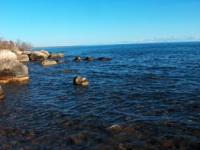
Breakfast. After breakfast transfer: Arkit - Sary-Chelek (17 km). From settlement Arkit our way to lakes passes on picturesque gorge and approximately for 4 kilometers before lakes we rise on lake plateau. The lake Sary-Chelek in length of 7,5 kilometers and from 0,5 up to 1,8 kilometers is located by width at height of 1876 meters.
verage depth of lake Sary-Chelek about 100 meters, the maximal depth of 220 meters. Walk in vicinities of lake. Picnic on coast of lake Sary-Chelek. Returning to lake Kyla-Kol (1 km). Stop at lake Kyla-Kol. The lake Sary-Chelek creek is connected to lake Kyla-Kol in the length 700 m and width 400 m.
Walk on viewing platform at lake, the magnificent panorama on gorge leading to lake Sary-Chelek and settlement Arkit whence opens. Walk to lake Kyka-Kol also ancient, sacred tomb of the saint Toskool-Ata. This tomb of the saint - sacred place for moslems under name Toskool-Ata so called the elder which became sacred. The further walk to lake Tuyk-Kol. Walk in vicinities of lake Tuyk-Kol. Acquaintance to flora of reserve. Returning in Arkit, dinner and overnight.
Day 10. Lakes Aram-Kol - Chelek-Kol - Bakaly-Kol - Iri-Kol (22 km).
Breakfast. Transfer: Arkit - lake Aram-Kol (22 km). Today we rise on lake plateau, we pass lake Kyla-Kol which remains from us at the left and on soil road we direct to lake Aram-Kol. Arrival on lake Aram-Kol. Foot walk in vicinities of lake. Then we continue walk to small lakes Chelek-Kol and Iri-Kol.
Lake Chelek-Kol is located in southeast from lake Sary-Chelek, its length about 2000 meters, width - 230 meters, depth - 9 meters, this biggest lake from group of lakes located in southeast from lake Sary-Chelek. The sizes of lakes Aram-Kol, Bakaly-Kol and Iri-Kol from 1 up to 18 hectare.
Picnic on pass. After picnic free time. Interested persons can rent horses and make walk on pass Keterme of 2446 meters above sea level. On lake Sary-Chelek it is possible to rent boat and to make walk on northern coast of lake. Returning in Arkit, dinner and overnight.
Day 11. Arkit - settlement Tash-Kumyr - settlement Shamaldy-Sai - settlement Kochkor-Ata - settlement Msyy - settlement Arslanbob (244 km).
Breakfast. Our way after settlement Tash-Kumyr passes by northern part to extensive Fergana valley and after settlement Red-October will run along the river the Kara-Unkur gradually going deep in mountains of the Fergana ridge. Lunch in a way. The settlement Arslanbob is named the legendary gardener who has planted, under the legend, surrounding nut woods.
The settlement was stretched at height 1400 meters above sea level and since ancient times involves inhabitants of east part of Fergana valley with soft climate and beauty of the nature. Arrival in settlement Arslanbob, transfer to guest houses, accommodation, dinner and overnight.
Day 12. Arslanbob.
Breakfast. The natural boundary Arslanbob settles down along rough river Arslanbob-Su on 8 - 10 km and is at height from 1200 up to 1800 meters above sea level. In the north from settlement in the western spurs of the Fergana ridge there is the highest peak of neighboring mountains - Babush-Ata 4427 meters above sea level. On subalpine and Alpine meadows all variety of the rich nature and paint of field colors is presented.
Visiting tomb of the saint Arslanbob where the legendary gardener, visiting of local mosque is buried.The tree of a hawthorn at inhabitants is considered a tree of dream and desires. Here, near to a falls, on this tree fasten shred fabrics and think of desires.
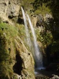
Walk on horses in natural boundary Dashman (3 km) to falls Chiltan. The height of falls 30 - 35 meters water falls and is broken to bottom about boulders and fragments of rocks. In air it is lot of moisture, cool. Downwards to falls the good footpath is laid, to the left of falls there is cave.
Picnic on the nature. After visiting falls walk in nut woods of natural bundary Arslanbob (4 km). Returning in settlement, dinner and overnight.
Day 13. Arslanbob - settlement Kaiyrmy - settlement Kyzyl-Kyrman - town of Uzgen - settlement Kara-Debe - town of Osh (175 km).
Breakfast. Transfer: Arslanbob - town Uzgen (123 km). After settlement Kyzyl-Kyrman we visit in town Uzgen historical sight of the south of Kyrgyzstan. Uzgen, one of the oldest town the south of Kyrgyzstan to which more than two thousand years also have ancient history.
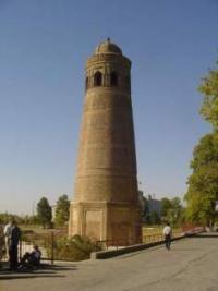
It is located town on coast of river Oi-Tal in Kara-Darya to valley. Lunch in Uzgen. Visiting of three mausoleums and minaret. The mausoleums Karakhanids governors are located in territory medieval Uzgen, their state was capital in XI - XII с.с. The mausoleums are constructed at various times, but their architecture is traditional for the Central Asia. Advantage of these monuments that their construction dated approximately one chronological by time, shows development of construction of religious monuments of time karakhanids.
Two mausoleums are dated rather precisely: northern - 1152, southern - 1187. The oldest mausoleum - average. After excursion transfer: Uzgen - Osh (52 km). Arrival in town Osh, transfer in hotel, accommodation, dinner and overnight.
Day 14. Town of Osh.
Breakfast. Excursion on the town of Osh, visiting: unique natural-historical the sight of Kyrgyzstan, which survey includes mountains Suleiman-Too: Osh settlement of an epoch of bronze, to this settlement about 3 thousand years, about it archeological finds testify.
Visiting of cave complex. Expositions of cave complex are devoted to religious traditions since ancient times: buddhism, shamanism, christianity and an islam. Visiting of archeological-cultural monuments in vicinities of mountain Sulaiman-Too, at first top Sulaiman-Too is unique single-chamber mosque of the Fergana architecturally-building school XVI - XVII c.с., the mosque of prophet Suleimana (Solomon), mosque is located at height more than 150 meters on a sea level.
Visiting of historical museum «Great Silk way», premise of museum shares on two halls. In the first hall an exposition, devoted to flora and fauna of Kyrgyzstan. In the second hall the exposition is devoted to history of Kyrgyzstan, since the most ancient times till now. Visiting of mausoleum Asaf Ibn Burkhiay of XVIII century which is in historical city centre Osh, near to the museum complex Sulaiman-Too located at mountain Sulaiman-Too.
Visiting madrasah Alymbeka Paravanchi Datka, madrasah Mukhamedboi Turki Hal Muratbaeva these madrasah are unique samples of the Fergana architecturally-building school. After lunch transfer: town of Osh - check point «Dostuk» (4 km). At once behind city stop on the Kirghiz check point «Dustuk», passage of formalities of boundary and customs service of Kyrgyzstan.
The Kirghiz check point is followed with the Uzbek check point "Dustlik», passage of formalities of boundary and customs service of Uzbekistan. Transfer Uzbekistan.
Additional price of services on tour «Tour to Sary-Chelek lake and to Arslanbob»:
Folklore concert in Bishkek (KZT) - 114 000 on group.
National game «Upak-Tartysh» on lake the Song-Kul (KZT) - 68 400 on group.
Indicative installation yurt on lake Song-Kul (KZT) - 38000 on group.
Visitings shop of manual manufacturing «Shirdaks» (national carpets) in village Kochkorka (KZT) - 2300 for the pax.
Walks on horses on the Song-Kul lake (KZT) - 2000 pax.
https://www.nationalbank.kz/?docid=747&switch=russian - on this reference can see an official ratio of KZT to US dollar.
Note on «Tour to lakes Sary-Chelek and to Arslanbob»:
At will in settlement Arslanbob it is possible to lead additional day and to make walk to the Big falls at bottom of mountain Babash-Ata of 4427 meters above sea level
Day 13. Big falls at mountain Babash-Ata of 4427 meters above sea level (7 km).
Breakfast. Horse riding: Arslanbob - the Big falls (7 km). Our way passes through village, with houses constructed in national style. Horse riding to a tourist center, the panorama on near mountain ridges from here opens, the highest tops lay under a snow. From a track the falls is well looked through from settlement Arslanbob and it is visible on a background of rocks. The track goes on rise. When we approach to water-pood more close, it is visible that it wide and big, soon it a short time later clear away a ledge of mountain.
On a way there are thrickets of a barberry, tavolga, exzokhord, above there is a birchwood. We pass the rivers and slopes of mountains, the road rises to the Big falls 2200 meters above sea level. We pass small rivers and slopes, the track rises to the Big falls which is at height of 2200 meters above sea level.
The juniper, maples, nut trees, apple-trees, different bushes Here grow: a dogrose, cotoneaster, ipesas. From height of 140 meters crystal-clear water which form two separate falls, the first falls in height about 80 meters, the second falls, about 60 meters falls.
Further our way goes through nut woods, here there are very high trees. Among century nut trees there is a tomb legendary sacred Ibn-Abasa. A following place of our excursion to a place of the big panorama of neighboring mountains where traditionally inhabitants celebrated arrival of spring. At descent to a falls there are three caves which Caves of forty angels refer to. Women who do not have children, come to these caves, enter into caves, sacred angels pray also help them to have the child.
Now we hear only noise of falling water. From small houses of hydrostation it is risen to a place, the falls whence falls. Tracks here are not present, on slopes it is a lot of stones which lay under legs. Waters of a falls fall from a monolithic and high rock. Picnic at a falls. After visiting falls walk in of Arslanbob (7 km). Dinner and overnight in guest houses.
Note:
Author program is Alexander Petrov. Copying and introduction - from the sanction of author.
Photos by
Alexander Petrov.


