


![]()
You are here
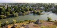
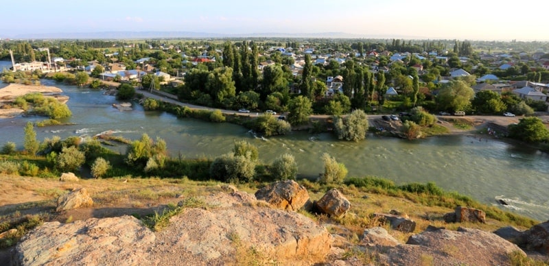
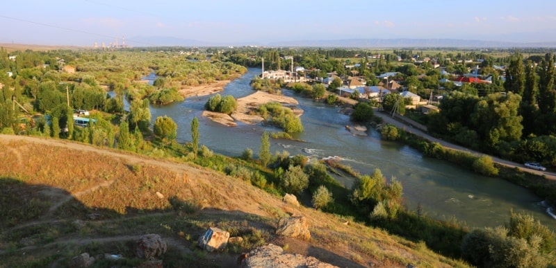
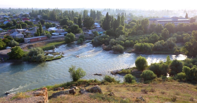
Talas river.
Tours across Talas region.
"A little below the bridge, the Talas River splits into a mass of channels, forming a vast riverbed, which can be crossed even by fording, abundant in pebbles and rather deserted, with sparse yellowed vegetation. But along the bank from the Aulie-ata side there is a whole meadow. Here, on the soft soil, grows a mass of Festuca arundinacea Schreb., completely covering the meadow. Two species of willowherb (Salix) also grow here. For some reason, the Talas riverbed and the narrow-leaved willowherb immediately reminded me of the area along the Onon River in Transbaikalia."
"Across Mountainous Regions of Russian Turkestan." V. I. Lipsky. 1906.
Sights of Talas region.
Talas River (Kirghiz Talas, Kaz. Talas) flows through the territories of Kyrgyzstan and Kazakhstan.
The length of the river is 661 kilometers, the catchment area is 52,700 square kilometers. The river is formed by the confluence of the Karakol and Uchkosha rivers, fed by runoff from the slopes of the Kyrgyz Alatau and Talas Alatau ranges. Below the confluence of these rivers, the Talas flows through a wide valley, breaking into many branches.
The village of Kirovskoye Talas has the most developed network of tributaries, the waters of which are used for irrigation and often do not reach Talas. Having skirted the Kyrgyz ridge from the west, the river enters the open steppe, where they are disassembled for irrigation and are partially lost for evaporation and infiltration.
The river is fed by ice and snow. It is formed from the confluence of the Karakol and Uch-Koshoi rivers, which originate in the glaciers of the Talas ridge of Kyrgyzstan. On its way, the Talas River receives many tributaries, of which the most abundant are: Urmaral, Kara-Buura, Kumushtak, Kalba, Besh-Tash.
In the lower reaches, the river is lost in the sands of Moyinkum. On the left bank of the river is the administrative center of the Talas region of Kyrgyzstan - the city of Talas, and downstream - the administrative center of the Zhambyl region of Kazakhstan Taraz.
There are Talassky, Temirbeksky, Zhiembetsky and Uyuksky hydroelectric complexes on the river. Also on the river is the Kirov reservoir. High water occurs from late April to early September. Average discharge of water in the upper reaches (555 km from the mouth) 15.7 cubic meters per second, above Taraz (444 km from the mouth) 27.4 cubic meters per second.
Talas ends with a network of lakes and swamps in the flat areas of the Muyunkum desert, far from reaching the Chu River, of which it was a tributary in the past. The Talas River has a left tributary - the Asy River. In 36 BC. e. In the Talas Valley, under the walls of the Chzhichzhicheng fortress, a battle took place between the Xiongnu troops led by Chzhichzhi-Shanyu and the troops of Han China.
The battle ended with the capture of the fortress and the death of Chzhichzhi-shanyu. In 400 years near this river in the territories of the modern Kazakh city of Taraz, there was a city called "Tolosa". He is mentioned by the Chinese monk Xuanzang.
Tolosa, when translated from Tocharian, means "Abode of the Az" (Azy-Turkic tribe). From there came the name of the river. In 751, the battle of Talas took place near modern Taraz, in which the cavalry of the Abbasid Caliphate, the forces of the Turgeshes and Karluks utterly defeated the army of Tang China.
The decisive role in the battle was played by the sudden blow of the Karluk horsemen to the rear of the Chinese. As a result of this historic victory over the Chinese, the Arabs, who won only thanks to the intervention of the Karluks, stopped their expansion into the lands of the Turks, although they gave impetus to the spread of Islam there over the next centuries, the Karluks formed the Karluk Khanate, and the Uighurs restored independence in East Turkestan.
And Chinese expansion in this region was no longer renewed until the XVIIIth century. In 1269, a kurultai of Mongol princes gathered in the Talas valley, where the boundaries of their lands were determined. In the Talas valley, there are archaeological sites with ancient Turkic inscriptions.
Geographic coordinates of Talas River are: N43°05'56 E71°36'23
Authority:
https://ru.wikipedia.org/wiki
Photos by:
Alexander Petrov.