


![]()
You are here
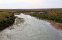
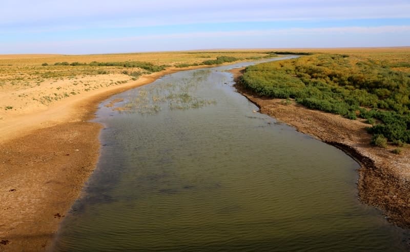
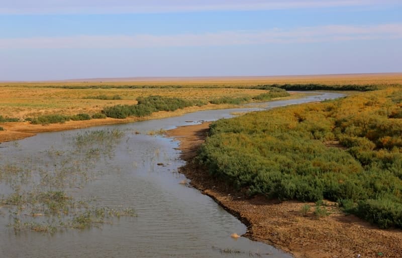
Sagiz River on West Kazakhstan.
Wildlife Tours Atyrau region.
“Flood meadows! Flood meadows!
Both for the eyes and for the heart are sweet to me
Scattered around the colorful snowstorm.
How beautiful meadow carpets are!”
Anatoly Bolutenko.
Flower Tours Atyrauu region.
Sagyz River, a former tributary of the Emba, flows through the Aktobe and Atyrau regions, now a drying river in the upper and lower reaches. The Sagyz river begins on the Poduralsky plateau, from the confluence of the Kyzyladylsay and Daulda rivers, has a permanent watercourse and is lost 10 - 12 kilometers south of the Makat railway station in the Tentyaksor salt marshes.
The length of the Saga River is 551 kilometers, the basin area is 19.4,000 square kilometers, the average discharge at the mouth is 2.0 - 3 1 s (8 - 9 times less than at the Emba). It flows mainly within the Caspian lowland, ends in a system of saline land, not reaching 60 - 70 kilometers to the Caspian Sea.
The water in the river is salty. The width of the river is from 3 meters and on floods up to 48 meters, the depth is from 0.3 to 2.0 meters, the flow rate is 0.1 meters per second. The bottom is mostly sandy. The floodplain of the river is open, overgrown with reeds and swampy in places, has a width of 1 to 4 kilometers, is cut by channels, drying channels, gullies up to 4 meters deep.
The shores are gently sloping, in some places steep (from 2 to 7 meters high and up to 2 kilometers long). Fords on the river are often located, up to 0.8 meters deep. The river flows among steep banks, winding heavily. On the right bank of the middle reach of Sagyz there is a sand massif Kyzylkum-Sagyz.
In the lower reaches of the Sagyz, meadows of saltwort, wormwood, and itsigek dominate. Thickets of chia are common on light saline soils. Flat depressions are occupied by azhrekovo-saltwort vegetation. Before reaching the village of Sagyz, the riverbed is lost among the saline-chaks Tenteksor, bordered by salt marshes with shrub saltwort - sarsazan.
The river is fed mainly by snow. It freezes at the end of November, opens at the beginning of April. In summer, the water is salty and stored in separate reaches. Used for irrigation.
Geographical coordinates of Sagyz River in Atyrau region: N48°18'05.04" E54°37'27.05"
Geographical coordinates of Sagyz River in Aktobe region: N48°29'50.75" E55°58'10.78"
Authority:
A.A. Chibilev. "The Ural River." Leningrad. Hydrometeoizdat, 1987.
http://www.caspianmonitoring.ru/
Photos by
Alexander Petrov.