


![]()
You are here
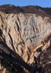
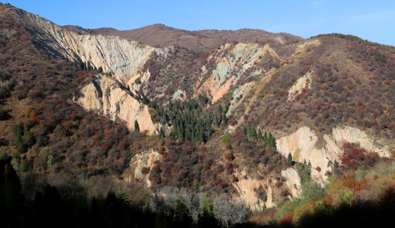
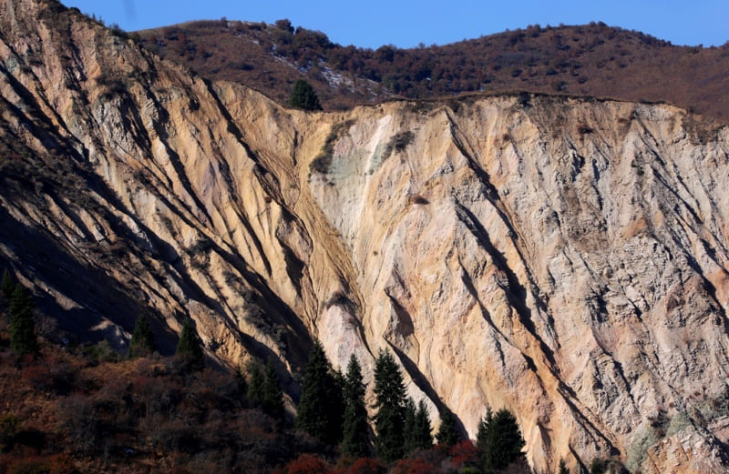
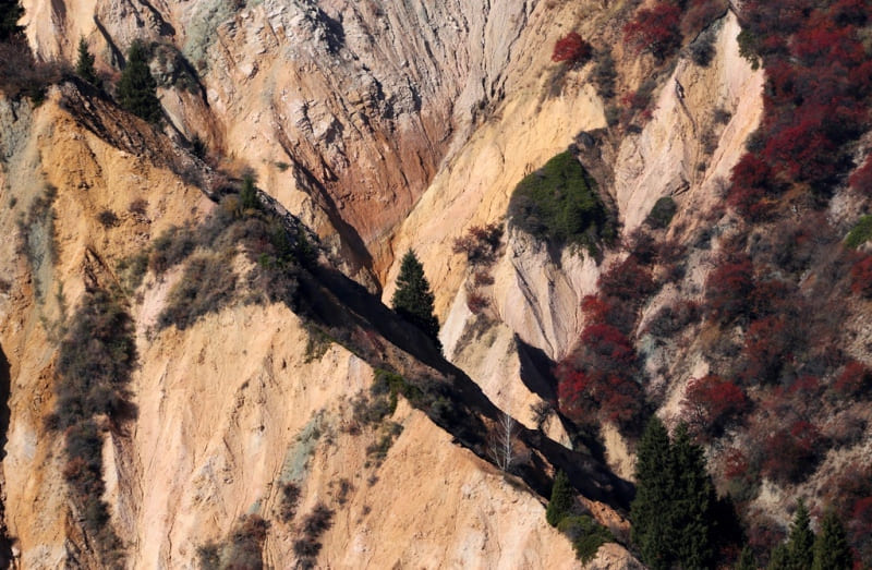
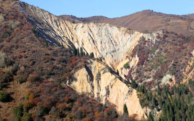
Landslide Stone flower in Big Almaty gorge.
Tourist routes to Big Almaty Gorge.
“Don't laugh, you know the mountains are life,
In the steppe, only death finds shelter.
We run here from her for an hour,
And then we leave for centuries"
Irina Trubacheva. 1988.
Walk to landslide Stone flower in Big Almaty gorge.
The middle part of the collapse of the Stone Flower is located at an altitude of 1481 m. a. s. l., located at the beginning of the eastern slope in the Big Almaty Gorge, 1.8 kilometers (in a straight line) from the Big Almaty Dam in Bostandyk district of Almaty city.
The perimeter of the collapse is 2305 meters, the area is 0.23 square kilometers. The length of the collapse from the beginning of the top point at an altitude of 1721 m. a. s. l. and to the end of the collapse in the stream bed at an altitude of 1398 meters above sea level is 1.1 kilometers.
A small stream 3.1 kilometers long flows along the bottom of two gorges of the collapse, which originates from the northeastern side of Mount Kaskabas, 2305 m. a. s. l. The width of the collapse in the upper western part is 300 meters.
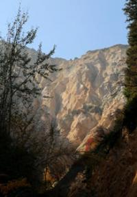
The exposed rocks of the slopes of the gorge created by nature are striking in their colors: white, pink, green, reddish, brown.
This gorge and the landslide itself are called "Stone Flower" by tourists. The vicinity of the collapse belongs to the low-mountain erosion-denudation relief. The landslide consists of loess rocks with boulders and pebbles, sandy loams and loams.
This relief is located in the zone of erosion and landslide processes. Most likely, as a result of the earthquake, a flood was formed, which led to a tremendous collapse of the slope. The length of the pedestrian part in the vicinity of the landslide is from 3 to 5 kilometers.
The walk starts from the bird nursery "Sunkar", then the trail leads to the stream bed and then you can navigate by the signs, information on which shows the direction and distance. To see most of the landslide, one has to climb the trail from the Sunkar nursery, along the slope on the east side of the landslide.
Then, focusing on the middle part of the landslide, and reaching the birch grove, go down through it and then go through the walnut grove to the stream. It should be noted that there is no path from the eastern slope down to the stream, you must move carefully.
In the walnut grove there is a clearing, a fallen tree, a fireplace here you can rest. Then a short distance to the stream, along which it is necessary to descend to the northeast (to the right) and soon the mouth of the stream is reached. From this place, you need to turn west (left) and then follow the signs.
In order to reach the main gorge, which is more expressive, it is necessary to keep to the right.
Geographic coordinates of Stone Flower landslide: N43°07'18 E76°53'33
Authority and photos by:
Alexander Petrov.