


![]()
You are here
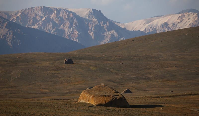
Kubyrgenty Pass.

High mountain passes in Dzhanydzher Range.
"Ascent to Kubergenty Pass is very easy. The pass is located on the very ridge that blocked the headwaters of the Kara-Chukur. This was an ancient moraine or connecting trough skeleton, covered with old glacial deposits. The summit of the pass is a fairly flat plateau with small, gentle ridges. Clay soil with sparse, sparse grass clumps and few rocks covers it. The damp surface indicated that the snow had melted here quite recently. The pass is 3,909 meters above sea level. Its point, or rather the entire area with a uniform horizon for 100 meters or more, is remarkable in its own right. This is something similar to the famous border post in the Urals with the inscription: "Europe and Asia." Kubergenty Pass separates two river systems, the lower reaches of which disappear into the deserts at opposite ends. To the north is the Syr Darya basin, which flows into the Aral Sea, and to the south is the Tarim basin, which ends at Lake Lob-Nor."
Palgov N.N. "Along Central Tien-Shan." 1930.
Passes in Borkoldoy Range.
Kubyurgenty Pass is located at an altitude of 3907.2 meters above sea level, on a high-mountain plateau separating Dzhanydzher mountain range to west and Borkoldoy mountain range to east, in At-Bashi district of Naryn region.
The Kubyurgenty Pass is one of the high-altitude passes of the Inner Tien-Shan, opening the way across the plateau from the Naryn River valley to the valleys of the Eastern and Western Aksai and Uzengegush mountains, where the rugged beauty of rocky peaks, the purest icy air, and the silence of glacial valleys merge.
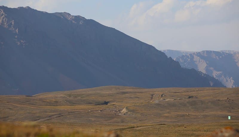
The pass's geology is composed of ancient metamorphic, granitic, and gneissic rocks of the Paleozoic era. Traces of ancient glaciation are clearly visible here - morainic ridges, cirques, and troughs, where tiny snowfields melt in the summer, feeding streams and mountain springs.
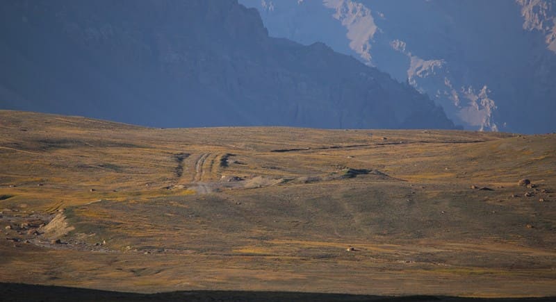
The plateau surface where the pass lies is uneven, with alternating rock scree, debris flows, and patches of permafrost. The climate of the pass is typically high-altitude - sharply continental and harsh. Winter temperatures drop below -35°C, snow lingers until late May, and summers are short and cool.
Frequent winds and sudden temperature fluctuations make travel here a challenge even for experienced climbers and explorers. Since ancient times, caravan routes and shepherd's trails have traditionally crossed the Kubyurgenty Pass, connecting the Naryn River Valley with the Inner Tien-Shan.
According to local oral tradition, the pass is considered a "gateway to heaven," through which mountain spirits watch over nomadic tribes. According to legend, it was here that ancient travelers left stone mounds - both to prevent mountain winds from diverting their path and to help them return home.
Today, the Kubyurgenty Pass is rarely visited by tourists, but is of great interest to geographers, geologists, and mountain travel enthusiasts. From its heights, stunning panoramas open up of the Borkoldoy and Dzhanydzher massifs, the northern slopes of the Kakshaal-Too ridge with the Kyzyl-Asker and Dankov ice caps, whose glacial peaks are often hidden in white clouds, as if in the mists of time.
Tips for travelers and explorers about Kubyurgenty Pass.
Kubyurgenty Pass is a difficult and harsh section of the high mountain plateau, so preparation for the route requires a serious approach.
Best time to travel through Kubyurgenty Pass:
The optimal period for crossing the pass is from mid-July to mid-September, when the snowfields on the slopes partially melt and daytime temperatures at an altitude of approximately 4,000 meters above sea level range from +5 to +10 °C. In spring and fall, the pass is almost always covered by snow and strong winds, while in the winter months, polar silence reigns, with temperatures reaching -30°C.
What to bring:
Warm, windproof clothing, sunglasses and sunscreen (ultraviolet radiation is extremely intense at these latitudes), a supply of gas or fuel for heating, a GPS, a first aid kit, and a snow shovel. A small supply of food for 2 - 3 days beyond your planned time is a good idea, as the mountains often delay travelers with snowstorms or fog.
Features of route through Kubyurgenty Pass.
Kubyurgenty Pass is located in the intermontane space between two mountain ranges. The 13.5-kilometer-long left Kotur River originates on the southern slopes of the pass. The 19.5-kilometer-long Karachukur River, a left tributary of the Dzhagalmay River, originates on the northern slope of the pass.
At kilometer 16, the 16-kilometer-long Dzhangdzhir tributary flows from the left into the Karachukur. Since ancient times, the caravan route from Lake Issyk-Kul has passed through the Kubyurgenty Pass via the Barskoon, Dzhukuchak, or Dzhuku passes.
Then, along the left bank of the Taragay and Naryn River valleys near the Taragay valley, the crossing to the right bank of the Naryn River begins. Along the Karakol River valley, the ascent begins between the Chakyrkorum mountain range in the east and the Janydzher mountain range in the west.
Then, along the left tributary of the Karachukur, the ascent to the Kubyurgenty Pass leads to the descent to the Kagalyachap plateau in the Eastern Aksai Valley. From the Kubyurgenty Pass, a road runs along the Karakol River to the left bank of the Naryn River.
A tip from locals:
Before starting the ascent, it is customary to leave a small sign on the rocks - a coin, a piece of cloth, or simply a word of gratitude to the mountains. This is believed to bring good luck and allow the traveler to return home the same way they came.
Echo of Kubyurgenty Pass in Borkoldoy Mountains.
At the Kubyurgenty Pass, the wind doesn't just blow - it speaks. It carries the whisper of ancient caravans, the traces of nomads and dreamers whose footsteps have vanished in the snow but never faded from the earth's memory. Here, where the sky seems closer than a breath, one senses the measure of one's journey and the infinity of the world.
The silence of the Kubyurgenty is not emptiness, but a reminder that all living things are interconnected: stone, glacier, rider, and eagle in the sky. Everyone who has crossed this pass takes with them not only impressions but also a feeling of inner purification - as if they have become part of these mountains, ancient and eternally young.
Geographic Coordinates of Kubyrgenty pass: N41°14'13 E77°21'49
Authority and photos by:
Alexander Petrov.