


![]()
You are here
Glacier TEU.
Exclusive tours in Tien-Shan mountains.
“The skier left traces of the turns:
twists of fate, twists of love.
Snowy Milky Way rushing through the gate
rushed off to infinity, call - don't call”
Yuri Kukin. "In memory of Vizbor." September 1984 – 1994.
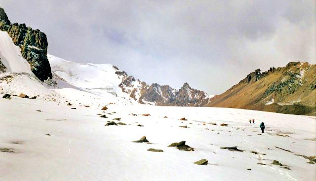
Hiking on glaciers of Southern Kazakhstan.
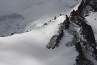
The TEU glacier (Tourist and Excursion Office) is located at altitudes from 4355 to 3397 meters above sea level, located in the upper part of the Middle Talgar gorge, belongs to the Talgar river basin, on the territory of the Almaty nature reserve, on the northern slope of the Zailiyskiy Alatau ridge in the Talgar region of Almaty area.
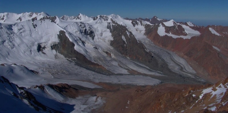
Against the lower part of the Shokalsky glacier, two wide and rather long basins with steep slopes approach the main river valley. A part of these slopes facing north-east rises to a height of 4356 meters above sea level (Dzhambul peak) and is covered with constant snow.
Two glaciers stretch from it eastward to the left. Both belong to the type of hanging valley glaciers. The lower one (downstream) is known as the TEU Severny glacier, and the upper one is known as the TEU South glacier.
The length of each of them does not exceed 2 kilometers. The area of the North is no more than 2 square kilometers, and the area of the South is no more than 2.5 square kilometers. Both glaciers at a distance of 1 - 2 kilometers from the left branch of Shokalsky sink into their moraine deposits, which are closer to the foot in some places overgrown with grass.
Two streams roll down the fresh moraines, one from the bottom. On the eastern slope of the Stalsky spur, in addition to the aforementioned glaciers of the Northern and Southern TEU, there are a number of small glaciers such as hanging and ice. V. G. Gorbunov has six of them, but there are three more or less significant in magnitude.
This, counting down the valley of the Middle Talgar River, the Jamalak (Jamalak), Solnechny and Strelok glaciers. All three are valley types. Area - 2.5, 1, 0.5 square kilometers. From the ends of all named glaciers, long moraine deposits are drawn down approximately on the slope.
North of the Strelok glacier, behind a fairly wide ledge of the mountain, is the Yubileinaya peak with a spacious glacier. The latter is filled with moraine deposits, under which the small Yubileiny glacier has been preserved.
The area of glaciation on the entire eastern slope of the Stalsky spur is 8 square kilometers.
Geographic coordinates of the TeU North glacier: N43 ° 06'18.47 "E77 ° 14'22.34"
Geographic coordinates of the TEU Yuzhny glacier: N43 ° 05'41.47 "E77 ° 14'43.97"
Authority:
Catalog of glaciers of the USSR. - Leningrad, 1967, v. 13, c. 2. Part 2. Tuyuksu Glaciers (Northern Tien Shan). L.: Gidrometeoizdat, 1984. Icing of the Tien Shan. Ed. N. B. Dyurgerova. - M., 1995. Icing of the Trans-Ili Alatau. - M .: Nauka, 1969. Palgov N. N. Bolshealmatinsky glaciation site in the ridge of Zailiysky Alatau. Brief Encyclopedia Kazakh SSR, Volume 2, Nature, Alma-Ata, 1990.
Photos by
Sergei Mikhalkov, Roman Stetsenko.