


![]()
You are here
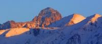
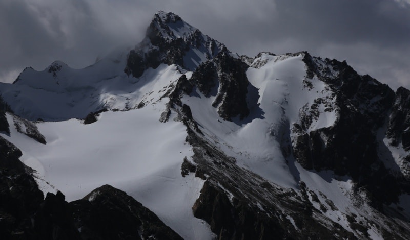
Glacier of Bogatyr.
Kazakhstan mountaineering Tours.
“Travel brings power and love back into your life.”
Rumi.
Guided Tours in Kazakhstan mountains.
The Bogatyr depression glacier is located at an altitude of 3420 to 4580 meters above sea level, located in the Talgar mountain range, belongs to the Chilik river basin, on the southeastern slope of the Zailiysky Alatau mountain range in the Northern Tien Shan mountain system, on the territory of the Almaty nature reserve in the Almaty region.
The area of the glacier is 30.3 square kilometers, the ablation area is 10.2 square kilometers, the volume of ice mass is 4.5 square kilometers. The glacier is 9.1 kilometers long, with an area of 30.3 square kilometers, and consists of three ice streams forming a short tongue.
The peculiarity of these glaciers is that each of the branches composing them has its own regime. On the Bogatyr glacier, the left and middle branches had an ice speed of 6.2 and 3.1 meters per year respectively. The rapid movement of this glacier in the 1980s is known.
Named by the discoverer S.E.Dmitriev in 1910. The brand line runs at an altitude of 4020 meters above sea level. The tongue of the glacier is covered with moraine deposits below. The middle branch of the Bogatyr glacier ends at an altitude of 3450 meters above sea level.
Observations of recent years have established a significant reduction in the volume of the glacier in 1984. The Bogatyr glacier is the second largest glacier in the Zailiyskiy Alatau. The Bogatyr glacier, according to the definition of its discoverer S.E.Dmitriev, belongs to the basin type. It lies in the headwaters of the South-East Talgar River.
Its rear side is the eastern slope of the main ridge, from the opposite (western) side of which the Toguzak, Kalesnik, Pioner and Severtsov glaciers are fed. The highest peak of the glacier is Bogatyr Peak 4580 meters above sea level.
From the south, the Bogatyr glacier is limited by the lateral spur of Zhusandy-Kungei, from the north - by the southern Issyk spur, bearing the summit of Issyktenshoky at a height of 4800 meters above sea level. The upper reaches of the glacier are divided by the side spurs of the mountains into three basins.
S.E. Dmitriev gave the latter a special name: the left basin - Shuytsa, the middle one - the Head and the right one - the Hand. Shuytsa has a multi-chamber circus, Head - single-chamber and Hand - too. Circus The head is closed with a ridge.
Part of the ridge is the Toguzak saddle. When leaving their separate basins, all three branches of the glacier are united into one, marking the junctions with median moraines. The length of the glacier without frontal moraines is about 8 kilometers, the width at the confluence of its three branches is 2300 meters, and near the end of the tongue is 700 meters.
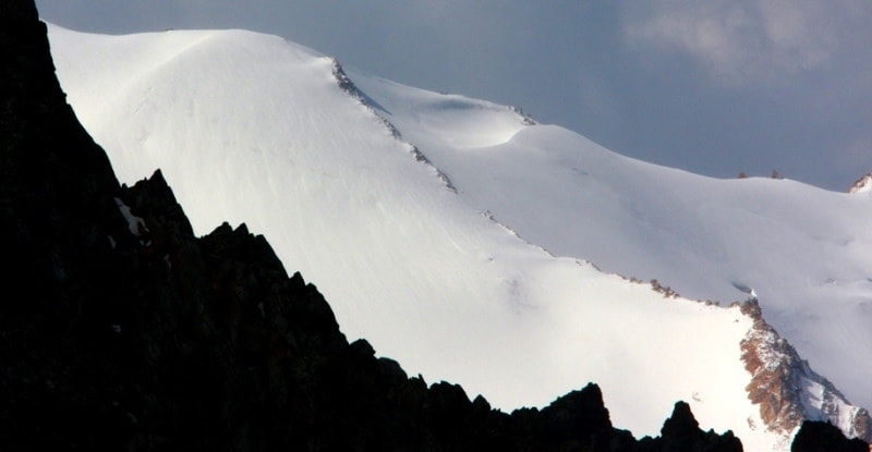
The upper reaches of the Bogatyr glacier are distinguished by sharp and strict contours. Here, among the flat and undulating surfaces of the circus, steep rocky peaks rise. One side of them, facing southeast, is completely naked.
The other northwestern part of the glacier is covered with mounds of snow. Some of the flatter peaks are completely buried in these strata, those that are steeper are lined with separate snow strips lying in gorges and niches.
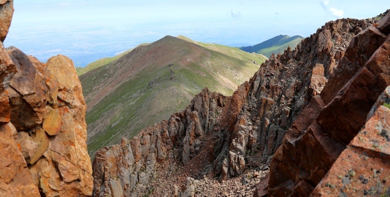
In the lower reaches, the slope of which is about 6 degrees, the glacier is gradually covered with moraine deposits. Cliffs, depressions and, occasionally, hollows with lakes of water are randomly scattered along the moraines.
On the left side, the glacier ends with a steep inaccessible forehead, on the right - it is all buried under the rubble of stone. In one place, on moraine deposits, there are huge blocks, which were torn off, probably during an earthquake, from the neighboring slope of the mountain.
The right and left sides of the glacier are separated from the mountain slopes by deep ravines. Glacial streams flowing from different parts of the glacier spread over the glacial outwash, representing the lake-like expansion of the valley.
In the South-East Talgar basin, in addition to the main glacier, there are eight others. Of these, four glaciers are located in kars on the southern slope of the Issyk spur. Here the upper glacier (downstream) has a length of about 1.0 - 1.5 meters and with its final moraine abuts against the side moraine of the Bogatyr glacier.
The other three glaciers are insignificant. They are located downstream, one after the other. Four glaciers are located on the northern slope of the Zhusandy-Kungei spur. All of them have a northeastern exposure.
Three of them are crimson, one is hanging. The total area of the entire glaciation in the South-East Talgar basin is approximately 45 square kilometers.
Geographic coordinates of the Bogatyr glacier: N43 ° 02'46.50 "E77 ° 14'56.71"

Authority:
"Glaciers." L.D. Dolgushin, G.B. Osipova. Series "Nature of the world." Moscow, the publishing house "Thought". 1989.
Photos by
Alexander Petrov.