


![]()
You are here
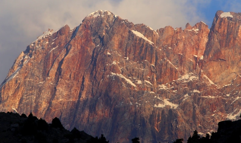
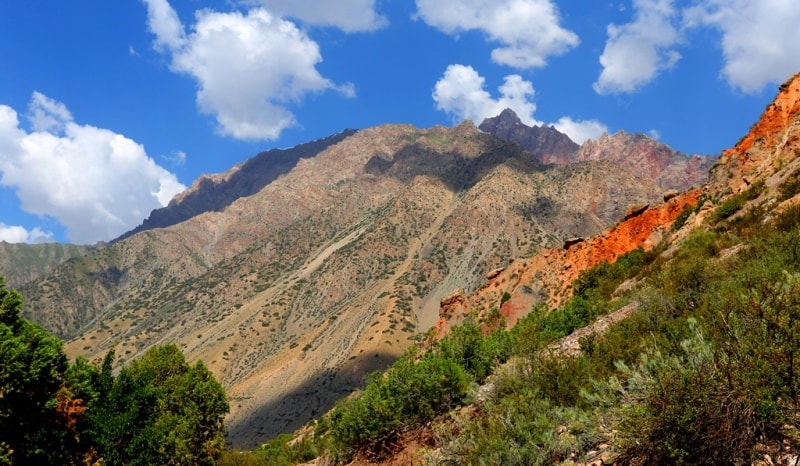
The Ghissar Range.
Mountain hiking to Fany mountains.
“I think you travel to search and you come back home to find yourself there”
Chimamanda Ngozi Adichie.
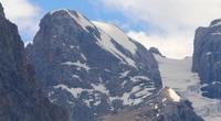
Trekking to peak Chimtarga in Ghissar range.
Ghissar Range - a mountain range in Central Asia, in the western part of the Pamir-Alai mountain system, in the territories of Uzbekistan and Tajikistan, the watershed of the Zeravshan and Amudarya river basins.
In the north, the ridge is bounded by the valleys of the Yagnob, Iskanderdarya and Sarytag rivers, in the south - by the Gissar and Surkhandarya valleys. The length of the Gissar Range is about 200 kilometers. It passes south of the Zeravshan ridge and north of Dushanbe through the Ghissar district in Tajikistan and the northern part of the Surkhandarya region in Uzbekistan.
The highest point of the ridge, 4643 meters above sea level, the former peak of the XXII Congress of the CPSU,) is located in Uzbekistan on the border with Tajikistan, in the north-west of the city of Dushanbe). This peak is the highest point in Uzbekistan.
The ridge is composed mainly of crystalline rocks, schists and sandstones, broken through by intrusions of granites. On the lower parts of the slopes there are subtropical high grasses and steppes, above - sod and grass steppes and woody and shrubby vegetation, even higher - subalpine meadows, mountain xerophytes, alpine low grasses and meadows.
In the river valleys there is woody vegetation: poplar, maple, walnut, plane tree, birch, willow, juniper Alpine relief prevails, more than 30 peaks reach a height of more than 4000 meters above sea level and about 10 peaks exceed 4000 meters above sea level.
The northern slope of the ridge is steep and short with a height difference of 2,000 to 3,200 meters above sea level, the southern slope is long, descending in steps to the Ghissar Valley, with a height difference of 1,800 to 3,300 meters above sea level.
The height of the firn line on the northern slopes is from 3500 to 4000 meters above sea level, on the southern from 3600 to 3800 meters above sea level. The total area of glaciation of the Gisssser range, about 200 square kilometers.
The most comfortable period of visiting the mountains of the Ghissar Range is from May to October. In winter and spring there is an increased avalanche hazard. More than 100 passes with a height of 2,450 to 4,400 meters above sea level are known.
The main approaches for tourists from the north, from the valley of the Zeravshan river (gorge of the Archamaidan and Fandarya rivers), from the east - from the valley of the Yagnob river, from the south along the Ghissar and Surkhandarya valleys.
In the southwestern spurs (Babatag, Baysuntau, Karategin and other ranges) and the northern foothills - there are karst caves, in the upper Kafirnigan River there is the Romit Nature Reserve. In the central part of the northern slope at an altitude of 2195 meters above sea level, is Lake Iskanderkul - one of the most beautiful mountain lakes in Central Asia, the vicinity of which is a popular place for recreation and tourism.
Authority:
"Glaciers." L.D. Dolgushin, G.B. Osipova. Series "Nature of the world." Moscow, the publishing house "Thought". 1989.
Photos by
Alexander Petrov.