


![]()
You are here
Dyn Ekidyn II.
Monuments of history and culture of Ulytau.
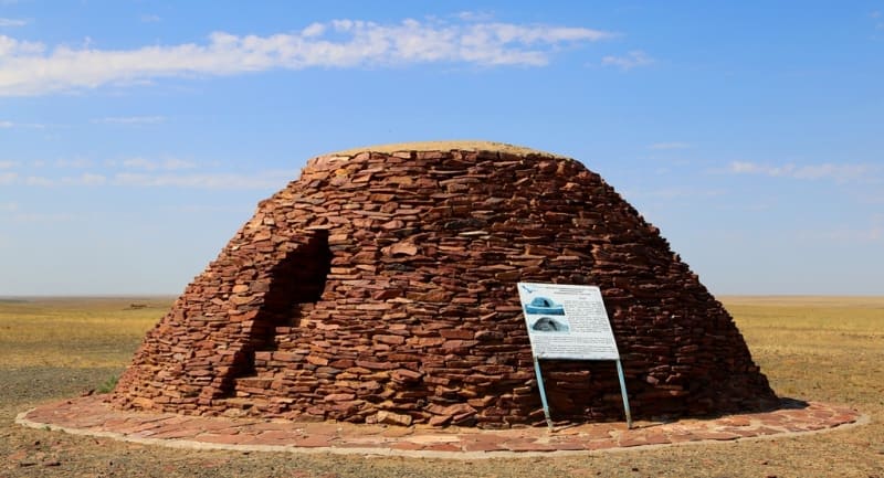
“Ancient Ekidin is a true pearl of natural resources and historical monuments. Two ancient spherical structures made of wild stone - melons, which gave the name to the village - date back to pre-Islamic times.
These structures, which are quite rare on the territory of Kazakhstan, known as “uytas” or “dyng”, were built in the form of the oldest Kazakh dwelling “shoshala” and may have had ritual significance. Presumable dating - early Iron Age."
А.Х. Маргулан.
Architectural monuments of Ulytau.
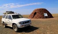
Dyn (dyn- dome-shaped structure made of wild stones) Ekidyn II is located at an altitude of 220 meters above sea level, located 440 meters northeast of right bank of Kara-Torgai river, 3.9 kilometers southeast of confluence of Kara-Turgai and Sary-Turgai rivers, 3 ,3 kilometers north and slightly east of village of Ekidyn, 1.7 kilometers southwest of Zhauke Batyr Mosque, subordinate to town administration of town of Arkalyk in Kostanay region.
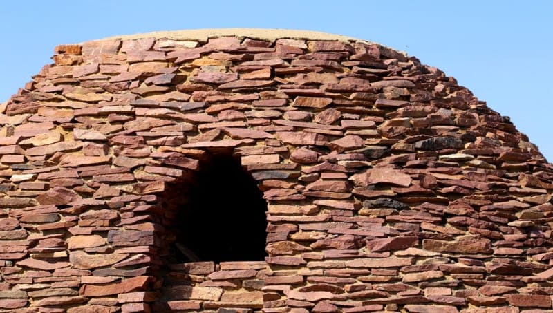
The yurt-shaped structure is built of wild flagstone, with a plan diameter of 6 meters, the total height reaches 3.8 meters. The entrance orientation is northwest. The upper part of the dyn is crowned with a skillfully made hole.
Most likely it served as a smoke exhaust. As a rule, melons are located on a hill. Along with stone sculptures of the Turkic period, there are architectural structures of the “dyn” type in Ulytau. Dyns, dyngeks or uytas are architectural structures of the pre-Islamic period, the Oguz-Pecheneg period with a characteristic structure reminiscent of a yurt.
The building material was steppe “wild” stone from which structures were erected, characterized by simplicity of architecture, lack of decor and characteristic only of Central Kazakhstan. Uytasy are found in the valleys of the Atasu and Sarysu rivers. Ulken Zhezdy, Terisakkan in the foothills of Ulytau in the upper reaches of the Kengir and Torgai rivers, in the Karkaraly and Bayanaul mountains.
Geographic coordinates of Ekidyn II dyn: N49°32'52 E66°08'42
Note:
If you are using geographic coordinates for Google Earth or Google Maps navigation systems, you must remove the last two digits from geographic coordinates and " (hundredths of a second) and enter the result in the input line. Example: N51°44'09.67" E72°39'40.81" = N51°44'09 E72°39'40
Authority:
Alexander Petrov.
https://culturemap.kz/ru/object/soorujenie-ekidyn-vii-ix-vv
Photos by:
Alexander Petrov.