


![]()
You are here
Dyn Ekidyn I.
Best historical monuments of Kazakhstan.
“Men hangar tai, bark zharatturtym,” “I ordered the construction of this stone structure.”
Orkhon tombstone inscription given by A. Margulan.
Architectural structures Kazakhstan.
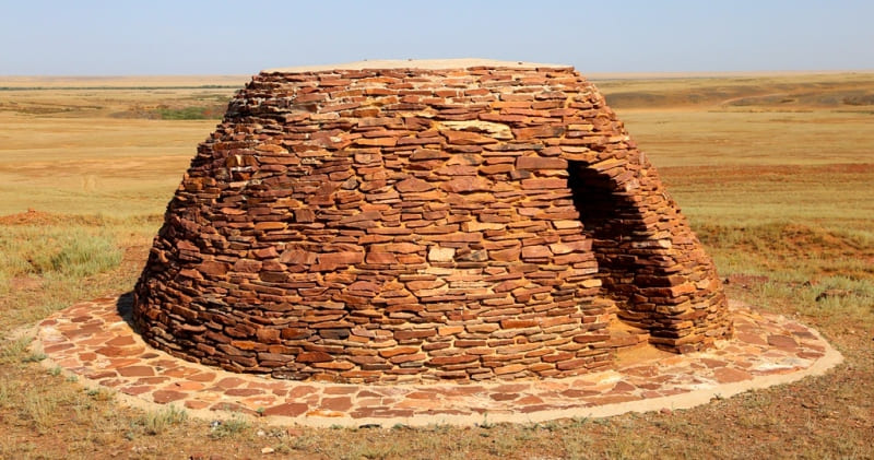
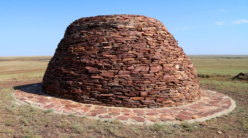
Dyn (dyn- dome-shaped structure made of wild stones) Ekidyn I is located at an altitude of 229 meters above sea level, located in the interfluve of Sary-Torgai and Karai-Torgai, 865 meters southeast of the left bank of the Kara-Torgai River, 965 meters east of the right bank of the Sary-Torgai River , 5.3 kilometers southeast of the confluence of the Kara-Turgai and Sary-Turgai rivers, 1.2 kilometers north and slightly east of the village of Ekidyn, 2.9 kilometers southwest of the Zhauke Batyr mosque, in 2 kilometers south and slightly east of the Ekidyn II melon, subordinate to the city administration of the city of Arkalyk in the Kostanay region.
Dyn is a type of religious building from the VIth – Xth centuries. Dyn represents a transitional type from mounds to architectural monuments. Distributed in Kazakhstan, Central Asia, Southern Siberia and Mongolia.
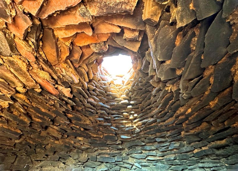
The archaic dyn was built from slabs of “wild” stone and is shaped like a yurt, often with an internal chamber. The estimated dating of this historical object dates back to the early Iron Age. According to some scientists, they originally had a sacred, ritual purpose.
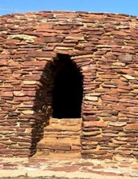
This historical monument has the common name Yekidin (two dyns), it consists of two objects located on different hills, at a relatively large distance from each other. The diameter of the mound No. 1 is 15 meters, the height is 3 meters.
On the northwestern side there is an entrance 0.6 meters wide. There is a dome-shaped room inside. The upper part of the dyn is flat; after restoration, it is filled with mortar and leveled. Around the dyn there is a ditch wide, in some places up to 3 - 4 meters, depth up to 0.3 meters.
The ditch does not completely enclose the mound. Ekidyn 1 is located on an elevated place and is a landmark, visible from afar. There are local legends according to which, in the XVIIth - XVIIIth centuries, a bloody battle took place in the valley between the hills on which the dyn stand.
It was here that the headquarters of the warring clans' military leaders were located. The valley and hills on which the dyns are located are considered sacred places by the local population, full of mysteries and secrets.
Scientists have a version according to which these ancient structures were actively used in the IXth – XIth centuries A.D. and served as observation towers for Kazakh sarbaz. In the 1980s, the dyns, which had been partially destroyed by that time, were restored using funds raised by the local population.
The Ekidyn building is included in the list of historical and cultural heritage of the Kostanay region, and is a popular tourist attraction.
Geographic coordinates of dyn Yekidyn I: N49°31'47,48" E66°08'52,47"
Note:
If you are using geographic coordinates for Google Earth or Google Maps navigation systems, you must remove the last two digits from geographic coordinates and " (hundredths of a second) and enter the result in the input line. Example: N51°44'09.67" E72°39'40.81" = N51°44'09 E72°39'40
Authority:
Alexander Petrov.
https://culturemap.kz/ru/object/soorujenie-ekidyn-vii-ix-vv
Photos by:
Alexander Petrov.