


![]()
You are here
Bayan-Zhurek mountains.
Small excursion Kazakhstan tour.
“There will never be jut in the Bayanzhurek mountains,” “if horses grazed on the banks of Buyen for six years, tulparas (winged horses) would be born.”
Asan Kaigy.
Tours to Kazakhstan from Moscow.
Low, remnant mountains of Bayan-Zhurek, located at an altitude of 1210.3 to 2070.7 (Mount Bayan-Zhurek) meters above sea level, are located in northern part of intermountain valley bounded in north by Konyr-Tau and Airakkol mountains and in south by northern slopes ridge of Dzhungar Alatau, in Ak-Su district, Zhetysu region.
(Bayanzharyk - “mighty heart”, A. Kaidarov derives this oronym from the Mongolian “bayan” - rich and “zurag” - drawing and connects it with petroglyphs). The Bayan Zhurek Mountains cover an area of 156.24 square kilometers, the perimeter of the mountains reaches 47.59 kilometers.
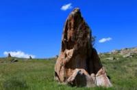
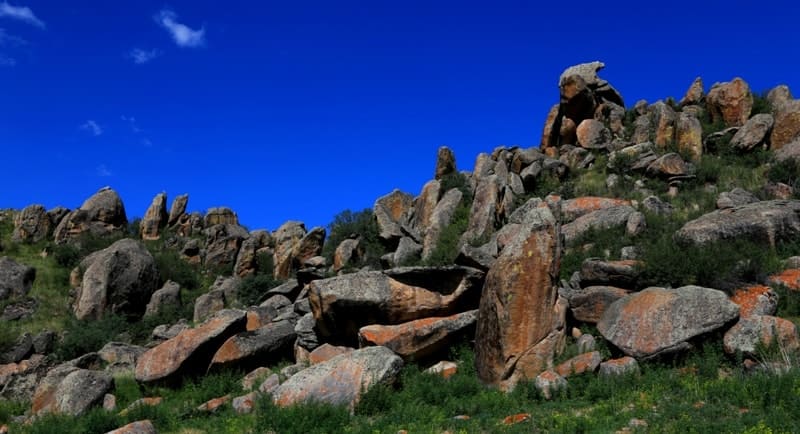
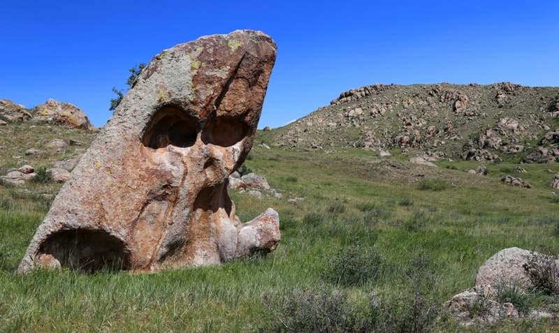
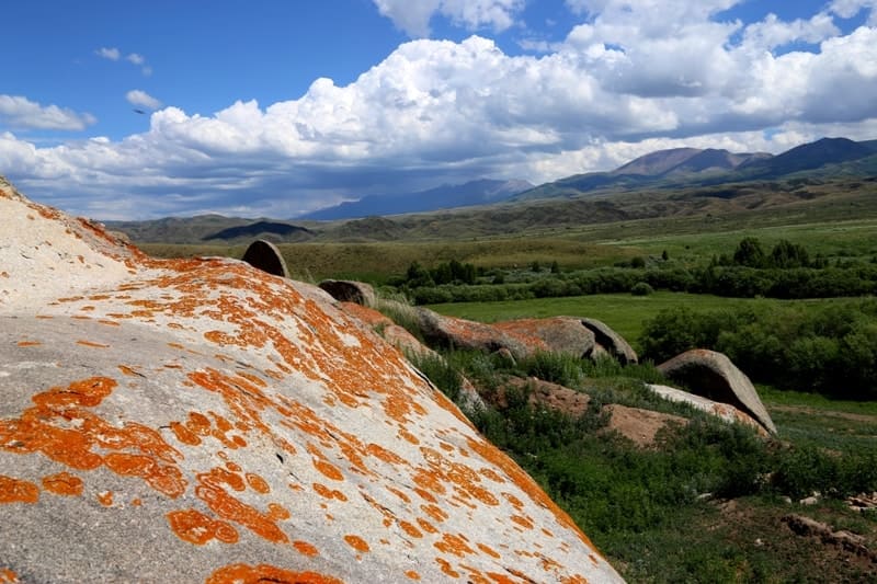
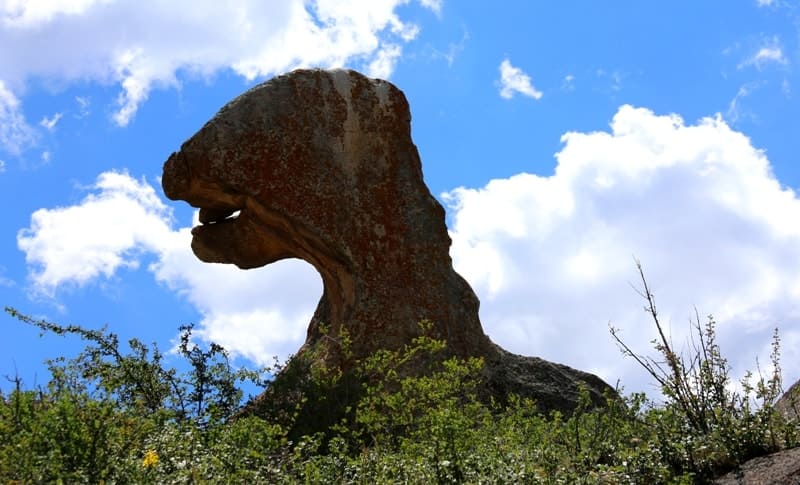
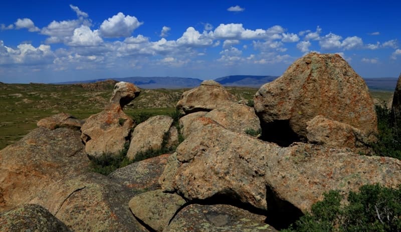
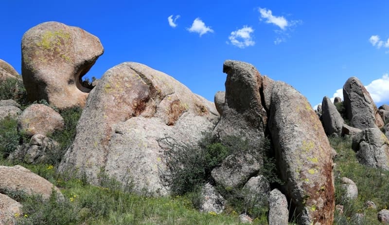
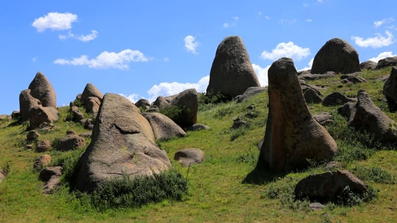
The mountains stretch from east to west for 16.8 kilometers, from north to south for 14.7 kilometers. The mountains are composed of granites, and in flat areas they have a clearly defined mattress-like shape. The fine-grained rock is in some places composed of blocky forms, which sometimes form bizarre figures.
In the northwest, the mountains border with a small spur, Kyzyl-Agash, stretching from southeast to northwest. The western border of the mountains is a plain with a slope to the north, along which the Inzhenertogan canal runs from east to west, towards the village of Kapal, in the northern part of which the Kurymbel valley is located.
In the south, the mountains border on the northern slopes of the Karatau and Burkitt mountains, which are spurs of the Dzhungar Alatau ridge. In the east, Bayan-Zhurek comes into contact with the western slopes of the latitudinal mountains of Zheldy-Karagay and Airakkol.
In the northeastern part, in the vicinity of the village of Balasaz, the mountains border the small Sary-Tau mountain range. The highest point, Mount Bayan-Zhurek, is located in the southern part of the mountains at an altitude of 2079.7 meters above sea level.
In the northern part, the mountains decrease and reach a height of 1210.3 meters above sea level, in the central part - 1742 meters above sea level. On the northern slopes of Bayan-Zhurek, the small rivers Arman-Sai and Baygabul-Sai originate, which are the left tributaries of the Bien River.
In the western part of the Bayan-Zhurek mountains there are famous petroglyphs of the same name. There are a large number of rock carvings carved on the rocks and large stones in the southwestern part, the subjects and style of which differ from other similar monuments to Zhetysu.
The space between the southern slopes of the Bayan-Zhurek mountains and the northern slopes of the foothills of the Dzhungar Alatau is filled with numerous Saka burial mounds, settlements, burial grounds, and ancient cemeteries. In the eastern part of the mountains there is the settlement of Tasbas, in the southern part there is the Kalakai (Schoenber-Tas) sanctuary.
Geographic coordinates of Bayan-Zhurek mountains: N45°08'36 E79°18'06

Authority and photos by:
Alexander Petrov.