


![]()
You are here
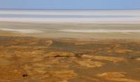
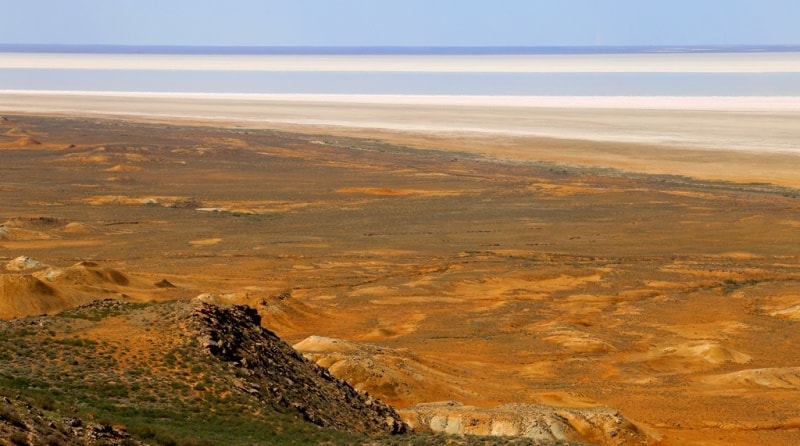
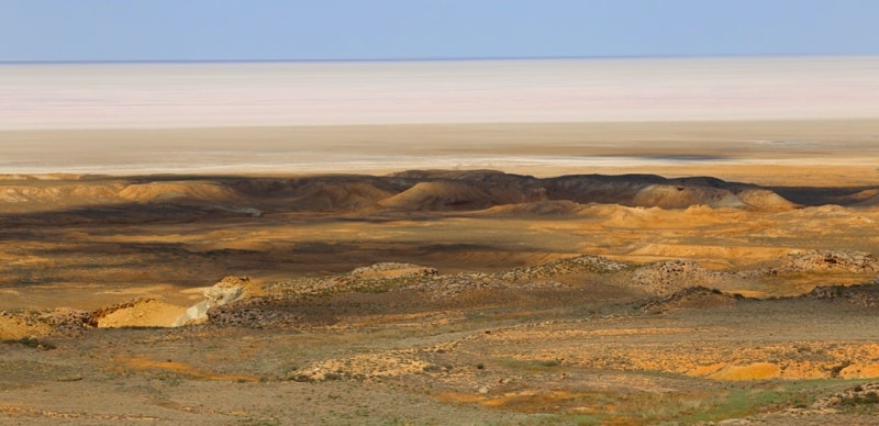
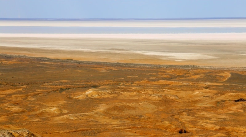
Bay Kaydak.
Protected areas of Mangystau.
“... near Prorva the coast deviates to the east, forming the shallow bay of Tsesarevich, which at the end turns to the southwest and, together with the Buzachi peninsula, forms the Kaidak bay. At the very turn of the coast, the Novo-Aleksandrovskoe fortification was arranged for the development of our trade with Central Asia ... Khiva, it is inaccessible from the sea through the shallow bay of the Tsarevich ... The very area chosen for the construction of the fortress turned out to be unhealthy. Therefore, the Novo-Aleksandrovskoye fortification was moved from 1846 to Tyub-Karagan, where it still exists under the name of the Aleksandrovsky fort ”.
"Hydrographic description and guidance for sailing in the Caspian Sea." 1877. Captain 2nd Rank N.L. Puschin.
Bays on Caspian Sea in Kazakhstan.
Kaidak Bay (kaz. Kaidak) is a narrow, long and shallow bay on the eastern coast of the Caspian Sea in the Mangistau district of the Mangistau region. The bay is a continuation of the Dead Kultuk Sor (former name - Tsesarevich Bay) in the southwest and bordering the Buzachi peninsula in the east.
The depth of the bay reaches 4 - 5 meters in places. To the west of the bay there are the Karakum and Uyaly sands. From the east, the bay is bordered by the Western cliff of Ustyurt, here in the Kyzyltas tract in May 1834 the construction of the Novo-Aleksandrovsky fortification began.
Starting from the 30s of the XX century, the level of the Caspian Sea began to drop sharply, due to which the Kaidak Bay dried up, and a sor (salt marsh) formed in its place. In the 80s - 90s of the XX century, the sea level began to rise, and the Kaidak sor was again filled with water.
Geographic coordinates of Kaydak Bay: N44 ° 52'24.74 "E53 ° 32'31.15"
Authority and photos:
Alexander Petrov.