


![]()
You are here
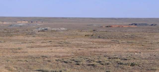
Baikonyr coal deposit.
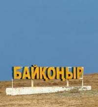

Photo tours in Ulytau.
“... It is brought to the attention of the residents of Moscow and the province that for illegal gatherings and trouble-making talk about some kind of Orthodox flights to the moon, Nikita Petrov, a tradesman from the Zamoskvoretsky part, was expelled from Moscow under police supervision to the Kyrgyz-Kaisak settlement of Baikonur.”
Second half of XIXth century. Newspaper "Moskovskie Vedomosti".
Trip to village of Baikonyr in Ulytau region.
Baikonyr (kaz. Baikonyr - “rich valley”) is a brown coal deposit located 50 kilometers southwest of Karsakpai. According to one version, the name "Baikonyr" is translated from Kazakh as "sandy hills with rich vegetation" or "the area belonging to Bai Konur."
It is named after the Kypchak bai of Baikonyr, who in 1905 handed over coal mines to the British. The English geologist West conducted large-scale geological surveys at the mines, as a result of which, according to preliminary data, two rich seams were established, sufficient to provide the future plant with fuel for at least 12 years.
Therefore, engineer Garvey designed the construction of a plant on the banks of the Kumola River in the Karsakbay-asha area.
The deposit is confined to a small depression (6 x 2 kilometers) in the Lower Paleozoic rocks of the eastern framing of the Turgai trough. It is located in the Ulytau region of the region of the same name, 58 kilometers west of the village of Karsakpai. Absolute marks of the surface are 350 - 400 meters above sea level.
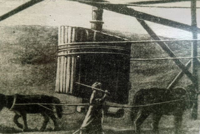
Coal-bearing deposits are exposed in outcrops along the banks of the Baikonur rivers. The deposit was discovered in the 90s of the last century by entrepreneurs Surin and Zheleznov and was developed by adits.
In 1916, the first exploration work was carried out on it and operation was started by English concessionaires. At the same time, M.M. Prigorovsky compiled the first geological map of the deposit.
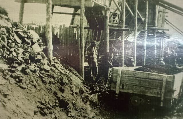
In 1929, after a break, the exploitation of the deposit was resumed for the needs of the Karsakpai plant. Mining was carried out by small mines and was stopped in 1951 in connection with the development of the main reserves.
Systematic reconnaissance was carried out simultaneously with exploitation from 1930 to 1947. Productive deposits filling the depression have a thickness of about 260 meters. Their lower part is composed of poorly sorted conglomerates of different talcs and sandstones of disordered texture.
The color of the rocks is red-brown and greenish-gray. This part of the section is parallelized with deposits of the Chernigov Formation. Its thickness is 160 - 200 meters. There is a Baikonyr railway station on the Zhezkazgan - Saksaulskaya line (the line was built in 2012 - 2014, since 2016 passenger traffic has been operating on it).
Chronology of development of Baikonur coal deposit.
1890 - Baikonur coal mines at the disposal of the businessman Surin.
1903 - 1915 - English specialists completed the exploration of copper reserves in the Zhezkazgan region.
1906 - N. Ushakov gave the Zhezkazganskoye deposit to the concession of the British company Joint Stock Company "Atbasar copper mines".
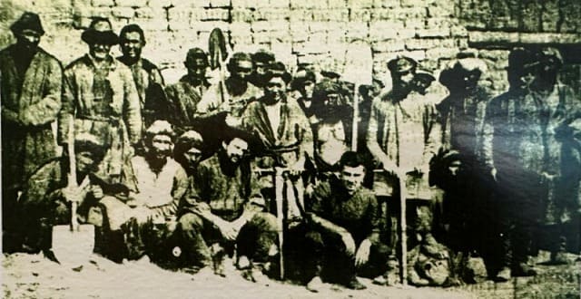
In 1907, British entrepreneurs, who became interested in the copper ore deposit in the vicinity of Dzhezkazgan, carried out geological exploration and discovered deposits of coal in the Baikonur tract, which is necessary for the operation of a copper smelter. The tract was rented by the British and in 1914 coal mining began there.
1908 - Zhezkazgan gold and copper mines and Baikonur coal mines were sold to the Atbasar Copper Mines Joint Stock Company.
1911 - the British mastered the extraction of Baikonur coal.
1911 - 1917 - 36419 tons of coal were mined at the Baikonur coal mines.
In 1914-1917, a narrow-gauge railway was built connecting Baikonur with Karsakpai and Dzhezkazgan. The road was dismantled in the early 1980s.
From July 29, 1948 to October 7, 1950, there was a branch of Steplag at the coal mine operating in the village of Baikonur.
Geographical coordinates of Baikonyr coal deposit: N47°49'59.50" E66°03'31.09"
Note:
If you are using geographic coordinates for Google Earth or Google Maps navigation systems, you must remove the last two digits from geographic coordinates and " (hundredths of a second) and enter the result in the input line. Example: N51°44'09.67" E72°39'40.81" = N51°44'09 E72°39'40
Authority
https://industrial-wood.ru/geologiya-mestorozhdeniy-uglya/16007-mestorozhdenie-baykonur.html
Muhtar Seitzhanov.
https://www.litres.ru/book/muhtar-seytzhanov/britanec-karsakbay-35735743/chitat-onlayn/
https://ru.wikipedia.org/wiki/%D0%91%D0%B0%D0%B9%D0%BA%D0%BE%D0%BD%D1%83%D1%80_(%D0%A3%D0%BB%D1%8B%D1%82%D0%B0%D1%83%D1%81%D0%BA%D0%B0%D1%8F_%D0%BE%D0%B1%D0%BB%D0%B0%D1%81%D1%82%D1%8C)
Photos by
Alexander Petrov.
Black and white photographs from the K.I. Satpayev LLP "Corporation Kazakhmys" of the town of Zhezkazgan.