


![]()
You are here
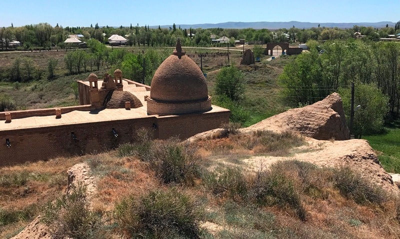
Ancient settlement Baba ata.


Visiting ancient settlement of Baba ata.
“The architectural appearance of the building, which makes us feel appropriate to its purpose, this is the style”
Stendhal.
Sights of Turkestan.
The ancient settlement Baba ata (VI-XV centuries) is located in the northern part, 400 meters from the outskirts of the village of Baba ata, on the left bank of the river of the same name, 23.3 kilometers southeast of the regional center of the Sozak district, the village of Sholakkurgan in the Turkestan region.
The settlement was first mentioned in scientific literature in 1901 (V.P. Kolosovsky). Inspected in 1946 by the Central Kazakhstan Archaeological Expedition (A.Kh. Margulan), in 1948 by the South Kazakhstan Archaeological Expedition (A.N. Bernshtam).
Stationary excavations were carried out in 1953 - 1954, partially in 1957 - 1958. South Kazakhstan Archaeological Expedition (E.I. Ageeva, G.I. Patsevich, T.N. Senigova). Excavations affected all the main parts of the settlement - the citadel, shahristan, rabad.
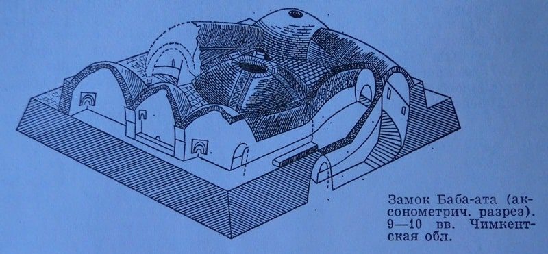
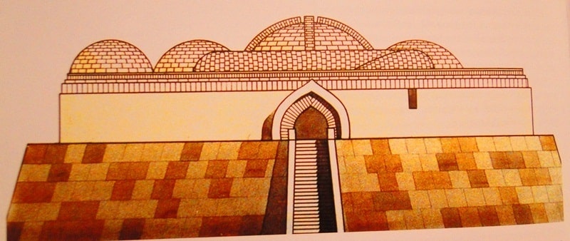
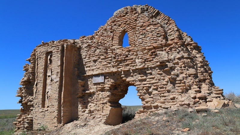
The citadel is located in the southeastern part of the settlement, adjacent to the shahristan. Monument topography: in terms of the citadel, it is a semi-oval shaped hillock about 10 meters high, 42 x 60 meters in size at the base and 12 x 17 meters in the upper platform.
Excavations on the citadel revealed the premises of the lower construction horizon, where the palace structure is of particular interest, in the center of which there was an octagonal room with a well. The diameter of the room is 5.8 meters, the height to the base of the dome is 2.88 meters, and the total height is 5.38 meters.
The room was connected to the corridors by vaults and stairways with other rooms and the courtyard. Lighting was provided through light openings in the walls and domes of buildings. The building of the lower layer dates back to the VI - VIII centuries.
The premises of the citadel of the upper construction horizon were constructed after the construction of the lower layer rooms. All the bearing walls of the new premises repeated in most cases the contours of the walls of the lower construction horizon.
Shakhristan in terms of a rectangular shape with orientation to the countries of the world has an average height of 7 - 8 meters and sizes from north to south 182 meters, from west to east 145 meters. On three sides (except the south, adjacent to the citadel), the shahristan is surrounded by a rampart up to 1.5 meters high with preserved remains of 15 towers, traces of which in the form of swollen mounds are clearly visible on its outer side.
Excavations in Shahristan revealed 3 construction periods. The earliest of them dates back to the X - XXII centuries. The remains of rectangular rooms from 12 to 30 square meters were found, made of raw brick on clay mortar with traces of plaster and flooring.
Ceramic material is characterized by fragments of boilers, pots, lamps; some of them are preserved with drawings in the form of jugs at the bottom or stylized Arabic inscriptions around the edge. Excavations in the slaves (their area is about 25 hectares) made it possible to obtain additional material on the history of the settlement.
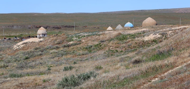
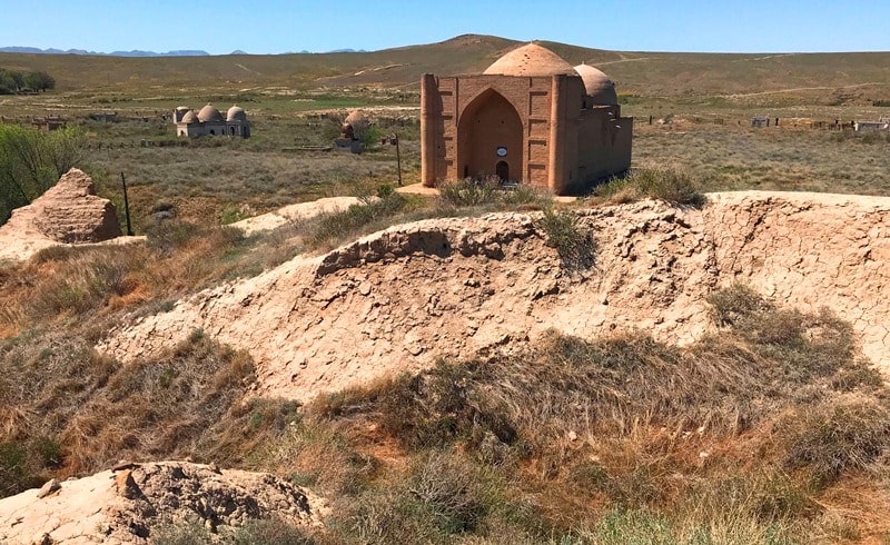
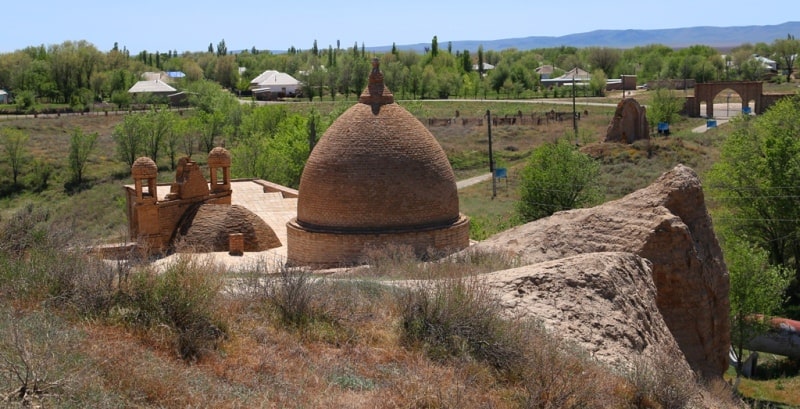
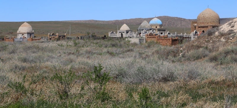
Rabads are adjacent to the citadel and Shahristan from all sides and are surrounded by a shaft around the perimeter with traces of defensive towers. Southern rabad (about 9 hectares) adjoins the citadel; ponds, brick kilns, XVIIth century saint of the tomb, XIXth century madrassas were built on its territory at different times.
On the territory of northwestern rabad (about 5 hectares), the remains of the rampart and corner towers are well preserved. The living quarters of the rabads were located along the rampart and the defensive walls on the inside and were constructed mainly from raw brick; had flat reed ceilings.
Ceramics of the Xth - XIst centuries are mostly made on a potter's wheel. Ceramics XIII - XV century mainly easel work. It includes irrigation utensils (bowls, bowls, pots) with colorless glaze, as well as green, yellow and brown colors, painted with a stylized floral ornament.
The back side is decorated with arches and epigraphic ornaments. The analysis of ceramic material from the excavations indicates the peculiarity of the ceramic production of Baba ata. At the same time, there is a similarity of individual forms and ornament with neighboring regions.
In addition to ceramics, metal, bronze, and iron products were found in the form of various household items, tools, as well as crafts made of bone and stone. The archaeological material of the ancient settlement of Baba ata dates from the VIIth - XVth centuries. at.
There is an opinion in the scientific literature that Baba ata corresponds to the Balaju named in historical sources of the 10th century. Excavations of Baba ata (Balaja) give an idea of the appearance of a small town on the northern slopes of Karatau, its crafts and genesis in the VI - XVth centuries.
Materials from the excavations are stored in the Museum of Archeology N.A.N. R.K.
Geographic coordinates of the Baba ata settlement: N43 ° 35'28.88 "E69 ° 20'24.22"

Authority:
D. A. Taleev. "Code of monuments of the South Kazakhstan region." Architectural and archaeological heritage of the South Kazakhstan region. In the framework of the regional program "Cultural Heritage". http://www.farsah.kz
Photos by
Alexander Petrov.