


![]()
You are here
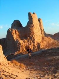
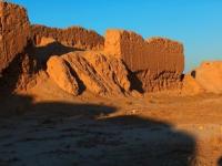
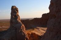
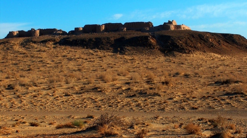
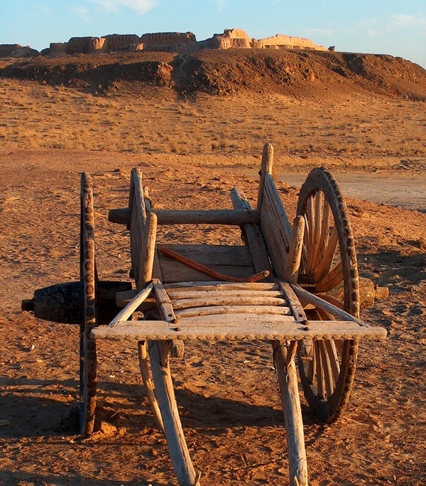
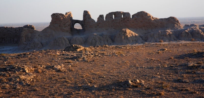
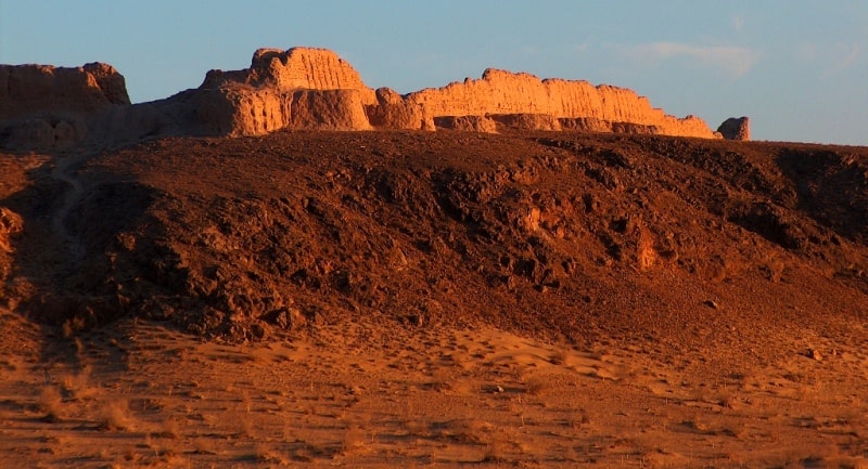
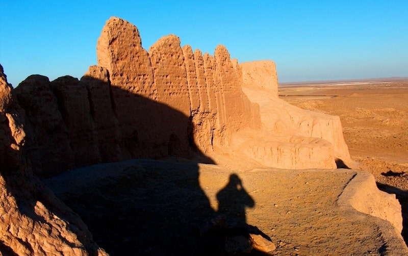
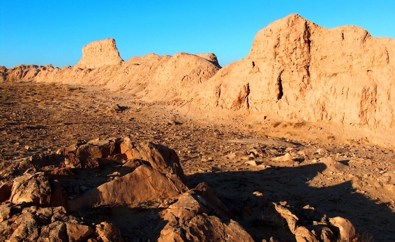
Ancient settlement Ayaz Kala in Karakalpakstan.
Tours in Karakalpakstan.
“Khorezm is a country of unique culture, fine art, high enlightenment, wise philosophy of life, literature and poetry filled with the ideas of humanism, which is one of the centers of secular education. Our nation, people, from the time of appearance on the Khorezm land of "Avesta", has lived its own life, history and culture ”.
Islam Karimov.
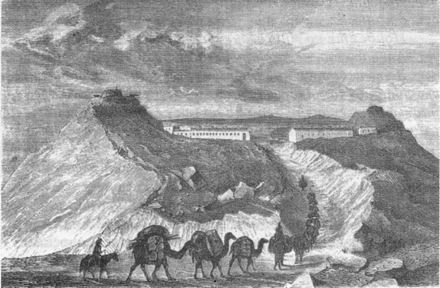
History of Karakalpakstan.
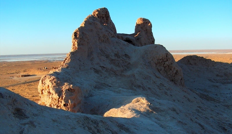
The Ayaz Kala settlement is located on a natural hill 170.9 meters above sea level, located in the southern part of the Ayazkol salt marsh and in the waste part of the Pashakhaikum sands, 21 kilometers north and slightly east of the village of Bustan, 3.6 kilometers north and slightly west from the village of Shark-Yulduzi, 19.5 kilometers north-west of the village of Dzhambaskala and 42.7 kilometers north-east of the city of Berun in the Ellikala region of the Republic of Karakalpakstan.
The settlement was surveyed by A.I. Terenozhkin. In 1939 and 1946, the study of the monument was continued by S.P. Tolstov. In 1968 - 1970, the State Museum of Arts of the Karakalpak Autonomous Soviet Socialist Republic carried out additional measurements and cleanings.
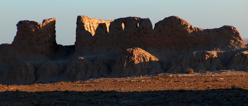
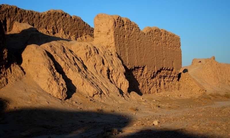
The mound, 182x152 meters in size, has the shape of a quadrangle, oriented with its sides along the cardinal points. It is built on a flat hilltop and is surrounded on three sides by multi-meter cliffs. There is no internal layout.
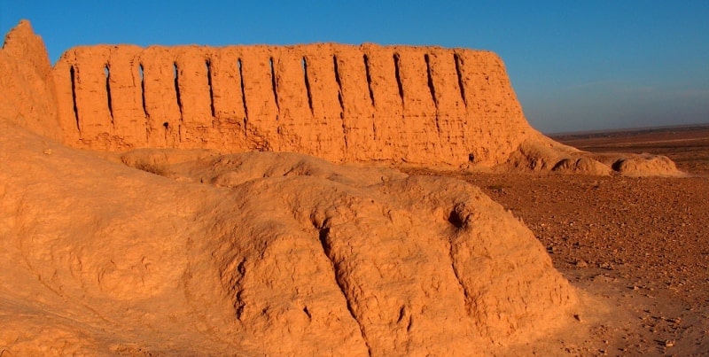
The walls, preserved in some places up to 10 meters, were built on the mainland from adobe bricks measuring 32 - 46 x 32 - 46 x 10 - 13 cm. The thickness of the outer wall at the base is 2.4 meters, and the inner wall is 2.1 meters.
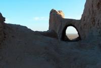
The inclination of the outer surface of the wall to the base is 86 °. Between the walls, along the entire perimeter, there is a blind corridor 2.5 meters wide, without skylights and rifle loopholes, covered with a box vault. Its height is 1.87 meters.
The brick of the arch is trapezoidal. From the inside, the vault was coated with clay mortar. In the back corridor there is a backing under the floor. On the northern wall, directly behind the second tower from the northeastern corner, an arched passage 1.55 meters wide and 1.42 meters high has been cleared.
The first row of the vault is made of trapezoidal bricks, the second - of wall bricks. The gate is located in the southern wall and is cleaned by a rectangular gateway projecting 37 meters. The entrance to it is in the east wall.
On the sides of the gate there are passages leading to a corridor that is blind between the walls. The passage in the north wall is better preserved. Its width is 1.14 meters, height is 1.8 meters. It is covered with a vault.
Semi-oval towers are located along the outer walls. The curtains on the eastern and western walls are 13.8 meters, on the north - 11.5 meters, on the south - from 9 to 15 meters due to the presence of a gateway.
At the corners they are located by a fork - "dovetail". The width of the towers is 8.4 meters, their projection is 8.15 meters. At the corners of the gatehouse, the towers are located on the continuation of the bisector of the corner, their length is 7.5 meters, width is 6.5 meters.
There is a shooting gallery above the back corridor. Only two towers on the north wall exceed the level of the shooting gallery floor. The tops of the walls of the fortress, the gatehouse and two towers on the northern wall are cut by loopholes, which are separated by an average of 1.5 meters from each other.
They are arrow-shaped. Their width is 13 - 20 cm, the height of the inlet openings is 0.48 meters, and the height of the outlet openings is from 2.9 to 3.5 meters. The angle of incidence of the embrasure bed is 48 ° or 54 °.
The loopholes are covered with ordinary bricks, built by a hut. The curtains on the northern, western and eastern walls have seven loopholes, 4 of which are oblique. Each tower has 8 loopholes. About the third to fifth towers on the northern wall, counting from the northeastern corner, near the southwestern towers at the corner of the gatehouse and the fortification itself, piles of bricks prepared for construction, but remained unused, were found.
The bricks are covered with sand. Unfinished towers, but raised to the full height of the wall; prepared, but also used bricks, the complete absence of any traces of building, testify to the unfinished fortifications. The site is dated by a few lifting pottery, which finds analogies in the materials of the lower layer of the Koi-krylgan kala and can be dated to the IVth - IIIrd centuries. BC.
During the clearing, a bronze three-bladed arrowhead with a hidden sleeve was found in the gatehouse. t has elongated proportions. On the northern side of the gate, there is an inscription in the Khorezm language of three characters.
In the XII - the beginning of the XIII centuries in the southeastern corner of the settlement, minor rebuildings were carried out.
Geographic coordinates of the Ayaz Kala settlement (Main): N42 ° 00'52.50 "E61 ° 01'46.06"
Authority:
Dospanov October. “Improving the efficiency and sustainability of the functioning of the created Nizhne-Amudarya State Biosphere Reserve”. Nukus - Tashkent. 2013.
Photos by
Alexander Petrov.