


![]()
You are here
Akyrtas water supply.
Tours to Akyrtas ancient settlement.
“Water stands out in the history of our planet. There is no natural body that could compare with it in its influence on the course of the main, most grandiose, geological processes. Not only the earth's surface, but also deep - on the scale of the biosphere - parts of the planet are determined, in their most essential manifestations, by its existence and its properties"
Vladimir Ivanovich Vernadsky.
Drive from Almaty to Akyrtas.
Reservoir No. 1 at the outlet of the Kyzylikainarai (Shoshkaly) gorge, from where the Akyrtas settlement was supplied with water, is located 3.7 kilometers to the south and slightly to the east. Reservoir No. 2 at the outlet of the Uzunbulak gorge, from where the Akyrtas settlement was supplied with water, is located 3.1 kilometers to the south and slightly to the west.
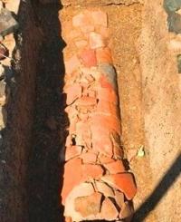
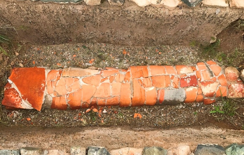
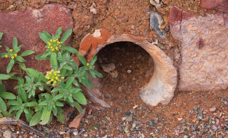
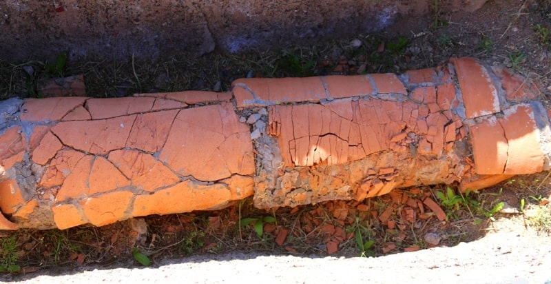
It was established by previous studies that Akyrtash was supplied with water through a water supply system, which had fences from the springs of the shoshkaly and Uzunbulak slits. Water flowed through clay pipes 50 - 60 cm long.
The diameter of the wide end of the pipe was 20 cm and the narrow end was 18 cm.The narrow end of each link was inserted into the wide other, In the Uzunbulak gorge, the water supply began from a reservoir, built by ori with the help of a stone-earthen dam that blocked the gorge in a narrow place, where there were outcrops of rocks on both sides.
Excavations showed that the water supply network was complex. A water supply system was cleared at the site near Akyrtas and at the site of supplying a reservoir (hauz), from which water was diverted to residential buildings and estates, in the courtyards of which there were pools.
Water distribution was carried out with the help of pipes of a smaller diameter (fragments of pipes of different diameters were collected in gorges, along water pipelines and near Akyrtash). It was found that there are two reservoirs to the north of Akyrtas.
One of them, the western one, now looks like a rectangular pit (40 x 40 meters) 2 meters deep. Thus, its volume was 3200 cubic meters of water. The eastern reservoir was somewhat smaller in volume, the diameter of the pit of which is 30 meters.
Apparently, the water that accumulated here was intended for irrigation of crops located in the areas north of Akyrtas.
Geographic coordinates of reservoir No. 2 at the exit from the Uzunbulak gorge, near the Akyrtas settlement: N42 ° 55'30.43 "E71 ° 47'42.80"
Geographic coordinates of reservoir No. 1 at the exit from the Kyzylikainarai (Shoshkaly) gorge near the Akyrtas settlement: N42 ° 55'09.25 "E71 ° 48'21.94"
Authority:
K.M. Baypakov. “Medieval settlements on the Great Silk Road”. Almaty, "Gylym". 1998.
Photos by
Alexander Petrov.