


![]()
Вы здесь
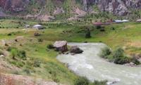
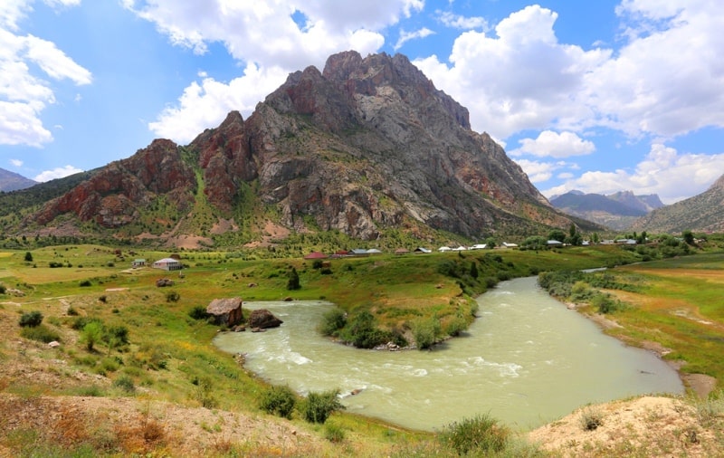
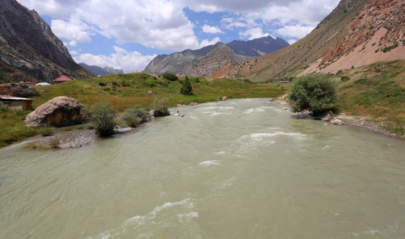
Karakul River in Ghissar ridge.
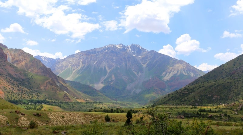
The nature of Fany Mountains.
“The water in the vessel is transparent. The sea water is dark. Small truths have clear words; the great Truth has great silence"
Rabindranath Tagore.
Landscape natural monuments of Tajikistan.
The Karakul River flows in the Sughd region of Tajikistan, one of the constituent parts of the Iskanderkul Lake basin. The Karakul River is formed from the confluence of two rivers originating on the northern slope of the Gissar ridge - Aksai and Akhbashi.
The length of the Karakul River from the confluence of the Aksai and Akhbashi rivers to the right tributary of the Sarykhoda River is 20 kilometers. After the confluence of the right tributary Sarykhoda, the river is called Sarytag.
From the place where the Akhbashi flows into the Aksai river, the Karakul river overflows and flows to the Karakul lake along a wide green valley. The river is fed by snow and glaciers. The valley of the Karakul River in the upper reaches is thoroughly developed by a previously existing glacier and is covered with meadows.
Ahead it is blocked by a wall of one of the last moraines of the old glacier. Above the moraine is the lake. The water broke through the moraine, and the lake became significantly shallow. Karakul is gaining strength, it is already difficult to cross the river without a bridge.
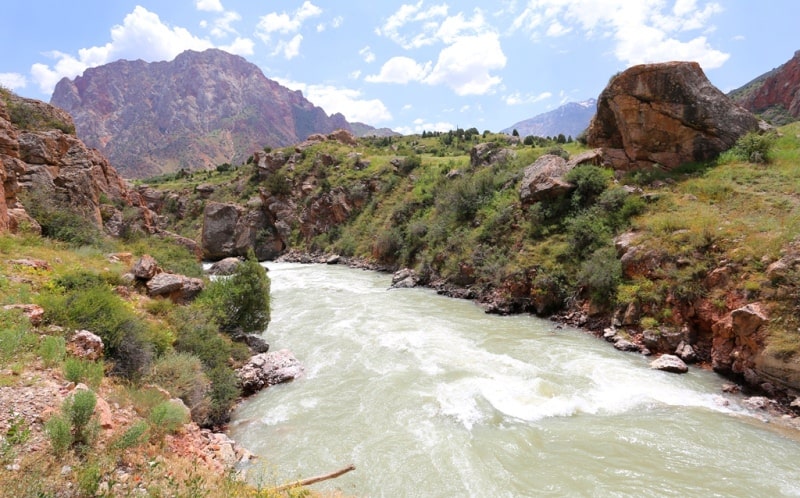
The first juniper trees appear. A huge block of stone that fell into the river helped build a bridge and lead the path to the right bank. The green valley narrows, the Bachauldy river flows into the right. A particularly picturesque section of the Karakul gorge begins from here.
The next right tributary, Kal-Akhba, leads to an unknown pass across the Gissar ridge. The tributaries of the right side are numerous and full of water, the nearby glaciers hang over the gorge. The left side and
he slopes of the Dukdon section of the Zeravshan ridge are less rich in water and vegetation, only small glaciers lie in the hollows of the rocky couloirs.
The Dukdon River, flowing into Karakul on the left, begins at the glaciers at an altitude of about 3500 meters above sea level. She quickly runs her short path, plunging 1000 meters down. Its gorge is narrow, and the fall is rapid.
From the mouth of the Dukdon River, the Karakul River is overthrown in a steep cascade and quietly spills over the forest gorge. On the right, Karakul receives a tributary of the Zombar. The Karakul River flows among the trees, forming wide floods in places.
The forest is thinning, and on the left you can see the gorge of the river Apr and the village of Sarytog in front. In the depths of the Arga gorge, the distant cones of Energy and Chimtarga are visible. The source of the Arga is located near the Kaznok glacier at an altitude of about 3500 meters above sea level.
The river that starts here under the southern slopes of the Energiya summit is called Kaznok. The valley of Kaznoka in the upper part is poor in vegetation: stones and lawns of grass. Snow bridges block the river. It turns south, the trail crosses a wide stone placer and the Yashmovaya river, which originates from the Malaya Hansa glacier.
Kaznok angrily licks the sheer cliffs of the right bank. The trail approaches the left tributary of the Kaznok - the Suvtor River. Crossing over the stones through Suvtor is not difficult. Further, the trail goes along the upper slopes above Kaznok among the sparse juniper forest.
Down at Kaznok you can still see a snow block - the trail of an avalanche. The Akhbasoy river comes out of the right gorge and merges with Kaznok. From here the river Apr. Now the river is called Sarytog. Passing the village of Sarytog and taking the tributary Kanchach from the right, the river rushes into the breakthrough of the ancient moraine with a long foamy ribbon.
Having made this jump, Sarytog rests, and then, passing the poplar grove Mukhta, flows into Lake Iskanderkul. The lake also receives the waters of the Khazor-Mech River with the Saryduvol tributary and the Serima River flowing from the slopes of the Big Hansa.
Authority:
Alexander Petrov. "Fan Mountains and Yagnob". N.V. Paganuzzi. 1968. Moscow. Physical Culture and Sports Publishing House.
Photos by
Alexander Petrov.