


![]()
Вы здесь
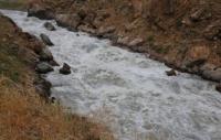
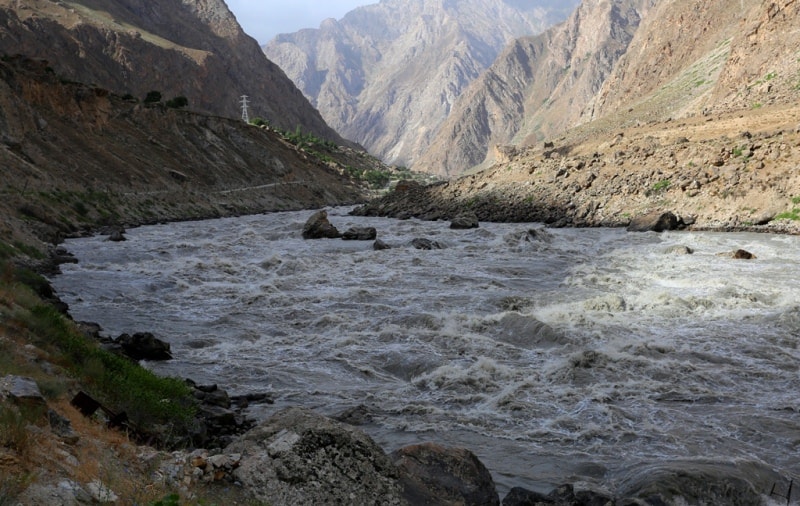
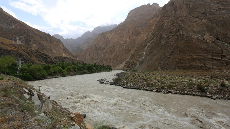
Bartang River.
Rafting on the Bartang River.
“Travels reveal not so much our curiosity about what we are going to watch, but how tired we are from leaving”
Carr Alphonse.
The Bartang River flows from Lake Sarez.
The Bartang River in the Pamir, in Tajikistan, its sources are in Afghanistan, the right tributary of the Pyanj River. The Bartang river, in its upper reaches, has the name Oksu (Aksu, Ak-Su, in the middle reaches the river is called Murgab), and below the Sarez lake is Bartang.
It flows through the Afghan province of Badakhshan, flows under the name Aksu from Lake Chakmaktinkul located in the extreme north-east of Afghanistan in the province of Badakhshan, flows through it for about 30 kilometers in a northeast direction, then eastward along the state border of Afghanistan and Tajikistan.
It goes around the eastern end of the Vakhan ridge, then turns to the north-west, takes the left tributary of the Sulistyk, then turns west, takes the right tributary of the Akbaital and gets the name - Murghab. At the village of Murgab, the river crosses the Pamir tract.
It goes around the Pshart ridge and Muzkol from the south, flows into the dammed Sarez lake, which arose as a result of the catastrophic overlapping of the Murghab channel, which occurred on February 18 (March 3), 1911.
It is filtered through the dam of the Usoi Dam and turns to the north-west, takes the right tributary of the Gudar and the new name - the Bartang River and turns to the south-west, bends around the Yazgulemsky Range and flows into the Pyanj River to the east of the village of Rushan on the border with Afghanistan.
The length of the entire Oksu - Murgab - Bartang system is 528 kilometers (Bartang proper is 133 kilometers), the basin area is 24,700 square kilometers. After confluence with the South Akbaital River (within the Pamir Highlands), the river takes the name Murghab, which it retains until Lake Sarez, and then receives the name Bartang.
To the very mouth of the Bartang flows in a narrow rocky gorge between the Rushansky and Yazgulemsky ranges. The average downstream water flow rate is 131 cubic meters per second. Flowing in a deep incised valley.
The food of the river is mainly glacial and snow. Maximum flow is observed in August. The average annual flow rate at the mouth is 128 cubic meters per second. The Bartang River flows in a deep narrow gorge formed from the north by the Yazgul and Muzkol ridges (after the confluence of the Kudara River) and their spurs, from the south by the Rushan Ridge, its extension to Bazardar and their spurs.
The Bartang Gorge is winding, with steep slopes, rocky in its upper parts, and below - covered with stone screes. In places, at the confluence of the rivers, the gorge slightly widens. There are small Tajik villages, crops, gardens.
The Bartang River, at the confluence of the Panj (a post at the village of Shujan), has an average annual cost of 103 (1947) to 154 cubic meters per second (1944) and flow in those same years from 3.25 to 5.4 kilometers cubic.
The maximum costs reach 624 cubic meters per second (VIII.1950), and the minimum fall to 42 cubic meters per second (IV. 1947). Available for rafting, catamarans (5 - 6 difficulty categories) in August - October from source to mouth.
The duration of the alloy is 8 to 10 days. In the channel of Murghab there is an impassable stretch of 1.5 kilometers with a waterfall 5 meters high above the confluence of the Akdzhilgi River, a rapids stretch before flowing into Sarez Lake.
In the Bartang channel, there is a cascade of rapids 7.5 km long above the mouth of the Khavadzh River. The right tributary of Bartang, the Kudara River, is also suitable for rafting.
Authority:
http://www.cawater-info.net/bk/water_land_resources_use/docs/rivers.html
Photos
Alexander Petrov.