


![]()
Вы здесь
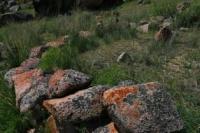
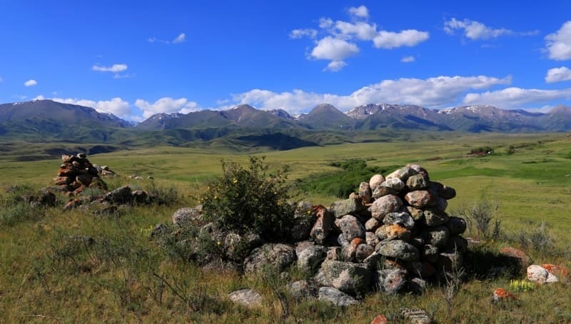
Ancient settlement Bayan-Zhurek.
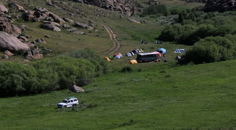
Bus and walking tour Almaty region.
“I've known rivers:
I've known rivers ancient as the world and older than the flow of human blood in human veins. My soul has grown deep like the rivers”
Langston Hughes.
Night-time tour in Almaty.
The settlement of Bayan Zhurek is located at an altitude of 1509 meters above sea level, located at the foot of the western slope of the Bayan-Zhurek mountains, on the right bank of a drying stream that encircles the mountains from east to northwest, 13 kilometers east of the village of Kapal, 21 .4 kilometers southwest of the village of Arasan, 65.7 kilometers northeast of the town of Taldykorgan in the Aksu district of the Zhetysu region.
Experience of work on such monuments, like Eshki-Olmes and Tamgaly in Semirechie showed that under definition of chronology of big by quantity concentrations of petroglyphs is possible to base on archaeological materials, received in the result of excavations of settlements and burial grounds.
At foothills of the mountains Bayan-Zhurek in the valley Kaskarau and foothills of the mountains Djungar Alatau sucl, excavations had been carried out in the 90-es and from the year 2000 to the year 2003.
Excavations were organized in the west part of the valley Kaskarau, in the month of canyon on settlements Muzdy-Bulak I and II, in the eastern part of settlement Kalakai I and of the same name burial ground and also on the southern slopes of the mountains Bayan-Zhurek on settlement Tasbas I.
Above mentioned settlements present the insignificant part of archaeological monuments in this region. Except monuments of the Bronze Epoch, in valley are fixed monuments of the Early Iron Age: they are numerous burials mounds of Sakae and Ancient Turkic time.
Part of them, situated to the west from petroglyphs, was excavated already in early 80-es of the XX century by A.K.Akishev and B.Nurmukhanbetov. More to the west, between the village Copal and the mountains Bayan-Zhurek, along road are situated big up to 50 - 60 m in diameter burial mounds of Sakae nobles.
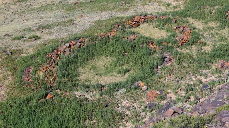
In the east part of valley on big boulders along channels of rivers and on plain are discovered holes, cut on plain stones, being, supposedly, sacrificial places. In region between rivers Berkutty and Muzdy-Bulak was discovered sanctuary, formed of swollen big boulders.
It had diameter 92 m and was directed by the sides of universe with help of two crossed stone layers inside circle. Big stone was situated inside a circle in center. In the west in valley settlements were situated on high right bank in the mouth of the river Muzdy-Bulak on distance 400 m from each other.
On settlement Muzdy-Bulak 1 were revealed 28 dwelling, on settlement Muzdy-Bulak 2 - 34 ones. Dwelling had oval, sub rectangular, sometimes round shaped form. Their sizes were from 8 x 10 dm and from 6 x 12m. They had each two building horizons.
Walls of houses by perimeter of dwellings were put by big and average size stones. Depth of excavated dwellings amounted from 0,7 m up to 1,3 m. Dwelling N1 on settlement Muzdy-Bulak 1. It was directed by line south-west-north-east, sizes of the southern wall are 4,1 m, western wall is 7,2 m. In its center was situated layer of stones.
From the north is seen entrance in width up to 1 m. On the floor, on depth 15 cm were discovered nimbus and sides of vessels of good burn, made on potter's wheel. Fragment of grey color ceramics of slight burn were discovered on depth 0,5m.
On some of them was ornament in a form of pearls, holes, carvings. On one of fragments on top part of nimbus was discovered ornament in a form of triangles. Fire places were situated at eastern wall.
Along the western wall on all length of dwelling was prolonged stone layer from entrance width 1,5 m.
On the depth 0,7 - 0,8 m was situated ground. Late constructions overlapped layer with ceramics of the Bronze Epoch. As the result it was established, that dwelling №1 was inhabited onן prolongation of several centuries - in the Bronze Epoch and in Early Iron Age.
Dwelling N1 on settlement Muzdy-Bulak 2 is situated on upper terrace. Before excavations dwelling was stone layer in sizes 10 m axis east-west and 6 m by axis south-north and had sub rectangular form.
In upper layers and on depth 40 cm in the south-east corner of house were found fragments of reddish color ceramics in cut of good burn. There are fragments of black color ceramics with stamp ornament in a form of wave lines.
On depth 70 cm remained fragments of floor plastering-floors of upper building horizon. On the floor was discovered layer of burnt wood. Low flow was going layer of black color ground in thickness 30 - 40 cm. Depth of dwelling is 1,3 m. In that layer was discovered ceramics of the epoch of the Late and, probably, final Bronze like necks, nimbus, sides of vessels. On some of them remained ornament in a form of triangles, filled by stretch lines, canellures, carvings, wave lines.
Pearls were discovered on some fragments. Analogous ceramics is presented in the East Kazakhstan and in Central Kazakhstan. Entrance to the house was from the East. Findings by ceramic material, settlements existed in one and the same time and appeared on the eve of the II - I millennium B.C.
In early I millennium B.C. that dwellings had been inhabited again and existed, probably, up to the Middle Ages. Their secondary use is connected with mine works. In three canyons, enclosing to the main canyon, were discovered traces of iron melting; pieces of ore, coals, melted slag and several samples of Sakae ceramics.
On one of settlements, stood higher in 1 km from settlements Muzdy-Balak I and II were discovered stone melting pits, cut and polished in ore. So, secondry of dwellings, most likely, is connected with processing of ore in that region.
Settlement Tasbas is situated is the southern slope of the mountains Bayan-Zhurek, in 4 - 5 km to the north from settlement Kalakao. Settlement was established on several terraces, going one above another on distance 50-70 m; to the west in 300 m were situated some more similar terraces.
For excavations were chosen dwelling, established on low terrace. On surface was observed stone layer. Further it was established, that was part of the late Kazakh dwelling of the XVIII - XIX c.c.
After cleaning up constructions it was clarified, that ancient dwelling was under winter settlement on depth 1,8-2,3 m. Construction of dwelling appeared compound enough. House was cut into slope and covered from the north and north-east by rock.
Floor of dwelling was plastered by clay and was going down to the west. It remained very well only in the eastern part of house. Several building horizons were revealed: under plastering of floor were discovered 2 fire places.
The first fire-place was mode of clay. Its sizes are 60x80 cm, lower for 35 cm from this fire place was the second fire place, made of stones. Its sizes are 80x90 cm. Lower was going layer of burnt wood and earth under it. In whole dwelling presented itself earth house. It is dated by the epoch of the Late Bronze.
On square of dwelling were collected pieces of grey color ceramics - fragments of sides, necks and bottoms of pots. Part of them had ornament. On necks and nimbus were discovered pearls, carvings, cannellures.
Some fragments of ceramics in a form of stretched triangles and holes were also discovered. Analogous ceramics is met on settlements of Central and East Kazakhstan and in Semirechie.
By their form and ornament vessels from Tasbas are close to Semirechie ones from settlements Serektas, Talapty, Asy, but the biggest similarity is observed with ceramics on settlement Serektas. It gives possibility to date settlement by the Epoch of Final Bronze.
Choice of place on rather rough slope on terraces is stipulated by climatic conditions. In conditions of cold winter the southern slopes of Bayan-Zhurek were protected from the northern winds and there it was much warmer.
In summer conditions there were a lot of grass and plain slopes and plains of Djungar Alatau let in one day to go up on summer pastures-djailau. Burial ground Kalakai 1 is situated on the right bank of the same name stream between rivers Koksai-Bien and Berkutty-Bien.
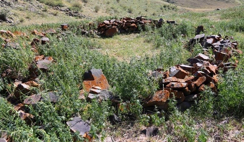
Burial pits were cat in rocks on depth 30 - 50 cm. Burial ground is dated by different time: it consists of groups of burial mounds of Early Iron Age and fences of the Bronze Epoch. Fences of the Bronze Epoch present themselves compound constructions. Inside the first central fence in stone box were situated bones of buried man; bones were mixed. But it is possible to make conclusion, that a man was buried in writhing pose on the left side. Fragments of not ornamented ceramics remained.
Among them was fragment, decorated by fine comb stamp. The second construction, situated in 1,5 m to the east consisted of two fences of rectangular and round shaped form. In fence of rectangular form were discovered bones of man.
A man was buried on his left side; no things were there. The third construction, probably, was ritual one. The fourth and the fifth constructions contained burials without things. The most interesting is construction 6. It consists of 11 fences of oval and rectangular form. Burial cameras are presented by stone boxes with burials of adults and children, placed in the burials in writing position on the left side.
Ten archaeologically whole vessels made of clay with admixture of sand have been discovered. Ceramics discovered on the burial ground Kalakai has the row of features, by which it's possible to compare it with ceramics from other burial grounds and settlements of Semirechie.
Among elements of ornament there are triangles with slanting stroke with tops inside, going up and down, canellures on necks of vessels, carvings. Analogous vessel is known in burials Chu-Ili Mountains in Oi-Djailau and in Tamgaly. It is referred to the epoch of the Late Bronze. Burial constructions in a form of fences of oval, round shaped and sub rectangular form have analogues in Djungar region.
So, in the valley of Kaskarau were researched or excavated partially settlements Tasbas and Muzdy-Bulak of the epoch of the Final Bronze and burial ground Kalakai of the epoch of the Late Bronze, what let to define the time of settlement of valley and to imagine more clearly the time of appearance of sacral zone with petroglyphs in the mountains Bayan-Zhurek.
Suggested dating on excavations confirms, that settling of valley and appearance of sanctuaries happened in one and the same time approximately and can be dated in the frames from the second half of the II millennium B.C. up to early I millennium B.C.
Big quantity of Sakae and Ancient Turkis burial mounds indicates in the following epochs there lived above mentioned people, what is confirmed completely by offered dating of petroglyphs.
Geographical coordinates of Bayan-Zhurek settlement: N45°07'10.30" E79°12'29.73"
Authority:
The book “Baya-Zhurek petroglyphs” K.M.Baipakov, A.N. Maryayshev. “Credos”, Almaty, 2008.
Alexander Petrov by
photos.