


![]()
Вы здесь
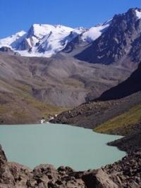
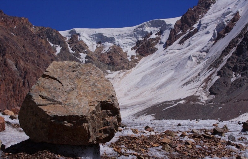
Glaciers of Zailiysky Alatau.
Nature Almaty Tours.
"A man knows himself only to the extent that he knows the world"
Goethe.
Participation in photo tour in Central Asia.
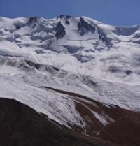
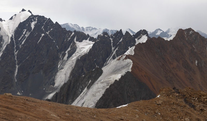
The Zailiysky Alatau Range extends 360 kilometers along 43 ° N. w. The main watershed of the ridge in the central part for 140 - 150 km has a height of 4000 meters above sea level and more. In the Talgar massif there are many peaks above 4500 - 4600 m. a. s. l., the highest point is Talgar peak, 4973 m. a. s. l.
The northern slope of the ridge is drained by the left tributaries of the Ili River. The southern slope of the ridge abruptly breaks off to the intermountain valleys of the Chilik (tributary of the Ili river) and Chong-Kemin (tributary of the Chu river) rivers, which flow one to the east, the other to the west and separate the Zailiysky Alatau ridge from the Kungei-Ala-Too ridge lying south.
At the source of these rivers, the ridges are connected by the Chiliko-Kemin bridge. The length of the Kungoy-Ala-Too ridge is about 280 kilometers. The western and eastern parts of the ridge are below 4000 meters above sea level, and only in its central part with a length of about 120 kilometers do individual peaks rise to 4300 - 4700 m. a. s. l.
The southern slope of the ridge faces Lake Issyk-Kul. There are 464 glaciers on the Zailiysky Alatau ridge with a total area of 492.2 square kilometers, on the Kungey-Ala-Too ridge 433 glaciers with an area of 411.1 square kilometers.
The main spatial pattern of glaciation of these ridges is the development of its predominantly small forms in the western and eastern parts and an increase in the area of glaciation and the size of glaciers in the central higher parts.
The largest glaciers are confined to the Talgar massif and the Chiliko-Kemin lintel, where vast glaciers of predominantly valley and valley types are located in the upper reaches of the rivers and their main tributaries. On the northern slope of the Zailiysky Alatau ridge, there are 307 glaciers with an area of 308.3 square kilometers.
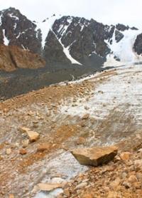
The largest glaciation nodes are located in the left Talgar river basins (83.7 kilometers square), Issyk (53.0 kilometers square) and Turgen (39.5 kilometers square). Glaciers occupy the highest sections of valleys and mountain slopes. More than 50% of the total number of glaciers are small glaciers (up to 1 square kilometer).
The largest is the Dmitriev Basin Glacier (5.3 kilometers long, 17.4 square kilometers). Valley glaciers have well-defined wide firn basins, surface slopes of 6 - 12 °. Hanging valley glaciers are widespread. In general, on the northern slope of Zailiysky Alatau, glaciers of valleys account for 22% of the number and about 65% of the area.
Hanging glaciers create the main background of glaciation in the peripheral parts of the ridge and its spurs. Quite a lot of stratified glaciers. Their ends are usually located along the slopes from which they receive the main avalanche food.
The largest stratified glacier is Turists Glacier (length 3.4 km, area. 6.2 km square) in the basin of the Left Talgar River.
In the eastern half of the ridge there are small glaciers of flat peaks. The average height of the glacier ends of the north slope of the Zailiysky Alatau is 3,500 m. a. s. l. in the western part of the ridge and 3,400 m. a. s. l. in the central and eastern.
The average height of the firn line is 3800 m. a. s. l. The average annual air temperature at an altitude of 3400 - 3800 m. a. s. l. from -4 to -8 °, at an altitude of more than 4000 m. a. s. l. from -10 to -12 °. The amount of precipitation falling on the northern slope of the Zailiysky Alatau ranges from 700 to 1300 mm per year. 75 - 80% of all precipitation falls in the spring-summer period, most of them - in solid form.
Over 20 years of observations in the Malaya Almatinka river basin, the average rainfall was 870 mm per year (maximum 1173 mm, minimum 633 mm). The length of the ablation period in individual glaciers experiences significant fluctuations from year to year: from 42 to 110 days, on average, the ablation period lasts 2 - 2.5 months. Melting at the ends of glaciers up to 3 meters or more per year.
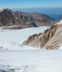
The glaciers of the Trans-Ili Alatau have a continental set of ice formation zones. The firn and ice zones account for about 70%, the ice supply zone - 28% of the accumulation zone. The cold firn zone is present only in the highest parts of glaciers and makes up about 2% of the area.
The ice temperature at the depth of seasonal freezing (6 - 15 meters) is from - 1.8 to - 2.5 °. With increasing depth, the temperature more and more approaches the melting point of ice under pressure. The speeds of most glaciers are from close to 0 to 20 m / year.
Only on individual glaciers do they reach 40 - 60 and even 90 - 100 m / year. For several glaciers, periodic accelerations of ice movement were noted. For example, the Shokalsky glacier (length 4.7 kilometers, area 10.8 square kilometers).
Each of the three branches of this glacier has an independent regime, characterized by alternating periods of activation and degradation (Makarevich, Fedulov. 1974).
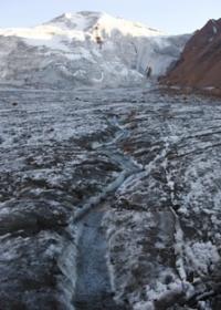
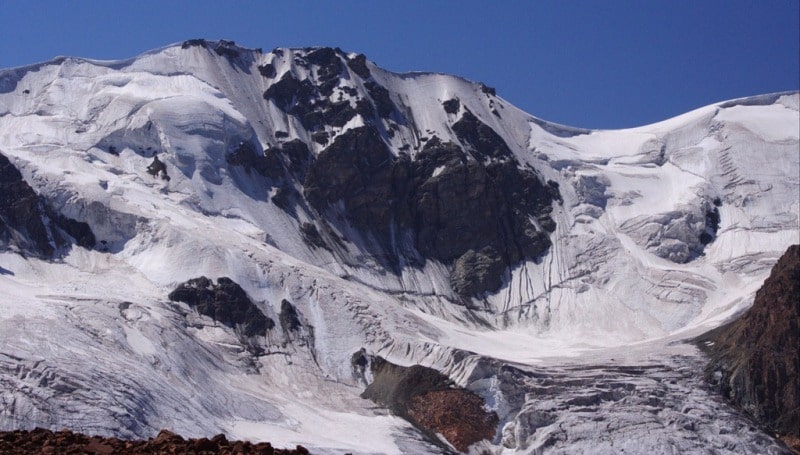
On the northern slope of the Zailiysky Alatau ridge, in the upper reaches of the Malaya Almatinka River, there is the Tuyuksu mountain glacial basin, which was investigated under the MHD program. There are 10 glaciers of different morphological types in this basin.
Their total area is 7.9 square kilometers.
Tuyuksu Glacier in Zailiskiy Alatau.
The main observations were made on the Tuyuksu glacier (3.8 kilometers long, 3.2 square kilometers). The height of the end of the glacier is 3400 meters above sea level, the firn line is 3800 m. a. s. l. The thickness of the ice in the middle part of the glacier is 50 - 80 m.
The average speed of ice movement is 22.3 m / year. For the period from 1964 to 1974, the average annual accumulation on the Tuyuksu glacier was 104.6 g / cm2, ablation was 118 g / cm2, and the balance was -13 g / cm2. Of the 10 years of observation, 5 years were with a negative balance and 5 years with a positive one.
Over the same period, the mass balance of the remaining glaciers of the Tuyuksu basin was negative (from - 11 to - 28 g / cm2 per year). In the basin as a whole, the average weight balance over 10 years was 14.3 g / cm2. Over 25 years (1937 - 1962), the area of the Tuyuksu glacier decreased by 0.084 square kilometers (Tuyuksu Glaciers. 1984).
Glaciers of the southern slope of Zailiysky Alatau and the northern slope of Kungey-Ala-Too give runoff to the Chilik and Chon-Kemin river basins. The Chilik River flows east along a wide longitudinal valley, the upper section of which is a well-defined spur.
It is formed from the confluence of the Zhangyryk, Southeast Talgar and Southern Issyk rivers, starting from the largest glaciers of the Northern Tien Shan - Zhangyryk, Bogatyr and Korzhenevsky. In total, there are 249 glaciers in the Chilik River Basin with an area of 302.4 square kilometers.
There are relatively few large glaciers. The largest valley and hollow glaciers are confined to the Chiliko-Keminsky lintel and to the Talgar massif.
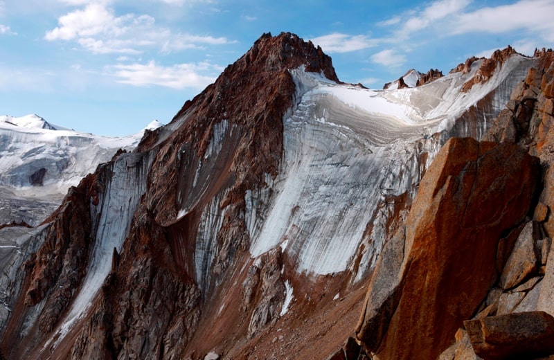
Korzhenevsky Glacier
Length 11.7 kilometers, area 38.0 kilometers square, ice volume 6.3 kilometers cubic - the largest in the Northern Tien-Shan - is located in the upper reaches of the South Issyk River. This is a valley glacier with a complex feeding area, consisting of four large glacial basins on the southeastern slope of the Talgar massif.
Ice flows from these basins are connected, but do not merge and flow side by side in one channel, separated by distinct middle moraines to the very end of the glacier. In 1964 - 1966 the average annual speed of ice movement in the middle part of the tongues was 29.4 meters on the left branch of the Korzhenevsky glacier, 36.4 meters on the left central branch, 51.9 on the right central branch and 16.9 meters on the right.
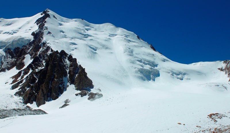
Glacier Bogatyr.
The second largest structure in the Northern Tien Shan is the Bogatyr hollow glacier (9.1 kilometers long, 30.3 kilometers square), consisting of three ice streams that form a short end. A feature of these glaciers is that each of the branches composing them has its own regime.
On the Bogatyr glacier, the left and middle branches had an ice speed of 6.2 and 3.1 meters per year respectively. The rapid movement of this glacier in the 1980s is known. There are 182 glaciers in the Chon-Kemin and Kichi-Kemin river basins, their area is 153.2 square kilometers.
60% of glaciers and 73.3% of the area of glaciation are confined to the northern slope of the Kungoy-Ala-Too ridge. Here, an average of 600 - 700 mm of precipitation falls annually, on the southern slope of the Zailiysky Alatau, 1.5 - 2 times less.
Basin icing is mainly represented by small glaciers both in length and in area. The size of glaciers is increasing from west to east. There are few large glaciers. The largest glaciers are Aksu Vostochny (length 4.9 kilometers, area 6.9 kilometers square) and Mashkovtseva (length 5.2 kilometers, area 6.9 kilometers square).
The average height of the ends of the glaciers in the basin as a whole is 3600 meters above sea level. 10% of the area of glaciers is covered with moraine. The ends of some glaciers are fully armored with moraine. A typical representative of armored glaciers is the Karakoram glacier (3.0 km long, 2.3 km2 square) on the northern slope of Kungey-Ala-Too.
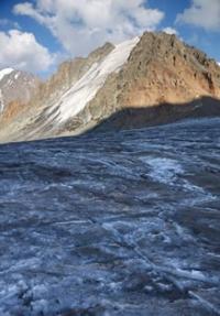
The end of this glacier, protected from melting by a moraine cover, descends to an altitude of 3120 m. a. s. l. On the surface of the valley glaciers there are many cracks up to 2.5 - 3 meters wide. Some of them have icefalls. The forms of ablative microrelief are widely developed in glacial tongues - glacial tables, "ant heaps", glacial honeycombs and glasses.
The prevailing slopes of the surface of glaciers are 8 - 12 °, firn basins - 4 - 6 °. Slopes of hanging glaciers up to 35 °. Most of the glaciers of the southern slope of the Zailiysky Alatau have an eastern exposure, and they are larger, although precipitation on the western slopes more.
This is due to the transfer of snow by prevailing westerly winds to the leeward eastern slopes of the ranges. For the same reason, larger glaciers are located on the eastern side of the Chiliko-Kemin bridge, than on the western. General trend of glacier vibrations Chon-Kemin River Basin - Retreat.
However, in the 1920s and early 1930s, many glaciers were stationary or even advanced. So, for example, from 1921 to 1928, the Aksu Vostochny glacier stepped on 36.6 meters, and by 1932, another 15 meters. But then he began to retreat, and from 1932 to 1963 decreased by 363 meters. Schnitnikov Glacier for 35 years (1927 - 1962) was reduced by 1311 m.
On the southern slope of Kung-Ala-Too 159 glaciers with an area of 140.3 square kilometers. Small glaciers predominate (74% of glaciers are smaller than 1 square kilometer), located in the upper valleys and in the crests of ridges. About a third of all glaciers are of the valley type.
Most of them are concentrated in the central part of the ridge. There are 53 glaciers in the Chon-Ak-Suu river basin with a total area of 65.6 kilometers square, including the largest glacier on the southern slope - Chon-Ak-Suu (6.1 kilometers long, 8.1 kilometers square).
n the peripheral parts of the ridge, the main background of glaciation is hanging glaciers. The end of the valley glaciers have a slope of 5 - 10 °, many cracks. The lower parts of most glaciers are completely buried by moraine. The height of the ends of the valley glaciers is from 3400 to 3600 m. a. s. l., hanging - from 3700 to 3900 m. a. s. l.
The height of the firn line decreases from west to east from 4200 to 3800 m. a. s. l. Most glaciers (65%) have southern, southeastern and southwestern exposures. (Palgov. 1958; Makarevich et al. 1969; Vilesov, Grudzinsky. 1971; Vilesov. 1975, 1979).
There are 464 glaciers on Zailiysky Alatau ridge with a total area of 492.2 square kilometers.
Largest glaciers of Zailiysky Alatau ridge.
Korzhenevsky Glacier in Zailiskiy Alatau.
Korzhenevsky Glacier, with a length of 21.5 kilometers, an area of 38.0 square kilometers, is located at an altitude of 3800 to 5020 m. a. s. l.l, belongs to the Chilik river basin.
Bogatyr Glacier in Zailiskiy Alatau.
Bogatyr Glacier, with a length of 9.1 kilometers, an area of 30.3 square kilometers, is located at an altitude of 3420 to 4580 m. a. s. l., belongs to the Chilik River Basin.
Glacier of Constitution in Zailiskiy Alatau.
Glacier of the Constitution, with a length of 6.0 kilometers, an area of 6.0 square kilometers, located at an altitude of 3270 to 4520 m. a. s. l., belongs to the Talgar river basin.
Gorodetsky Right Glacier in Zailiskiy Alatau.
Gorodetsky Right Glacier, 6.0 km long, 3.1 square kilometers long, located at an altitude of 3150 to 4250 m. a. s. l., belongs to the Kaskelen River Basin.
Dmitriev Glacier in Zailiskiy Alatau.
Dmitriev Glacier, with a length of 5.7 kilometers, an area of 17.4 square kilometers, located at an altitude of 3400 to 4520 m. a. s. l., belongs to the Talgar river basin.
Gorodetsky Glacier Left in Zailiskiy Alatau.
Gorodetsky Glacier Left, 5.5 km long, 3.8 square kilometers, located at an altitude of 3150 to 4310 m. a. s. l., belongs to the Kaskelen River Basin.
Palgov Glacier in Zailiskiy Alatau.
Palgov Glacier, with a length of 5.1 kilometers, an area of 7.5 square kilometers, is located at an altitude of 3250 to 4460 m. a. s. l., belongs to the Issyk basin.
Sapozhnikov Glacier in Zailiskiy Alatau.
Sapozhnikov Glacier, with a length of 5.1 kilometers, an area of 3.6 square kilometers, located at an altitude of 3680 to 4310 m. a. s. l., belongs to the basin of the Chong-Kemin and Chu rivers.
Makarevich Glacier in Zailiskiy Alatau.
Makarevich Glacier, with a length of 4.9 kilometers, an area of 6.0 square kilometers, located at an altitude of 3450 to 4230 m. a. s. l.l, belongs to the Kaskelen River Basin.
Shokalsky Glacier in Zailiskiy Alatau.
Shokalsky Glacier, with a length of 4.7 kilometers, an area of 10.8 square kilometers, located at an altitude of 3370 to 3930 m. a. s. l., belongs to the Talgar River Basin.
Grigoryev Glacier in Zailiskiy Alatau.
Grigoryev Glacier, with a length of 4.7 kilometers, an area of 8.9 square kilometers, located at an altitude of 3400 to 4500 m. a. s. l., belongs to the Issyk basin
Shubar Glacier in Zailiskiy Alatau.
Shubar Glacier, with a length of 4.7 kilometers, an area of 4.0 square kilometers, is located at an altitude of 3670 to 4460 m. a. s. l., belongs to the Chilik River Basin.
Central Tuyksu Glacier in Zailiskiy Alatau.
Central Tuyksu Glacier, with a length of 4.7 kilometers, an area of 3.8 square kilometers, located at an altitude of 3200 to 4230 m. a. s. l., belongs to the Kaskelen River Basin.
Zharsai Glacier.
Zharsai Glacier, right and left, with a length of 4.6 kilometers, an area of 6.5 square kilometers, located at an altitude of 3380 to 4600 m. a. s. l., belongs to the basin of the Issyk River.
Zhusandykungey Glacier in Zailiskiy Alatau.
Zhusandykungey Glacier, with a length of 4.6 kilometers, an area of 4.2 square kilometers, located at an altitude of 3450 to 4410 m. a. s. l., belongs to the Chilik River Basin.
Kassin Glacier in Zailiskiy Alatau.
Kassin Glacier, with a length of 4.5 kilometers, an area of 6.6 square kilometers, located at an altitude of 3400 to 4580 m. a. s. l., belongs to the Issyk River Basin.
Glacier No. 288 in Zailiskiy Alatau.
Glacier No. 288, with a length of 4.5 kilometers, an area of 4.1 square kilometers, located at an altitude of 3520 to 4690 m. a. s. l., belongs to the Chilik River Basin.
Glacier of the Gornyi Institute in Zailiskiy Alatau.
Glacier of the Gornyi Institute, with a length of 4.5 kilometers, an area of 9.8 square kilometers, located at an altitude of 3670 to 4460 m. a. s. l., belongs to the Turgen river basin.
Kalesnik Glacier in Zailiskiy Alatau.
Kalesnik Glacier, with a length of 4.3 kilometers, an area of 6.6 square kilometers, located at an altitude of 3400 to 4580 m. a. s. l., belongs to the Talgar River Basin.
Toguzak Glacier in Zailiskiy Alatau.
Toguzak Glacier is left, with a length of 4.2 kilometers, an area of 5.6 square kilometers, located at an altitude of 3470 to 4180 m. a. s. l.l, belongs to the Talgar River Basin.
Toguzak Glacier in Zailiskiy Alatau.
Toguzak Glacier is right, with a length of 4.1 kilometers, an area of 3.4 square kilometers, located at an altitude of 3650 to 4510 m. a. s. l., belongs to the Talgar River Basin.

Authority:
"Glaciers." L.D. Dolgushin, G.B. Osipova. Series "Nature of the world." Moscow, the publishing house "Thought". 1989.
Photos by
Roman Stesenko.