


![]()
Вы здесь
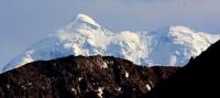
Glaciers of Tien-Shan.
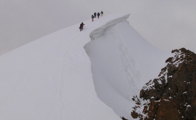
Travel in Tien-Shan mountains.
“Travel is a method of prolonging human life by intensifying it.
You travel twice as much on a trip.
You learn twice as much in a day.
Nothing happens while sitting at home, but something happens on a journey every day and you change and grow.
Therefore, for ten years of travel you live and grow by twenty ”
Anton Krotov.
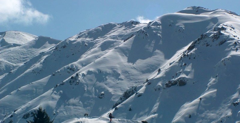
Nature of Tien-Shan mountains.
Tien-Shan mountain system is located between 40 and 45 ° C. W, 67 and 95th c. d., stretching in the latitudinal direction for 2450 kilometers. Within Central Asia, the western part of the Tien-Shan is 1,200 kilometers long (the eastern part is in the territory of the People’s Republic of China).
The Tien-Shan ridges are composed of Paleozoic and Precambrian rocks of sedimentary, metamorphic and eruptive complexes (schists, sandstones, limestones, marbles, gneisses, granites, and effusive rocks). Hollows and intermountain valleys are filled mainly with younger sedimentary deposits.
The Tien-Shan mountains, created in the Hercynian era of folding, lowered by the end of the Paleozoic, and in the Neogene again rose high as a result of sharp differentiated tectonic movements. The modern relief of the Tien-Shan is a series of mountain ranges of folded and block structure, elongated mainly latitudinally and
separated by wide basins - Issyk-Kul, Naryn, etc. On the crests of the ranges and their slopes, the remains of ancient alignment surfaces have been preserved. In the Quaternary Tien-Shan experienced significant glaciation, which lasted long enough to create characteristic alpine landforms on the slopes in the highlands
Climate of Tien-Shan.
ranges, which in our time are places of glaciers. The climate of the Tien-Shan is determined by its position in the central part of the continent of Eurasia and has a sharp continental. In winter, the Tien-Shan is in the zone of influence of the western periphery of the Siberian anticyclone, which brings clear frosty weather without precipitation.
During northwestern, northern, and northeastern invasions, cold Arctic air enters or temperate latitudes, and southern cyclones are accompanied by thaws. In spring and autumn, cyclone activity intensifies - moist air comes to the Tien-Shan masses from the west and northwest from the regions of the Atlantic and the Mediterranean Sea with cloud cover and frontal precipitation.
In summer, with penetration of tropical air from the south, for the most part Tien-Shan is set to cloudy, dry weather. The local mountain and valley circulation play a large role in the formation of weather. The alternation of warm and cold intrusions of air masses and the complexity of the mountainous terrain determine the strong variability of the weather, both in time and in space.
Temperature conditions mainly depend on the height of the terrain. Average annual air temperature decreases with height, remaining positive to an altitude of 2500 meters above sea level. For example, at the Naryn weather station at an altitude of 2040 meters above sea level, the average annual air temperature is + 2.5 °, and at an altitude of 3610 m. a. s. l. (Tien-Shan weather station) - 7.9 °.
In the area of glaciers (3500-3900 m. a. s. l.), the warm period lasts 75-125 days. The average air temperature for this period is 2 - 4 °, and the average temperature of the coldest month (January) is 20 degrees. Above 4200 m. a. s. l., positive air temperatures almost never happen.
The mountains of the western and northwestern parts of the Tien Shan are the first to encounter humid air currents and receive up to 1500-2000 mm of precipitation per year at the height of the snow line. To the east of the mountain system, rainfall is decreasing.
In the interior of the Tien-Shan at an altitude of 1800 climate of the Tien-Shan, 200-400 mm of precipitation falls annually. With the height of the terrain, their number increases and in the glacial zone reaches 1000-1200 mm. About 2/3 of the annual precipitation falls in the spring and summer months.
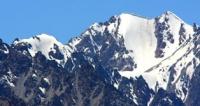
Above 4,000 climate of the Tien-Shan, precipitation occurs only in solid form. The snow line is the lowest in the western part of the Tien Shan (3500-4000 climate of the Tien-Shan). To the east, its height increases, and reaches its maximum values (4,500 m. a. s. l.) in the area of Pobeda and Khan Tengri peaks.
On the southern slopes of the ranges it often lies 200-500 meters higher than on the northern ones. In most of the Tien Shan, glaciers exist under conditions of prevailing low air temperatures, its great dryness and low rainfall with a significant number of hours of sunshine and the prevalence of westerly and northerly winds.
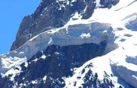
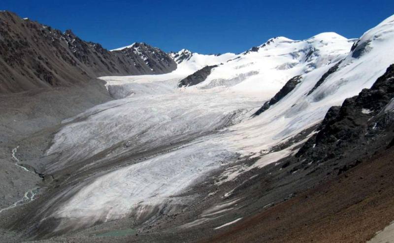
Currently, there are 7,590 glaciers in the Tien-Shan with a total area of 7,311.3 square kilometers, and the volume of water is estimated at 463 square kilometers. The Tien-Shan glaciers feed the rivers of the inner basins of Central and Central Asia (Syrdarya, Chu, Ili, Tarim).
The meltwater of glaciers is of great importance for the irrigation of arid foothill areas, especially in the summer months, when the share of glacial runoff in the total river flow is significant, and the fields need watering most. Glaciers of all morphological types characteristic of mountain glaciation are found in the Tien-Shan.
A distinctive feature of the Tien-Shan glaciation is the presence of glaciers of flat peaks located on the high elevated remains of ancient denudation surfaces. In general, there are few such glaciers in the Tien-Shan - 232, or 4% of the total, and their area is 3% of the total.
But in some areas, especially in the Inner Tien-Shan, their share is greater. Small glaciers prevail sharply in number: 80% of all glaciers are smaller than 1.1 square kilometers and another 16% of glaciers have areas from 1.1 to 5 square kilometers each.
But glaciers are larger than 5 square kilometers, although they are only 4% of the total, occupy almost 40% of the total glaciation area, including about 20% of the total area of 15 glaciers larger than 25 square kilometers. Among them - the South Inylchek glacier with an area of 567.2 square kilometers - the largest in the Tien Shan and the second in Central Asia after the Fedchenko Glacier in the Pamirs.
Glaciers are scattered over the mountain ranges and are located in the upper valleys, transverse to the direction of the ridges. Against this background, glaciation nodes stand out, confined to the highest elevated parts of the mountain system.
In these nodes large glaciers are developed, occupying longitudinal valleys between the ridges. They are characterized by extensive firn fields, often in contact with each other through watersheds. These nodes are Victory and Khan-Tengri peaks, the Aksai node, the Ak-Shyyrak massif, Talgar peak region, etc.
We examine the icing of the Central Asian part of the Tien-Shan in 4 main areas: Western, Northern, Internal and Central Tien-Shan.


Authority:
"Glaciers." L.D. Dolgushin, G.B. Osipova. Series "Nature of the world." Moscow, the publishing house "Thought". 1989.
Photos by:
Sergey Mikhalkov, Roman Stesenko and Alexander Petrov, Almaty city.