


![]()
Вы здесь
Climate of Pamir-Alai mountain.
Mountain hiking on Pamir Tajikistan.
“Not all those who wander are lost”
J.R.R. Tolkien.
Go for a ride Tajikistan.
In climatic terms, the Pamir-Alai is also heterogeneous, although all of it is in the subtropical zone. Huge heights causing high-altitude climatic zonality, and sharp differences in the distribution of moisture associated with the directions of moist air currents and orographic barriers, cause climatic contrasts.
In the western part of the Pamir-Alai, on the Gissar Range, up to 1,500 mm or more of precipitation falls annually, and forests from walnut and maple grow there, while in the Eastern Pamir, only about 100 mm of precipitation falls and it is characterized by the most Desert alpine landscapes you can imagine.
The climate of the Pamir-Alai is formed under the influence of: continental tropical air formed in the summer over Central Asia and the neighboring Iranian highlands, continental air of temperate latitudes formed in the winter over Siberia and Central Asia.
Cyclones of the Iranian part of the front are of moderate latitudes (in the low and mid mountain tiers), constant western moist air currents in the higher layers of the atmosphere (from an altitude of about 3000 meters above sea level).
Due to the nature of the atmospheric circulation, precipitation occurs most in the western part of the mountain system and mainly on the western and southwestern slopes, while the eastern slopes and the valleys and plateaus lying behind them are in the rain shadow.
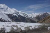
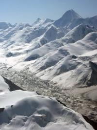
The contrasts in the distribution of precipitation over comparatively short distances are striking. So, even in the depths of the mountain system, on the Fedchenko Glacier, due to the barrier effect of the Academy Nauk ridge and adjacent ridges, giving an impulse to rainfall, the annual rainfall reaches 2236 mm, and only a few tens of kilometers to the east, in the regions of the Eastern Pamirs , their number, as we have seen, is negligible.
In the highlands, especially much rain falls where latitudinal and sub-latitudinal ridges converge to the east, forming a kind of trap for western air flows. Large glaciers originate in such places (Zeravshansky, glaciers in the upper reaches of the Obihingou River - Garmo, Gando, etc.).
In the middle mountains, under the influence of cyclones of the Iranian branch of the temperate latitude front, more precipitation falls on the south and south-west side of the mountains, however, due to the southern exposure, there is more insolation, so it is often necessary to see more dense forests on the northern slopes.
According to the nature of climatic processes, mid-mountain and especially low-mountain regions have much in common with neighboring desert regions. In winter, however, since intrusions of cold air do not spread above 500 - 600 meters, it is warmer in the mountains than on the plains, i.e. a temperature inversion occurs, and when cyclones pass and heavy precipitation occurs on the southern and south-western slopes of the mountains on the northern slopes phenov phenomena develop.
In the spring, as in the southern deserts, as a result of increased cyclonic activity, rains often continue, which continue even in the beginning of summer. The maximum rainfall here is spring, winter-spring, spring-summer.
Drought in the mountains begins only in the second half of summer, since the rains here stop much later than on the plain. Before the onset of drought, ephemeral vegetation develops in the foothills and low mountains.
The duration of drought in the mountains is much shorter than in the desert plains, only August and September are sharply arid. In these months, the vegetation burns out and goes under the snow cover of the winter season much more dried up than in the Tien-Shan, where in summer there is a maximum of rainfall and the vegetation does not stop until the autumn snowfalls.
Only in the Eastern Pamirs, in contrast to the rest of the Pamir-Alai, is a summer maximum of precipitation observed, which is explained by the influence of circulation processes developing over Tibet (B.P. Alisov, 1956), or by the action of the South Asian monsoon (O. E. Agakhanyants, 1965).
As in the Tien-Shan syrts, summer precipitation often falls in the form of cereals and snow. In the foothills of the Pamir-Alai and in the low mountains, winters are relatively short and mild, summers are long, with high temperatures; rainfall is greater than in neighboring deserts (350 - 700 mm per year).
At altitudes of 1,500 - 3,500 meters above sea level, the climate already has the characteristic mountain features, it is cooler and more humid in the predominant part of the territory. Within these altitude ranges, there is a belt of greatest moisture and in some places precipitation exceeds 1000 and even 1600 mm per year.
In the Eastern Pamirs, the climate is very dry, sharply continental and severe (at an altitude of about 4000 meters above sea level, the average January temperature is −20 °, July 8 °). In the valleys of the Western Pamirs, temperatures are higher (at an altitude of about 2100 meters above sea level, the average temperature in January is −7.4 °, July 22.5 °) and, although not the same as in the Eastern Pamirs, it is still very dry (annual rainfall is less than 260 mm), in the highlands of the Western Pamirs, much more precipitation falls, especially in the north.
Authority:
N.A. Gvozdetsky, N.I. Mikhailov. “Physical geography of the USSR. Asian part. Third edition, revised and supplemented. Moscow "Thought" 1978.