


![]()
Вы здесь
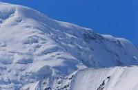
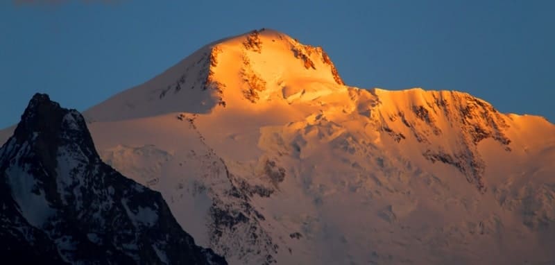
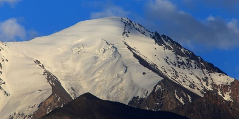
Ridge of Peter Great.
Pamir Sights Tour.
“The Peter the Great Ridge - discovered and named in such a way in 1878 by the expedition of V. F. Oshanin, stretches for more than 200 miles along the left bank of the Surkhaba River on the southern border of Karategin (bekstvo in mountain Bukhara, see), between 40 ° and 42 ° East longitude from Pulkovo. In the western, relatively low snow-free part, the ridge of P. the Great is broken by the left tributary of the Surkh Khullas, or Ob-Hingou; on the meridian of Garma (see) snow appears on it, and somewhat east of the mountain rise no lower than 18,000 feet (Sary-kaudal); further east, peaks covered with eternal snow reach 20 thousand feet in places, at the eastern end of the ridge, where it seems to be connected with the Darvaz Range and where the huge Sandal massif covered with glaciers rises, the ridge rises to 24 - 25 thousand feet above sea level. Through the ridge of P. the Great there are 3 passes open for movement only in summer and leading from Karategin to Darvaz, namely to the Hullas valley. Of these, the westernmost Kamchirak is accessible for pack movement; Luli Harvey Pass to the east is covered with eternal snow and very difficult; almost at 41 ° east longitude there is a third, also very difficult Gardani-kaftar pass”
V.M. ESBE. Russia, St. Petersburg, 1890 – 1907.
Cultural walks from Dushanbe to Ishkashim village.
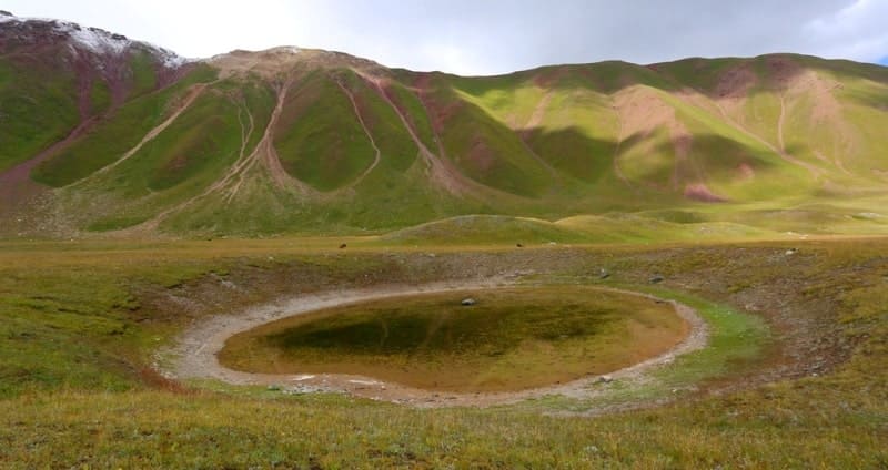
To south of western part of Zakayskiy ridge stretches adjacent ridge of Peter Great. Here, almost meridionally, is line of mountain ridge of Academy of Nauk. At place where it meets ridge of Peter Great, where these two chains of giants meet, stands highest peak of Pamirs - Peak of Communism (Peak of Ismoil Somoni, Stalin) 7495 meters above sea level. Peter I ridge has a latitudinal direction, its length is more than 226 kilometers, it departs from Academy of Nauk ridge in area of Communism Peak, where famous Pamir firn plateau is located. Peter Great ridge is located in Western Pamirs between the Surkhob and Obihingou rivers. Ridge is mostly located in Sangvor region and partially (eastern spurs) in Murghab region of Gorno-Badakhshan Autonomous Region of Tajikistan.
The length of the Peter the Great ridge is 226 kilometers. The entire mountainous region near these ridges is a complex, intricate system of mountain nodes, ridges, high peaks and powerful glaciers. The average height of the ridge ranges from 4,300 meters above sea level in the west to 6,000 meters above sea level in the east.
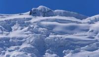
The ridge is characterized by sawtooth ridges, deep gorges and high seismicity. Maple forests grow on the slopes, giving way to juniper open forests and thickets of bushes; above alpine meadows. There are 487 glaciers on the ridge with a total area of about 480 square kilometers.
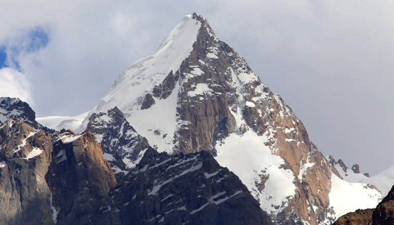
The ridge is composed mainly of sandstones and conglomerates. A characteristic feature of the relief of the Peter I ridge are the remains of ancient flat surfaces, raised to great heights; along the edges, rubble formed from uprooted trees. The next peak in the Peter the Great ridge, which follows after Communism Peak, is Moscow Peak, 6785 meters above sea level.
Due to the high altitudes, as well as the fact that the Academy of Sciences ridge closes the Western Pamir valley from the east, the largest node of modern glaciation is located here.
History of discovery of Peter Great ridge.
The name behind the ridge of Peter the Great has been established since 1932; before that, the name ridge of Peter the Great, assigned to V.F., appeared. Oshanin in 1878 at the discovery of the ridge. An attempt to isolate the western shoulder of Communism Peak, 6950 meters above sea level, as an independent peak (Dushanbe Peak, 1974) was unsuccessful.
The same is the fate of the upper extremity of the Burevestnik ridge, named Parachutists Peak, in honor of the parachute landing carried out on the Pamir firn plateau in 1967.
Following peaks belong directly to Peter Great ridge and its spurs in area of Fortambek glacier system:
in the axial part (from east to west) - Communism, Kuibyshev with an altitude of 6189 meters above sea level, “Kroshka” with an altitude of 5854 meters above sea level, Leningrad with an altitude of 6507 meters above sea level, Abalakova with an altitude of 6446 meters above sea level, Borodino with an altitude 5959 meters above sea level, Moscow.
In northern spur of Peter Great ridge, extending from Moscow peak:
30th anniversary of the Soviet state with an altitude of 6447 meters above sea level, Oshanin with an altitude of 6380 meters above sea level, Rodioclub with an altitude of 6181 meters above sea level, Krupskaya with an altitude of 5808 meters above sea level, Shapak with an altitude of 5700 meters above sea level, Shataeva with an altitude of 5425 meters above sea level sea, Suloev height of 5816 meters above sea level and a number of other lower peaks.
In addition, the Peter the Great ridge includes Kirov Peak, 6372 meters above sea level, located in the northern part of the Pamir firn plateau, peaks 5203 and 4962 in the northern spur extending from Kirov Peak.
Passes in ridge of Peter the Great.
There are two passes across the ridge: the Shini-Bini pass - between the Rodionov and Krupskaya peaks, connecting the glaciers of the Sugran and Fortambek systems, and the Kurai-Shapak pass north of the Shapak peak, connecting the Khodyrsha and Shapak glaciers. In the spur of the ridge northeast of the Krupskaya peak between the Shataeva and Suloev peaks there is the Suloev Pass.
Geographic coordinates of beginning of Peter the Great Ridge: N38°55'42 E70°08'04
Geographic coordinates of average position of Peter Great Ridge: N38°59'04 E70°48'43
Geographic coordinates of end of Peter Great ridge: N38°56'34 E72°00'56
Authority:
"Fortambek and its peaks." G. Kalinin. Uzbekistan, Tashkent. 1983. "Glaciers." L.D. Dolgushin, G.B. Osipova. Series "Nature of the world." Moscow, the publishing house "Thought". 1989.
Photos by:
Alexander Petrov.