


![]()
Вы здесь
Glacier of Garmo.
Mountain ranges of Tajikistan.
“Do not discover the old truths: everyone knows that the sun is setting in the west”
Sights of mountains of Tajikistan.
Upper limit of Garmo glacier is located at an altitude of 6507 (Leningrad peak) above sea level, 6189 (Kuibyshev peak) meters above sea level and 5854 (Kroshka peak) meters above sea level. From northeast it has large tributaries of glaciers: Vavilov and Shokalsky.
In upper reaches, Garmo glacier is located between Belyaev glacier in east and Lipsky glacier in west. End of glacier is located at an altitude of 2971 meters above sea level. It is located on southern slope of Peter Great ridge, southeastern part of glacier is limited by Darvaz ridge, in Sangvor region of Republic of Tajikistan.
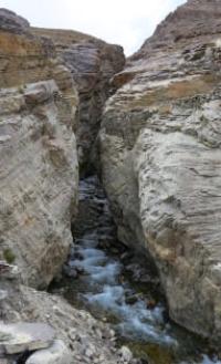
A river of the same name flows from the glacier, 30.5 kilometers long, which merges with the Kyrgyzob and Bokhud rivers to form the Obihingou River. The right slope of the valley forms a spur of the Peter I ridge, the OPTE ridge, the left - a spur of the Darvaz ridge.
The lower reaches of the glacier were described in 1916 by an expedition of the Russian Geographical Society (Ya.I. Belyaev and P.I. Besedin). The length of the Mushketov glacier is 30.4 kilometers, the area is 114.6 square kilometers. The Garmo Glacier is formed from 4 large ice tributaries, which themselves are complex glaciers with an extensive network of tributaries.
These are the Lipsky, Belyaev, Vavilov, Shokalsky glaciers. In the lower part, for 7 kilometers, the Garmo glacier is completely covered with a moraine cover, its surface is hilly, there are many small lakes. The Garmo glacier has three sources: the Lipsky glacier with a length of 5 kilometers, the Belyaev glacier with a length of 9 kilometers, flowing from the foot of the peaks of Communism (Ismail Somoni), Garmo and the Vavilov glacier with a length of 4 kilometers.
The Garmo Glacier has no large right tributaries. The glaciers lying on the slopes of the OPTE ridge have lost contact with it. The left tributaries are more significant, but they also retreated deeper into their valleys. Below the Vavilov glacier are the Shokalsky glaciers with a length of 12 kilometers, Mumbni with a length of 9.5 kilometers, Tokaist with a length of 2.5 kilometers and Safetob with a length of 3.2 kilometers.
The spurs separating them are the Vavilov, Shokalsky, Mumbni, Tokaist and Safetob ridges, according to the observations of topographer I.G. Dorofeev are located at a distance of about 5 kilometers from each other. The Garmo glacier is connected through side valleys with the glaciers Gando (Kirgiz-Ob River), Fortambek (Muksu River), Bivachny (Fedchenko Glacier), RGO, with the Darai-Poimazar (Vanch) River and the Bokhud River (Obi-Hingou).
In its lower reaches, the Garmo glacier is covered with an armored moraine, and in the last 5-6 kilometers it is very hilly and broken by thermokarst sinkholes, often filled with water. Clear ice opens above the Shokalsky glacier, although individual stripes can be traced much lower, to the level of the Avo-Dara camp.
The end of the glacier encroaches into an area of juniper and birch forests.
Geographic coordinates of Garmo Glacier: N38°53'13 E71°56'35
Authority:
"Glaciers." L.D. Dolgushin, G.B. Osipova. Series "Nature of the world." Moscow, the publishing house "Thought". 1989. http://poxod.ru/guidebook/darvaz/p_darvaz_lednikgarmopci_a.html
Photos by:
Alexander Petrov.