


![]()
Вы здесь
Tour to valleys Zhairakty, Ktayayrakty, Akmyshtau.
Trip to the valley Akmyshtau.
“These picturesque mountains, called Ayrakty and Chir-kala, have the form of ruins of large fortresses, as it were; they consist of white chalk and at the base have a dirty green loose sandstone with splices”
"Through Mangyshlak and Ustyurt to Turkestan." Barbot de Marni. 1889.
Short description of route of excursion trip to valleys Kurturmas and Ktayairakty:
Aktau - Shetpe village - Zhetybai village - Kyzylkala ancient settlement - Mount Sherkala - Zhairakty mountains - Ktayayrakty mountains - Akmysh lost mountain - Aktau town.
Distance of route: 391 km.
Distance of active part: 4 - 5 km.
Season: April - October.
Duration: 1 day.
Best time for tour: April, May, June, September.
Detailed travel program to the mountains of Western Karatau:
Visiting the valley Zhairakty.
Transfer: Aktau - Zhetybai village - Shetpe village - Kyzylkala ancient settlement - Akmysh valley (181 km).
From the town of Aktau, our path lies to the southeast, after the village of Zhetybai our path lies to the north towards the village of Shetpe. We pass the large village of Shetpe and after it our path lies to the north-west to the Kyzylkala ancient settlement.
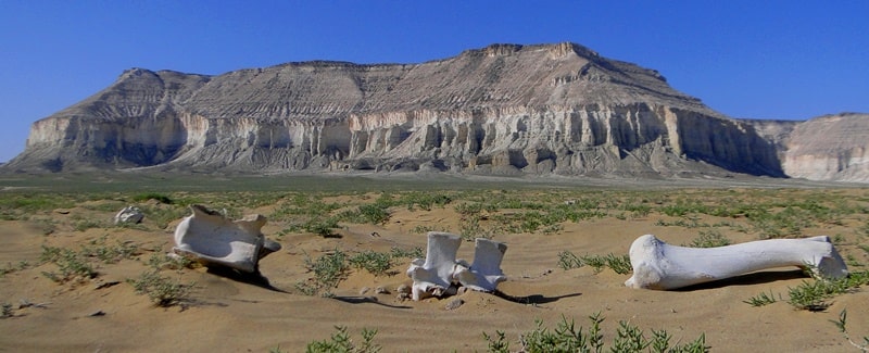
The large medieval ancient settlement of Kyzylkala is located in the immediate vicinity of the valley Akmysh. The ancient settlement was founded in the X century by Khorezm, as an outpost for expanding borders on the northern branch of the great trade route - the Silk Road.
Dates X - XIII centuries. The hillfort consists of the remains of a fortification, surrounded by numerous estates along the perimeter. In written sources, this settlement is referred to as the impregnable fortress of Mankyshlak (according to one version, the name translates as "Big Village"). A walk in the vicinity of the settlement, a visit to the archaeological site and Akmysh valley.
Transfer: Kyzylkala ancient settlement - Mount Sherkala (4 km).
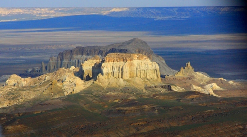
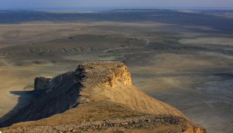
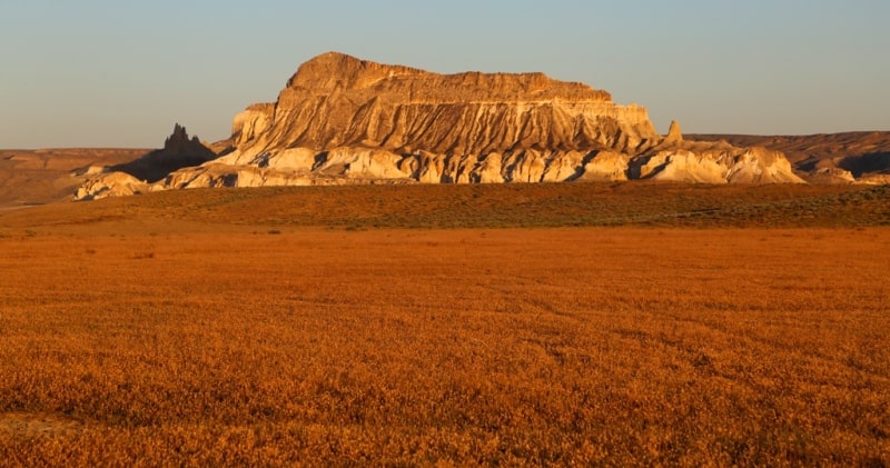
Mount Sherkala is located in the Mangistau district of the Mangistau region, 21 kilometers northwest of the district center of the Mangistau district - the village of Shtepe and 181 kilometers to the north-east of the town of Aktau. Translated from Turkic, "Sherkala" means "the strength of a lion" ("cher" - a lion, "kala" - a fortress).
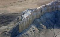
The geology of Sherkala is represented by Upper Cretaceous rocks, clay, sandstones, marls, and limestones. The mountain is located in the northwestern spurs of the Western Karatau mountain range. At 1600 meters from the mountain, in the northwest, there is the Kyzylkala hillfort, which dates from the X - XIII centuries and a picturesque green oasis spring and a small stream - Akmysh valley.
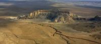
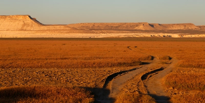
To the north of Sherkala there is a hollow between the Western and Northern Karatau mountains, called the vast valley Kurturmas. The Kurturmas valley has a length of 15 kilometers from west to east, 4 kilometers from north to south.
The height of Mount Sherkala is 307.7 meters above sea level. On the way, visit the old necropolis and the underground mosque Temir Abdal, located 1 kilometer west of Sherkala. Walks in the environs of Mount Sherkala.
Transfer: Mount Sherkala - Zhairakty mountain range (14 km).
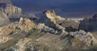
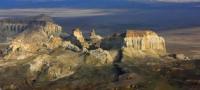
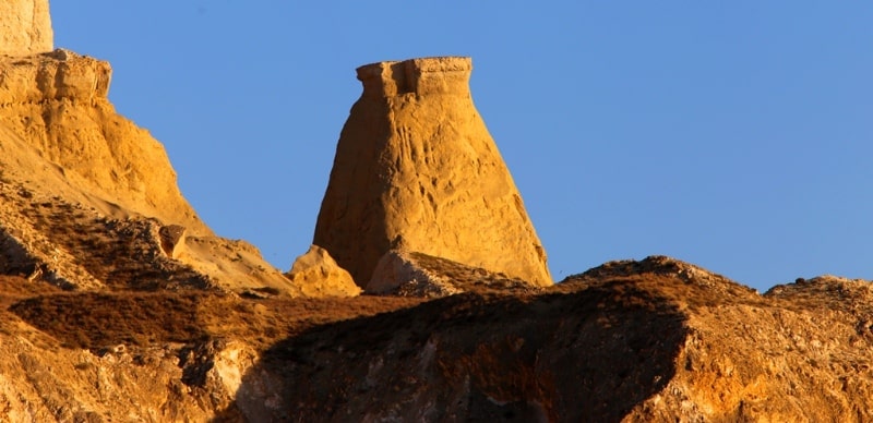
The Zhairakty massif is located in the Mangistau district of the Mangistau region, 5 kilometers west of Mount Sherkala. The Zhairakty massif adjoins the northern slopes of the Western Karatau mountain range, the northern spurs of the massif border a vast valley Kurturmas.
The southern part of the Zhairakty massif is elevated and has a height of 351.5 meters above sea level, this is the most dominant height in the area. The northern part of the massif was divided into two independent mountain spurs by a huge ravine.
The northeastern part of the spur rises to a height of 322.8 and 324.3 meters above sea level. 3.6 km east of Zhayrakty is the Akmyshtau mountain massif, in the southeastern part of the Ktaiyrakty massif 311.2 meters high above sea level.
The length of the eastern part of the massif, from the southern part of the cliff to the longest ridge of the northern part, is 2494 meters, the western part of the massif is 2585 meters. The largest, latitudinal width, in the central part of the mountain, is 2103 meters.
The perimeter of the mountain is 12 kilometers. The Zhairakty massif is composed of Upper Cretaceous rocks, clays, sandstones, marls, and limestones. Walks in the environs of the Zhairakty massif.
Transfer: Zhairakty massif - Ktayayrakty massif (5 km).
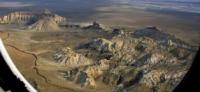
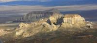
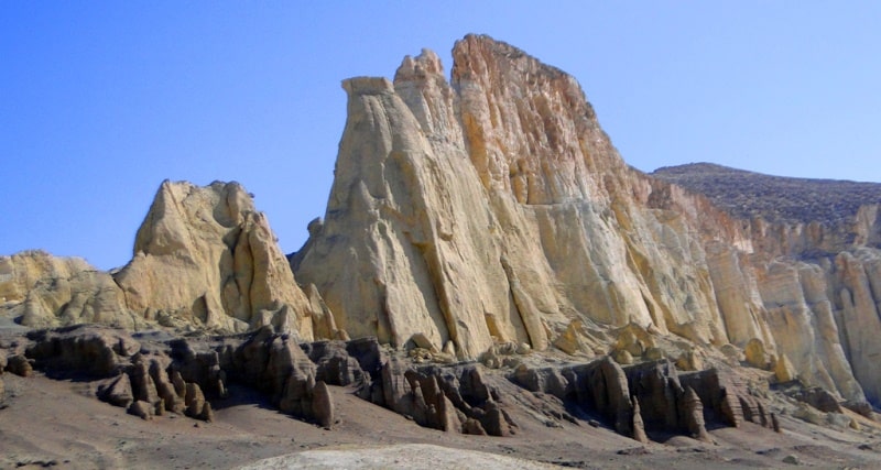
The Ktayairakty massif is located in the Mangistau district of the Mangystau region, 2 kilometers, southeast of the Zhairakty massif. The Ktaiyrakty massif is adjacent to the northern slopes of the Western Karatau mountain range, the northern spurs of the Ktayairakty massif border a vast valley Kurturmas.
The southern part of the Ktaiyairakty massif is elevated and has a height of 311.2 meters above sea level. The length of the eastern part of the massif, from the southern part of the cliff to the northern part, is 1132 meters. The largest, latitudinal width, in the central part of the mountain, is 690 meters.
The perimeter of the mountain is 3257 meters. The Ktaiyrakty massif is composed of Upper Cretaceous rocks, clays, sandstones, marls, and limestones. Walking in the environs of the Ktaiyrakty massif.
Transfer: Ktaiyrakty mountain massif - Akmyshtau lost mountain (4 km).
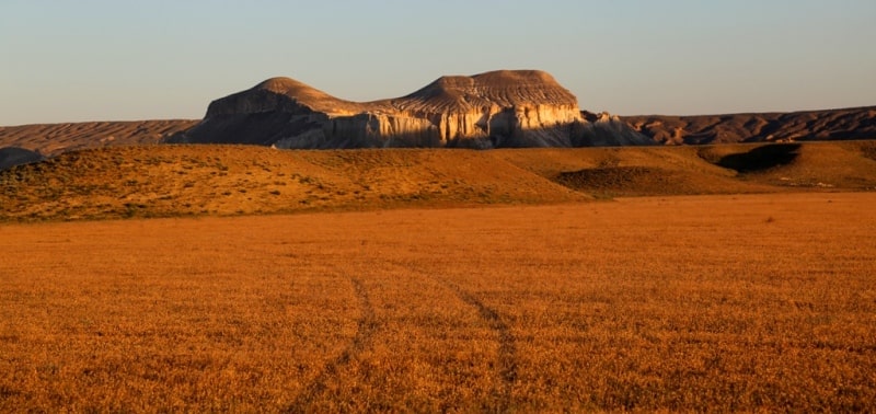
The Akmyshtau lost mountain range is located in the Mangistau region of the Mangistau region, 2.8 kilometers east of the Zhairakty massif and 2197 meters north of the Ktayairakty massif. The Akmyshtau massif adjoins the northern slopes of the Western Karatau mountain range, the northern spurs of the Akmyshtau massif border a vast tract Kurturmas.
The Akmyshtau mountain range consists of small outlier, picturesque mountains. The southern part of the Ktaiyrakty massif is elevated and has a height of 311.2 meters above sea level. The length of the Akmyshtau massif is small, from south to north, is 1121 meters.
The greatest width, in the central part of the massif, is 948 meters. The perimeter of the Akmyshtau mountain range is 3340 meters. The Akmyshtau lost mountain is composed of Upper Cretaceous rocks, clays, sandstones, marls, and limestones. Walking in the vicinity of the Akmyshtau massif.
Transfer: Akmyshtau massif - Shetpe village - Zhetybai - Aktau village (181 km). The end of the journey.
Note:
Author program of Alexander Petrov. Copying and introduction - from the sanction of the author petrovsra@mail.ru
Photos by
Alexander Petrov