


![]()
Вы здесь
Mountains of southeast and east of Central Asia.


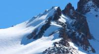
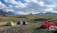
Tours in mountains of Central Asia.
"The mountains have the power to call us to their lands...
Our friends stayed there forever
People of great soul are reaching for height
Do not forget those who did not come from the peaks..."
Photo tours in mountains of Central Asia.
Separation of the mountains of the southeast and east of Central Asia into mountain systems. The mountains of the southeast and east of Central Asia are diverse geologically and physically-geographically. The folded base of the northern and middle mountain ranges formed in the Paleozoic.
In the south, along with the Paleozoic and Mesozoic folding-forming movements, the Cenozoic folding was very intense. The relief everywhere, both in the north and in the south, is created by young uplifts - Neogene and Quaternary. The tectonic development of mountain regions continues to this day, as evidenced by their seismicity.
When highlighting mountain systems, i.e., when orographic zoning, it is necessary to take into account primarily the isolation of individual groups of mountain ranges and their isolation from other groups by intermountain depressions. This isolation is caused not by a common geological history, but by the manifestation of the latest tectonic movements and may not be consistent with the age of ancient structures, which is observed in the mountains of southeast Central Asia.
The main mountain systems of Central Asia are Tien-Shan and Pamir-Alai. However, there is no consensus on how to draw a line between them. In accordance with the representation of many geographers, we believe that the Ferghana Valley separates the mountains of the Tien-Shan and the Pamir-Alai
1. South of the Ferghana Valley lies the compact mountain region of the Pamir-Alai. The Ferghana Valley itself represents an important orographic boundary, predetermined by tectonic subsidence and almost completely separating the Pamir-Alai from the Tien-Shan system (only the eastern part of the Alai ridge adjoins it).
1 L. S. Berg, E. M. Murzaev and some other geographers attribute the northern part of the Pamir-Alai to the Tien Shan, which violates, however, the general principle of using their own geographical names. On this occasion, see: N. A. Gvozdetsky. On the geographical concept of “Pamir-Alai” and the partition of the mountains of Central Asia into mountain systems. - In the book: “Questions physical geography of the USSR. " M., 1959; N. A. Gvozdetsky, V. K. Zhuchkov and others. Physical geography of the USSR. Selected Lectures, Issue 3. M., 1959.
The Ferghana Valley, as the boundary between the Tien-Shan and the Pamir-Alai, has not only orographic, but also wider geographical significance. B.P. Alisov considers the Ferghana Valley an important climatic boundary, classifying the Tien Shan as a zone of temperate climate, and the Pamir-Alai as subtropical.
According to V.L.Shults, the Ferghana Valley is a boundary in hydrological zoning: south of this boundary in the mixed glacial-snow feeding of large rivers, the share of glacial feeding is higher than to the north. The Ferghana Valley also serves as a botanical and geographical boundary: this is the southern border of the distribution of coniferous species typical of the Tien-Shan - spruce and fir.
Only at the eastern end of the Zaalai Range are spruce groves found, but this is an exception that confirms the rule. Thus, we will draw the border between the Pamir-Alai and the Tien Shan along the Ferghana Valley.
Some geographers attributed the Dzungarian Alatau to the Tien Shan system, but it should be considered an independent mountain system, which, by natural conditions, occupies an intermediate position between the Tien Shan and the mountains of southern Siberia.
First of all, it should be noted the orographic isolation of the Dzungarian Alatau, separated from the Tien-Shan by a wide valley along which the Ili River flows. True, in the foreign territory it has an orographic connection with the Bororohoro ridge, which belongs to the East (Chinese) Tien-Shan system, but this orographic connection is even less distinct than the Pamir-Alai and Tien-Shan links at the junction of the Alai, Ferghana and Kokshaa-Too ranges.
The intermediate position of the Dzungarian Alatau between the Tien Shan and the mountains of southern Siberia is reflected in the composition of its vegetation. For example, Siberian fir (Abies sibirica) penetrates the mountains of the Dzhungarskiy Alatau, while the other species of fir, A. semenovii, is characteristic of the Tien-Shan.
Along with this, in the Dzhungarskiy Alatau there are juniper thickets characteristic of Central Asian uplands and Tien Shan spruce (Picea schrenkiana). S.P.Suslov, considering the Dzungarian Alatau an independent mountain system, notes the quantitative predominance of Altai-Siberian plant species in its vegetation cover.
To the north of the Dzhungarsky Alatau, between the Alakol and Zaysan depressions, the mountain ranges of Tarbagatai and Saur rise, the folded structures of which are a direct continuation of the structures of the Kazakh small hills, but are much higher. S. P. Suslov classifies them as “the semi-desert region of Central Asia (Central Kazakhstan)”.
However, these ridges (like the mountains of the Northern Tien Shan and the Dzhungarsky Alatau, which are structurally tectonic also directly related to the Kazakh small hills) have a fundamental difference from the Kazakh small hills: they have a different character of the latest tectonic movements, and hence large heights and wide ranges high-altitude zoning landscapes.
If we also take into account that in the foreign territory (in Western China) there are intermediate orographic links between the aforementioned ranges and the Dzhungar Alatau (the Miley, Barlyk and Urkashar ranges), it would obviously be more correct to connect Saur and Tarbagatai to the mountains of southeast and east of Central Asia as a relatively large fourth system, bordering the mountains of southern Siberia.
So, in the mountains of southeast and east of Central Asia, four mountain systems stand out. Saur and Tarbagatai, Dzhungarsky Alatau, Tien-Shan, Pamir-Alai. The borders between the last three are the Ili and Ferghana valleys. The following is a description of the physical and geographical features of each of the identified mountain systems.
Authority:
N.A. Gvozdetsky, N.I. Mikhailov. “Physical geography of the USSR. Asian part. Third edition, amended and supplemented. Moscow “Thought” 1978. http://tapemark.narod.ru/geograf/1_5_5.html
Photos by:
Alexander Petrov.