


![]()
Вы здесь
Ancient settlement Syutkent.


Monuments of the history of Turkestan region.
«If I sigh, whose hand will help?
If I endure, then death is near!
And I grieve and rejoice, I only remember you.
May this passion and longing pass by the living”
Ilyas ibn Yusuf Nizami.
Trip from Shymkent to Syutkent ancient settlement.
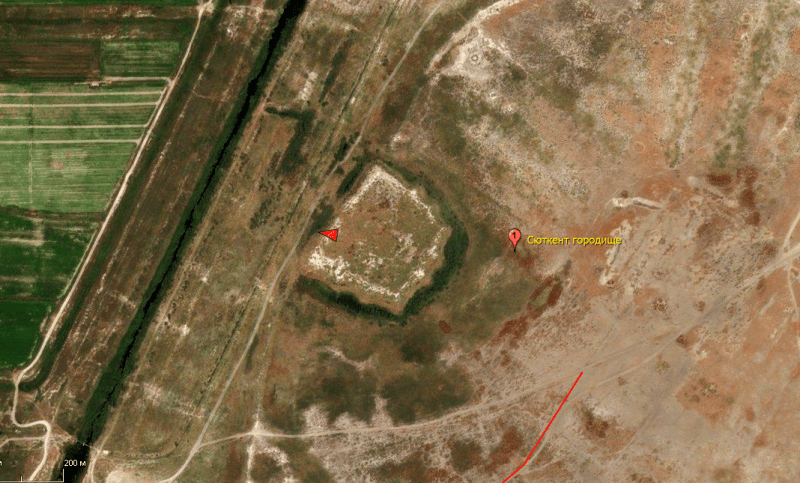
The settlement Syutkent is located on the mound of the same name, 226 meters above sea level, 2.2 kilometers south-west of the village of Syutkent, 2.3 kilometers to the east and slightly north of the left (western) bank of the Syr Darya River, 7.4 kilometers to northeast of the village of Kyzylkum in the Shardara district of the Turkestan region.
In 1900, the ancient settlement was surveyed by N. B. Rudnev, in 1949 - by the South Kazakhstan Archaeological Expedition (A.N. Bernshtam). At the same time, archaeologists carried out 2 stratigraphic excavations, which allowed to reveal parts of household structures on the citadel from the inner part of the city and found ceramic material.
Syutkent is repeatedly mentioned in written sources of the Xth - XVth centuries. For example, ibn-Haukal (X century) writes that in the city “there is a mosque and Turks from (different) tribes gather in it”; and the anonymous author of Khudud al-Alam (X century) reports that "Syutkent is a place abundant in benefits and located on the banks of the river, its population is militant."
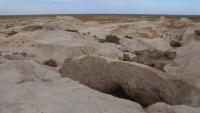
Similar information is contained in the writings of other authors. The topography of the monument of the Syutkent settlement is a site 2 - 2.5 meters high, rounded from the western, southern, eastern sides, in the north-western part the border is straight.
Along the edge of the entire line of the site are traces of a shaft with a height of more than 1 meter, a width of 4 - 6 meters, with the remains of more than 30 towers. On the outside, the settlement is surrounded by a moat (depth 1 - 1.5 meters, diameter 8 - 10 meters).
In the eastern part, the remains of the reservoir, the entrance to the southeastern part are preserved. The size of the site from north to south is 750 meters, from west to east 850 meters. In the northwestern part of the site, traces of the citadel in the form of a hill of a quadrangular shape, with a height of 7 - 8 meters and a side length of 150 x 150 meters, have been preserved.
On the upper, outer side of the citadel, the remains of the shaft and defensive towers in the corners and between them. The base of the citadel is separated from the city by a moat, the entrance to the citadel in the northwestern part.
To the east of the settlement, adjacent to it, are the remains of numerous suburbs, the contours and borders of which are now difficult to establish. Traces of this suburb are located in the northern part, opposite the citadel.
Ceramic material is diverse: mainly fragments of large and medium vessels such as humas, carafes, tables of dastarkhan, jugs, pots. Fragments of the sphere of cones, ceramic spindle, the remains of a round millstone from a manual mill, and other products made of ceramics and stone were found.
The ceramics are mainly made on a potter's wheel; in the decor traces of engobe, traced horizontal wavy lines, traces of a stamp, etc. are traced.
Geographic coordinates of the settlement Syutkent: N41 ° 56'19.03 "E68 ° 04'14.95"
Authority:
http://www.ontustiktravel.kz
Photos by
Alexander Petrov.