


![]()
Вы здесь
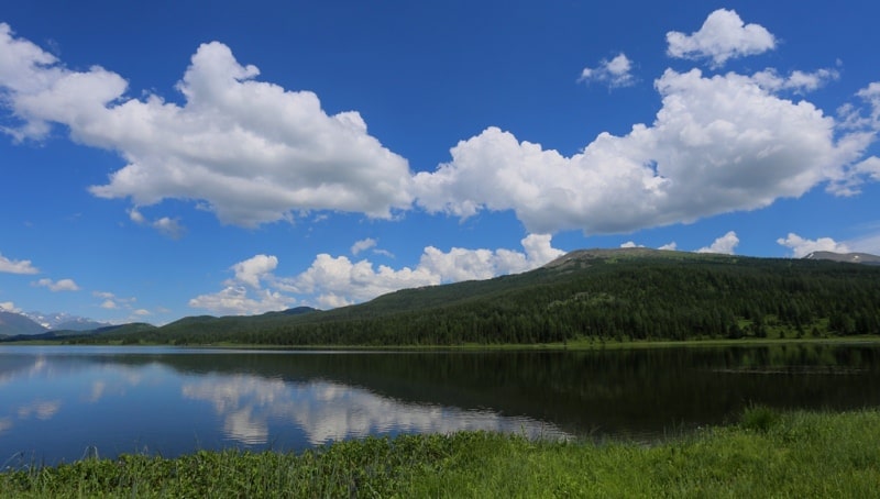
Water resources of Central Asia.


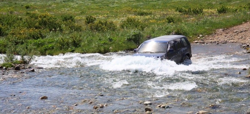
Natural Wonders Adventure in Uzbekistan.
“Nature is an infinite sphere whose center is everywhere”
Ralph Waldo Emerson.
Holidays tour in Uzbekistan.
Territory of Central Asia and Central Kazakhstan, with the exception of high-mountainous regions, has insufficient and, for the most part, extremely insufficient moisture. Associated with this is the extremely large for the territory of Central Asia, the rarefaction of the hydrographic network, the exceptional importance of the exotic, that is, not characteristic of the desert landscape, rivers originating in the high mountains, and the incompetence of most of the territory.
The density of the river network in the desert plains of Central Asia is about 2 meters per kilometer square, while, for example, in the northern half of the Russian Plain it reaches 300-350 km / h of square kilometer.
The rivers of the main part of the territory, except for the northern half of Central Kazakhstan, end in inland lake water bodies (the Caspian Sea, Aral, Balkhash, Issyk-Kul, etc.) and small lake-marsh spills or have so-called dry deltas - in this case water of the rivers, not reaching large lakes or large river arteries, it is spent on evaporation, infiltration into the ground and mainly on irrigation of fields.
The climatic conditions of the flat part of Central Asia, low rainfall with high evaporation are not conducive to the formation of runoff. Surface runoff here is very small. There is a slope runoff to takyr depressions and occasional channel runoff of small temporary streams formed during the melting of snow and during rains in ravines along the edges of desert heights.
There are no rivers with a constant flow that would begin in the desert zone of the flat part of Central Asia. Exceptions are small streams (Karasu), fed by the springs of the outer edge of mountain trails. Only in the north, within Central Kazakhstan, there are permanent streams of local origin.
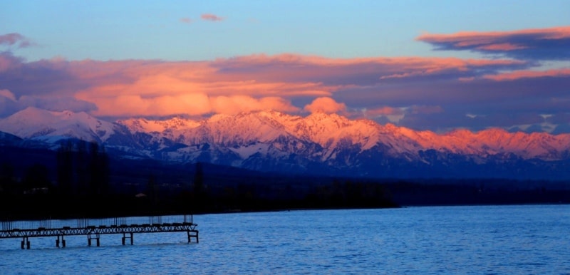
In the mountains, starting from about 700 meters of absolute height, precipitation falls in large quantities in the form of rain and snow (in the highlands even in summer). The maximum amount of precipitation (up to 2000 mm per year) is observed at altitudes of 2000 - 3500 m, and their number decreases.
The runoff coefficients in the high-altitude zone of maximum humidification are large, ranging from 0.6 to 0.8, and in some places approaching unity. The predominance of the steep slopes of the ridges, mostly composed of crystalline and metamorphic rocks and often devoid of land cover, provides abundant and rapid flow of rainwater and, in particular, thawed snow waters into river valleys.
The river network here is most developed. Its density in the Tien Shan reaches more than 600 square kilometers. Liquid precipitation and melt water not only form surface runoff in the mountains, but also partially seep into fractured and porous rocks, feeding groundwater.
Mountain slopes oriented to the west and south-west and not protected on this side by other mountain barriers, i.e., accessible to moisture for air masses, have the greatest importance in the formation of runoff. The main role in the formation of surface and groundwater runoff in Central Asia belongs to solid precipitation, since much of the moisture that falls in the form of rains in summer evaporates.
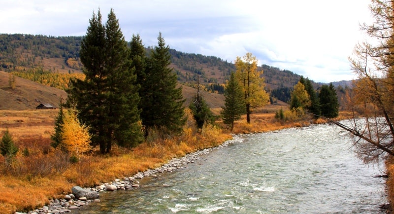
Rivers of Central Asia.
The main source of power for the rivers of Central Asia is the meltwater of the high-mountain snows. Glacial feeding is significant only in the upper reaches of those rivers, the main catchment area of which is occupied by glaciers and firn fields (especially in the Pamirs).
When the rivers leave the mountains, the share of glacier feeding usually does not exceed 25% of the annual volume of flow, and in the total annual flow of all Central Asian rivers, it is only slightly more than 6%. In the mountains, a significant role in feeding rivers belongs to groundwater (in most rivers they make up 10 – 25% of the annual flow, in some up to 50%).
The rivers of Central Asia are an important landscape forming factor.
Along with the rivers feed and desalinate groundwater in adjacent desert areas. Most of the rivers of Central Asia, especially large ones, have mixed glacial snow feed. These are rivers starting in the highlands. Their floods occur during the period of the most intense melting of glaciers and snow in the high mountains, that is, during the summer months (June, July, and early August).
It is often preceded by a secondary flood (April - May), associated with the melting of seasonal snow in the lower horizons of the mountains. Rivers of glacier-snow feeding are characterized by small fluctuations in annual runoff and high water stretched in time, which, together with a steep fall of the riverbed, makes them especially valuable for economic use - irrigation and hydropower.
Small and medium-sized rivers, whose sources are located on the mountain slopes below the snow line or in the mid-high mountains, feed on melt snow water and have a spring flood (March, April, in the north - May). Small rivers, starting in the lowest tiers of mountains that do not have a steady snow cover, mainly in the south of Central Asia, have mainly rainwater and flood regimes. On these rivers often formed destructive mudflows.
Groundwaters, whose role is especially great in winter, take part in the feeding of rivers of all the types listed. The rivers of Central Kazakhstan feed mainly on spring thawing of seasonal snow and partly on account of groundwater; spring floods from them.
Soon, it receives to the right the tributaries Kafirnigan, Surkhandarya and Sherabad, and then for 1257 km, up to the mouth, does not receive more than a single tributary. Here, a significant proportion of its flow is spent on irrigation, evaporation and infiltration.
The low, mostly river banks have a dam system that protects fields from flooding during floods. The width of the channel during low water is 1 - 3 km. Near the city of Nukus, in the area of the ancient delta, the Daryalyk (Kunyadarya) dry sleeve leaves the Amu Darya, through which formerly part of the Amu Darya waters flowed into the Sarykamysh depression and through it into the ancient bed of Uzboy.
The runoff on Uzboy to the Caspian Sea was periodically carried out back in historical time, as mentioned by medieval authors. Below Nukus begins the modern Amudarya delta - a slightly sloping plain with many ducts. The bed of the Amu Darya in the lower reaches is very variable, which is associated with the speed of flow and easy erosion of the soil of the shores.
The volatility of the river bed hampers navigation and water intake in irrigation canals. In the lower reaches of the Amu Darya, the Tyuyamuyun reservoir was created for irrigation purposes. The rivers of Central Kazakhstan feed mainly on spring thawing of seasonal snow and partly on account of groundwater; spring floods from them.
The largest waterway of Central Asia - Amu Darya (length - 2540 km) begins on the northern slope of the Hindu Kush, in the upper reaches it is called Vakhandarya, and after the confluence with the Pamir River - Pyanj. From the place of the confluence of the Panj and the Vakhsh, the river is called the Amu Darya.
Soon, it receives to the right the tributaries Kafirnigan, Surkhandarya and Sherabad, and then for 1257 km, up to the mouth, does not receive more than a single tributary. Here, a significant proportion of its flow is spent on irrigation, evaporation and infiltration.
The low, mostly river banks have a dam system that protects fields from flooding during floods. The width of the channel during low water is 1-3 km. Near the city of Nukus, in the area of the ancient delta, the Daryalyk (Kunyadarya) dry sleeve leaves the Amu Darya, through which formerly part of the Amu Darya waters flowed into the Sarykamysh depression and through it into the ancient bed of Uzboy.
The runoff on Uzboy to the Caspian Sea was periodically carried out back in historical time, as mentioned by medieval authors. Below Nukus begins the modern Amudarya delta - a slightly sloping plain with many ducts. The bed of the Amu Darya in the lower reaches is very variable, which is associated with the speed of flow and easy erosion of the soil of the shores.
The volatility of the river bed hampers navigation and water intake in irrigation canals. In the lower reaches of the Amu Darya, the Tyuyamuyun reservoir was created for irrigation purposes. The energy potential of the Central Asian rivers has been used to a small extent, although hydroelectric power stations have already been created on many rivers.
Extensive surveys are being conducted and the energy of large mountain rivers is being partially used. The At-Bashinskaya, Uchkurgan and Toktogul hydropower stations are built on the Naryn, the Kurpsay hydropower plant is under construction, preparations are underway for the construction of the Tash-Kumyr hydropower station, and design penalties are being built to build the Kambarata hydropower unit in the Tian-Shan cascade.
Several hydroelectric power plants are projected on the tributaries of the Naryn. The large Nurek hydroelectric power station with a dam of almost 300 meters in height was built on the Vakhsh River; In the future, it is planned to build six more hydropower plants of the Vakhsh cascade.
The dam of the Rogun hydropower plant will rise even higher than the Nurek one. Research is being conducted on the hydropower development of Pyanj, where it is planned to create a cascade of eight hydroelectric power plants (Dashtidzhumskaya, Nizhnepyandzhskaya and others).
The Kapchagai hydroelectric station with a large reservoir was created on the Ili River. Energy problems are solved simultaneously with irrigation problems. The construction of large reservoirs on many Central Asian rivers leads to a wide regulation of river flow.
Many reservoirs have been created, new ones are being built and designed. For gravity irrigation, sharp kinks in the longitudinal profile of the rivers when they leave the mountains on the plains and the “convex shape of the river valleys” are favorable, that is, the elevation of the beds of large rivers above the surrounding plains in the lower reaches.
Especially important is that, flowing through low desert plains, rivers have high water at the height of summer, that is, just at the same time that not a drop of rain falls in the south of Central Asia, and the cultural vegetation is in the phase of the most vigorous growing season.
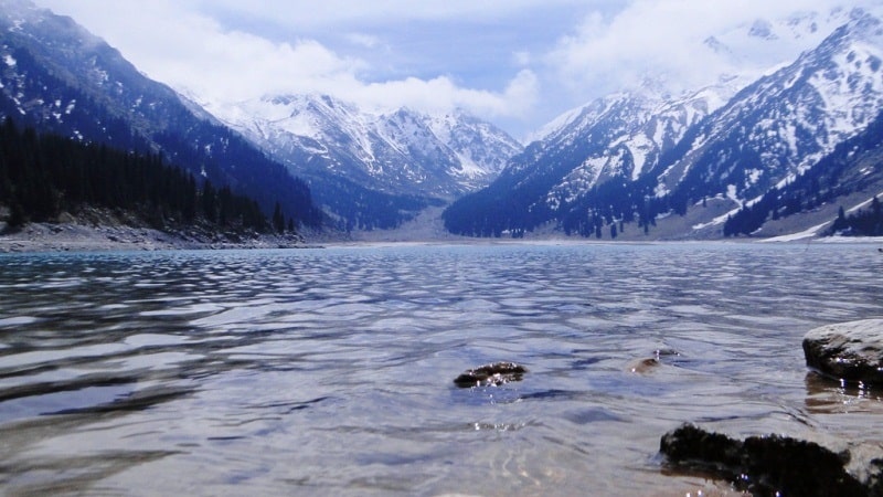
Lakes of Central Asia.
There are many lakes in Central Asia, and, paradoxically at first glance, their abundance is the result of arid climate. Many lakes of the plains with enough rainfall would turn into continuous water flows, since they are confined to the dry valleys.
The statement about the connection of the abundance of lakes with dry climate is legitimate not only for the desert plains of Central Asia, but also for the territory of Central Kazakhstan, where, according to G. E. Bykov and A. E. Mikhailov, an increase in precipitation would lead to increased drainage and descent of lakes.
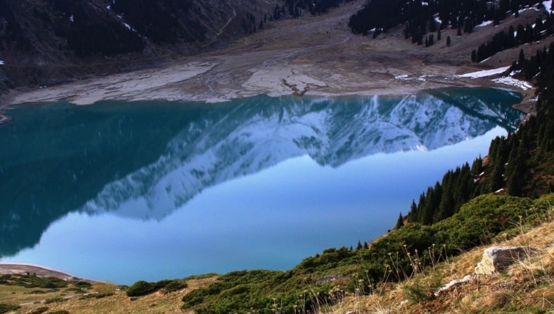
1. Lakes of tectonic origin, filling the depressions, which were formed due to fractures and troughs of the Earth's crust. The largest lakes of this type are the Aral Sea, Balkhash, Issyk-Kul, Karakul and others. In the valleys of Central Kazakhstan there are lakes springing up with tectonic uplifts.
2. Lakes occupying shallow depressions of the moraine relief on the mountain plateaus and in the mountain valleys subjected to glaciation (for example, the numerous lakes of the Inner Tien Shan syrts).
3. When glacial moraine lakes located at the bottom of mountain valleys, partitioned off by the terminal moraines of ancient glaciers, often near the end of modern glaciers.
4. Tarns (in the mountains of Central Asia are relatively rare).
5. Lakes of a zavalny origin, formed as a result of the huge collapses which have blocked up the mountain rivers in close gorges (Sarez and Yashilkul on Pamir, etc.). Such large mountain landslides are accompanied by an earthquake, but often the landslides themselves, which formed dam lakes, were caused by seismic events (Zindikul on the Peter the First Ridge).
6. Lakes of karst origin, relatively small or very small in area; known both in the mountains (for example, on the ridge of Peter the Great), and among the desert plains (in Ustyurt).
7. Lakes-oxbows in river valleys, especially numerous in the valleys of the Amu Darya, Syr Darya and some other rivers.
8. Delta lakes (typical for Amudarya and Syrdarya deltas).
9. End lakes - terminal lake spills in the mouths of rivers.
Among the lakes there are both salty and fresh. Salt lakes are especially widespread in deserts, since the rivers desalinate there, and salt lakes, being suppliers of salt. Salinity depends on a number of reasons - the influx of river water, evaporation from the surface of the water basin, groundwater recharge, age.
The most common salts are sodium chloride and magnesium chloride, sodium sulfate and calcium. Even in the mountains, the non-flowing lakes have brackish and saline water (Issyk-Kul, Karakul, etc.). When glacial and obstructed lakes are always fresh.
The levels of Central Asian lakes are subject to considerable seasonal variations and depend on the climatic conditions of the year. Fluctuation of lake levels causes a change in the degree of their mineralization. Many lakes of desert plains exist periodically; in spring, when the snow melts (or during heavy rains), they are filled with water, and in summer they dry up, turning into salt marshes with a surface salt crust - the saline march.
Commercial fishery is developed on many lakes, in particular on the largest ones - the Aral Sea, Balkhash, Zaisan. These lakes are used for shipping. In a number of lakes table salt is extracted. Mountain waste lakes (Sarez, Iskanderkul) serve as natural reservoirs and flow regulators of the rivers flowing from them, which can be of great importance for energy.
The Aral Sea is the largest lake in Central Asia, the second largest in the USSR and the fourth in the world (after the Caspian, Lake Superior in North America and Lake Victoria in Africa). Its area is about 64,000 sq. km., its length is 428 km, and its width is 235 km.
The northern shore of the Aral Sea is cut by deep bays, the western one, on the contrary, is quite even and represents a high precipice (chink) of the Ustyurt Plateau. The eastern shore is low, mostly sandy, with numerous small bays and islands: the edge of the sandy Kyzylkum desert is flooded here.
The flat, low, marshy south coast is formed by the Amudarya delta. The maximum depth (off the west coast) is 65 meters. The surface layer of water in summer heats up to 26-30 °, in winter it cools below 0 ° (in depth even in summer the water temperature is only 1-3 °).
In the whole space of the reservoir there is ice in winter; the northern part is usually completely covered with ice. Salinity of water - 10-11. The chemical composition of the water is different from the ocean and is close to the Caspian: it has a lot of sulphate salts and relatively little chloride (59% instead of 90% in ocean water).
Compared to the Caspian, there is more calcium here, which in the form of sulphate is brought by rivers. Currents form a clockwise rotation. Fishery is well developed in the Aral Sea (spike, carp, barbel, ide, asp, etc. are caught).
Navigation between Aral and Muinak, a port in the Amudarya delta, is carried out.
The expansion of irrigated lands in the Amudarya and Syrdarya river basins and the diversion of water from these rivers through canals to other areas caused a decrease in the level of the Aral Sea (by 3 m in 10 years), and in the future may lead to its complete drying by the year 2000).
To maintain its level at the desired level will be able to water of Siberian rivers. This is one of the reasons for advancing the problem of transferring water from Siberian rivers to the south, to Kazakhstan and Central Asia. Prior to the implementation of this project, urgent measures are needed to prevent unproductive water losses in the Amudarya and Syrdarya basins (losses due to filtration and evaporation in canals, standing bodies of water and irrigation systems, irretrievable discharge of excess water).
The second largest lake in Central Asia - Balkhash - has a length of 605 km with a maximum width of 74 km and a maximum depth of 26 m. In the north and west, the surface of the Kazakh Hills and the directly connected eastern part of the Betpak Dala desert breaks off to the lake.
Spaces of sandy deserts and the marshy delta of Ili stretch on the southern coast. The lake is divided into five morphologically and hydrologically almost separate pools by narrowed sections. In the western part of the lake the water is fresh, in the eastern - brackish.
The low salinity of the waters of the drainless lake lying in the middle of the desert and the relative poverty of its fauna indicate that the reservoir is relatively young in its present form. In winter, Balkhash freezes. Of commercial fish in the lake are common carp, pike perch, perch, marinka. The lake is navigable.
Kara-Bogaz-Gol Bay.
This almost closed bay of the Caspian Sea is undoubtedly a Central Asian water body, located in Turkmenistan. It is separated from the Caspian Sea by a sand spit, cut by a narrow (0.2 - 1 km) strait about 11 kilometers long. Kara-Bogaz-Gol Square - 12,000 sq. km., depth - up to 3.5 meters.
The water level in it is 4.5 meters below the level of the Caspian Sea, which determines the constant influx of sea water into the gulf. A “sea river” flows at a speed of up to 1 meter per second in a cutting sandy slanting strait, in some areas up to 3 meters per second.
In the lower reaches, it forms a four-meter height waterfall. The delta is increasing at the mouth of the strait. Due to the large magnitude of evaporation, the salinity of the Kara-Bogaz-Gol water is very high (280 - 305%). The salt content is even higher in fossil solutions among the buried salt beds of the coastal part of the bay.
These solutions are pumped out with powerful pumps for the extraction of mirabilite (sodium sulfate). In the village of Bekdash on the Caspian coast is being processed. After precipitating the sulfate, valuable products remain in the solution, which have not yet been used.
In the future, it is necessary to establish a more complete, integrated use of the Kara-Bogaz-Gol Gulf mineral raw materials.
Groundwaters of Central Asia.
Two types of groundwater are widespread in Central Kazakhstan: cracks confined to Paleozoic rocks, and reservoir waters in Paleogene, Neogene and Quaternary sediments. In the hydrogeological sense, the Central Territory is divided into three main types: mountain, piedmont and flat. In mountainous areas, the melting of snow and rainwater is immersed, that is, these are areas of groundwater recharge.
There are many sources in the mountains, which are characterized by low mineralization and predominantly hydrocarbon composition of water. Fractal waters in crystalline and metamorphic Paleozoic rocks are especially poorly mineralized.
The sources fed by these waters have a significant and constant flow rate. In limestone strata karst hard waters circulate, sometimes giving very abundant sources of type (for example, Abshir-Bulak in the northern forward chain of the Alai Range).
In the Mesozoic, Paleogene and Neogene sedimentary strata, along with cracks, there are also reservoir waters. Sources fed by stratal waters are less constant and often have a small flow rate. In the foothill areas and on the piedmont sloping plains, there is a transit of groundwater feeding in the foothills and upper parts of the fan; in the lower parts of the fans, partial wedging of water occurs.
Pore waters predominate on the piedmont plains, although fracture is also developed in conglomerates. Groundwaters here form a solid mirror, the direction of the slope of which coincides with the slope of the surface of the foothill plains and their components of the fan. Sometimes the waters are pressurized.
For the upper parts of the alluvial fans, powerful aquifers in a gravel-pebble material with high yield are typical. In the lower parts, where layers of different water permeability alternate, the aquifer is often multi-tiered, with more or less insulation on separate sections.
At the periphery of the piedmont trails, there is an immersion of the groundwater mirror towards the desert plains; at the same time, salinity increases significantly. On the young, mostly Quaternary alluvial and coastal desert plains, composed of loose and poorly cemented sandy clay strata, there is usually ground water with a hydraulically single mirror over large areas.
It is dominated by the transit of groundwater from the remote supply, they are spent on evaporation and transpiration. Local nutrition is not decisive in the overall balance of groundwater, although sometimes its role is significant. The slope of the groundwater mirror from the feeding areas to the largest lake hollows (Caspian, Aral, Balkhash) or desert depressions (Sarykamysh depression) is observed.
The groundwater mirror of alluvial desert plains is a surface of underground streams with a cross section of tens and even hundreds of kilometers and a capacity of tens of meters. The bulk of their water is formed by filtering from the channels of large rivers, immersing waters in delta spills and underground runoff from piedmont plains.
The upper zones closest to the power sources carry fresh and slightly saline water in most cases. With increasing distance from power sources, a change in the chemical composition of water occurs, depending on the dissolution of salts of the surrounding rocks, ion exchange and intra-breed evaporation.
An increase in the total mineralization, a transition to sodium chloride salinity, and the appearance of calcium chloride water are observed. The waters of the northern alluvial plains of Central Asia are more fresh than those of the southern ones.
Strong salinization is observed here at a considerable distance from the main power sources, local food is becoming more important. On the southern plains of the desalinated water zone, associated with the inflow of transit waters from the feeding area, in short, high salinization occurs faster.
For structural desert plains, composed mainly of marine sediments, a hydraulically unified groundwater mirror is not typical. Localized pools and local streams are widely developed here. Local nutrition plays a decisive role in the balance of groundwater. Remote feeding forms interstratal, in particular artesian, aquifers.
The hydrochemical diversity of groundwater and the different depth of their occurrence are characteristic. Groundwater, saturating alluvial sediments of valleys and confined to channel, terraced and delta sediments, plays a major role in the hydrogeology of Central Asia.
Where saline groundwater prevails on desert plains, filtration of alluvial waters creates desalinated zones, the width of which can reach many kilometers. The role of artificial irrigation is great in the balance of groundwater; moreover, the slower the groundwater movement in natural conditions, the more they change under the influence of irrigation.
The groundwaters of the desert plains are of enormous importance in the national economy, providing the possibility of developing large-scale transhumance animal husbandry outside irrigated oasis lands. Livestock requires much less water than irrigated farming.
A cubic meter of fresh water consumed for irrigation, with the expenditure of enormous labor, makes it possible to obtain 50-100 g of raw cotton; the same amount of water, and not necessarily fresh, spent on watering sheep, with year-round pasture keeping of herds in the desert provides 3.5 kg of wool, 10 liters of milk, 7 - 10 kg of meat and fat, and also skin.
For the development of animal husbandry it is necessary, however, to create a uniform network of watering points Tens of thousands of dug wells of various designs and depths (from several meters to 286 meters - the deepest well in the South-East Karakum) are scattered over the vast expanses of the deserts of Central Asia.
It is necessary to maintain this water system in proper condition, improve the placement of wells and use the techniques of modern hydraulic engineering in their construction. Hydrogeological studies of recent times have revealed new areas of groundwater flow, huge freshwater lenses and artesian basins.
Thus, the water base for the development of animal husbandry has been expanded, and the possibilities of using the groundwater of deserts for small oasis farming have increased. In some cases, groundwater irrigation is even cheaper than surface water irrigation.
Moreover, for watering of sheep and for irrigating a number of agricultural crops, it is possible to use not only fresh water, but also slightly saline. Along with the search for new aquifers, the improvement and expansion of the well network, it is necessary to increase the collection of precipitation, in particular by arranging simple hydraulic structures on takyrs.
In addition, with the help of a collector system, takyr waters are immersed in the ground and thus create freshwater lenses floating on saline waters. In the Western Karakum artificial lenses of fresh water reach a capacity of almost 20 m.
Perspective Amu-Darya water in the eastern part of Turkmenistan. Water supply problems.
An additional source of desert water supply is the production of fresh water from salt by chemical means, and especially by natural freezing. The next step is the problem of desalination using solar energy. Sea water is desalinated in large quantities using thermal energy from heat and power plants and nuclear reactors.
Such desalination plants are already in operation at a number of points on the Caspian coast, and a powerful installation in the city of Shevchenko, working on atomic energy, desalinates 120 thousand tons of seawater per day. A radical improvement in the water supply of desert pastures and oases is achieved by transporting river waters over long distances through irrigation canals.
The waters of the Syr Darya irrigate large spaces of the Hungry Steppe. The waters of the Amu Darya through the Karakum Canal are diverted to the Mary oasis in the lower Murghab, to the Tedzhen oasis and further to Ashgabat. Then the canal goes along the Kopetdag to the north-west to Kazandzhik.
When laying the channel in the Kopetdag plain, artificial explosions were used. The total length of the main channel highway will be 1100 km. At Kazandzhik, the canal will be branched off: the left branch will go to subtropical areas of south-western Turkmenistan, the right - towards Nebit-Dag.
In Nebit Dag, from it to Krasnovodsk and other cities and towns of the industrial region of western Turkmenistan its water will be supplied through pipes. The Karshi, Amudarya-Karakulsky and Amudarya-Bukhara channels are created on the right bank of the Amu Darya.
The Takhiatash Canal is heading from the lower reaches of the Amu Darya towards Uzboy. The Zeravshan created the Shafaran hydrotechnical center, which improved the water availability of the Bukhara oasis. In the sands of Kyzyl Kum, a channel was laid from the Chardara reservoir on the Syr Darya.
In addition to open canals in the deserts (Karshi “steppe”, Kyzyl Kum), water conduits in the pipes were constructed. For irrigation purposes (often together with hydropower) large reservoirs have been created. In addition to those already mentioned (on the Ili, Amu Darya, Syrdarya rivers), we call Tash-Utkulskoye in the middle reaches of the Chu River, Kirovskoe on the Talas River, Andijan is being created on the Karadarya.
The development of the problem of strengthening and regulating the internal moisture in circulation in Central Asia is extremely important in the long term. It is necessary to find out the possibility of increasing the evaporation of moisture when expanding the area of irrigated land, artificially increasing precipitation in the high mountains, and creating large reservoirs in mountain valleys by the method of directed explosions that cause artificial blockages.


Authority:
N. A. Gvozdetsky, N. I. Mikhaylov. "Physical geography of the USSR. Asian part. The edition third corrected and added. Moscow "Thought" of 1978.
http://tapemark.narod.ru/geograf/1_5_5.html
Photos by:
Alexander Petrov.