


![]()
Вы здесь
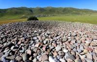
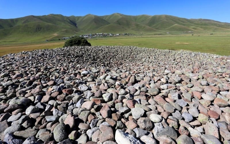
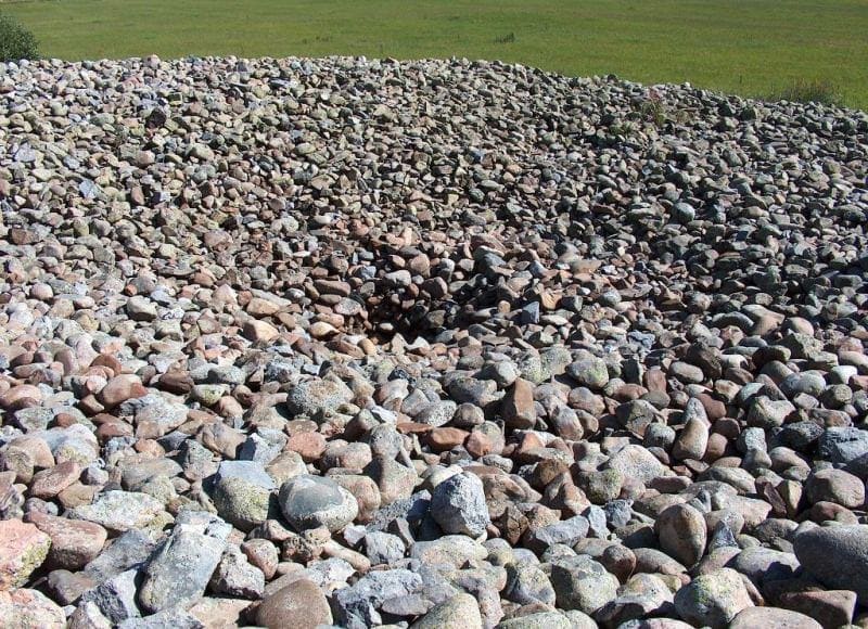
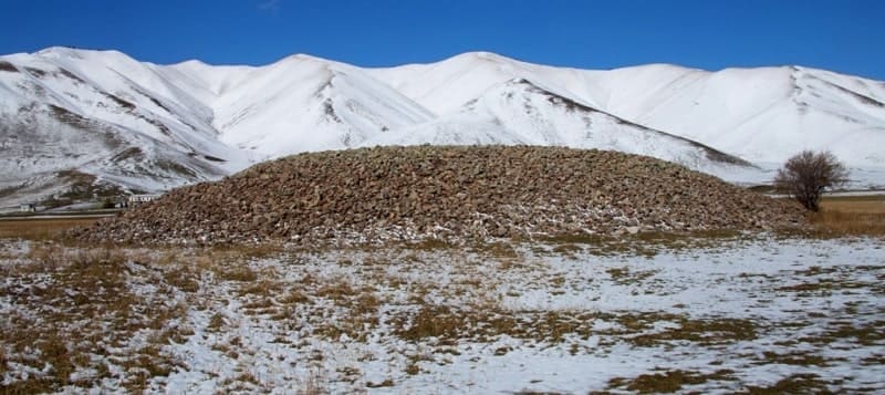
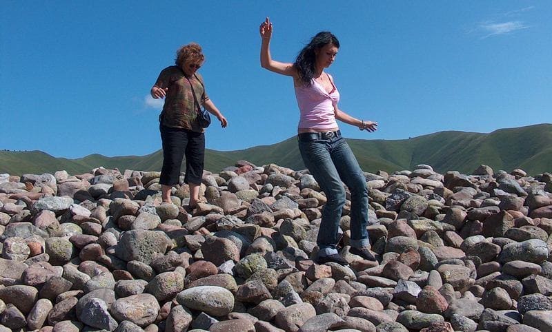
Burial mound of San-Tash.
Monument tours in Kyrgystan.
“Santash is a counting stone. This passage got its name from a pile of stones laid in one barrow. The height of the mound in sazhens is 3, the circumference of sazhens is 35. Tradition says that when Emir Temir-Kurgen (Emir Temir-Kurkan, as Tamerlane is called in the East) went to China to take the daughter of Emperor Kaan-Chin into his harem (there is a kaanchin the title of Emperor of China (in Turkic, otherwise) Khakanchin - Emperor of China, (title), turned by the Kirghiz into his own name), then he ordered each of his warriors to put a stone in one place.
Upon his return, he ordered all the soldiers to take a stone and put it in another place. By the remaining unlifted stones, he judged his loss. The place of the former burial mound lies near and now.”
Chokan Valikhanov. "Diary of a trip to Issyk-Kul." 1856.
Historical tours from Kazakhstan to Kyrgyzstan.
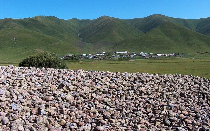
The mound of oval stones San-Tash is located at an altitude of 1992 meters above sea level, located 920 meters north of the right bank of the Tyup River, 840 meters from the 3rd farm of the village of San-Tash, 3.1 kilometers southwest of the pass Syptas, 1997 meters above sea level, in the southeastern part of the Kungei Ala-Too ridge, in the western part of the Kalchikbai mountains in the eastern part of the Tyup district of the Issyk-Kul region.
Opposite the mound in the northern part, across the road, there is a small village of San-Tash, on the territory where the border outpost of the Karakol border detachment was located in Soviet times. The distance from the highway that connects the village of Kegen with the village of Tyup is 500 meters.
The dimensions of the barrow are: height 4 meters, the length of the barrow from south to north is 53 meters, the width from west to east is 50 meters, the area of the barrow is 2246.53 square meters, the perimeter of the barrow reaches 171 meters.
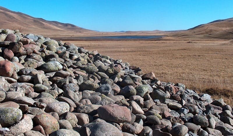
In the southeastern part of the mound, 10 meters away, there is an almost circular recess, up to 3 meters deep, with an area of 212 square meters, perimeters of 53 meters, the length of the recess from south to north reaches 16 meters, and the width from east to west is 15 meters.
The southern part of the excavation wall is inclined, lined with pro-aluvial pebbles. Apparently, the mound is the tomb of a tribal leader. Dated to the VIth-IIIrd centuries BC. Traces of an ancient robbery are visible, modern excavations have not been carried out.
The mound is associated with the legend of Tamerlane, who passed here with the army. The terrible ruler ordered each of his soldiers to put a stone in a pile. Returning, each warrior also took one boulder from the pile.
The remaining and counted stones gave the number of those killed in battles. An identical burial mound Uygen-Tas made of oval stones is also located in the Almaty region in the Alakol district of Kazakhstan in the foothills of the Dzhungar Alatau.
Geographic coordinates of San-Tash mound: N42°44'49.38" E78°59'45.22"
Authority and photos by
Alexander Petrov.