


![]()
Вы здесь
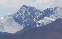
Ridge Dzhetim-Bel.
Sights of Mountains Tien-Shan.
“It is not the strongest of the species that survive, nor the most intelligent, but the one most responsive to change”
Charles Darwin.
Hiking trip to Mountains Tien-Shan.
Jetim-Bel ridge is located south of the Terskey Ala-Too ridge, north of the Jetim ridge, is located in the Inner Tien Shan in the Jety-Oguz district of the Issyk-Kul region. The extended mountain range stretched out in a sublatitudinal direction from the southwest to the northeast, divided into two ridges: the southwestern part of the massif passes into the Jetim-Bel ridge, the northeast into the Sook ridge.
The watershed between the two ridges is: on the south side, the Sarytor River, which originates on the southern slope of the Sarytor Pass at a height of 4050 meters above sea level, flows into the high-altitude lake Ekurgen-Kel located at an altitude of 3628.5 meters above sea level.
To the north, the southern sources of the Burkhan River, 66 kilometers long, flow down, which merges with the Dzhilisu River and gives rise to the Bolgart River south of the Keryu-Karagomak Mountains. The length of the Jetim-Bel ridge is 72 kilometers, the maximum width in the western part between the Burkhan and Archaly rivers reaches 19 kilometers.
The southern boundary of the ridge is the valleys of the Jamanechki and Archaly rivers, which stretch from the southwest to the northeast. The border of the ridge in the north is the valley and upper reaches of the Burkhan River.
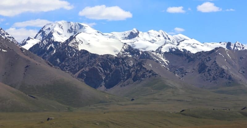
The western boundary of the range is the mouth of the Archaly River into the Burkhan River. The eastern border of the range is the Sarytor Pass watershed. The highest dominant height of the ridge is an unnamed peak 4584.1 meters above sea level, located to the west of the sources of the Sarytor River.
The second highest peak is Kyzyl-Su, which rises to 4437 meters above sea level, located in the upper reaches of the Tuyuk-Kyzyl-Su and Djol-Kyzyl-Su rivers in the main ridge of the ridge. The third highest peak is Bordu, 4359.9 meters above sea level, located in the upper reaches of the Tuyuk-Kyzyl-Su and Bordu rivers in the main ridge of the ridge.
The hydrography of the Burkhan River is complex and is formed from 10 tributaries that flow from the glaciers of the northern exposure of the Jetim-Bel ridge. In the central part of the ridge, from the glaciers of the southern exposure, the Sarytor River flows out, which is formed from 6 tributaries that originate in the group of northern glaciers of the ridge.
The Jamanechki River, which encircles the ridge in the northwest and south, originates from the eastern side of the Jamanechki pass and is formed from nine tributaries that flow from the glaciers of the northern exposure.
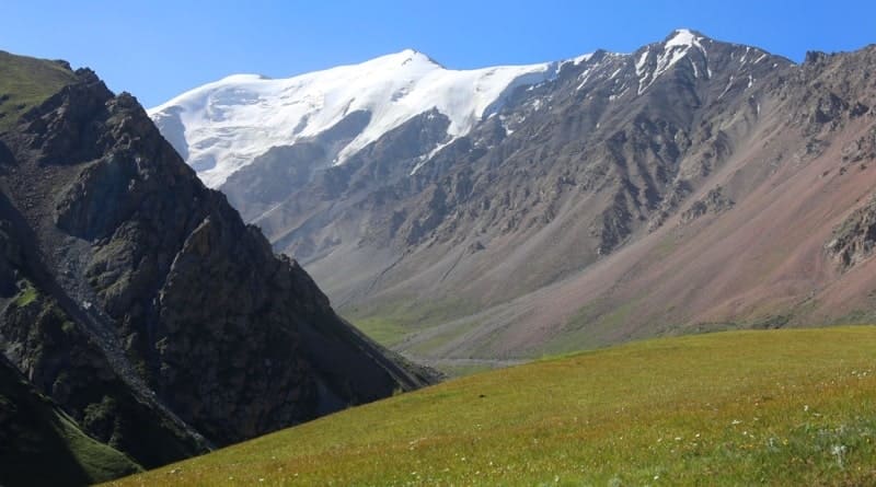
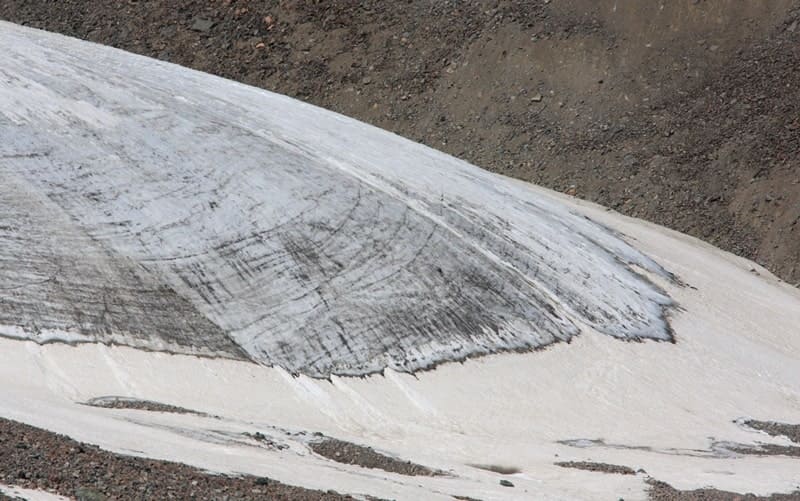
There are 9 large glaciers in the ridge, the tongues of which are elongated and spread mostly to the north. In the south of the ridge there is a country road to the village of Karakolka and further to the Naryn region along the right bank of the Naryn River.
The Jetim-Bel ridge serves as the southern frame of the Syrts. Above the surface of the syrts, located at an altitude of 3800 meters above sea level, the ridge rises an average of 600 meters. Its slopes are weakly dissected, relatively gentle, with oval-rounded watersheds, with wide short valleys.
Glaciers in the eastern part of the range occupy a relatively small area and lie on the bottoms of spacious small valleys with gentle slopes. The feeding areas occupy the gentle wide slopes of the upper part of the valleys.
The glaciers are slightly clogged with moraine and have rounded, clearly defined ends. All of them are easily accessible, and some can be reached by car very close. On the Jetim-Bel ridge, up to 4627 meters above sea level, there are 116 glaciers, their area is 71.5 square kilometers.
Small, mainly cirque and hanging glaciers are scattered along the ridge mainly in its western and central parts and occupy cirques and cirques of northern exposure. There are more and larger glaciers on the northern slope.
The average height of the ends of the glaciers is 3750 meters above sea level on the northern slope and 3900 meters above sea level on the southern slope.
Geographic coordinates of Jetim-Bel ridge: N41°42'07.98" E77°21'42.65"
Authority and photos by:
Alexander Petrov.