


![]()
Вы здесь
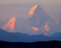
Climbing on peak of Khan-Tengri.
Group inclusive tour Kyrgyzstan.
"The grandiose Tien-Shan mountain system extends from the ends of the horizon with its glaciers and snowfields. This entire region is illumined by the gold, orange and red of dusk, while Mt. Khan-Tengri towers from on high, like a gigantic faceted ruby stone mounted on a dark turquoise sky"
M. Pogrebetskiy. 1931.
Leisure package tour in Kyrgystan.
The first ascent to the summit was made in 1931 by Mikhail Pogrebetsky, Boris Tyurin and Franz Zauberer. They walked along the South Inylchek glacier to Chapaev Peak, then to the western shoulder of Khan Tengri and further up the southwestern slope. On September 11, all three climbers reached the summit.
The first ascent of Khan Tengri from the north was made in 1964 by a group of climbers from the Burevestnik society, an expedition led by E.I. Tamm. Since it was unknown whether it was possible to reach the Northern Inylchek glacier along the shore of Lake Merzbacher, a group was first sent to study the possibility of accessing the glacier above the lake through a pass in the Sarydzhas ridge from the Mushketov glacier.
The group managed to find a pass, find a convenient site for a base camp on the shore of the lake and ensure the reception of cargo dropped from a helicopter. The main part of the expedition reached the base camp, going around the lake along the left (orographically) shore through the saddle of the buttress of the ridge separating the Northern and Southern Inylchek ridges.
The ascent to Khan Tengri was made by two groups from the assault camp on the right (orographically) coastal moraine of the Northern Inylchek glacier, the loads for which were dropped from a helicopter. The first group under the leadership of E.I. Tamm returned after six days of ascent, not reaching 200 meters to the summit due to weather conditions that led to a strong avalanche danger of reaching the pre-summit ridge.
The second group under the leadership of K. Kuzmin, having set out on the route two days after the first group had left, climbing along an already processed path, moved faster and approached the “critical” place a day later, during which the snow that had fallen the day before was swept away by avalanches and the path to the pre-summit ridge turned out to be not so dangerous.
At the top, a note was found from a group of the Trud society under the leadership of B. Romanov, who had climbed the “marble” ridge of Khan Tengri from the South Inylchek glacier a few days earlier. Both of these ascents were recognized as the best in the class of high-altitude ascents, and their participants were awarded gold medals.
Currently, at least 25 climbing routes from the north and south have already been laid on Khan Tengri. There are also instructions for climbing from experienced climbers. Anatoly Boukreev, who conquered the Himalayan eight-thousanders twenty-one times (CIS record), said that Khan-Tengri is perhaps the most beautiful peak in the world because of its regularly spaced ribs and geometric pyramidal symmetry.
For another Kazakh climber Denis Urubko, who was the first in the CIS to conquer all 14 eight-thousanders in the world, Khan Tengri became a home, “training” seven-thousander before the Himalayan climbs.
He climbed it a dozen times. Urubko also holds the record for the speed race on Khan Tengri, set in 2000 - from the base camp at an altitude of 4000 meters above sea level to the top 6995 meters above sea level in 7 hours 40 minutes.
Several times mountain climbers spent the night on the top of Khan Tengri. In preparation for the traverse Pobeda Peak - Khan Tengri Peak under the leadership of Valery Khrishchaty in the summer of 1990, future traverse participants spent the night on the summit for acclimatization purposes.
Such cases at serious peaks are quite rare. But on August 1, 2011, Denis Urubko spent a planned solo overnight stay at the top of the Khan Tengri peak. And just two days later, famous climbers from Novosibirsk Gleb Sokolov and Vitaly Gorelik repeated their overnight stay on the top of Khan Tengri.
The record for the number of ascents to the Khan Tengri peak is held by 62-year-old Novosibirsk resident Gleb Sokolov, one of the three in the world to conquer all three peaks of Lhotse (with E. Vinogradsky and S. Timofeev - both from Yekaterinburg) - on August 15, 2015 he climbed Khan -Tengri for the 33rd time:
“The day before yesterday I was on Khan again. One. There was no one else on the Mountain. I almost gave up because of the cold wind. I’m still shaking snot on my fist. The weather is calling." In 2016, he brought his record to 34 ascents.
The youngest conqueror of Khan was 17-year-old Pole Adam Bielecki, who climbed to the top in alpine style in 2000.
In 2002, the National Bank of Kyrgyzstan issued a 100 som banknote with an image of the Khan Tengri peak (6995 meters above sea level) on the back. Until now, only Iran has issued a 10,000 rial banknote with the image of a mountain - the highest point of the country, the extinct Damavand volcano 5604 meters above sea level, as well as Turkey - a 100-lira banknote (1972 - 1986) and Armenia - on on the back of five banknotes (issued in 1993 and 2001) with the image of Mount Ararat located in Turkey, 5165 meters above sea level, which is nevertheless a national symbol of Armenia and is also depicted on the state emblem.
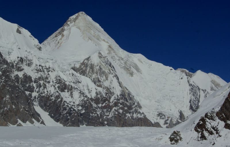
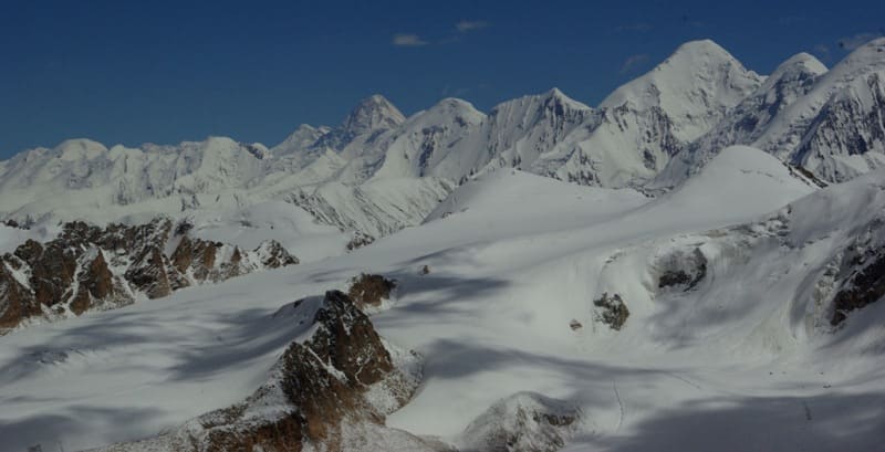
In terms of its location from the north, Khan Tengri, its western bridge at 5900 meters above sea level to the neighboring Chapaev Peak at 6371 meters above sea level, is very similar to the location of the Himalayan giants Everest at 8848 meters above sea level, its South Col at 7900 meters above sea level sea level and the neighboring Lhotse Peak, 8516 meters above sea level.
But everything is 2 kilometers lower, which allows you to imitate the Himalayan classic route. Approximate route for climbing Khan Tengri along the classic route from the South Inylchek glacier.
Classic route of climbing Khan Tengri Peak from the tourist company Aksai-Travel (Bishkek city).
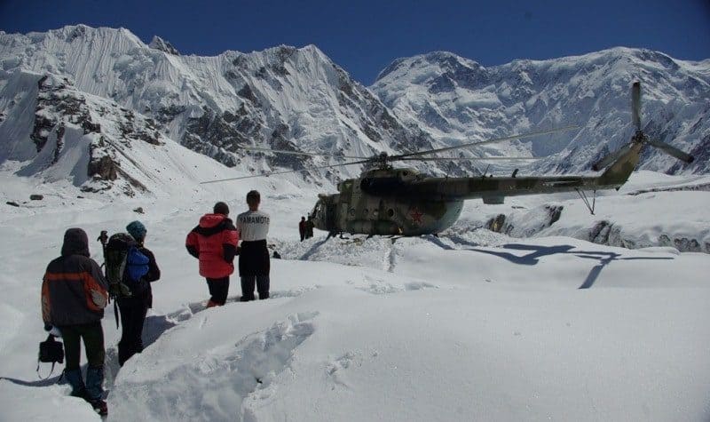
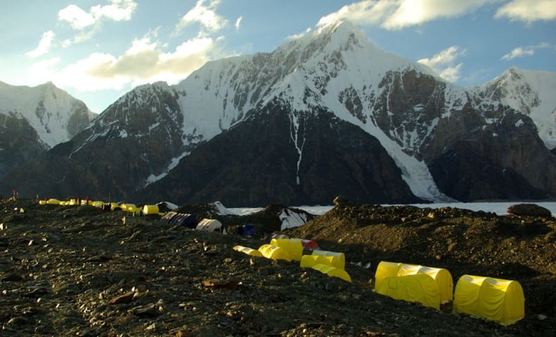
The ascent to Khan Tengri peak begins from the base camp “South Inylchek”, located on the left bank moraine of the South Inylchek glacier at the confluence of the South Inylchek glacier with the Zvezdochka glacier, at an altitude of approximately 3900 - 4000 meters above sea level.
The further route runs along the central part of the South Inylchek glacier to the camp, which is located at an altitude of 4200 meters above sea level at the confluence of the South Inylchek glacier with the Semenovsky glacier on the right bank moraine at the foot of the southern slope of Chapaev Peak.
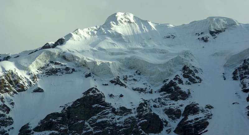
Climbing up the Semenovsky glacier in the direction of the icefall, in the upper reaches of the glacier is objectively dangerous due to possible landslides from Chapaev Peak and Khan Tengri Peak. We recommend walking this section early in the morning and without stopping to rest.
To pass the icefall, there are two ways - “head-on”, or along the slopes of Chapaev Peak. The second option is faster, but more dangerous than the first, due to possible avalanches and rockfalls from the slope of Chapaev Peak.
We recommend using a rope between the climbers; there are many cracks on the glacier here. After passing the icefall, climb to the upper cirque of the Semenovsky glacier at an altitude of 5200 meters above sea level, here is the second camp.
If acclimatization is not sufficient, you can stop here for the night and then continue climbing to the next camp. From the second camp we climb along non-steep snow-ice slopes to the upper reaches of the Semenovsky glacier cirque to the bridge between Khan Tengri Peak and the eastern shoulder of Chapaev Peak.
On the left side of the lintel at an altitude of 5700 meters above sea level there is a third camp. Here it is possible to set up tents or prepare snow caves. From the third camp, the ascent route passes through the col and further along the western ridge of Khan Tengri. The ridge, as a rule, is suspended with stationary rope “railings”.
Old, worn railings are often found here; you need to be careful. The route is rocky up to an altitude of 6900 meters above sea level, then there is a snow dome, turning into a narrow snow knife that leads to the top.
When climbing on the ridges there are platforms at altitudes - 6200 meters above sea level, 6400 meters above sea level, 6700 meters above sea level. Here, if necessary, you can set up a fourth camp. The most convenient site is at an altitude of 6400 meters above sea level.
Up to an altitude of 6700 meters above sea level, the ascent goes along the right side of the western ridge, from the site at an altitude of 6700 meters above sea level - a traverse to the right in the direction of the couloir.
At the beginning of the couloir there is a rock wall 10 meters high. Continue along the couloir and turn right again. Along the rocks there is access to a snow ridge abutting a rock wall up to 20 meters high. Next is the exit to the dome. At the top there is a tripod. The way down is no easier - along the way up.
Authority:
http://mountains.tos.ru/clmb.htm
https://ru.wikipedia.org
Photos by
Alexander Petrov and Vladimir Serbenko.