


![]()
Вы здесь
Jeep tour across Kazakhstan Altai.


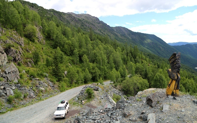
Tour across Austrian Road Kazakhstan.
“I address you all tonight for who you truly are: wizards, mermaids, travelers, adventurers, and magicians. You are the true dreamers”
Brian Selznick.
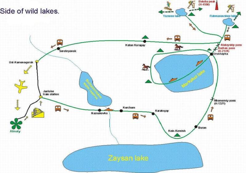
Short description of route of tour from Ust-Kamenogorsk on Austrian Road:
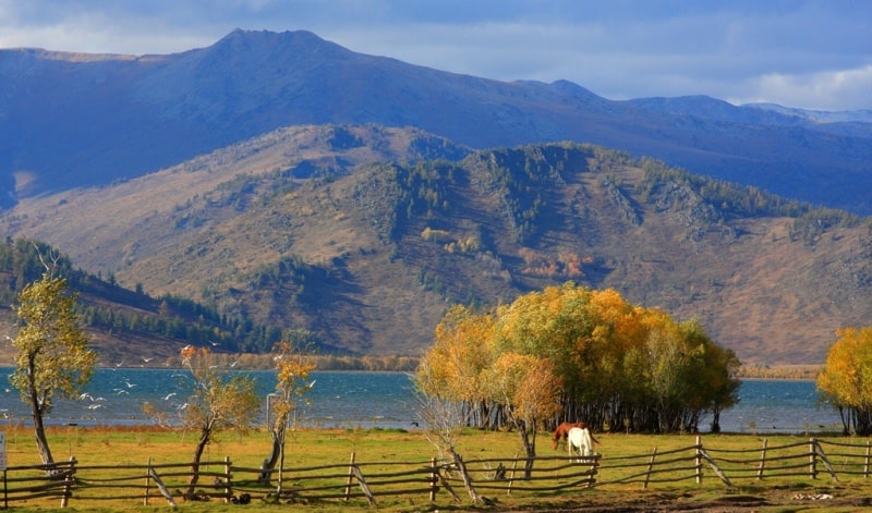
Almaty - Ust-Kamenogorsk - Bukhtarma reservoir - lake Zaysan - valley Shakelmes - valley Kein-Keriish - lake Markakol - Austrian Road - lake Yazevoye - lake Rakhmany - Ust-Kamenogorsk - Almaty.
Distance of route: 1278 km.
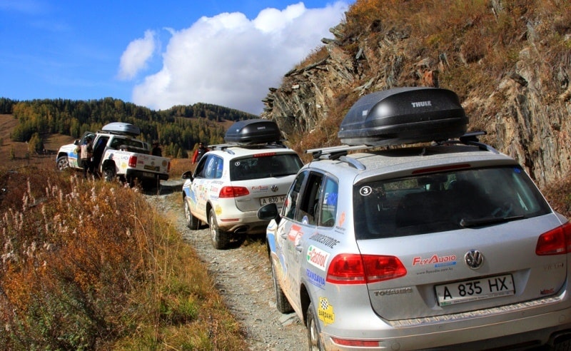
Distance of active part of tour: 50 km.
Season: June - September.
Best time for tour: June, July, August.
Duration of tour: 15days, 14 nights.
Detailed program of tour day by day on lake Markakol to village of Urunkhayka:
Tour to village of Urunkhayka.
Day 1. Almaty - Ust-Kamenogorsk.
Arrival in the city of Almaty. A meeting at the airport, transfer to hotel, accommodation. Rest. Breakfast. Sightseeing tour, visit: park of 28 Panfilov's men, Cathedral, museum of musical instruments, state national museum, the valley of Medeo, area of the Republic (4 h). In the second half of day flight to the city of Ust-Kamenogorsk (2 hours). Arrival in Ust-Kamenogorsk, a meeting at the airport, transfer to hotel, accommodation, a dinner and overnight.
Day 2. Ust-Kamenogorsk - valley Shekelmes (346 km).
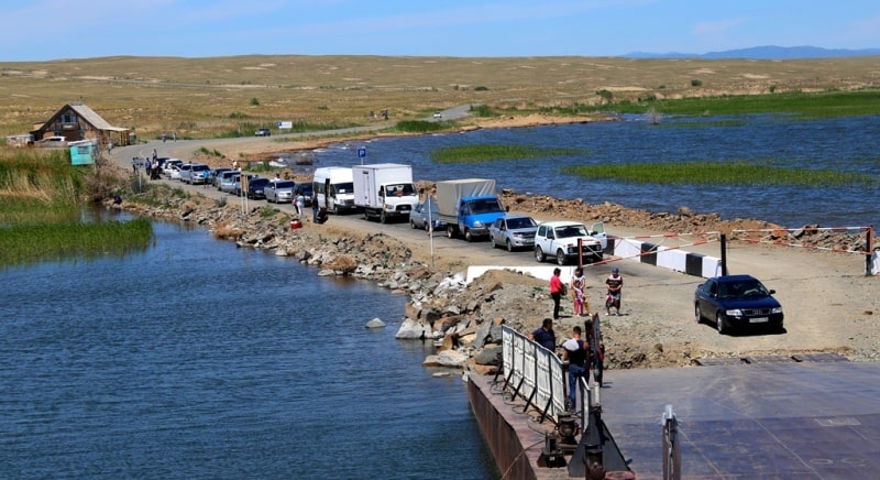
Transfer: Ust-Kamenogorsk - the Kaznakovskay crossing (175 km). Arrival on Kaznakovskay a crossing, expectation of the ferry.
Crossing on the opposite coast of the Bukhtarma reservoir (4 km). Further transfer: the Kaznakovsky crossing - the settlement of Kurchum (34 km). A lunch in the settlement of Kurchum.
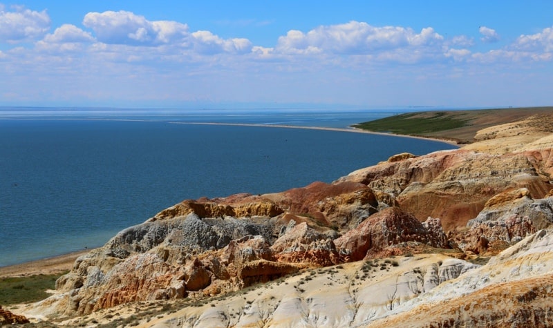
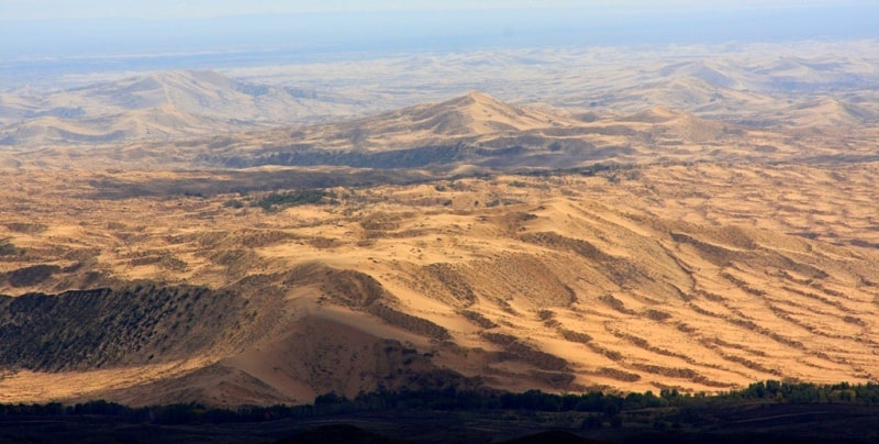
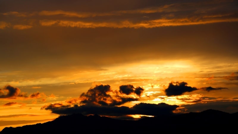
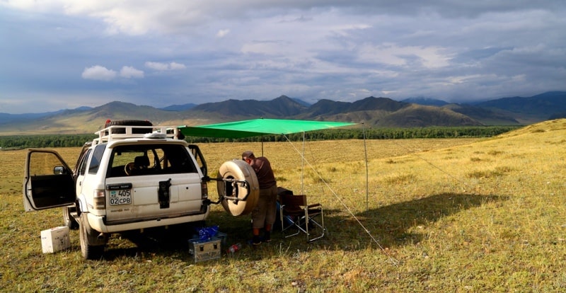
Further transfer: the settlement of Kurchum - the settlement Barack batyr - the settlement of Karatogay - the valley Sarykaryn - the valley Shekelmes on the bank of the Lake Zaysan (133 km). Behind the settlement of Karatogay we turn with asphalt roads and 51 kilometers we go on the steppe road. Arrival in the valley Shekelmes, walk in the environs of the valley Shekelmes, photographing of a decline in the environs of the valley and the Lake Zaysan. Pitch up a tent, accommodation in tents, dinner and overnight.
Day 3. The valley Shekelmes - the valley Kein-Keriish (36 km).
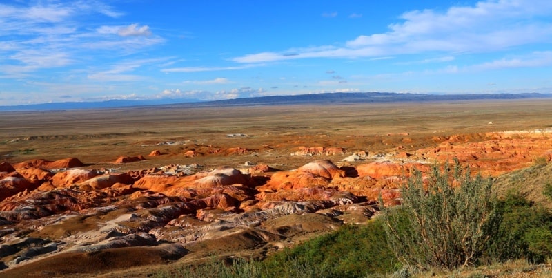
Breakfast. Half a day of walks in the environs of the valley Shekelmes and Lake Zaysan. Lunch. Transfer: the valley Shekelmes - the valley Sarykaryn - the valley Kein-Keriish. Arrival in the valley Kein-Keriish. Pitch up a tent, in the top part of the valley from where the magnificent and picturesque view on a sedimentary relief with not repeating forms and different coloring of soil opens. Walks in the environs of the valley on a panoramic point of a decline. Return to the camp, dinner and overnight.
Day 4. Valley Kein-Keriish - lake Markakol (176 km).
Breakfast. Photofilming of the valley on rising. Walk in the environs of the valley Kein-Keriish. Lunch.
Transfer: the valley Kein-Keriish - the settlement of Kalzhyr - the settlement of Markakol (the former name Alekseevka, Terekty) (118 km).
Arrival in the settlement of Markakol, visit of shops. Short walk on the settlement, visit and survey of old brick buildings in the settlement, constructions the beginning of the XXth century.
Further transfer: the settlement of Markakol - mountains Derelbiigy - the pass Marble (21 km). In the envirions of the settlement of Moilda there is a boundary post, here verification of documents and permits.
Further transfer on the pass Marble 1317 meters high above sea level. The stop on the pass from the pass opens a majestic panorama of vicinities. In the south, in the territory of China, barkhans and sands of the desert Akkum and Kyzyl-Kum which borders by the northern part on the territory of Kazakhstan are well visible. In the south the mountain Marble consisting of marble breeds 1398,3 meters high above sea level towers.
Transfer: the pass Marble - the anonymous pass 1452,3 meters high above sea level - the settlement of Akzhalau - the river Belezek - the pass 1804,6 meters high Tikkabak above sea level - the settlement of Urunkhayka (lake Markakol) of 1447 meters above sea level (37 km). Arrival in the settlement of Urunkhayka, accommodation in the guest house or in tents, a dinner and overnight.
Day 5. Lake Markakol (2 + 6 = 8 km).
Breakfast. Hiking an excursion in lake Markakol environs. Climbing the mountain which is to the east from the settlement of Urunkhayka opens a magnificent panorama on the lake and surrounding mountains from here (1 + 1 = 2 km). Let's make short walk on the ridge and we will go down to the southern part of the lake Markakol. Return to the settlement of Urunkhayka. After a lunch walk on east coast of the lake Markakol to a lodge of fishermen (3 + 3 = 6 km). Dinner and overnight.
Day 6. Lake Markakol - Cold valley (5 + 5 = 10 km).
Breakfast. Walk to the Cold Valley (5 km). The Cold Valley is created by the nature, it is among not high, flat ridges. From the small pass the beautiful view of the lake Markakol which western part is lost in the distance opens. In environs of the Cold Valley there lives an endemic toad who can be seen in boggy places. A lunch in way. Return to the settlement , dinner and overnight.
Day 7. Lake Markakol - Lake Yazevoe (137 km).
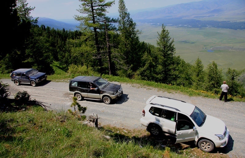
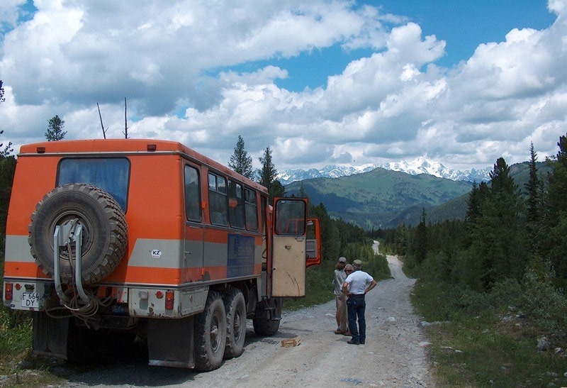
Breakfast. Transfer: the settlement of Urunkhayka (lake Markakol) - the bridge through the river Sorvenok (12 km). A stop at the bridge, short walk in environs. From here Austrian Road which was built by the Soviet military builders at the end of the 60th, the beginning of the 70th years of last century begins.
Transfer: the river Sorvenok - the pass Altay 1792 meters high above sea level (7 km).
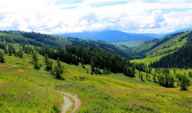
The stop on the pass, from the pass opens an impressive panorama of surrounding mountains and the Altay taiga. Walk in environs.
Transfer: the pass Altay - the first bridge through the river Karakoba (6 km).
The bridge through the river Karakoba the most picturesque place of our travel across Altay. The river Karakoba graceful, magnificent and transparent originates on slopes of Ridges Tarbagatai and Southern Altay and all the waters flow to the Republic of China. A stop, short walk in the environs of the river.
Further transfer: the first bridge through the river Karakoba - Camp of fishermen on the river Karakoba (7 km).
After the first bridge on the river Karakoba we pass three more bridges through this beautiful river and in the picturesque place, on the right river bank where it does sharp turn to the right we will stop for lunch. Here often fishermen stop to catch a taimen and an iridescent grayling. Walks in the environs of the river.
Transfer: Camp of fishermen of Karakoba - Top winter quarters - pass Burkhat of 2141,9 meters above sea level (14 km).
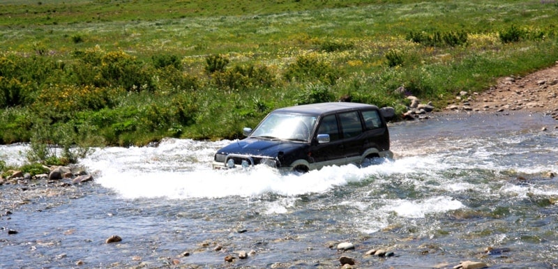
After a lunch we will also go on the right side of the river Karakoba and we will soon overcome the ford through the left inflow of Karakoba – the river Tautekeli. From the river Tautekeli slow rise to the Top winter quarters begins. We pass winter quarters and the road begins rise on the stony road on the pass Burkhat.
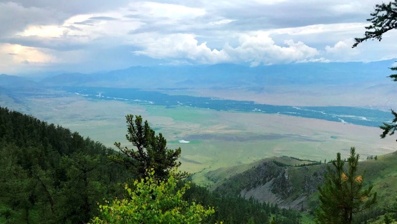
A stop on the pass. It is one of unique panoramas of the Kazakhstan Altay, on the North the view of the valley of the river Bukhtarma opens, from the pass it is visible how the thin river Bukhtarma curls and flows on the West. Burkhat begins descent to the valley of the river Bukhtarma with the pass. On the way from the pass Burkhat visit of the lake Burkhat-Kol which is in 600 meters from the road.
Transfer: pass Burkhat - settlement of Uryl (41 km).
The stop in the settlement of Uryl, visit of shops, will not be farther than shops on our way.
Transfer: settlement of Uryl - settlement of Berel - bridge through river Belaya Berel - settlement of Karaayryk (Yazovka) - lake Yazevoe (50 km).
Arrival on the lake Karakol (Yazevoye). Accommodation in guest houses or pitch up a tent tents, a dinner and overnight.
Day 8. Lake Yazevoye. Visit to Yazevy falls (5 + 5 km).
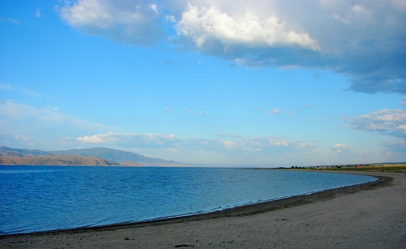
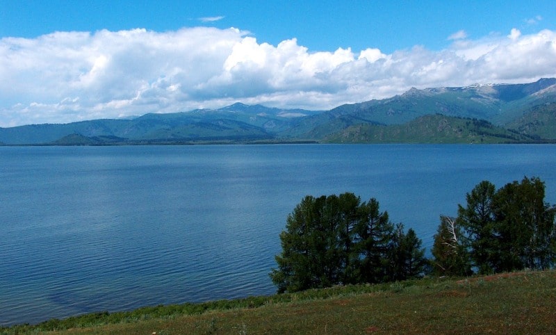
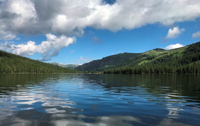
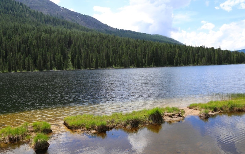
Breakfast. The lake Yazevoye is a fascinating part of our route across Kazakhstan Altai.
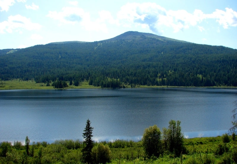
The lake Yazevoye is in the picturesque valley located at the height of 1656 meters above sea level. Lake length, from the North on the South 3 kilometers, width is 600 meters.
The lake rather warm during the summer period, it is possible to swim in the lake. In a clear weather from the coast of the lake the magnificent view on double tops of Mount Belukha of 4506 meters above sea level opens. Only one species of fish - an lives in the lake.
Day of rest on the lake Yazevoe. Lunch. Walks in the environs of the lake. Walk on the falls Yazevy (5 km). Return to the camp, dinner and overnight.
Day 9. Lake Yazevoye. Walk on thrown sawmill which is in a northeast part of lake (5 + 5 = 10 km).
Breakfast. Color of water in the lake Yazevoe yellow and green, transparency of water to 4,2 meters. Color of water is influenced by silt and seaweed which filled the lake. Coast are formed by sand, pebble and boulders. The river Yazevoe about the North and several small anonymous rivers flows into the lake.
Follows from the lake - the river Yazevaya on which, in the 5th kilometers lower on a current, several waterfall cascades were formed. Walk on the thrown sawmill which is in a northeast part of the lake (5 km). Lunch. Here walks in vicinities. Return to the lake Yazevoe, dinner and overnight.
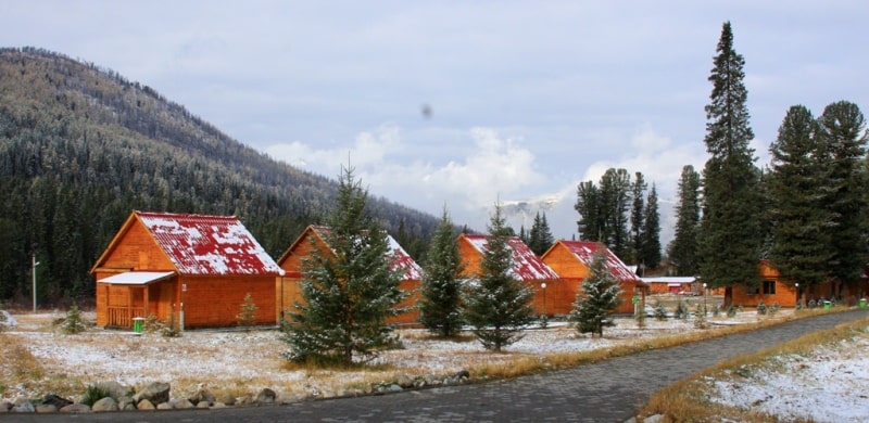
Day 10. Lake Yazevoye - Health resort Rakhmanovsky klyuchi (38 km).
Breakfast. Transfer: lake Yazevoye - settlement of Yazovka - bridge through river Belaya Berel – river Belaya Berel - Usy batyra falls on river Arsan (34 km). Walk on falls (600 + 600 = 1200 meters).
Further transfer: Usy batyra falls - lake Arasan (Small Rakhmanovskoye) (2 km).
Walk in the environs of the lake. T
ransfer: lake Arasan - health resort Rakhmanovsky klyuchi (2 km). Arrival in Health resort, accommodation, lunch.
After a lunch walk on hiking footpaths and wooden cover by a southwest and northwest part of the lake (2 km). Dinner and overnight.
Day 11. Health resort Rakhmanovsky klyuchi. Walk on pass Radostnyi (3 + 3 = 6 km).
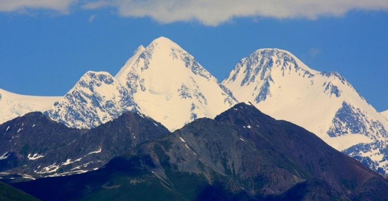
Breakfast. Walk on the pass of Radostnyi 2306 meters high above sea level. The pass is between two rivers Arasan and Black Berel. From the pass, it is far on the South, the picturesque panorama to Katun Range and Mount Belukha 4 506 meters high above sea level opens. Only 30 kilometers, separate us from the pass Radostnyi to Mount Belukha top now. In good weather it is possible to see the highest part of Katun Range which was stretched in the width direction.
From height of bird's flight in the southeast we will enjoy a view of Rakhmanovsky lake which was stretched from the northwest on the southeast in the valley of the river Arasan. Return to health resort Rakhmanovsky klyuchi, dinner and overnight.
Day 12. Health resort Rakhmanovsky klyuchi. Walk by boats on Rakhmanovsky falls (2 + 2 = 6 km).
Breakfast. Today on by boats we will make walk on the Rakhmanovsky lake on Rakhmanovsky falls which are in 2 kilometers on northeast side of the lake. The falls have the poetic name of the Volosy of Veronika. Falls water falling height - 30 meters. We will climb to falls the right side of the river, a footpath which is laid between rocks and fir-trees.
Extent of foot walk near (1 + 1 = 2 km). The falls are formed from an anonymous stream, the stream begins from three small thin lakes located the cascade at the height of 2265 meters above sea level. A lunch in an arbor on the bank of the lake. Return to Health resort dinner and overnight.
Day 13. The Health resort Rakhmanovsky klyuchi - Ust-Kamenogorsk (495 km).
Breakfast. Transfer: the health resort Rakhmanovsky klyuchi – settlement Berel - the Settlement of Uryl (50 km). A stop in the settlement of Uryl, visit of shops.
Further transfer: the settlement of Uryl - the settlement of Katon-Karagay (60 km). A lunch in cafe.
Transfer: the settlement of Katon-Karagay - the Kaznakovsky crossing (206 km). A crossing on the opposite coast of the Bukhtarma reservoir (4 km).
Transfer: The Kaznakovsky crossing - Ust-Kamenogorsk (175 km). Arrival in Ust-Kamenogorsk, transfer to hotel, accommodation, farewell dinner and overnight.
Day 14. Ust-Kamenogorsk - Almaty.
Breakfast. Transfer to the airport. Flight: Ust-Kamenogorsk - Almaty (2 hours). Arrival in Almaty. A meeting at the airport, transfer to hotel, accommodation, free time, overnight.
Day 15. Almaty.
Accompanying service at departure to airport. Departure from Almaty.

Note:
Author program of Alexander Petrov. Copying and introduction - from tsanction of author.
Alexander Petrov
photos by: