


![]()
Вы здесь
Shakpakatasai canyon.
Walking Tours in Mangyshlak.
“Travel is fatal to prejudice, bigotry, and narrow-mindedness, and many of our people need it sorely on these accounts. Broad, wholesome, charitable views of men and things cannot be acquired by vegetating in one little corner of the earth all one's lifetime”
Mark Twain.
Small Group Hiking Trips on Mangyshlak.
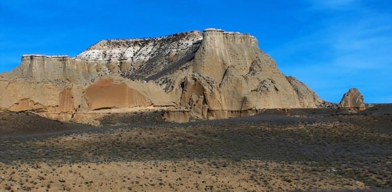
Canyon Shakpakatasai (Shakpakatasai, Shakpakty) is located in the northwestern part of the Tyub-Karagan peninsula in the western part of the Kaushe mountains, in the eastern part of the Kapam canyon, 5 kilometers southwest of Mount Ungoza in the Tyupkaragan district of the Mangystau region.
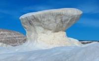
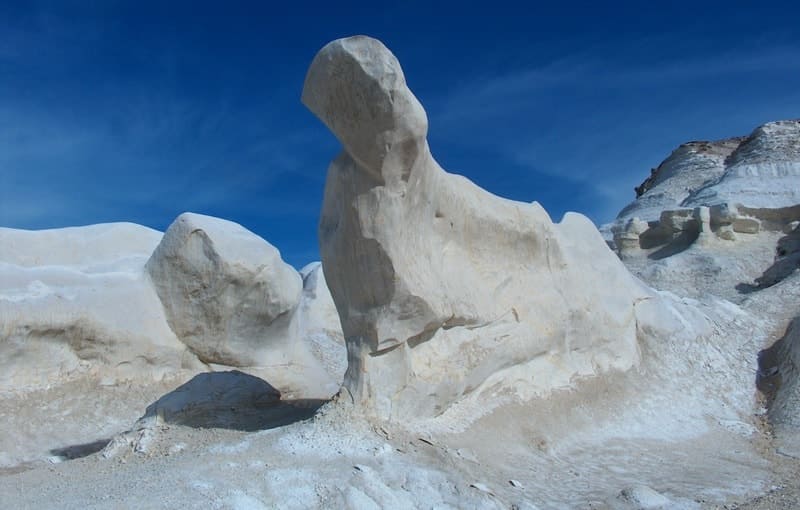
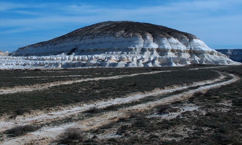
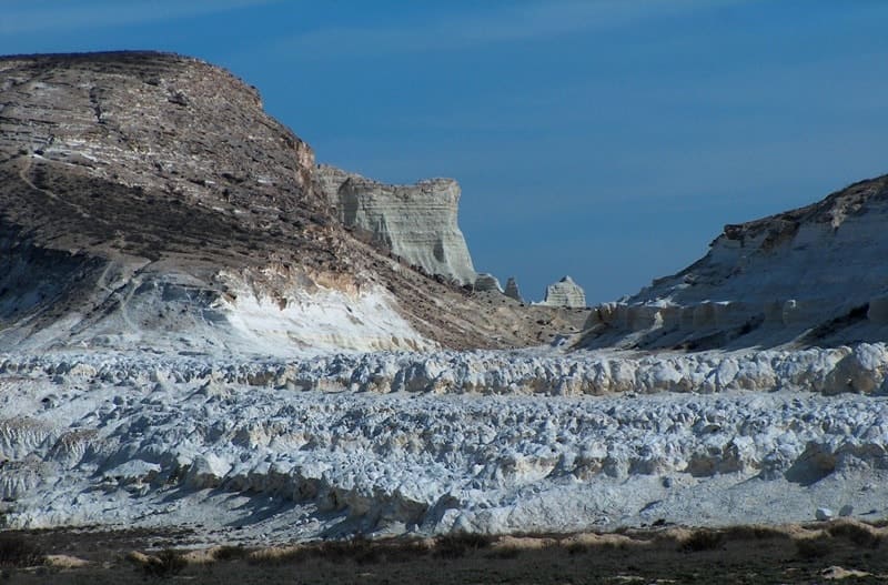
he northern coast of the Tyub-Karagan Peninsula is indented by numerous canyons, one of which is Shakpakatasai. Many millions of years ago, powerful ocean surfs washed away the soft limestone edge of the chalk plateau rising from the abyss, creating unusual gorges and dry channels.
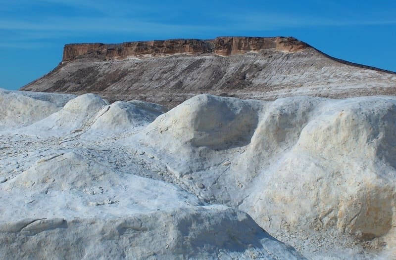
Shakpakatasai canyon is the most extensive. The length of the canyon from north to south is 9.5 kilometers, the maximum width in the central part of the canyon is 4.7 kilometers. The western part of the canyon breaks off with steep ledges, the southern part is indented by small ravines of the meridional direction.
The southwestern part of the canyon is called Zholbart. The southeastern part of the canyon is bordered by the Kaushe Mountains, which have a dominant mark of an unnamed mountain 234.1 meters high above sea level.
In the northeast, the border of the canyon is Mount Ungoza, 199.2 meters above sea level, and Ungoza East, 196.5 meters above sea level. In the southern part of the canyon, at its very beginning, there is a necropolis and an underground mosque Shakpak ata carved into the rocks, one of the unique sacral places of Mangistau, further 4.7 kilometers away is the southern coast of the Sarytash Bay.
The Shakpak Ata Mosque, the construction of which, according to archaeologists, dates back to the XIVth century.
At 4.4 kilometers to the west, the grandiose Kapamsay canyon stretches. In the north, the flat part of the canyon is closed by the Caspian Sea with the mosque and mausoleum of Yerzhan Khazret on the flat terrain.
There is also an operating well Zholbart, which gives vital moisture to a small village of local shepherds. Several million years ago, giant surf currents of the ancient Sarmatian Sea eroded the edges of the vast Tupkaragan plateau, creating a series of canyons.
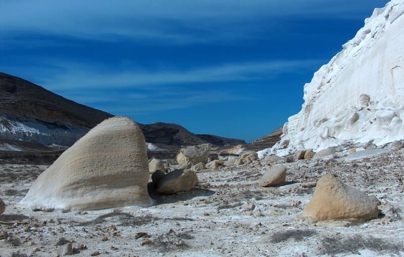
Shakpakatasai has a series of branched sources and a narrow, winding mouth, facing the Sarytash Bay. The sights of this place are the panoramas of the vast valley formed by the sides of the canyon. Like the crests of mythical dragons, white and yellow remnant mountains rise here, whimsically corroded by wind and rain.
The chalk cliffs of the canyon look like impregnable walls of castles and fortresses, fortified with watchtowers. Sometimes, fog coming from the sea gives the canyon a dark mystery. Shakpakatasai is full of mysteries. The history of the ancient inhabitants of the Tupkaragan Peninsula hid here.
In the course of the archaeological exploration on the sides of the canyon, workshops and settlements of the Stone Age, burial grounds and tombs of early nomads, two fortresses of refuge of the medieval era were discovered.
Geographical coordinates of Shakpaktysai canyon: N44 ° 24'28.34 "E51 ° 08'19.31"
Note:
If you are using geographic coordinates for Google Earth or Google Maps navigation systems, you must remove the last two digits from geographic coordinates and " (hundredths of a second) and enter the result in the input line.
Example: N51°44'09.67" E72°39'40.81" = N51°44'09 E72°39'40

Authority:
Andrey Astafyev, town of Aktau. Alexander Petrov.
Photos by
Alexander Petrov.