


![]()
Вы здесь
History of town of Turkestan.
Historical town monuments Turkestan.
“...And the fortresses in Turkestan and in the cities are made of walls, earthen ramparts and unbaked brick walls are laid along the rampart, and the height and rampart of the wall is half a third fathom, and the width in some places is a fathom, and in other places it is more and less; and to the top arshins of one and a half and 2; But what is more, in their cities there are only earthen ramparts without bricks, and the earth is dense and not loose, and there are no dug ditches...”
Journey of Fyodor Skibin to Cossack Horde. 1694 – 1696.
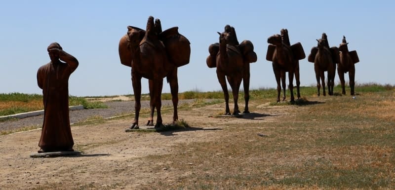
Tours across ancient cities of Southern Kazakhstan.
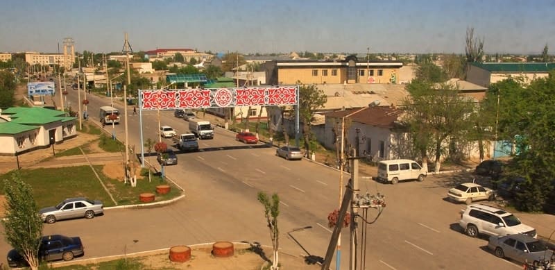
The city of Turkestan has been a city of regional subordination since 1968 as part of the Chimkent region. Since 1928, the administrative center of the Turkestan region of the South Kazakhstan region, the railway station of the Orenburg - Tashkent railway.
Since June 19, 2018, it has been the administrative center of the Turkestan region (formerly the South Kazakhstan region). Located on the right bank of the Syrdarya, at the foot of the southern slopes of the Karatau ridge. Population: 200,153,000 people (2022).
In 1864, with the annexation of Kazakhstan to Russia, Turkestan was a city within the Chimkent district, from 1867 to 1932 in the Syrdarya region, from 1918 to 1924 as part of the Turkestan Autonomous Soviet Socialist Republic, in 1932 - 1962 in the South Kazakhstan region, from 1962 - Chimkent region of the Kazakh SSR.
The ancient name of the city is Yasy | (Yasi, Yasy), from the 16th century - Turkestan; until the 19th century it was the residence of Kazakh khans. According to archaeological research, the founding of the town dates back to the middle of the 1st millennium AD. e., when the ancient settlement of Yasy arose on the site of the Kultobe settlement (located outside the urban area, on the southeastern outskirts of the modern city of Turkestan).
Before the Mongol invasion, and possibly in the XII-XIV centuries. The urban area was limited only by the Kultobe square and the surrounding area. As researchers suggest, this was a small settlement in the vicinity of Shavgar, the former center of the district of the same name.
The territory where the khanqah of Ahmed Yasawi is now located was the cemetery of the Yasy settlement, as evidenced by the numerous burials discovered in this area, which were partially destroyed during the construction of the khanqah at the end of the XIVth century.
Despite its insignificant size, after the fall of Shavgar as a result of the invasion of the Karakytai (Khitans), Yasy became the center of the district and the main trading point on the way from Chimkent to Sygnak. It gained particular fame at the beginning of the XIIth century, when Ahmed Yasawi, a Sufi preacher and mystic poet, settled here.
After his death (1166-1167), a mazar was built over his grave, which acquired the reputation of a “holy” place. The location of the town on the ancient caravan route - a branch of the Great Silk Road, the route - the trade road between Dasht and Kipchak and the agricultural oases of Central Asia - Khorezm, Shash (Tashkent), Bukhara, Samarkand, favorable geographical position, pilgrimage to the mazar contributed trade and rural development.
The earliest mention of the town of Yassy is found in the description of the journey from Mongolia of the Cilician-Armenian king Getum I, where in the middle of the XIIIth century. he went to the court of Khan Mengu, which was included in a separate chapter in the “History of Armenia” by Kirakos Gandzake.
Here the name of the town is conveyed, apparently, in a more ancient form Ason than in later eastern sources. More often, the name Yasa appears on the pages of historical works from the XIVth century. According to Sharaf-ad-din Ali Yazdi, in 1388 Yasy was plundered by the troops of Tokhtamysh, and the mazar of Ahmed Yasawi, which by that time had become a particularly revered shrine among the Turkic tribes, was also plundered.
After the defeat of Tokhtamysh, part of the loot seized by Timur was used for the construction of a new majestic khanaka building, construction of which began in 1397. In the middle of the IInd half of the XVth century, the town was repeatedly mentioned on the pages of eastern chronicles, telling about civil strife between Timur’s heirs, and later the Timurids and Shaybanids.
The medieval town of Iasi developed according to the traditional pattern of a Central Asian town: citadel, shakhristan and later rabad. The citadel was located to the north-east of the khanaka building and was limited by the fortress walls. t had the shape of an irregular pentagon with an area of approximately 2.6 hectares. in the western part there was a khanaka.
Stratigraphic pits and sections of the fortress walls allow us to date their construction to the XVth century, i.e., the time that followed the construction of the khanaka architectural complex. Turkistan (also sometimes spelt Turkestan) is an ancient settlement, originally known by the name of Yassy, the old town located on the eastern edge of present-day Turkistan. Its origin dates back to the VIIth Century, when it stood in the shadow of the much larger and ttiore significant city of Shavgar close by.
It was only in the XIV Century that Yassi became the centre of the region. In X century it was Shavgar (Shavagar), from XII century - Yasy (Yassy). Medieval Yasy was a town-fortress. In XII century poet Khodzha Akhmed Yasavi lived there and was buried there too.
In its size Khodzha Akhmed Yasavi Mausoleum is equal to mosque Bibi-Khanum in Samarkand (Uzbekistan). Middle Asian ruler Timur began constructing a mosque close to Yasavi Mausoleum in 1396 - 1398. Turkestan nowadays (since 1968 the town is in South Kazakhstan oblast) is a large industrial, educational and cultural center as well as a center of inner and foreign tourism.
It is a railway station on Orenburg - Tashkent line. Light and food industries are developed. In the city there is one of the largest Universities in Central Asia - International Kazakh-Turkish University named after Khodzha Akhmed Yasavi.
There are 13 plants in Turkestan town, the largest of them are as follows: a cotton-processing plant, a machine-building plant, sewing and knitted wear plant, antibiotics plant, joint Kazakh-English plant producing dressings.
Turkestan was an important trade center of the past known from IV century. The full ancient name of the city was “Hazrat-e Turkestan” meaning “Saint of Turkestan”. Turkestan city was the most important learning center for Kazakh steppes people.
In 1390 one of the most important architectural monuments of Kazakhstan was built. It is the tomb (mausoleum) over ancient leader Timur grave. Turkestan city is attracting thousands of pilgrims every year. Turkestan town is also known as the Second Mecca of the East. It is extremely important for Kazakhstan Muslims.
Also there are other historical sites in Turkestan city: ancient bath house, Timur’s granddaughter mausoleum, three mausoleums of Kazakh khans (leaders). From the XVI to XIX centuries the city was under the control of the Kazakh Khans. The name Turkistan, which was first mentioned in historical records in the XVI Century, has particular significance, expressing the claim that it represented the lands of the Turkic nations.
This tradition remains alive to this day, and is the reason why Turkistan was chosen as the seat of the Kazakh-Turkish University. The modern city of Turkistan is a typical town of the Central Asian steppe. With one monumental exception, it seems to have little to offer the tourist: a stroll around reveals the occasional traditional house with intricately carved wood gables, and the bustling and labyrinthine Night Market is definitely worth a visit, more to people-watch than to purchase - the melange of ethnic nationalities going about their business is fascinating.
Most shopping is done in the evening, when temperatures are more bearable, and the market serves as a social centre as well as shopping centre. Today, the mausoleum is separated from the modern city by a high outer wall, along whose ramparts you can walk.
There is a museum, where one can learn something about Yasawi's students and Sufism, and a large rose garden separates the holy shrine from an ensemble of small shops, where mainly devotional objects and souvenirs are for sale; most of these, inevitably, fall firmly in the category of kitsch.
Northeast of the outer wall is a simple but beautifully carved statue of Al-Farabi, in front of a number of small buildings where traditional craftsmen and women make and ply their wares. Beautiful felt rugs, dombras and ceramics can be bought here.
Turkistan (also sometimes spelt Turkestan) is an ancient settlement, originally known by the name of Yassi, the old town located on the eastern edge of present-day Turkistan. Its origin dates back to the VIIth Century, when it stood in the shadow of the much larger and significant city of Shavgar close by.
It was only in the 14th Century that Yassy became the centre of the region. From the XVIth to XIXth centuries the city was under the control of the Kazakh Khans. The name Turkistan, which was first mentioned in historical records in the 16th Century, has particular significance, expressing the claim that it represented the lands of the Turkic nations.
This tradition remains alive to this day, and is the reason why Turkistan was chosen as the seat of the Kazakh-Turkish University. The modern city of Turkistan is a typical town of the Central Asian steppe. With one monumental exception, it seems to have little to offer the tourist: a stroll around reveals the occasional traditional house with intricately carved wood gables, and the bustling and labyrinthine Night Market is definitely worth a visit, more to people-watch than to purchase - the melange of ethnic nationalities going about their business is fascinating.
The emergence of dense residential buildings here and the deposition of the cultural layer can only be attributed to the post-Mongol period, and the most intensive period of development to the XVth - XVIth centuries. An extensive shakhristan is being built to the west of the khanaka.
At that time, the city, apparently, was growing rapidly and becoming the leading trade and economic center of the region, the administrative center of the Timurid governors of the district, and the religious center of Turkestan. If in the first half of the XVth century.
Sharaf-ad-din Ali Yazidi calls it a small village (karma), which did not play a noticeable role in the economy of the district, then the Central Asian historian Ruzbikhan Isfahaii in the work “Mikhman-name-yi Bukhara”, describing Yasy in the XVIth century, noted:
- “The city of Yasa, which is the tomb of His Holiness Khoja, is a vast and fertile possession, the capital of the region of Turkestan. Its surroundings are fresh and blooming, like a flower garden. Goods and precious items are brought to the city of Yasi, and trading takes place there, and it (the town) is the place where merchants unload their cargo and the departure point for crowds of travelers across countries.”
In some other works of the 16th century. the city is mentioned under two names - Yasy or Tur-kestan. But the memory of the old name (Yasy) was preserved among the people for a long time, which was noted by Mahmud ibn Vali, who mentioned it in the IInd quarter of the XVIIth century.
The construction of the khanqah gave extraordinary popularity to the city in the XVth-XVIth centuries, which gained fame in the Muslim world as a religious center - Aeret (Hazret). A khan's necropolis was formed next to the khanaka. During the XV – XVII centuries.
The necropolis was intensively built up with mausoleums of the nobility, of which the most significant are the mausoleums of Rabi'i Sultan Begim (XV century), octagonal (XVI century), Yesim Khan (XVII century). In the drawing depicting Turkestan at the beginning of the XVIIIth century, the city, oval in plan, is surrounded by a wall with a sixth gate and round watchtowers.
The citadel was located in the north-eastern part of the city, and was surrounded by a wall, adjacent at one corner to the tower of the general clan wall. The picture shows many wells inside the city, near the southern walls - caravanserais with rows of shops, a bazaar - outside the town walls, next to the caravanserai, along the crooked streets - dense residential buildings.
From the entrance city gates, streets led to the fortification, caravanserai, and residential areas. Until the beginning of the 19th century. The appearance of the city apparently did not change. The town-planning dominant - the kanaka - rose above the buildings and was far visible outside the city.
One-story residential buildings had flat roofs and frame walls were filled with pakhsa. Of the buildings of this time, only the bathhouse building (XVIII century) made of burnt brick next to the “necropolis” has survived. The city occupied approximately 30 hectares, the length of the city walls reached 2-2.5 kilometers.
Internecine wars and Dzungar invasions led the city at the end of the XVIIIth century. to a sweaty decline, and by the beginning of the XIXth century. it was “so devastated that there are no more than 300 houses in it and the vastness of the former settlement is visible only in the ruins.”
From 1819 to 1864 Turkestan was part of the Kokand Khanate and served as its stronghold on the border with the steppe. Although by this time the city was large, its planning structure remained the same: the citadel, shakhristan and extensive suburbs of rabad.
During this period, no significant buildings were erected; only the fortress walls were updated and partially rebuilt. In plan, the city had the outline of an irregular circle, close to a 6-gon with unequal sides, and occupied an area of about 90 hectares.
It was surrounded by an adobe, monolithic wall about 3 km long. The wall had 12 towers and four gates (Darvaza-kakpa, Musallya-kakpa, Ietta-kakpa, Ishan-kakpa). In the city wall of the southeastern part on a high dune a powerful 4-cornered tower rose, dominating the surrounding area.
The citadel, pentagonal in plan, was in the northeastern part of the city, occupying an area of about 5 hectares. The citadel was separated from the city buildings by walls and a moat with water. The height of the walls reached 15 meters, they were made of large mud bricks, 8 security towers were made of burnt bricks.
The length of the perimeter walls is about 700 meters. A gate built in the north-eastern wall led from the citadel to the town. The khanaka was located in a special courtyard, in the western corner of the citadel. The territory of the citadel was densely built up with houses of officers of the Kokand garrison and local clergy.
Shakhristan, the city itself, was divided into 5 large residential areas. There was no correct, clear layout. The main streets of the city led from the gate to the citadel and the market square, which was now in the center of residential development.
The development was very dense, one-story houses made of adobe and pakhsa were grouped along narrow crooked streets and dead ends into blocks of various configurations - mahallas. The main structural element of the block is a residential building with a courtyard surrounded by a duval.
Outbuildings with blank walls faced the street, residential buildings faced yard There was practically no greenery in the yards. The walls of the ridges gave the streets the appearance of narrow corridors that provided good protection from the heat.
The most well-appointed were the neighborhood mosques, the iwans that opened onto courtyards with a house-pond and trees. The cornices, ceilings, and columns of the ivans were decorated with bright designs of floral patterns. Gardens and cultivated fields were located in rabads around the city; irrigation canals and ditches were built to them from the surrounding rivers.
In the early 60s XIX century in the city there were about 20 neighborhood mosques, 2 madrassas, a bazaar, 22 water mills, 21 tanneries, and there were 1,200 houses. The population was about 5,000 people, of which 3/4 were engaged in agriculture.
Until the middle of the VIIth century. The structure of the town did not change. Turkestan, even after the annexation of Kazakhstan to Russia, remained a typical Central Asian city with a closed radial layout, surrounded by a ring of defensive walls.
Only in the citadel were barracks built for the soldiers of the Russian garrison, a commandant's house and a church, and other structures of the military department. The western and southern walls were connected to the city wall by a new line of fortifications.
In 1172, Turkestan, which became a county town, grew, and a gradual influx of population from the European part of Russia and the indigenous inhabitants of the populated areas of the Syrdarya region began. Since the mid-70s The Turkestan Military District began to develop master plans for the development of the city.
One of the first master plans for the city of Turkestan, according to which the planning and division of the territory was carried out, was developed in 1875. According to this plan, outside the city walls on the north-eastern side, on undeveloped lands, a new residential formation is being formed, the so-called “new town with a fundamentally different layout - a regular, geometrically correct grid of blocks with straight wide streets.
The first blocks appeared in the square of modern Furmanov streets, 1 May. Matrosova, Lenin Ave. The main planning axes were a wide street, laid parallel to the eastern wall of the citadel in the direction from southwest to northeast (now Abai Street) and a street perpendicular to it (now 1 May Street).
At their intersection, a city garden with a church was laid out. Adjacent to the garden on the east side was a section of the infirmary. The territorial development of the “new city” proceeded in northern and eastern directions. The main street (now Abay Street) continued in a southern direction, along which areas were also allocated for the construction of new neighborhoods.
At its intersection with the street running along the southern walls of the citadel, there was a new bazaar, common to the old and new parts of the town. In the master plans of 1875, 1833 and later did not offer any recommendations for the preservation or development of the "old city", which remained within the town walls.
The “new town” developed slowly and separately from the “old”. The further growth and development of Turkestan is directly related to the construction in 1901 - 1902. railway Orenburg - Tashkent, which ran 4.5 kilometers west of the town. By the beginning of the XXth century the planning structure still consisted of shakhristan, i.e., the “old city”, the “new town” and the agricultural suburb - rabad.
The whole of Turkestan occupied an area of about 1400 hectares. The “old city” at the beginning of the 20th century had the same appearance as “hundreds of years ago... The streets are narrow and crooked. The third part of the town is ruins...
The city walls and the walls of the citadel have partially collapsed or continue to collapse.” The grandiose khanaka structure towered above the one-story building, being the architectural dominant. The mausoleums of the necropolis, located in the courtyard of the khanaka, gradually deteriorated and collapsed.
The eastern bathhouse and Juma mosque, located south of the necropolis, continued to function. In the “old city” residential buildings were built from raw brick and pakhsa, with earthen roofs; burnt brick and iron roofing were used very rarely. The “new city” adjoined the “old” one on the north-eastern side.
Its composition was based on the intersection of two axes: the main street in the direction from the southwest and northeast and the northern part perpendicular to it, enclosed between the modern streets of 1 May and st.
Soviet.
The public center was formed by 1910-912. along the perimeter of 4 blocks, within the boundaries of the current streets of Abay, 1 May, Furmanov, Lenin Avenue, administrative buildings and public places were located.The largest of them formed the corners of the blocks: the garrison headquarters on the current streets.
Furmanova, administrative building on the street. Sovetskaya, 4, apartment building with a pharmacy on the street. Molodezhnaya, 6, church on the street. Abay, 1. Single-storey, free-standing houses with long facades overlook the red line and are connected to each other by high duvals.
Residential buildings were mainly built from adobe, government buildings were built from baked bricks, iron roofs were 2-slope and 4-slope, the walls were plastered and whitewashed. The decorative decoration of the facades is dominated by recycled motifs of Baroque and late classicism architecture.
In residential buildings of the early XXth century, built in the European style, methods of building local traditional housing were used - ivans, courtyards entwined with greenery (now Molodezhnaya Street, houses 17, 18, where the post office and library are now located).
The “New City” during this period was quite well landscaped and, according to the descriptions of contemporaries, resembled the provincial cities of European Russia. Ditches were laid along straight and wide streets and trees were planted. In 1906 - 1907 sidewalks appeared, and in 1909 a highway was built from the town to the railway station.
On the eastern side of the “new city”, immediately behind the blocks with a regular regular layout, a residential area was formed, where mainly the indigenous population settled. The plots were developed spontaneously and formed into a residential formation traditional for Central Asia - mahalla.
Within the modern streets of Dzhansugurov, Frunze, Kolkhoznaya there was an area with a radial-ring system of streets and alleys, with household irrigated plots. Here the houses were located in the depths of the site, built from raw brick or pakhsa, and some of them had double-pitched roofs, the walls were plastered and whitewashed.
Examples of local housing from the early 20th century are residential buildings on the street. Kolkhoznaya (No. 18, 47 - 49. Rabad lands with gardens and irrigation canals were located on the western, southwestern and northwestern sides of Turkestan. Rabad developed mainly towards the current railway station.
In 1908, in Turkestan there were 3616 houses, 2 churches, 41 mosques, there was a city men's 2-grade school, a women's parish, Tatar and Jewish schools, a Russian-native school, a madrasah and 22 maktabs (schools), from the administrative public institutions - the office of the local police officer and military commander, a postal and telegraph office, a magistrate's chamber, an infirmary, a public library, 2 public gardens, a kindergarten, etc. The population of the city in 1910 was 15,236 people.
Of the industrial and commercial establishments in 1912, there were 4 cotton gins, 10 oil mills, 8 soap factories, 5 brick factories. 15 water mills. The basis of the modern planning structure of the city, which developed during the years of Soviet power, was laid by 2 settlements: the city of Turkestan itself and the railway workers’ village of Borisovka.
The first master plan (1955, engineer V. Ya. Chichagov, architect V. Sh. Gershberg, Kazgiprogorselstroy design institute) provided for the layout of the city, excluding the village of Borisovka. According to the new master plan (1964, architect L.L. Ukhobotov, Kazgorstroyproekt), the disparate residential areas of the city and the village of Borisovka were united by a single planning solution.
According to this plan, the city, linearly stretched in the direction from east to west, was divided into 3 planning areas. The city-wide center was planned at the junction between Borisovka and the town. Furmanov Street - now Lenin Avenue - was central, uniting urban areas. In the modern structure, urban areas with preserved architectural and urban planning monuments are clearly divided into eastern and western.
The eastern region occupies a fairly vast territory. It included the architectural and archaeological zone within the boundaries of the “old city” and the neighborhoods adjacent to it on the north-eastern side, which formed the so-called “new city” at the end of the XIXth - XXth centuries.
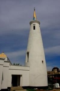
The “Old Town” is currently a deserted area free of development with remnants of traces of the city wall and residential buildings in the form of small hills. In addition to archaeological monuments, the zone is represented by a group of buildings included in the historical and architectural complex: this is the khanaka of Khoja Ahmed Yasawi (XIV century), chillyakhana (XVI century), Great Khilvet (XII century), Aulie-Kumchuk-ata mazar (XII century), mausoleum of Rabia Sultan Begim (XV century), Mazar Bezymyanny (XVI century), mausoleum of Yesim Khan (XVII century), oriental bathhouse (XVIII century), Juma mosque (XIX century.).
Almost all buildings have been restored, many have been rebuilt. A fragment of the fortress wall with a gate has been restored. The entire territory of the “old city”, the necropolis buildings around the khanaka and public and religious buildings are included in the state historical and cultural reserve Azret-Sultan (Post. Council of Ministers of the Kazakh SSR dated August 28, 1989).
The area of the reserve is about 90 hectares. The layout and development of the “new city” has been preserved almost no changes in the blocks bounded by Matrosov, Frunze, Furmanov streets and Lenin Avenue. The architecture of the buildings creates a characteristic urban environment, which, with its scale with the street and harmonious composition, is an example of the development of cities in Southern Kazakhstan at the beginning of the XXth century.
The western region was formed on the site of the railway workers' village of Borisovka. The territorial development of the city of Turkestan went along the highway towards the station. By the end of the 50s - early 60s. the vacant lands between them were completely built up, Turkestan finally merged with the station village.
Complex of station buildings 1902-1906 is an example of a single architectural solution. Construction was carried out according to standard designs of the railway department. All buildings are one-story, made of baked brick, under iron roofs.
Figured masonry was widely used in the decorative design of facades (crowning stepped cornice, blades, lintels, parapets in masonry patterns, etc.).
The center of the architectural composition is the monumental station building, which closes the perspective of the street. Karl Marx. The station was built in 1903; the external design clearly shows modern features - stucco details, railings, parapets and turrets. In 1903-1905 a depot, a water tower, a rest house for steam locomotive crews, a bathhouse, residential buildings, a hospital complex were built, and a public garden (now the Railway Workers' Park) was founded.
The layout and development of the beginning of the XXth century has been preserved within the modern streets of Proletarskaya, Shchorsa, Kotovsky, and on the other side of the railway - streets (Central, Krupskaya, Vokzalnaya. The basis of the planning composition of the railway area is the station square with the station.
The main street of the village (now Karl Marx Street) ran perpendicular to the station towards the town. Another main street ran parallel to the railway track (now Oktyabrskaya Street). These 2 streets retain the significance of the main planning axes that form the development of the station area,
In the 1970s-1980s In connection with the development of industry and in accordance with the master plans of 1964, 1978, the construction of microdistricts with 4-5-story buildings and a complex of cultural and public services is underway. At the junction of the eastern and western residential areas, a new city-wide center with developed large-panel housing construction is being formed.
In the eastern region, directly adjacent to the historical and architectural zone of the “old” and “new city”, the administrative center of the city was formed - the square named after. V.I. Lenin. The square contains 2-3-story buildings of the city and district party committees, the district executive committee, and a cinema.
The industrial zone is located in the northwestern and southwestern parts of the town. The working class of pre-revolutionary Turkestan was represented by railway workers and cotton gin workers. At the beginning of the 20th century. In Turkestan, the ideas of Marxism began to spread, and a Marxist circle arose.
During the Revolution of 1905-1907 in Russia, a Social Democratic group was created on its basis. Railway workers st. Turkestan, workers of the Turkestan cotton gin plant in 1905 -1907. actively participated in the revolutionary movement in the south of Kazakhstan.
In February 1905, they joined the strike movement that swept Perovsk (now the city of Kyzylorda), Chelkar and other stations of the Orenburg - Tashkent railway. On October 12, 1905, they joined the All-Russian political strike. In April 1917 at the station. In Turkestan, a legal social democratic group was organizationally formed.
29.8. 1917 in connection with the offensive of the White Army of General L. G. Kornilov on Petrograd, at the station. Turkestan, a crowded meeting of workers and soldiers of the garrison took place. At the meeting, it was decided to create a fighting squad in defense of the revolution.
At the same time, at the end of August 1917, one of the first communist youth organizations in Kazakhstan was created at the station - the “Party of Young Communists”, the organizer of which was the young Bolshevik V.S. Sudorgin.In the fall of 1917, all members of the station's communist youth organization joined the ranks of the fighting squad.
On November 7, 1917, a detachment of fighting squads disarmed the gendarmes, and Soviet power was established in the town of Turkestan. On the same day, the Military Revolutionary Committee (MRC) was created. Soon the Military Revolutionary Committee transferred power to the executive committee of the Turkestan Council of Workers', Soldiers' and Muslim Deputies.
The Red Guard detachment, created after the Great October Socialist Revolution at the station, fought heroically on the fronts of the Civil War. Their names are carved on obelisks erected to the fighters for Soviet power. In April 1918, the Bolshevik organization took organizational form in the city of Turkestan.
During the years of Soviet power, Turkestan turned into one of the industrial centers of Southern Kazakhstan. In September 1978, the museum of the architectural and archaeological complex of Ahmed Yasawi was organized. In the city of Turkestan, on the territory of secondary schools, obelisks and monuments were erected in honor of teachers and students who died during the Great Patriotic War: at secondary school N6 10 named after.
Al-Farabi (1970), near the secondary school named after. M.I. Kalinin (1967), near the secondary school named after. N. A. Nekrasov (1967), near the secondary school named after. A. Navoi (1971). Monuments to fellow countrymen who fell during the Great Patriotic War were erected in the region in the village of Old Ikan (1975), the village of Kommuna (1971), the village of Karashik (1970), the village of New Ikan (1976). ), the village of Urangai (1968), the village of Kyzylaskker (1970).
Authority:
Collection of historical and cultural monuments of Kazakhstan. South Kazakhstan region. Volume 1. Alma-Ata. Main editorial office of “Cossack Encyclopedias”, 1994. Authors of the article: N.I. Mustafaev, N.N. Muzamedieva, E.A. Smagulov.
Photos by:
Alexander Petrov.