


![]()
Вы здесь
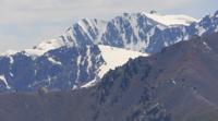
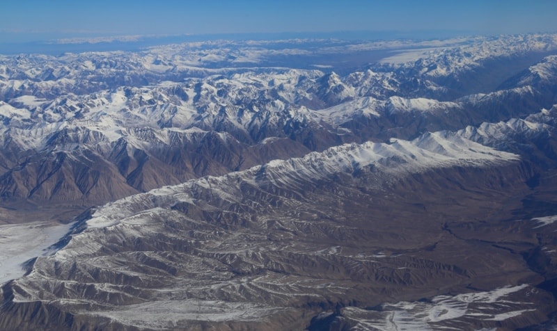
Central Tien-Shan mountains in Kazakhstan.
Expedition by mountain all-terrain vehicles in mountains of Central Tien-Shan.
“In a memory of those, whose souls remain to fly not visually in a silence of Mountain's Grandeur”
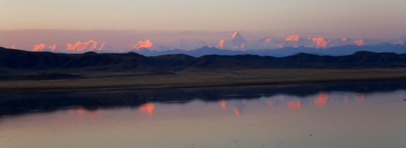
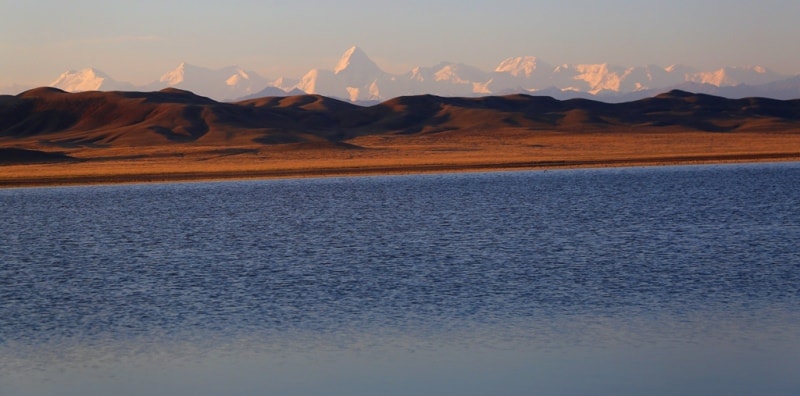
Travel Central Tien-Shan.
Eastern part of Central Tien-Shan mountains is located in Narynkol district of Almaty region.
The eastern part of the Central Tien-Shan is understood as the highest mountainous region of the Tien-Shan, bounded from the north by the eastern part of the Terskey Ala Too ridge from the west by the meridian along the valley of the Saryjaz River, from the south by the state border along the Tengri Too ridge and from the east by the Meridional ridge along which the state border also passes.
The region is characterized by powerful glaciation; here are the highest peaks of Kazakhstan, Khan-Tengri peak and Zapadny Shater peak, 6511 m. a. s. l. The eastern part of the Central Tien-Shan mountains is located on the territory of Kazakhstan.
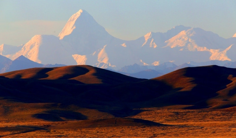
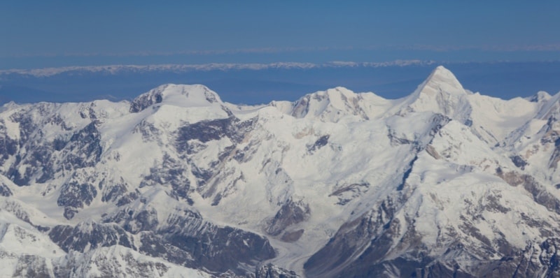
The eastern spurs of the Tengri Tooridge with the highest peak in Kazakhstan, the Khan-Tengri peak, 6995.2 m. a. s. l., for 10 kilometers, in the direction from west to east, are located in the very southeast of the Republic. Tengri Tau serves as a grandiose pedestal for the graceful pyramid of Khan-Tengri Peak, which rises for a kilometer above the crest line of the ridge.
Several more peaks in the eastern part of the ridge exceed 6,000 m. a. s. l., to the west, the ridge is slightly lower. The state border between the Republic of Kazakhstan and the Kyrgyz Republic runs along the main ridge of Tengri Too.
This includes the eastern slopes of the Meridional Range, which stretches from south to north from the Shater summit at a height of 6637 m. a. s. l. to the sources of the Narynkol River for 36 kilometers.
The meridional ridge is one of the main mountain nodes of the Central Tien-Shan on the border of Kazakhstan and the Republic of China. The total length of the ridge is 80 kilometers, including the southern distribution of the ridge in China and Kyrgyzstan, with an average height of more than 6,000 m. a. s. l.
The state border between the Republic of China and the Republic of Kazakhstan runs along the main ridge of the ridge. In the southern part of the Meridional ridge, there is the summit of the Marble Wall, 6140 m. a. s. l. The southern part of the ridge is the largest node of modern glaciation.
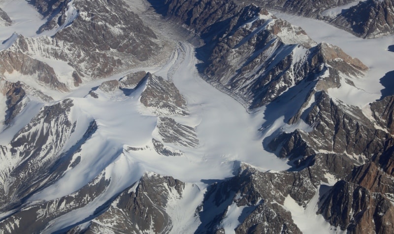
The large glacier North Inylchek flows to the west between the Saryjaz and Tengri tau ranges. The Northern Inylchek glacier flows down from the western slopes of the Meridional ridge, which is located on the territory of Kazakhstan for 11 kilometers.
The glacier is inaccessible - its valley is located between powerful ridges. To date, there is only one pass in the Tengri Too ridge - the Western shoulder of Khan-Tengri of 3B category of difficulty and near Lake Merzbakher across the spurs of the Bronenoses peak - the westernmost peak of the ridge - 2B.
The saddles of the ridge await pioneers. A mighty snow-covered barrier north of the Tengri Tau ridge, for 10 kilometers from west to east, the Saryjaz ridge rises. Its peaks rise above 5000 m. a. s. l. The highest peak of the ridge in its eastern part is Semenov Peak 5816 m. a. s. l.
The ridge is characterized by powerful glaciation of the northern slopes; the southern slopes have less powerful, but rather developed glaciation. The ridge has such a character in the eastern part, west of the peak of 5063 m. a. s. l. Saryjaz in the east is rapidly degrading - the heights of the peaks are sharply reduced, snow cover and glaciation are sharply reduced.
The northern slopes of the Terskey Ala Too ridge also belong to the above described area. Approximately, from the easternmost peak Ashutor Novy, 4427.6 m. a. s. l. in the eastern part of Terskey Ala Too, and to the Kakpak pass, 3482 m. a. s. l., in the west of the ridge, this region belongs to the mountains of the Central Tien-Shan in Kazakhstan.
Geographic coordinates of Central Tien-Shan in Kazakhstan: N42°17'57 E80°12'14
Authority:
Alexander Petrov.
A.G. Isachenko, A.A. Shlyarnikov. The nature of the world. "Landscapes", Moscow, "Mysl", 1989.
Photos by
Alexander Petrov.