


![]()
Вы здесь
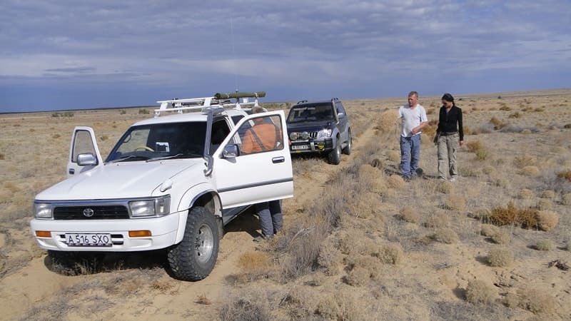
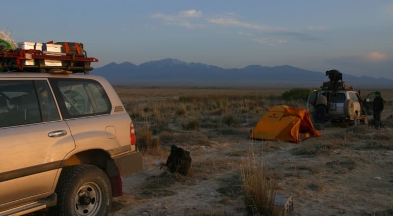
Moyynkum desert.
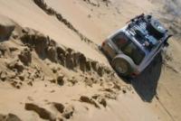
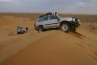
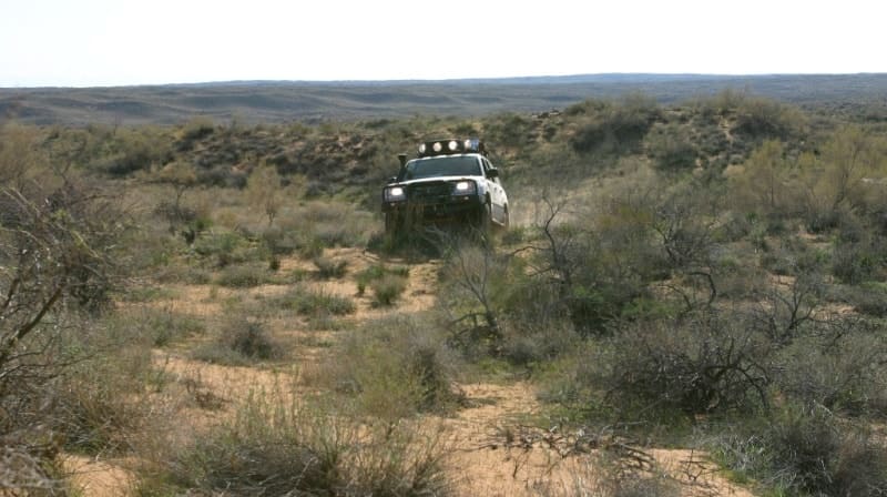
Trip to desert Moyynkum.
"Went on the melted deserts,
On not trodden tracks,
Under the sky blue
After the flaring pillars"
Maksimilian Voloshin. Koktebel. November 19, 1919.
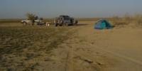
Travel on deserts of Kazakhstan.
Moyynkum (or Muyunkum) is a sandy desert in southern Kazakhstan, on the territory of the Zhambyl and Turkestan regions. The length from southeast to northwest is 530 kilometers. Altitude up to 700 meters above sea level.
From the north and east, the desert is bounded by the valley of the Chu River, from the south - by the Karatau and Kirghiz Alatau ranges. The width of the desert is 50 - 150 kilometers, from the northeast it is limited by the valley of the Chu River, from the south - by the Kyrgyz Alatau and Karatau ridges.
The area is about 37.5,000 square kilometers. The Moyynkums gradually decrease in a northwestern direction, towards the lower reaches of the Sarysu River, from 700 meters above sea level in the extreme southeastern part of the desert to 150 meters in the northwestern one.
Physical and geographical description of Moyynkum desert.
The height of the desert in the south is 500 - 600 meters above sea level, in the central part - 400 meters above sea level, in the north 300 meters above sea level, it is composed of alluvial aeolian sands. Muyunkums decrease in a northerly direction, forming a series of steps.
The desert is characterized by ridge-hilly, small ridge and hilly sands. Along the northern outskirts of the Muyunkums, a loamy plain adjoins the valley of the Chu River. The surface of the plain is intersected by numerous old dry channels of the latitudinal direction.
Muyunkums are located within the Chu-Talas depression. To the north, on the southern slope of the ledge of the folded Paleozoic basement of the platform, there is the Betpak-Dala plain, composed of Tertiary rocks.
Within the Muyunkums, the folded Paleozoic basement subsided even deeper. In the northwestern part, the folded basement comes to the surface in the valley of the Chu River, and carboniferous limestones form rapids in the riverbed.
The Chu-Talas basin is filled with a sequence of Cretaceous (clays, sands, sandstones) and lower Tertiary rocks overlain by Quaternary sands with interlayers of loams. The Muyunkum sands are ancient (Quaternary) alluvial and fluvioglacial deposits, blown from the surface by the wind, which created a complex of eolian landforms.
The formation and accumulation of sands is associated with the glaciation of the mountains in the Quaternary. Moiynkum are located in the tectonic foredeep of the Paleozoic basement (Chuya syneclise). Landscapes of overgrown and semi-overgrown, deep sands, formed due to the Paleogene, Cretaceous and river deposits of the Chu River, prevail.
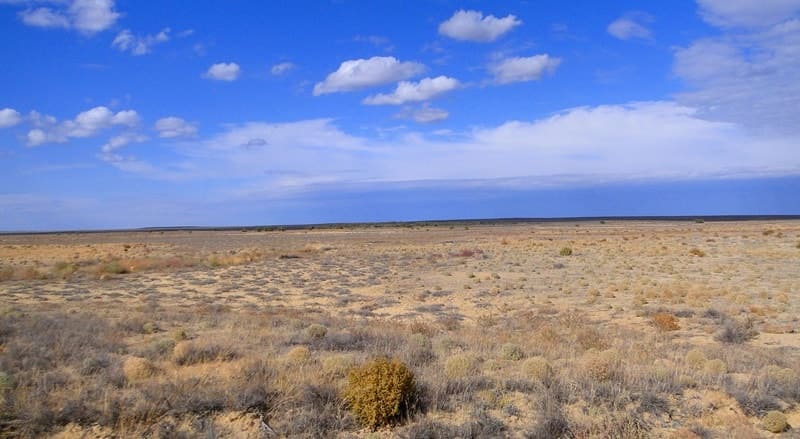
The northern part of the desert, adjacent to the Chu valley, is represented by a hilly plain 15-30 kilometers wide. The eastern part rises as a terrace south of the Chu River and is divided into separate parts 10 - 25 meters high and 2 kilometers long.
The undulating relief prevails in the west. The central part of Moinkum is characterized by high sandy ridges (50 - 70 meters). Ground waters (1 - 1.5 meters) lie in the depressions, often coming to the surface and forming lakes. In the southeast and west, the groundwater level drops to 35 - 50 m.
Climate of Moyinkum desert.
The climate of the desert is sharply continental. The average temperature in January in the west is 11.2'C, in the east - 7.5'C, the average temperature in July is 25.6 - 26.9'C. The absolute minimum temperature is 40 - 44'C, the absolute maximum is 44 - 47'C.
The sum of temperatures above 10 degrees is 3860 - 3678 C. The average annual amount of precipitation ranges from 150 to 330 mm. Snow cover on average does not exceed 10 - 15 cm. Sandy-desert soils prevail sierozem type and gray-brown.
Soils of Moyinkum sands.
Sandy desert and gray brown soils predominate. The soil cover is dominated by brown soils. In their structure and composition, they are close to gray soils. The humus horizon of brown soils is colored in brownish tones and is replaced by a pale-yellow carbonate horizon.
Brown soils are formed on light, fine-earth, rich in mineral salts, parent rock, which ensures their fertility.
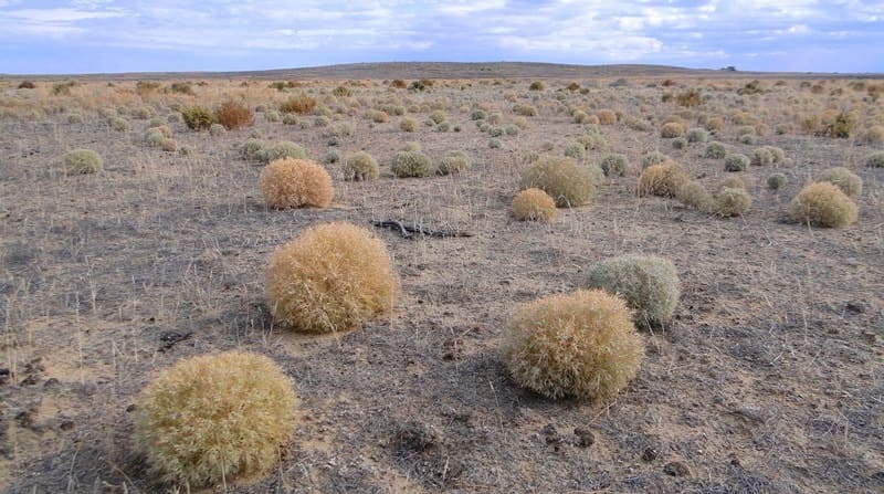
Vegetation of Moyinkum desert.
Vegetation cover is very sparse with less than 50% coverage. This favors the development of lower plants on the soil - lichens, algae and mosses. The period of summer dormancy, caused by high temperatures and dryness, is absent in these deserts, as well as in the entire northern subzone of the desert.
The most common are xerophytic shrubs, especially wormwood (Artemisia terrae albae). The deserts are characterized by a sagebrush-saxaul complex, torn by wedged takyrs. White saxaul grows on sands - ridge, hilly and ridge-hilly.
Black saxaul grows in silted depressions, a tree-like hodgepodge reaching 8 meters in height, with a thick, gnarled trunk, leafless. In Muyunkum, thickets of white saxaul occupy the northern part, while grassy vegetation dominates in the southern part.
The composition of herbaceous vegetation varies depending on the relief and soil. On the tops of ridges and mounds on the sands grows dzhusgun (CalligopitCaput Medusae), on loamy slopes - wheatgrass, or erkek (Agropyrum sibiricum), wormwood - red (Artemisia scoparia) and camphor (A. eucodes), wild rye (Secale fragile), and in depressions - mainly sandy sedge (Carex pachystylis).
Teresken (Eurotia ceratoides) and Astragalus (Astragalus brachypus) dominate in the central part of Muyunkum. Intrazonal vegetation spreads along river valleys. Tugai occupy the floodplain. Typical for them: willows (Salix gmelini, S. songorica), sucker (Elaegnus angustifolia), clematis liana (Clematis orientalis), wrapping around the trunks and branches of trees, in the second tier - shrubs: honeysuckle, barberry, tall grasses - licorice (Glycirrhiza uralensis ), bluegrass (Poa pratensis). Behind the tugai belt there are tall-grass water meadows (the height of the herbage is 1.5 meters).
On the surface of the second terrace, dry forb meadows are common - sedge, reed grass. The third terrace is outside the influence of the river, its floods and is covered with wormwood, saltwort, comb, sarsazan, etc.
Fauna of Moyinkum sands.
The fauna of the Muyunkum and Balkhash deserts consists of animals typical of sandy deserts. They meet: goitered gazelle, corsac fox, wolf, many rodents: thin-toed ground squirrel, gerbils - large and midday, jerboas - terry-legged, crested-toed.
Reptiles are also numerous: scapteira lizards (netted and striped), round-headed lizards (eared, sandy), steppe boa constrictor, steppe tortoise. In the tugai live: wild boar, tiger, jackals, reed cat, hares (tolai) are numerous, pheasants are common, feeding on sea buckthorn berries and djids.
For tugai, kingfishers, sandpipers, herons (gray and white), bitterns, and cormorants are also typical.
Economic development of Moiynkum desert.
The territory of Moiynkum is used as a winter pasture, partly for agriculture. On the depressions there are significant stocks of grasses, haymaking is carried out, there are plots of land suitable for sowing alfalfa, vegetables and melons.
In the future, it is possible to increase the sown areas by irrigating them with artesian waters. On the territory of Moiynkum, the Umbet state hunting economy and the Andysai state reserve are organized. he Moiynkum Desert, an important rangeland in Kazakhstan, has enough fodder for livestock grazing throughout the year.
However, for most of the desert year-round exploitation of pastures is undesirable, as it leads to their reduction. In addition, with the seasonal use of pastures, grazing of a much larger number of livestock is possible.
Therefore, the predominant part of the territory is used in combination with the Chui valley as a winter pasture. For the summer, cattle are driven through the desert of Betpak-Dala to the semi-desert of the Kazakh uplands (steppes of Sary-Arka).
Sheep, horses, cattle, and camels graze in the desert. Among the sands in some areas, in places where groundwater is close, it is possible to sow fodder grasses and hay. Irrigated agriculture can be practiced near lakes, which will provide additional fodder for livestock and food for transhumors.
Geographical coordinates of Moyinkum sands: N44°24'15.28" E69°54'26.74"
Authority:
N. A. Gvozdetsky, N. I. Mikhaylov. Physical geography of the USSR. An Asian part, the Edition third corrected and added Moscow "Thought" of 1978.
Photos by
Alexander Petrov.