




Вы здесь
Boom gorge.
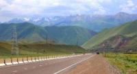
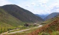
Trip by machine on gorge Boom.
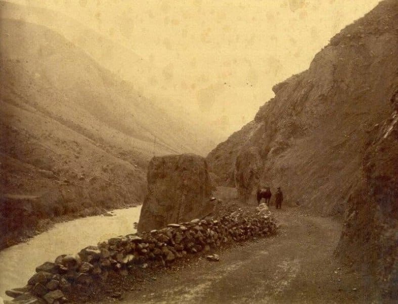
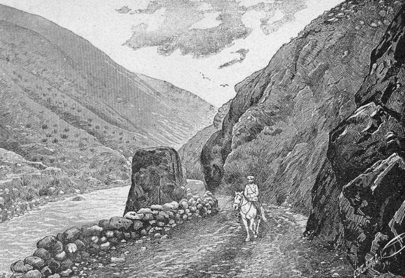
"This gorge is a deadly and dangerous trap. We made difficult progress along our route, which sometimes ran along the riverbank, sometimes had to climb up sheer cliffs that dropped off unexpectedly. To avoid such crossings, we had to follow the river whenever possible. We struggled against the swift current, which hid enormous rocks and threatened to wash us away at any moment."
P.P. Semenov-Tyan-Shansky. "Journey to Tien-Shan." 1856-1857.
Exploring Kyrgyzstan by Helicopter.
Boom Gorge is located at an altitude of 1319 to 1514 m. a. s. l. It is the boundary between the western part of the Kungei Ala-Too Range and the eastern part of the Kyrgyz Ala-Too Range, located in the Kemin District of the Chui Region and the Ton District of the Issyk-Kul Region.
The Boom Gorge is one of the most famous and striking natural features of the Northern Tien-Shan, located in Kyrgyzstan between the Chui Valley and the western part of the Lake Issyk-Kul basin. The Chu River flows through the gorge, and along the narrow mountain corridor lie the most important transport routes connecting Bishkek with the Issyk-Kul Basin.
Due to its geographical location, Boom has long been a natural gateway to the Issyk-Kul region and one of the key passages through the Northern Tien Shan mountain system. The gorge is located at the confluence of the Kyrgyz (formerly Aleksandrovsky) Range and the Kungey Alatau.
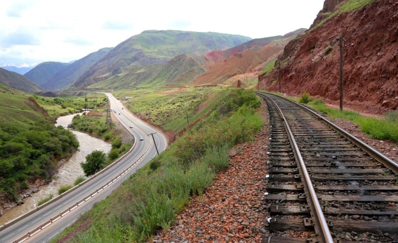
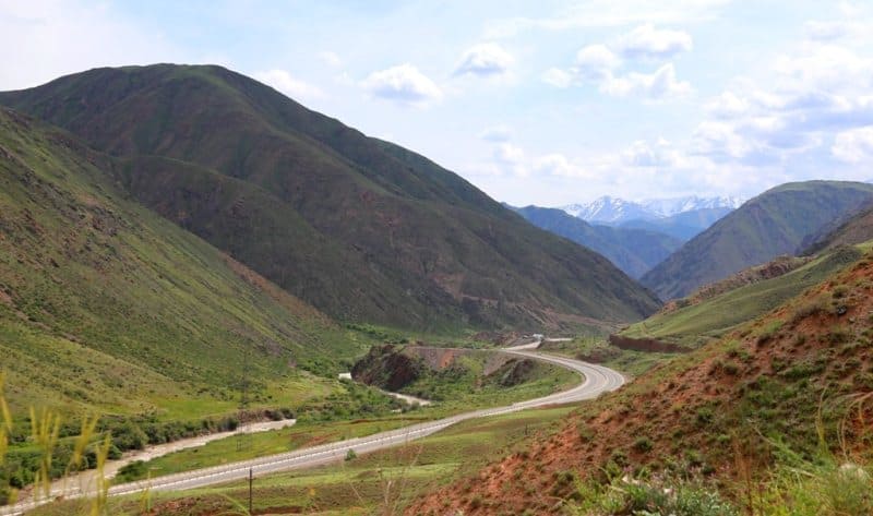
Its length is 26 kilometers, although estimates vary depending on where the gorge's boundaries are drawn. The valley floor lies at approximately 1,300-1,550 m. a. s. l., while the surrounding mountain slopes rise significantly higher. In the narrowest sections, the distance between the rocky valley walls is small, and the river, road, and railway line are concentrated in a single narrow space.
Geographical location and structure of the Boom Gorge.
Boom represents a unique cross-section of the mountain system. Unlike many longitudinal Tien Shan valleys, which flow primarily along the ridges, here the Chu River cuts through the ridge and flows from south to north. Therefore, the gorge has the character of a true breakthrough valley.
The modern topography of Boom was shaped by the long-term interaction of tectonic movements, river erosion, weathering processes, and slope denudation. The rising mountain structures were gradually dissected by water flows, and over long geological periods, the Chu River deepened its channel, exploiting the zone most favorable for drainage.
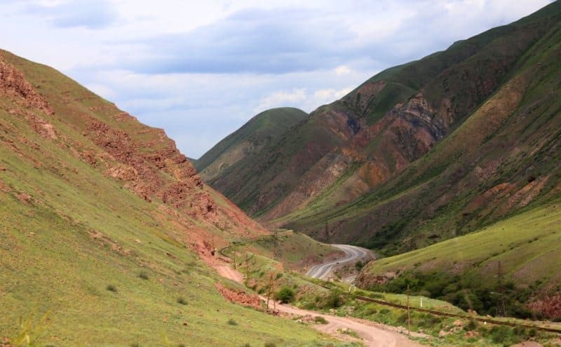
This is especially evident in the middle and lower parts of the gorge. Here, the slopes in places take on the appearance of powerful stone walls composed of bedrock, between which only a relatively narrow strip of the river valley remains. The rocks have a variety of colors, from gray and brownish to reddish and ocher tones.
Intense physical weathering in the sharply continental climate contributes to the formation of scree, stone placers, and bizarre forms of rock fracture. The slopes of Boom are relatively dry. The altitudinal and aspectual heterogeneity of the vegetation is clearly visible. In the most sheltered areas, shrub communities, herbaceous vegetation, and isolated patches of woody vegetation are found.
In the gorge, the contrast between the rocky slopes and the more moist Chu River floodplain, where vegetation grows much more densely, is particularly noticeable.
Chu River and Origin of Boom Gorge.
The Chu River is the main natural axis of the gorge. Its activity played a decisive role in shaping Boom's modern appearance. The history of the gorge's study is closely related. is associated with the study of the hydrography of Issyk-Kul. In the mid-XIXth century, geographers still believed that the Chu was a river flowing from Issyk-Kul.
The expedition of Pyotr Petrovich Semenov-Tyan-Shansky in 1856 revealed a completely different picture. The explorer traced the course of the Chu and discovered that, before reaching the western end of the lake, the river turns away from it and heads toward the mountains, where it enters the Boom Gorge.
These observations were of great importance for understanding the entire hydrography of the Issyk-Kul Basin. Subsequently, P. P. Semenov, I. V. Mushketov, and L. S. Berg linked the origin of the Boom to the ancient outflow of Issyk-Kul. According to the classical paleogeographic scheme, during periods of more significant glaciations, the lake level was significantly higher than today.
At a certain point, the waters of ancient Issyk-Kul may have flowed through the area of today's Boom Gorge. The river gradually deepened its channel, and as erosion deepened, the water regime of the entire western part of the basin changed. L.S. Berg called Boom a typical breakthrough valley.
Modern understanding of the region's development complements this picture with information about recent tectonic movements in the western part of the Issyk-Kul Basin. Thus, the origin of the gorge should not be viewed as the result of any single process, but as a complex interaction of tectonic movements and long-term river erosion.
Boom Gorge in era of first explorers.
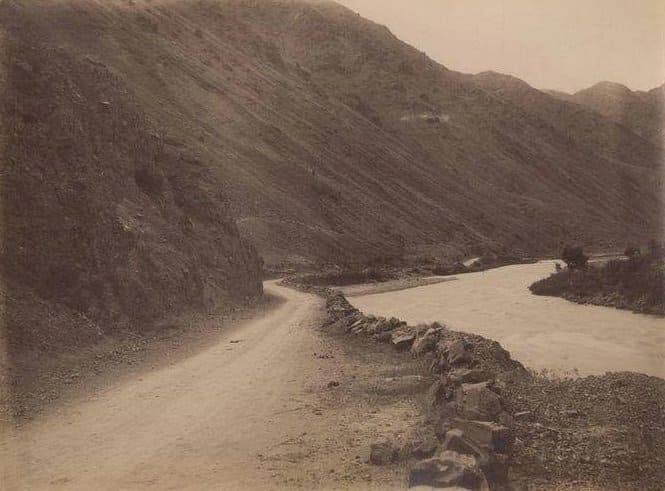
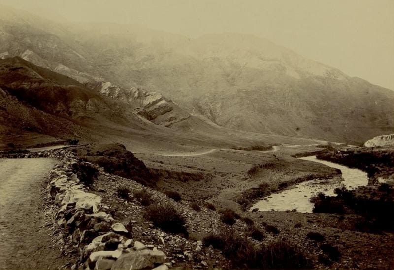
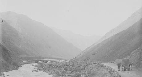
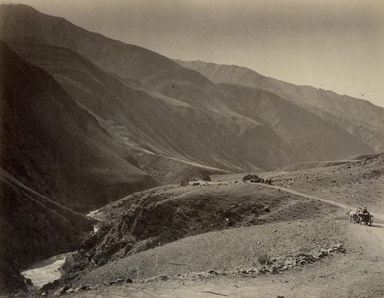
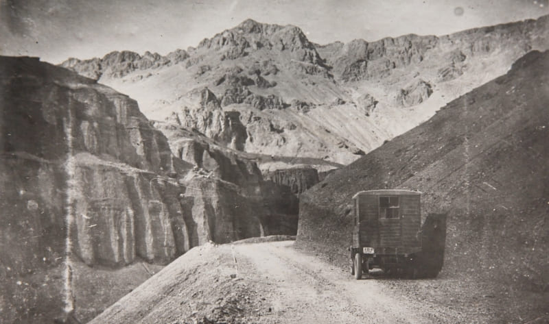
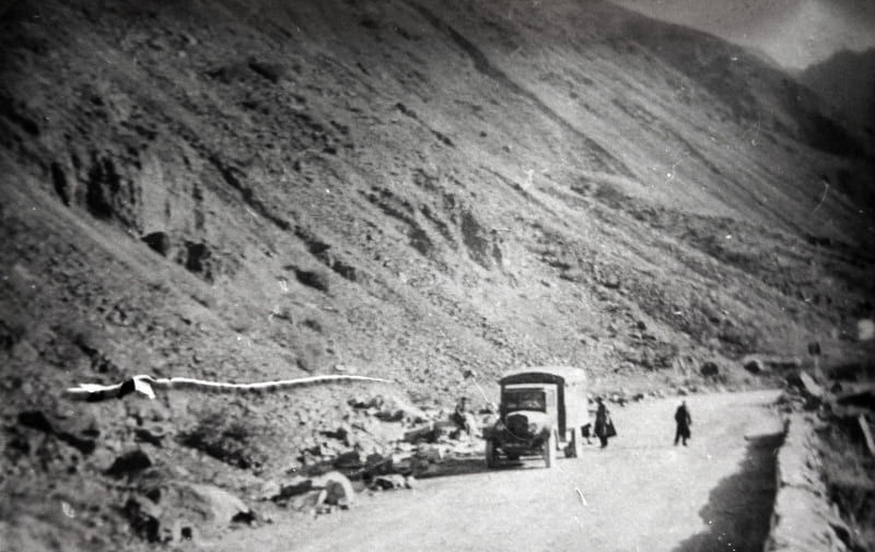
For 19th-century travelers, Boom Gorge was an exceptionally difficult section of the route. Old local trails, connecting Issyk-Kul with the Chui Valley, passed through it. The road followed the riverbank, in places climbing steep slopes and crossing rocky areas.
Where sheer cliffs came close to the Chu, travelers had to literally find a way between the water and the rock wall. In 1856, P. P. Semenov-Tyan-Shansky's expedition passed through Boom. It was this explorer's observations that became a crucial stage in the scientific study of the western part of the Issyk-Kul Basin.
Other research expeditions later passed through the gorge, including N. A. Severtsov's expedition. Old descriptions particularly emphasize the harshness of the landscape: sheer cliffs, the swift Chu River, scree, and the lack of a convenient road.
What a car traveler can traverse in a relatively short time today was a significant mountain trek for XIXth-century explorers.
Road through Boom Gorge.
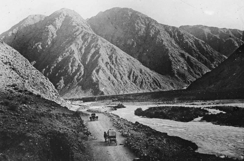
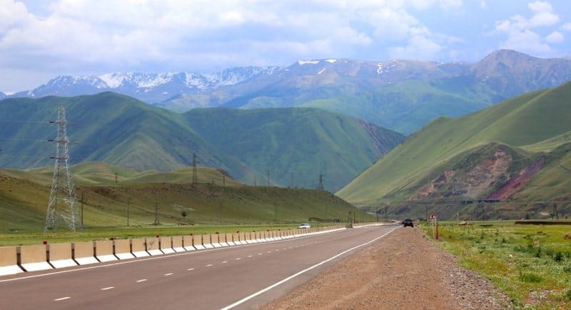
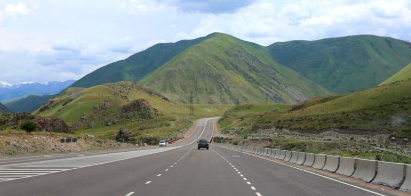
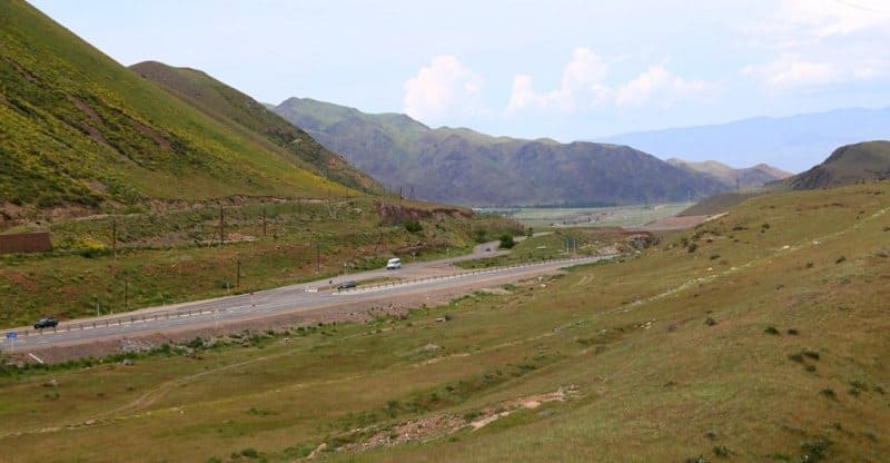
The development of the gorge was directly linked to the development of transport links between the Chu Valley and Issyk-Kul. In the second half of the XIXth century, a permanent pack trail and then a wheeled route gradually developed here. The modern road through the Boom Gorge largely follows the natural course of the Chu Valley.
However, its construction and subsequent maintenance required significant engineering efforts. In some sections, the road climbs approximately 260 meters, and the overall length of the challenging mountain section significantly exceeds the traveler's initial understanding of the gorge's size.
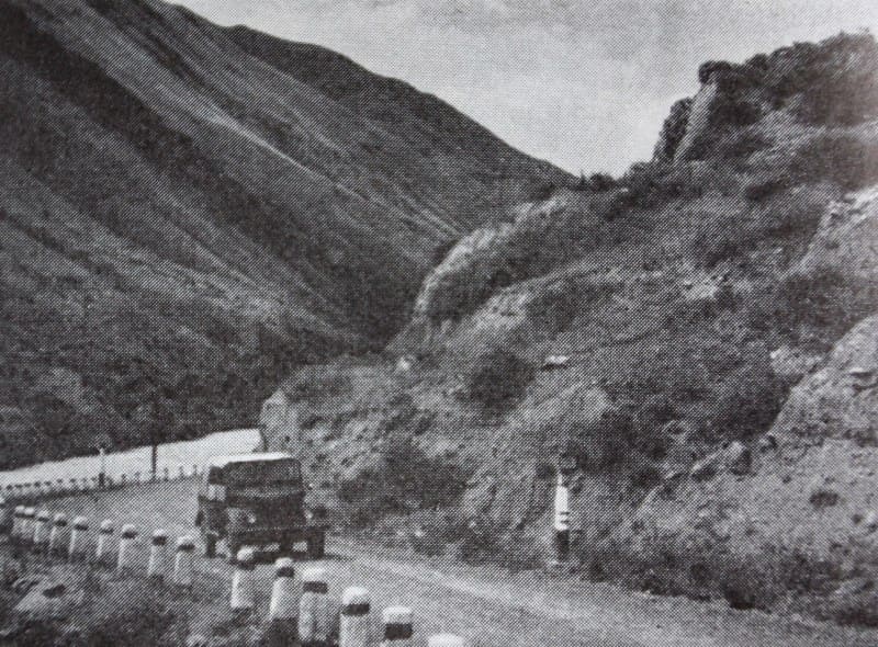
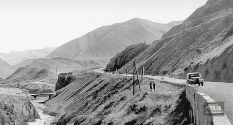
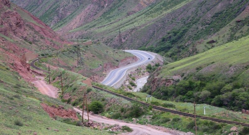
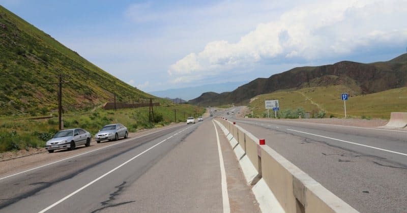
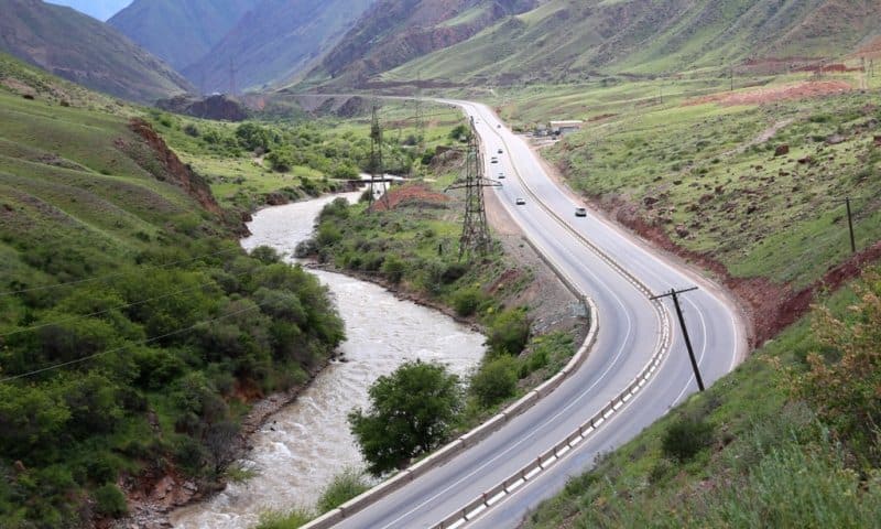
The highway runs among steep rocky slopes, in places literally following the curves of the riverbed. On one side of the road, the Chu River flows swiftly. In the narrowest sections, its bed is squeezed between the rocky sides of the valley, and the water forms numerous rapids and cataracts.
On the other side, steep mountain slopes rise, composed of igneous rocks resistant to destruction. A particularly characteristic feature of Boom is the contrast between the tranquil road and the rugged terrain of the surrounding mountains. It seems as if the road is not so much built through the gorge as carved directly into its rocky walls.
Rockfalls and scree remain a constant problem. Intense weathering, steep slopes, and seismic activity create conditions for the periodic collapse of individual rock blocks. Therefore, the engineering structures of the Boom road are no less important than the road itself.
The construction of the road significantly changed the significance of Boom: from a difficult natural passage, it gradually transformed into a vital transport corridor. In the gorge area Bridges were built, slopes were reinforced, and sections of road were laid along the banks of the Chu River.
Later, the highway became one of the main arteries connecting Bishkek with Balykchy and further on to the Issyk-Kul Basin. A modern traveler can clearly see here how narrow the natural corridor of the Boom River is: the road, the railway line, and the Chu River bed are often literally squeezed between the mountain slopes.
Railway in Boom Gorge.
Constructing a railway line through Boom proved an even more challenging task. The need for a railway connection between the Chu Valley and Issyk-Kul was driven by the development of the region's economy and transportation. Construction began during the Great Patriotic War – the railway line was laid from Kant station towards the Issyk-Kul Basin.
The Boom Canyon proved to be the most difficult section. Here, builders had to work in challenging mountainous terrain, high seismic activity, steep slopes, and the constant risk of avalanches and landslides. The construction of the railway through the Boom Gorge is divided into several stages.
Pre-war stage: The railway in the Chui Valley was built in stages. The tracks reached Frunze (Bishkek) in 1924, Kant in 1932, and Tokmak in 1941. The assault on Boom began in 1941-1942. In 1942, the railway was extended to Bystrovka station (Kemin).
It was from here that the most difficult and dangerous section began-the rugged Boom Gorge. The construction was carried out using the people's labor method. About 40,000 local collective farmers were mobilized to cut a path through the rock.
The work was seasonal: in the spring and summer, people went to sow and harvest the fields, and the rest of the time they crushed granite by hand. The first work train passed through the gorge to Rybachye station (now Balykchy) in May 1948.
The entire, extremely difficult section was fully operational by 1950. Technical difficulties and records encountered during the construction of the railway through the Boom Gorge. The builders were hampered by the constant steep slopes, sheer cliffs, and high seismic activity in the area.
There was a critical shortage of explosives and heavy equipment, so most of the rock excavations were made with shovels, crowbars, and picks. Unique engineering solutions: to enable the train to ascend the steep mountain slope, engineers designed the famous curves, which the workers affectionately and respectfully called the "Dead Loop," "Arc," and "Red Rock."
One of the most challenging sections was the pressure point near Marusina Mountain, where the track had to be literally fought to free the tracks from the turbulent Chu River and overhanging boulders. This section of the track is still considered a masterpiece of Soviet mining engineering, as the builders managed to perfectly fit the tracks into a narrow canyon parallel to the turbulent river and the highway.
The construction of the railway was a significant milestone in the region's transportation development. The railway connected the Chu Valley with Balykchy and provided a more reliable connection to the western part of the Issyk-Kul Basin. The railway track in Boom is located above the highway in many places.
Sometimes the two lines are located almost side by side, while at other times the railway climbs significantly higher up the slope. To protect against rockfalls, special protective structures were erected in the most dangerous areas. In some sections of the track, unique stone ledges can be seen, one above the other.
They form a multi-level system that allows the railway to be routed along a difficult slope while simultaneously protecting it from falling debris. These structures particularly clearly demonstrate how difficult it was to develop the Boom Gorge using 20th-century engineering methods.
The Bishkek-Balykchy railway line, approximately 189 kilometers long, passed through the gorge in the mid-XXth century.
Legend of Boom Gorge.
The name Boom is associated with an ancient legend that aptly conveys the impression this place makes on people. They say that in ancient times, travelers tried to avoid the gorge. The stone walls seemed so gloomy and inaccessible to them, and the roar of the river so menacing, that people believed this place was the domain of evil spirits.
When the wind passed between The rock formations emitted a drawn-out hum, which in the silence of the gorge could resemble a human voice. According to one folk theory, this is why Boom became associated with evil spirits and danger. A traveler finding themselves among the sheer cliffs was expected to behave carefully and not disturb the spirits of the gorge.
However, the linguistic explanation for the name is much more prosaic. The toponym "boom" is associated with Turkic words denoting a narrow space between a mountain and a river, a steep cliff, or an impassable rocky passage. In other words, the name itself very accurately characterizes the geographical appearance of the area.
Thus arose a unique combination of scientific and folk explanations: for the geographer, Boom is the result of the complex development of the river valley, and for the ancient traveler, it is a mysterious stone passage where people literally had to fight to find their way.
Nature and Landscapes of the Boom Gorge.
One of the main attractions of the Boom Gorge is the extraordinary diversity of landscapes within a relatively short distance. In the lower part of the gorge, the Chu Valley is at its narrowest. High rocky cliffs rise sharply above the road, and the riverbed cuts deeply into the valley floor.
The slopes are dissected by gullies, hollows, and scree. In some places, bizarre weathering forms can be observed, reminiscent of towers, walls, castles, and individual stone figures. Higher up the gorge, the terrain becomes somewhat calmer.
The mountains gradually retreat, the river valley widens, and floodplain areas and more developed vegetation appear. The contrast between the brightly colored dry cliffs and the green areas of the Chu floodplain is particularly picturesque. In some places, unique aeolian landforms are encountered-small stone outliers and rock formations created by the long-term action of wind and weathering.
They look most spectacular when the sun is low, casting deep shadows on the terrain and highlighting the reddish and yellow hues of the rocks.
Boom Gorge today.
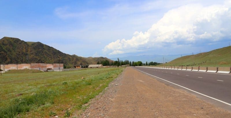
Today, Boom is not only a vital transport corridor but also one of the most visited natural sites in Kyrgyzstan. For travelers heading from Bishkek to Issyk-Kul, the gorge serves as a natural gateway to the lake basin. Once approaching Boom, the landscape of the Chu Valley begins to change rapidly: the flat expanse gives way to a mountain corridor, the road finds itself among cliffs, and alongside it appears the swift Chu River.
Of great interest are the car stops and observation points, from which one can admire the rock walls and the riverbed. The gorge is especially striking in the morning and afternoon, when the slanting rays of the sun highlight the relief of the rocks.
Boom is also famous among rafting and water tourism enthusiasts. The Chu River has a fast flow and rapids in some sections, making the gorge a popular destination for organized rafting trips. Side valleys and sections are interesting for hiking, such as the Konorchek Canyon in the central part of the gorge and the Kok-Moinok Canyon in the south.
These areas offer a safe escape from the main road. However, when exploring independently, it is important to consider rockfalls, scree, sudden weather changes, and the swift current of the Chu River. In the gorge itself, it is especially important not to stop directly beneath steep, unprotected rock slopes.
Wind in the Boom Gorge.
The Boom Gorge is important not only as a transportation and geographic corridor, but also as a unique aerodynamic passage connecting the Chu Valley with the Issyk-Kul Basin. The Issyk-Kul region is well known for its local westerly wind, which is sometimes referred to as the "ulan" or "boom."
Air masses passing through the narrow Boom mountain corridor acquire a directional flow here and then spread across the western part of the Issyk-Kul Basin. In general, westerly winds make up a significant portion of the air currents observed here.
The peculiarity of this wind is related to the very structure of the terrain. The Boom Gorge is a kind of natural wind tunnel: the narrowed sections of the valley They direct air movement along the Chu River, and the exit from the mountain corridor into the more spacious Issyk-Kul Basin is accompanied by a noticeable change in the air flow.
The name "boom" is thus associated not only with a geographical feature but also with a natural phenomenon well known to residents of the Issyk-Kul Basin. Wind passing through the gorge can be felt as a warm and dry air current, especially with the appropriate atmospheric circulation.
Krasnooktyabrsky Bridge in the Boom Gorge.
One of the notable structures on the road is the Krasnooktyabrsky Bridge, also known as the Red Bridge. The bridge spans the Chu River in the central part of the gorge. Here, the road crosses from one bank of the river to the other, following the contours of the mountain gorge.
The administrative border between the Chui and Issyk-Kul regions passes through the area of the bridge. The eastern slopes of the gorge lie in the Kemin District of the Chui Region, while the western slopes are in the Ton District of the Issyk-Kul Region.
Therefore, for travelers, this place holds not only engineering but also unique geographical significance: beyond lies the expanse of the Issyk-Kul Basin. The Krasnooktyabrsky Bridge stands out especially strikingly against the rugged mountain landscape.
The waters of the Chu River rush below, and steep rocky slopes rise above the road. This modern structure is perceived as a small but important element of the complex transportation system created by man in the Boom natural corridor.
Geological Structure of the Boom Gorge.
The rocky massifs surrounding the Boom Gorge have a complex geological structure. Among the rocks that make up the mountain slopes are granite, porphyry, and diorite, all igneous rocks. It is their stability and the nature of their destruction that largely determine the gorge's modern appearance.
Cracks in the mountain ranges gradually erode under the influence of temperature fluctuations, water, ice, and wind. Individual blocks break off from the rock walls and migrate down the slopes, forming scree and rock trails. As a result, Boom is a unique natural museum of mountain formation processes.
At a relatively short distance, one can observe steep walls, gentle slopes, scree cones, rock outcrops, and narrow terraces. The reddish and yellowish hues of weathered rocks are particularly striking. In lateral sunlight, individual rock masses acquire a rich color, giving the Boom landscape the appearance of a giant natural sculpture.
Earthquakes and rockfalls in Boom Gorge.
Boom Gorge is located in a seismically active region of the Tien-Shan. Earthquakes are one of the natural factors influencing the stability of the mountain slopes. Seismic vibrations can disrupt the equilibrium of rock masses, causing individual blocks to collapse.
But even without strong earthquakes, slopes are constantly subject to erosion. During the day, rocks are heated by solar radiation and cool rapidly at night. Water penetrates cracks, and seasonal freezing and thawing gradually widens the cracks.
As a result, over millennia, rock walls slowly erode, providing material for landslides. For humans, this slow geological process has practical significance. Rockfalls remain one of the main natural hazards of the Boom road and railway line.
Tourist information about the Boom Gorge.
One of the most powerful experiences of the journey through Boom occurs closer to the exit of the gorge. After a long walk among tight rock walls, the terrain gradually begins to change. The mountains part, the valley widens, and the space ahead becomes significantly more open.
And suddenly, beyond the last ridges, the blue of Issyk-Kul appears. This transition The view is especially vivid precisely because it is preceded by a long drive through a narrow mountain corridor. Until recently, the road was squeezed between sheer cliffs, with the Chu River roaring nearby and stone walls towering overhead.
Now the space opens up, and the vast expanse of the lake appears ahead. Beyond Issyk-Kul, the high wall of Terskey Ala-Too rises, creating a grand mountain backdrop. The contrast between the open water and the high, snow-capped ridges creates one of the most recognizable landscapes of the western Issyk-Kul Basin.
The outskirts of Balykchy, formerly Rybachy, also appear here, located at the western end of the lake. Boom Gorge is located approximately 110-115 kilometers from Bishkek and is directly connected to the Bishkek–Balykchy highway. For most travelers, the gorge is not a separate, long-term stop, but rather part of the route to Issyk-Kul.
However, it can easily be considered a standalone natural landmark. The best time to explore the gorge is during the warm season, when the roads are free of winter restrictions and the weather allows for stops and short walks. In summer, the lower and middle parts of the gorge can become very hot, so morning and evening hours are preferable for hiking.
It's important to remember that Boom remains an active transport corridor with heavy traffic. When stopping for photographs, choose safe spots away from roads and railway tracks. For hiking, it's best to use organized trails or pre-explored areas.
What to see in Boom Gorge.
When traveling through the Boom Gorge, noteworthy sights include:
the Konorchek Gorge,
the gorge and colorful outcrops of the Kok-Moinok Gorge,
narrow canyons in the Chu River bed;
multicolored rock walls and outliers;
floodplain sections of the river;
old and modern engineering structures;
sections of the Bishkek-Balykchy railway;
numerous weathered rock forms;
places where the road and railway pass side by side;
panoramic views of the mountains of the Kyrgyz Range and Kungey Alatau.
It is especially interesting to perceive Boom not simply as a section of the road to Issyk-Kul, but as a natural geological corridor where the results of ancient tectonic processes, river erosion, weathering, and modern human impact can be seen within a short distance.
Geographic coordinates of Boom Gorge: N42°35'23 E75°48'43
Authority and photos by:
Alexander Petrov.