


![]()
Вы здесь
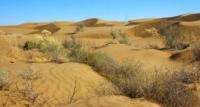
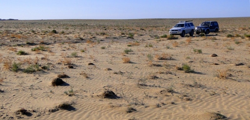
Karakum desert in Turkmenistan.
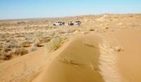
Ecological tours in Karakum desert.
"The desert is the garden of Allah, from which the Ruler of the faithful removed all unnecessary human and animal life, so that there would be at least one place on earth where He could wander alone."
Arabic proverb.
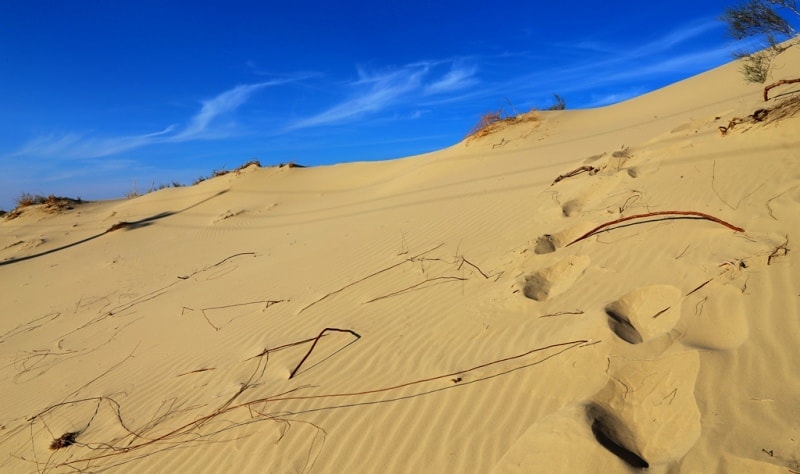
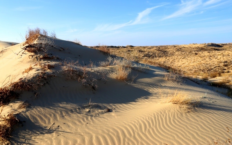
Sights of Karakum Desert.
Karakum Desert is located in the central part of Turkmenistan in the Akhal, Balkan and Dashoguz velayats and in the western part of Uzbekistan in the Khorezm and Bukhara regions and the Republic of Kkrakalpakstan. "Karakum" in translation from Turkic means, according to E. M. Murzaev, "earthen sands".
In the northeast, the desert is bounded by the Amu Darya valley, in the southeast and southwest, it gradually turns into the Badkhyz and Karabil foothills and into the sloping plains of the Kopet-Dag foothills. In the west and north-west, the border is formed by the dry channel Uzboy and the Sarykamysh depression.
E.M. Murzaev distinguishes five regions in the Karakum physical-geographical region allocated to him: Zaunguz (Northern) Karakum, Low, or Southern, Karakum, areas of the foothill plains of the Prikopetdag and Parapamizskaya and the Caspian plain (Southwestern Karakum).
The Zaunguz, or Northern, Karakums are located north of the chain of dry Unguz depressions. Southeastern Karakum is located on the territory of Lebap and Mary velayats. Turkmenistan. The Karakum is the most extensive sandy desert with an area of about 300,000 square kilometers.
The name is associated with the fact that 95% of the territory of the Karakum Desert is covered to one degree or another by vegetation that loses its green color in summer. Accordingly, the remaining 5% are sand dunes - the Turkmens call "Ak-Kum" ("White sand").
According to another version, the name of this desert is symbolic: "black" - heavy, unsuitable for life. But people appeared here as early as the 4th millennium BC. e. And they settled, as proved by archaeological excavations, in an oasis in the ancient (former, now non-existent) delta of the Murghab River.
This delta attracted people in the following centuries. At the end of the III millennium BC. BC, when the south of the Eurasian continent, from Greece to India, was struck by a severe drought, people from Eastern Anatolia, or Northern Syria, moved here, according to archaeologists.
But the loudest archaeological discovery here was made, in historical terms, quite recently, in 1972, by an expedition led by Viktor Ivanovich Sarianidi (born 1929), who later became famous for his discovery of the "gold of Bactria" in Afghanistan.
In the Karakum Desert, he and his staff discovered the Temple City of Gonur-Depe, which in Turkmen means Gray Hill. It was this hill with its shape that suggested to Sarianidi the idea that the local sands hide something large-scale. And so it turned out: it was a grandiose complex of stone, in the center of which is the Temple of Fire, the Temple of Sacrifices, the palace and other buildings.
Along the perimeter, they were enclosed (in the form of a regular square) with powerful walls with square towers. Gonur was erected around 2300 - 2250. BC e. Outside the walls, from the south, there was a huge pool with an area of 180 by 80 m and a depth of up to 2 m.
The inhabitants of the ancient powerful country of Margush, which the Greeks called Margiana, came here to worship fire. After Gonur, the Sarianidi expedition found traces of about 200 settlements. The archaeologist, whose authority today is beyond anyone in the world, claims that Margush was the center of the ancient world of the same importance as Egypt, Mesopotamia, India and China.
It was mentioned under the name Mauri Margush in the IIIrd-VIth centuries. in "Avesta" it is a collection of ancient sacred Zoroastrian texts. At the end of the II millennium BC. e. people left this oasis in search of, obviously, more abundant sources of water, and the sands covered the traces of a powerful civilization.
Some scholars tend to consider the inhabitants of Margush the first carriers of Zoroastrianism, but Professor Sarianidi is more careful in his conclusions: yes, they were fire worshipers, but rather they can be considered the predecessors of the Zoroastrians.
The geological age of the Karakum desert is about 1 million years (for comparison: the age of the Namib desert is about 55 million years). This applies primarily to the Zaunguz Karakum. As for the western part of the desert, 2000 - 2.5000 years ago there was still a steppe.
At the end of the XIX century. two hypotheses were put forward for the geological genealogy of the Karakum Desert. According to the first (author - mining engineer A.I.Konshin), this desert was formed on the dry part of the ancient Aral-Caspian Sea (the remains of the prehistoric ocean Tethys).
This is partly true. According to the second, which was adhered to by many scientists, including Academician V.A. Kopetdag products of destruction of rocks - sand, clay and in the first half of the Quaternary period, after a cold snap, sharply replaced by warming, when the rivers as a result of melting glaciers became full and rapid.
This theory was confirmed by later research. And then in practice, when geological prospectors began to work in the Karakum Desert. The bowels of this desert are rich, primarily in natural gas, as well as in oil and sulfur. According to plans for a decade, adopted in 2001 in Turkmenistan, by 2010 the country was supposed to bring natural gas production to 120 billion cubic meters, exporting 100 billion cubic meters.
The reality turned out to be much more prosaic: in 2009, 34 billion cubic meters were produced, 14 billion cubic meters were exported (according to the World Book of Facts). Of course, the last world financial crisis also made its own adjustments to these statistics, but in general, the period when the country was ruled by totalitarian methods (1991-2006) by Saparmurat Niyazov, or Turkmenbashi (1940-2006), was a time, to put it mildly, ambiguous for the whole of Turkmenistan, and for the Karakum Desert as a natural environment. Just one example is enough.
Niyazov seriously intended to spend $ 18 million on the creation of a zoo in the Karakum Desert with a large colony of penguins, which "are threatened with extinction due to global warming." All right. It is best to get acquainted with the real world of the Karakum fauna and flora in the Repetek Biosphere Reserve (it has had this international status since 1979).
It was created in 1928, is located in the southeastern part of the Karakum Desert, 70 km from the city of Turkmenabat, covers an area of 34 600 hectares, which is not very much for the reserve, but all the landscape zones of the desert are represented here.
There are 229 bird species in the Karakum Desert, and about 202 species in the reserve (13 of them are in the Red Book). There are 22 species of reptiles (in the Red Book - 2), amphibians - 1 species, mammals - 29 species (in the Red Book - 3), invertebrates - several thousand species (of which in the Red Book - 7).
Among the "Red Book" animals, Repeteka is the caracal (jungle cat, or desert lynx), the Indian porcupine, the gazelle. The thickets of black saxaul and other plant species, including many desert endemics, are protected here. Partially desert territories are included in the Amu Darya Nature Reserve (area - 49,500 hectares), where a project is being implemented to preserve the Bukhara deer population.
But the environmentalists of the Karakum Desert are sounding the alarm, and it is connected primarily with the Turkmen lake. This is also, to some extent, the legacy of President Niyazov, the second name of the reservoir is “Altyn Asyr” (“Golden Age” is what Turkmenbashi called the time of his rule without false modesty).
Arguments for: collector and drainage waters saturated with pesticides and other toxic chemicals will be diverted here, which will be purified due to the natural adsorbing properties of sand and aquatic plants; new cotton fields and pastures will appear. Arguments against:
Since the bottom of the reservoir is not lined, it may well turn into a dead sewage sump. In addition, in order to prevent drying out and reduce the concentration of harmful chemicals in it, it is planned to take water from the Amu Darya, which, of course, is opposed by Uzbekistan.
The fact that the desert is a very vulnerable object from an ecological point of view is proved by the sad fate of the Sarikamysh reservoir, which is gradually shrinking and extremely polluted by drainage waters. The Karakum Canal is also experiencing degradation problems: silting of the canal itself and its reservoirs, loss of about a quarter of the water entering it - again because the bottom is not lined, as well as pollution and salinization of irrigated lands as a result of irrigation with drainage and flushing waters.
For the defenders of the Karakum Desert, the connection between the causes and consequences of such phenomena is obvious. But not for those who need only the mirages of momentary profit. After all, as you know: "The more deserts we turn into gardens, the more gardens there are into deserts."
General information on Karakum Desert.
Sandy desert in Central Asia, covering about 80% of the territory of Turkmenistan.
Karakum Desert are subdivided into Zaunguz, or Northern; Low-lying, or Central; and Southeast. They differ from each other in origin, natural conditions and the degree of economic development.
Countries on whose territory the Karakum are located: Turkmenistan, Kazakhstan (Aral Karakum (about 40,000 square kilometers).
Population: concentrated in oases and near small rivers.
Ethnic composition: Turkmen - 78%, Uzbeks - 9%, others - 3%.
Religion: Islam (Sunni sense
Oases: Amudarya, Tezhensky, Mervsky.
Largest depressions: Sarykamyshskaya, Unguzskaya, Aktakaya depression.
Largest rivers: Amu Darya, Tejen, Murghab (the last two have a so-called blind delta - lost in the sands).
Largest reservoirs: Sarykamyshskoe - formed in the hollow of the same name in 1971 as a result of drainage of collector-drainage waters (drying up). Turkmen, or "Altyn Asyr" (under construction).
Largest city: Mary.
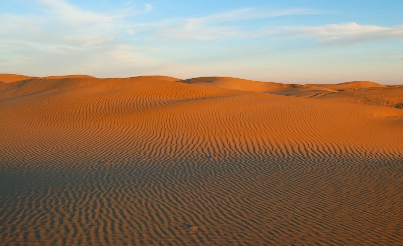
Highest sandy hills: about 200 meters above sea level.
Most important airport: international airport. Saparmurat Turkmenbashi in the capital Ashgabat.
Figures for Karakum Desert.
Parallel length: about 800 kilometers.
Length along the meridian: about 450 kilometers.
Total area: over 350,000 square kilometers.
Length of the Karakum Canal is 1,445 kilometers, the maximum depth is 7.5 meters, and the water flow rate is 600 cubic meters per second.
Economy of Karakum Desert.
Extraction of natural gas, oil, sulfur.
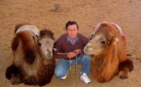
Agriculture: cotton growing, pasture animal husbandry, including the breeding of Karakul sheep, camels, in oases - the cultivation of fruits and melons.
The Karakum desert makes up about 80% of the territory of Turkmenistan and its economy is primarily related to the reserves of natural gas in the desert.
GDP of Turkmenistan, according to the World Book of Facts, is 536 640 000 (2010).
Proved reserves of natural gas - 7504 billion cubic meters (January 1, 2010).
Climate and weather of Karakum desert.
Sharply continental.
January temperature: (in the north), + 3 ° С (in the south).
Average July temperature: + 28 ° C (in the north), up to + 34 ° C (in the south).
Sharp changes in temperature: air - up to + 50 ° C, on the ground - up to + 80 ° C.
Average annual rainfall: from 60 mm in the north to 150 mm in the south. 70% of precipitation falls from November to April.
Sights of Karakum Desert.
■ Archaeological complex Gonur-Depe (III millennium BC), in 2009, nominated for inclusion in the UNESCO World Heritage List,
■ State Historical and Cultural Park "Merv" (included in the UNESCO World Heritage List), is located near the city of Bayramaly and 30 - 40 kilometers from the city of Mary. Historical and cultural monuments: Sultan-Kala (IX - XII centuries), Gyaur-Kala (III century BC - VIII - IX centuries AD), Erkkala (I century BC) ), Abdullakhan-Kala (XV century) and Bayramalikhan-Kala (XVIII century), mausoleum of Sultan Sanjar (XII century), Haram-Keshk castle (IX-XIII centuries), ancient settlements: Durnali, Ekedeshik, Gebekla.
■ Repetek reserve.
Interesting facts about Karakum desert.
■ The first mention of the country of Margush dates back to 521 - 520. B.C. The inscription was carved on one of the rocks along the road from Persia to Mesopotamia.
In 1904, the American archaeologist Rafael Pampelli went in search of Margiana in the sands of the Karakum Desert. But he found the remains of ancient settlements near modern Ashgabat.
■ The Karakum desert is rich in groundwater, especially near the banks of the Amu Darya (where they occur at a depth of 3-6 meters). On the Karabil Upland, the water is about 300 meters away. It is estimated that there are about 20,000 wells in the Karakum Desert, most often water is pumped from them in an ancient way, with the help of a camel walking in a circle.
■ One of the most attractive places for tourists in the Karakum Desert is a burning well near the village of Darvaza. It broke out in 1971. Then the geologists who were searching for natural gas deposits drilled an exploration well here and stumbled upon a cavity (underground void).
The drilling rig itself and the entire transport collapsed into it. People, fortunately, managed to escape. The inhabitants of the village could have been poisoned with gas. Reasoning that the gas would burn out by itself in a few days, the geologists set it on fire. Still not burned out. A crater with a diameter of 60 and a depth of about 20 meters was formed. It is not surprising that he was immediately dubbed "the gate to hell."
■ Almost all desert animals are nocturnal.
■ There was an observatory in Merv, where the poet and scientist Omar Khayyam (1048 - 1131) worked. Here he created his famous calendar, which is more accurate than the Julian and Gregorian ones, and is still valid in Iran.
■ Alabai, or the Asian Shepherd Dog, is a faithful friend and helper of the shepherds. He easily endures the heat He is also known as an excellent snake hunter, with a precise movement he grabs a poisonous wriggling tape and in the blink of an eye breaks its spine.
■ Modern shepherds in the Karakum desert move mainly on motorcycles.
■ According to British auditor Gaffney, Cline & Associates (GCA), the South Yolotan field has the second largest natural gas reserves in the world. The agency has estimated it at about 21.2 trillion cubic meters, but Turkmenistan believes that this figure could be much higher.
■ The Karakum desert has a namesake - the relatively small Karakum desert in Kazakhstan, located between lakes Balkhash and Sasykkol.
Geographic coordinates of Karakum Desert: N39°12'13 E61°07'20
Authority:
http://geosfera.org/aziya/765-karakumy-pustynya-v-azii.html
Photos by
Alexander Petrov.