


![]()
Вы здесь
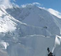
Karly Tau Peak.

Travel along Bayankol gorge.
“… It's how you climb, not where you climb. You know, many years ago in Yosemite we realized that there was nothing above. You climb out, and there are stones and a path down. Therefore, even then it became clear that it is important not where you climbed, but how you did it! And it is this process of "how?" compromises the rampant use of bolts. Or take Everest, for example. The most terrifying example of a "dead end" in mountaineering development! Dozens of almost permanently installed aluminum staircases, kilometers of handrails ... Having gone upstairs, you climbed “something”, but not the Top of the World - Everest. "
Yvon Showinard.
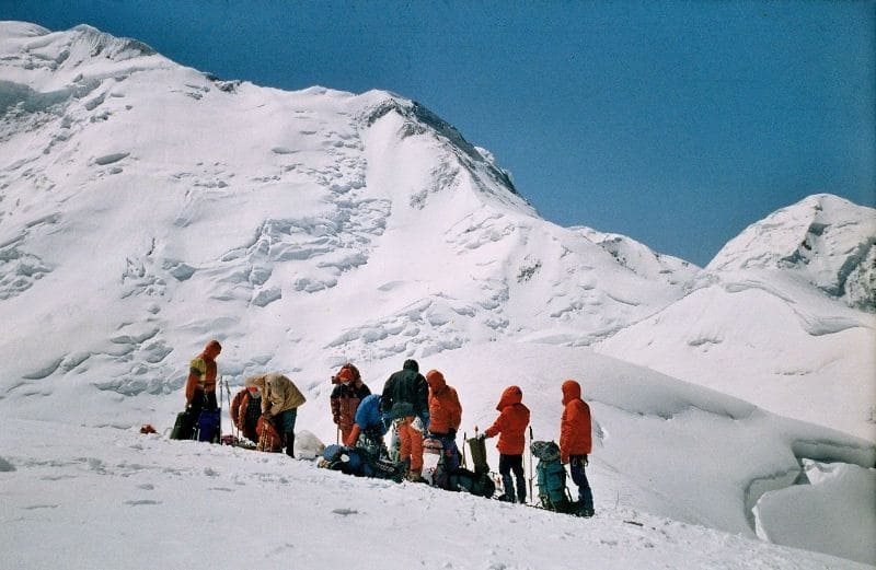
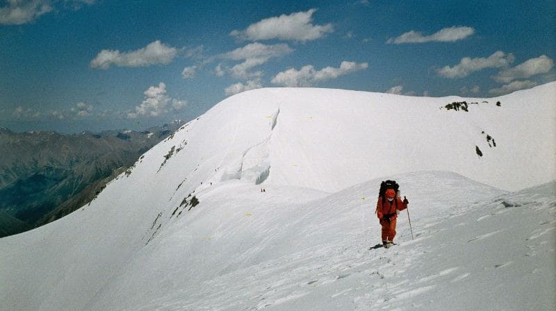
Climbing Karly Tau peak in Saryjaz ridge.
The Karly Tau peak is located at an altitude of 5550 meters above sea level, located in the main ridge of the Sarydzhaz ridge in the Narynkol district of the Almaty region. The Karly Tau summit is located between the peak Kazakhstan, 5769 meters above sea level in the south-west and the peak of the Plateau, 5850 meters above sea level, in the south-east, which is located in the Meridional ridge.
The summit of Karla Tau is the most eastern in the Sarydzhaz ridge, literally 1.5 kilometers along the ridge ridge separates it from the Meridional ridge. The distance from the Karly Tau peak to the Kazakhstan peak is 1.2 kilometers, and to the Plateau peak is 1.9 kilometers.
The lintels between the peaks of Kazakhstan and Karly Tau are inaccessible due to ice faults, the northeastern ridges leading from the peaks to the peaks are also complex icefalls. On the northern slope of the Sarydzhaz ridge from the Karla Tau peak, the East Bayankol glacier with a length of 6.4 kilometers descends.
The tongue of the Eastern Bayankol glacier ends at an altitude of 3571 meters above sea level, from here the sources of the Sarykoinou River begin. A 2.5 km long glacier descends to the south and southeast from the Karly Tau peak. For about 400 meters, the dome of the summit stretches to the southeast and gradually descends along the slope.
Further, the glacier becomes ruptured and in its lower part, at an altitude of 4697 meters above sea level, it connects with the glacier flowing down the southern slope from the peak of Kazakhstan. The complexity category of the classic routes to Karly Tau peak are rated at 4B, 5B.
History of ascents to Karly Tau peak.
In 1931, V. Gusev's group from the side of the Northern Inylchek glacier made an ascent to the top of Karly Tau.
The team of the Kazakh Republican Council of the DSO "Spartak" in the period from 14 to 22 August 1965 made the traverse of the peaks: Bayankol 5791 meters above sea level - the peak of Kazakhstan 5669 meters above sea level, Karly Tau peak 5550 meters above sea level and the peak of the Marble Wall with a height of 6140 meters above sea level, declared for the USSR championship in the class of traverses. Traverse participants: V. Savin, B. Studenin, G. Petrashko, G. Sverdlina, M. Akimenkov, B, Burambaev, I. Damianidi, G. Fedotov. G. Kireev. D, Ermilova.
Geographic coordinates of Karlytau peak: N42 ° 17'07.83 "E80 ° 14'45.78"
Authority:
Alexander Petrov.
Photos by
Sergei Mikhalkov, Almaty city